A Lienchiang County map is especially useful when you need to explain a part of Taiwan that does not fit the usual main-island layout. Lienchiang County, widely known as the Matsu Islands, lies northwest of Taiwan’s main island and close to the coast of Fujian, China. Instead of forming one continuous landmass, the county is spread across separate islands and small offshore groups. That makes island position, distance, and administrative grouping more important than a simple county outline.
This printable collection includes color, black and white, and outline versions designed for classroom handouts, presentation slides, regional comparison projects, blog graphics, and infographic editing. The files use an A3 layout and are provided as image files. Each version serves a different purpose: the color edition separates the four townships, the black and white edition keeps names and boundaries clear for printed documents, and the outline edition provides a clean base for adding routes, labels, statistics, or project notes.
The county is divided into Nangan Township, Beigan Township, Juguang Township, and Dongyin Township. Nangan and Beigan sit relatively close together, while Juguang lies farther south and Dongyin is separated to the northeast. Because these areas are divided by open water, a Lienchiang County map helps readers compare the entire island group on one page instead of treating each island as an unrelated location.
Table of Contents
Lienchiang County Map Overview
The administrative structure is simple in number but unusual in shape. Four townships cover a scattered group of islands rather than neighboring inland districts. Nangan Township includes Nangan Island, the county’s administrative center. Beigan Township is based around Beigan Island and includes offshore islands such as Gaodeng and Liang. Juguang Township is centered on Xiju and Dongju, while Dongyin Township includes Dongyin and Xiyin.
| English | Traditional Chinese |
|---|---|
| Nangan Township | 南竿鄉 |
| Beigan Township | 北竿鄉 |
| Juguang Township | 莒光鄉 |
| Dongyin Township | 東引鄉 |
The spacing between the island groups is part of the map’s value. Juguang should not look attached to Nangan, and Dongyin needs enough surrounding space to show its separate northeast position. The smaller offshore islands also matter because they help explain why each township covers more than one visible landform.
Color-Coded Township Map
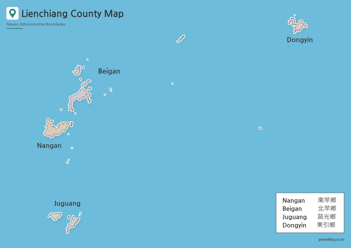
On the color version, each township is separated visually so that readers can quickly match distant islands to the same administrative area. This is especially helpful around Nangan and Beigan, where several smaller islands appear near the main islands and can be difficult to group without color.
The Lienchiang County map in color works well for presentations, educational posters, and blog graphics where viewers need to understand the four-township structure at a glance. It also makes the contrast between the southern Juguang islands and the northeastern Dongyin group much easier to follow.
Black and White Printable Layout
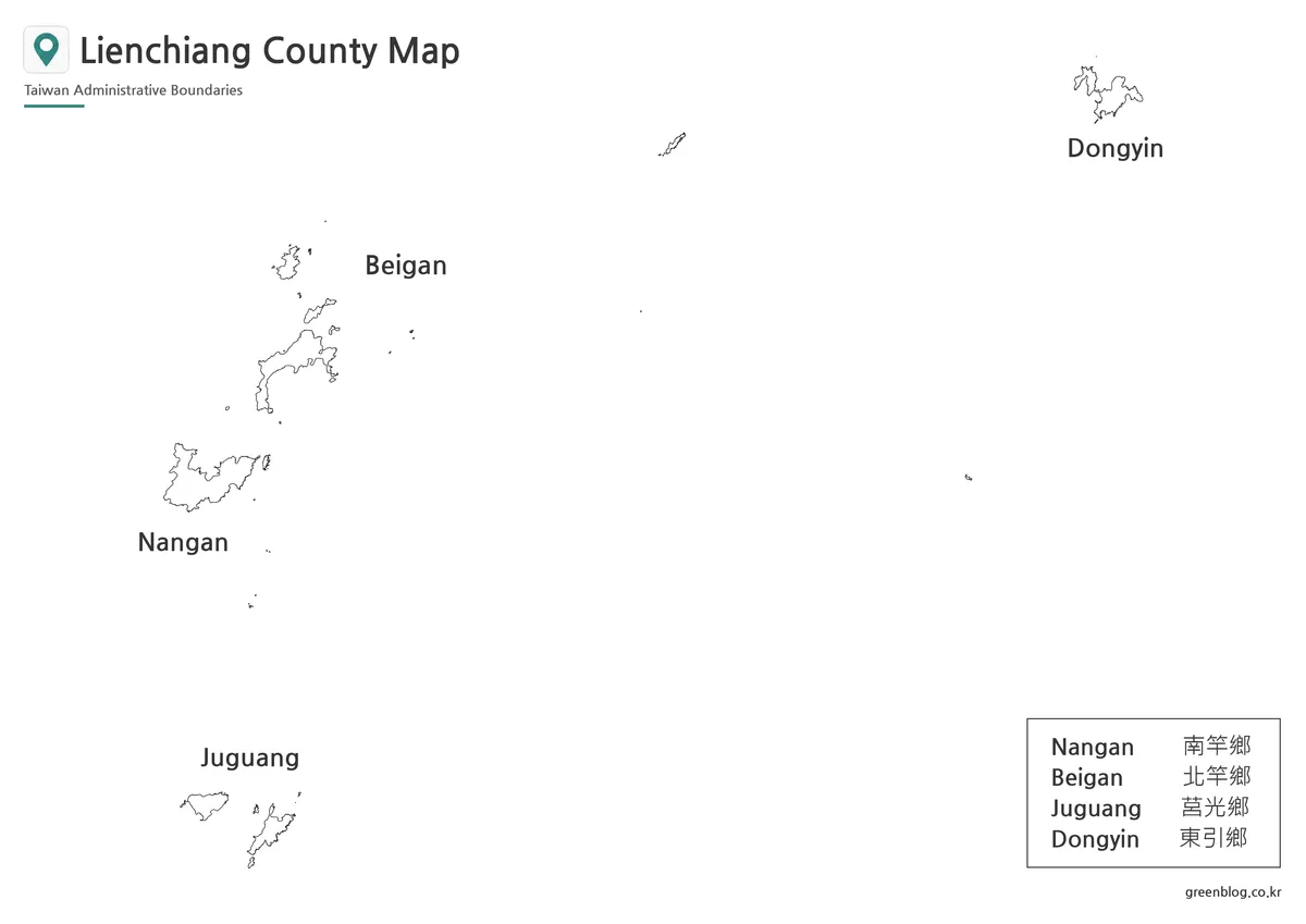
The black and white edition removes the color blocks and gives more attention to labels, coastlines, and township boundaries. Since the island groups are separated by large areas of water, the cleaner layout works well in reports, worksheets, and printed reference sheets where names need to remain easy to read.
For classroom use, a Lienchiang County map in black and white can support island-name exercises, township matching activities, or regional geography notes. It also fits more naturally into documents that use a limited-color or monochrome design.
Blank Outline Map for Editing
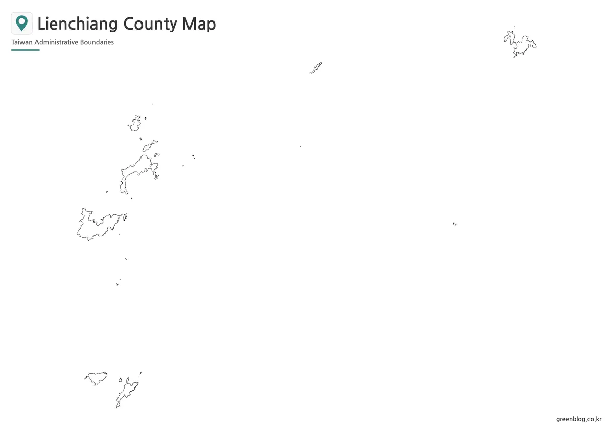
The outline edition keeps the island coastlines and administrative grouping while removing labels and color. It is intended as a working base rather than a finished reference image.
Users can add ferry routes, travel order, island names, population data, historical notes, or custom township colors. Because the county is spread across several island clusters, the Lienchiang County map outline is particularly useful for route diagrams and infographic projects that need open space for annotations.
Main Islands and Spatial Relationships
Nangan Island is the administrative center and the most practical reference point for understanding the county. Beigan Island lies to the north, with Gaodeng and Liang farther out. To the south, Juguang Township is divided mainly between Xiju and Dongju. Far to the northeast, Dongyin and Xiyin form the core of Dongyin Township.
These separated positions explain why a general Taiwan map often gives too little detail. A dedicated Lienchiang County map shows the whole archipelago clearly enough to compare island groups without enlarging each one separately. It is also useful when discussing the Matsu Islands alongside other offshore counties such as Kinmen and Penghu.
A Lienchiang County map makes these separated island groups easier to compare without losing their relative direction and spacing.
Choosing the Right Version
Choose the color map when township membership and island grouping are the main focus. Use the black and white version when labels need to remain clear in printed handouts or documents. Select the outline map when your project requires custom symbols, travel routes, data shading, or classroom coloring.
For presentations and infographics, the color edition offers the fastest visual reading. For worksheets and reports, the basic edition is cleaner. For design work, the blank version gives the most flexibility while preserving the distinctive shape of the island groups.
Frequently Asked Questions
Is Lienchiang County the same as the Matsu Islands?
In most Taiwan-related references, Lienchiang County refers to the Matsu Islands under Taiwan’s administration. “Matsu Islands” is the more familiar geographic name, while “Lienchiang County” is the administrative name.
How many townships are included?
There are four: Nangan, Beigan, Juguang, and Dongyin. Each township includes one or more main islands plus smaller nearby islands.
Does the Lienchiang County map label every rock and islet?
No. The collection focuses on the main island groups and township structure. Very small rocks or unnamed islets may appear in the coastline data without individual labels.
Which version is best for travel planning?
The outline version is the best base for adding ferry routes, island stops, or a custom itinerary. The color version is better for showing township membership and overall location.
Map File Information
This download includes printable Lienchiang County map versions for educational use, presentation design, document printing, and editable graphic projects.
- Included Versions: Color map, black and white map, outline map
- Printable Size: A3 layout
- File Type: Image files
- Intended Use: Classroom handouts, presentations, blog graphics, infographic editing, and printable reference materials
Related Maps
- Taichung City Map|Urban and Outer District Layout
- Kinmen County Map|Offshore Islands and Township Boundaries
- Penghu County Map|Island Groups and Administrative Areas
- New Taipei City Map|District Boundaries Around Northern Taiwan
- Taipei City Map|Printable District Reference
Additional Resources
- Matsu National Scenic Area – Publications : Official English guide maps and publications for Nangan and other parts of the Matsu Islands.
Green Map creates custom-edited map images using open geographic data sources such as geoBoundaries, Natural Earth, OpenStreetMap, and government open data.
These maps are edited visual materials, not raw data files, and are provided for education, documents, presentations, and graphic reference.