This Busan Map collection presents the city as a chain of 15 gu and one gun arranged around a deeply cut coastline, western water channels, and compact central districts. The three map versions share the same boundary geometry and support quick visual comparison, economical printing, and custom labeling.
The maps are administrative references rather than street guides. They identify district relationships, adjacent areas, and coastal orientation without filling the page with roads, stations, attractions, or facility symbols. That narrow scope makes the set useful when the question is where a district sits within Busan, not how to navigate to a particular address.
The color edition emphasizes district separation, the monochrome edition keeps labels clear on low-ink pages, and the outline edition provides a neutral base for learning or design work. The observations below describe the maps shown here and match the visible geographic features.
Busan Map at a Glance
The mapped city stretches from Gangseo-gu in the west to Gijang-gun in the northeast. Between those larger outer areas, smaller districts form a dense band around the central and eastern coast. Yangsan-si is labeled to the north, Gyeongsangnam-do to the west, the East Sea to the east, and the South Sea below the city. These surrounding labels add orientation without turning the graphic into a broader regional atlas.
Table of Contents
Quick Overview
Three coordinated views share the same map geometry. All retain district boundary shapes and the city’s relationship to surrounding land and water, while their labeling and color treatment differ.
- Color map: pastel district fills, district names, neighboring place names, and sea labels
- Black and white map: the same administrative labels and boundaries in a restrained monochrome treatment
- Outline map: unlabeled district divisions, coastline, islands, and surrounding boundary shapes
The map set suits A3-oriented printing, classroom exercises, reports, presentation slides, regional comparisons, and graphic layouts. Their strongest shared feature is consistency: a highlighted area appears in the same position across all three editions.
About Busan
Busan occupies the southeastern edge of South Korea. On this Busan Map, the administrative structure consists of 15 districts ending in -gu and one county, Gijang-gun. Gijang-gun forms the long northeastern section, while Gangseo-gu covers a broad western area shaped by multiple channels, islands, and an irregular shore. The inner districts are much smaller and meet along a tighter set of boundaries.
The contrast in size is part of what makes a visual reference helpful. Geumjeong-gu and Dongnae-gu sit north of the compact center; Haeundae-gu and Suyeong-gu face the eastern side; Yeongdo-gu occupies the prominent island area south of Jung-gu; and Saha-gu and Sasang-gu connect the center toward the west. The map supports this kind of relative reading, but it does not measure travel time or show a road network.
For current municipal information beyond the scope of these graphics, consult the official Busan Metropolitan City website.
Three Busan Map Versions
Each Busan Map version shows the same overall footprint and administrative divisions, with different levels of visual guidance. The two labeled editions name Gangseo-gu, Buk-gu, Sasang-gu, Saha-gu, Busanjin-gu, Dong-gu, Seo-gu, Jung-gu, Yeongdo-gu, Nam-gu, Suyeong-gu, Yeonje-gu, Dongnae-gu, Geumjeong-gu, Haeundae-gu, and Gijang-gun.
The maps also show the coastline and nearby land context. Roads, transit lines, neighborhood-level boundaries, building locations, relief, and attraction markers are outside the map’s scope. Their role is administrative reference, teaching, and regional illustration rather than navigation or emergency planning.
Regional Color Map
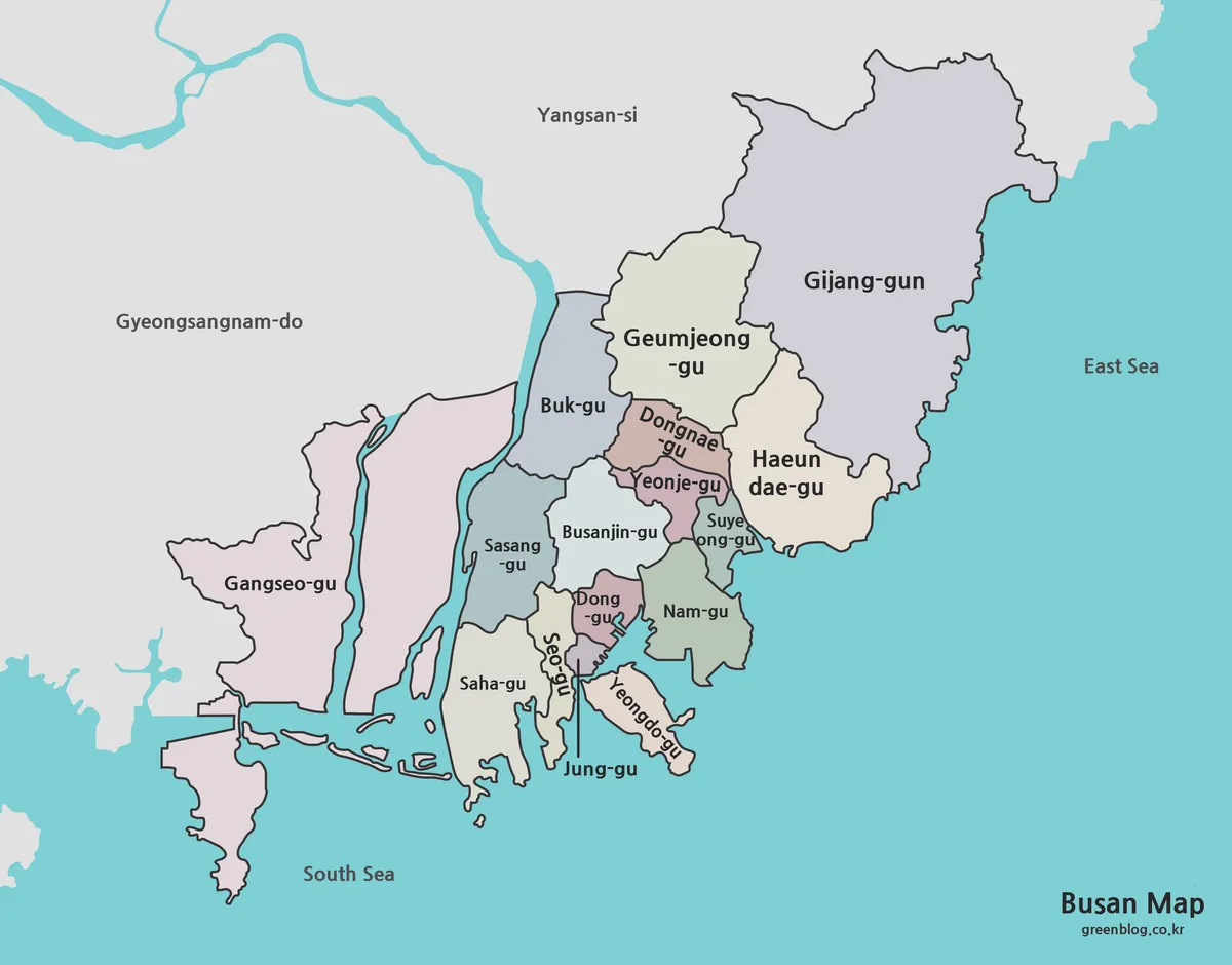
The color Busan Map assigns a separate pastel fill to every first-level administrative area. This is especially clear in the crowded center, where several short boundaries and leader lines fit into a limited space. Color separation makes each region easy to trace before checking its label, reducing confusion between neighboring districts.
Water is turquoise and land outside Busan is gray, creating a clear figure-and-ground relationship. The treatment also emphasizes two very different outer forms: the broad western expanse of Gangseo-gu and the elongated coastal shape of Gijang-gun. This edition works well in slides, posters, web illustrations, and worksheets comparing district position and extent.
Color indicates separation only; it does not encode population, land-cover data, elevation, politics, or another quantitative variable. The original palette has no quantitative meaning. Added statistics are clearest with a separate legend and explicit data labels.
Black and White Printable Version
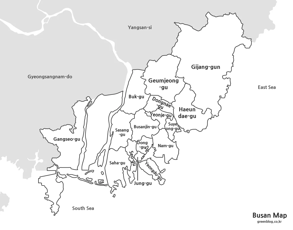
The monochrome Busan Map keeps the district names, neighboring place names, sea labels, boundary lines, and leader lines from the color edition. Busan itself remains light against gray surrounding land, while dark outlines carry most of the visual structure. It is practical for monochrome printing and for layouts where the map appears beside dense report text.
The largely unfilled interiors leave room for circling districts, shading selected areas, and handwritten notes. Pencil and colored-marker activities are easier to read than they would be over the pastel edition. The small central labels remain clearest when the print size provides enough room for the compact inner districts.
Blank Outline Map
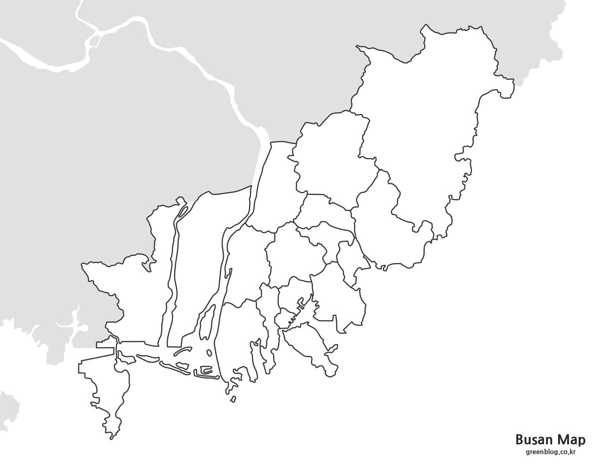
The outline Busan Map removes geographic labels and area fills while retaining district divisions, coastal edges, islands, western channels, and surrounding boundary forms. A small graphic title remains, but the geographic field is otherwise open. The edition suits recall exercises, custom color keys, route-free infographics, and graphics focused on a recognizable administrative base.
Classroom activities may cover all 16 areas or a selected group. In graphic layouts, separate text layers and a clean master copy simplify later changes. The preview is a raster image rather than an editable boundary dataset, so enlargement and recoloring depend on software and final output size.
A3 and Large-Format Printing
The map set supports high-resolution A3 output and enlarged presentations. The original aspect ratio and full-resolution ZIP image preserve more detail than the compressed page preview. Independent width or height stretching distorts the map.
- The color edition suits projected or full-color presentation boards.
- The monochrome edition suits handouts and economical repeated printing.
- The outline edition leaves room for labels, highlights, and custom graphics.
Central Busan contains the smallest label spaces, making those labels a useful guide to minimum print size. Busanjin-gu, Dong-gu, Seo-gu, Jung-gu, Yeonje-gu, and nearby leader lines are the most useful details for checking small-format legibility.
Why Busan’s Shape Benefits from a Map
A Busan Map is especially useful because the city is not a simple compact shape. The western side is broken by channels and islands, the eastern and northeastern districts follow the coast, and many central areas meet within a narrow visual field. A diagram lets a reader compare those relationships much faster than a list of district names.
Typical applications are administrative-division lessons, regional comparisons, survey-area orientation, travel overviews, and blank quizzes. The images also support thematic graphics when added data is accompanied by a clear source, date, units, and legend. The three versions are administrative reference graphics rather than substitutes for current official boundary data or turn-by-turn navigation.
Frequently Asked Questions
The FAQ below explains print scale, annotation space, and the level of detail shown in the Busan maps.
What print sizes suit the maps?
The high-resolution versions support A3 printing and enlarged presentations.
What is the outline version for?
The blank version leaves open space for annotations, labels, highlights, and custom graphics.
What details are shown on the maps?
The maps focus on administrative district structure and regional readability rather than roads or facility locations.
Busan Map ZIP
The ZIP groups the color, monochrome, and outline Busan maps for print and digital layouts.
- Map Set: Color, black and white, and blank outline maps
- Formats: Print, classroom, presentation, and custom graphic workflows
Related Maps
Green Map creates custom-edited map images using open geographic data sources such as geoBoundaries, Natural Earth, OpenStreetMap, and government open data. These maps are edited visual materials, not raw data files, and are provided for education, documents, presentations, and graphic reference.