A South Korea Map can show the republic alone or place it within the full Korean Peninsula, and this collection provides both perspectives. The displayed resources include a labeled Republic of Korea map, an unlabeled national outline, a labeled peninsula map, an unlabeled peninsula outline, and the Taegeukgi flag.
The four geographic images use white land, light blue water, and thin coastlines. Each map preview measures 1200 × 848 pixels; the flag is 900 × 600. The page therefore presents five visual items in total: four maps and the Taegeukgi flag.
These files are best treated as simplified visual references for worksheets, presentations, and general geographic explanation. Roads, terrain, scale bars, coordinates, and detailed municipal boundaries are not included. Some administrative labels also reflect an older naming scheme, an important limitation covered later in this guide.
Table of Contents
South Korea Basic Facts
The Republic of Korea occupies the southern part of the Korean Peninsula in East Asia. Seoul is the national capital, while Busan, Daegu, Incheon, Gwangju, Daejeon, and Ulsan are metropolitan cities. Sejong is a special self-governing city. At the highest local-government level, a current South Korea map includes all 17 metropolitan and provincial governments.
The labeled national image does not fully meet that current standard. It names Seoul and the six metropolitan cities, but it does not label Sejong. It also uses “Gangwon” and “Jeollabuk-do,” rather than the newer special self-governing province names. It therefore works as a general regional illustration rather than as an authoritative current administrative chart.
- Capital: Seoul
- National context: southern part of the Korean Peninsula
- Highest local-government level: 17 metropolitan and provincial governments
- Islands shown separately: Jeju, Ulleungdo, and Dokdo
- Map limitation: no roads, terrain, scale, or full current naming
What’s Included in This Korea Map Collection
This South Korea Map collection combines two national views with two peninsula-wide views. The labeled national map emphasizes provincial and metropolitan geography; the national outline removes all labels and internal divisions. The peninsula pair uses a different scope, showing both North and South Korea with either province-level labels or a completely open land area.
The maps are raster images, not editable vector boundaries. Individual regions will not necessarily behave as separate shapes. Keeping an untouched original before adding colors or annotations is useful, and excessive enlargement can reduce clarity.
- Republic of Korea reference: labeled regional boundaries and selected city-level governments
- Republic of Korea outline: national coastline without labels or internal lines
- Korean Peninsula reference: broad province labels across North and South
- Korean Peninsula outline: complete peninsula shape without labels or internal lines
- Companion visual: Taegeukgi flag image
1️⃣ South Korea Map (Regions & Major Cities)
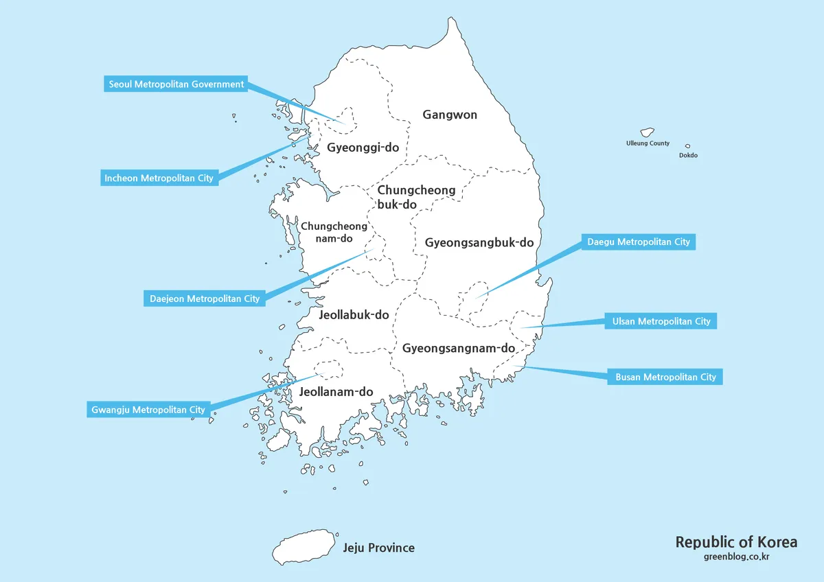
The labeled South Korea Map places the country against a pale blue sea and uses dotted lines for regional divisions. Large province names sit inside the land area, while blue callout boxes identify Seoul, Incheon, Daejeon, Gwangju, Daegu, Ulsan, and Busan. Jeju appears below the mainland, and Ulleung County and Dokdo appear east of the peninsula.
The map is useful for seeing the capital region in the northwest, the Chungcheong provinces in the center, the Jeolla provinces in the southwest, the Gyeongsang provinces in the southeast, and Gangwon in the northeast. Its callout lines reduce crowding around the metropolitan areas, although they are labels rather than route or distance indicators.
This image works well for a broad country introduction or a lesson comparing major regions. It is not suitable for counting all current first-level governments because Sejong is not labeled. The image also predates recent English naming updates for Gangwon and North Jeolla, so a current administrative presentation is better paired with a dated clarification or a newer official reference.
2️⃣ Outline Map (Editing Template)
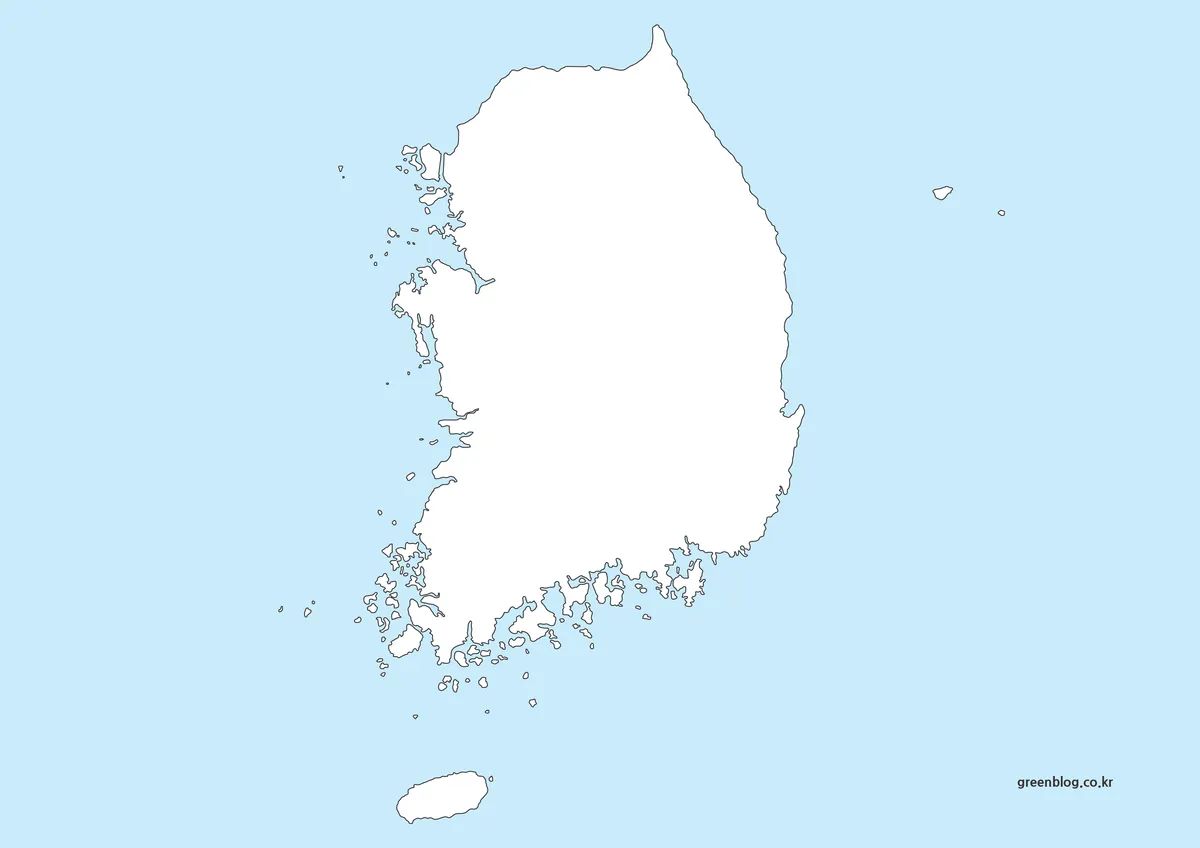
The outline South Korea Map removes regional boundaries, place names, city callouts, and the country title. It retains the mainland coastline, Jeju, west- and south-coast islands, and the two eastern island symbols. White land against light blue water creates a clean base for handwritten notes or a simple digital overlay.
This version is appropriate for country-location exercises, coastline recognition, travel-route sketches, or custom title graphics. It is not a blank administrative worksheet because no province boundaries remain. Province-identification exercises require either drawing the divisions or working from a separate boundary reference.
The many small coastal islands make the silhouette more detailed than a simplified textbook outline. At reduced print sizes, some tiny islands may disappear visually. A test page is helpful before distributing a worksheet, and the image is unsuitable for measurement because it includes no scale or projection information.
3️⃣ Korean Peninsula Map (Regional Labels)
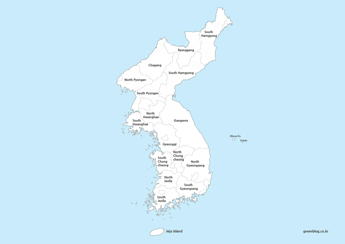
The labeled peninsula map expands the view northward and names broad provincial areas on both sides of the inter-Korean boundary. In the north it includes North and South Pyongan, Chagang, Ryanggang, North and South Hamgyong, North and South Hwanghae, and Gangwon. In the south it labels Gyeonggi and the paired Chungcheong, Jeolla, and Gyeongsang areas.
This is a province-oriented geographic overview, not a complete present-day list of first-level governments. It omits separately governed cities such as Pyongyang and Seoul and does not distinguish South Korea’s metropolitan cities. The provincial labels also use simplified English forms, so they do not establish official administrative equivalence across the entire peninsula.
It works well for discussing the peninsula’s overall north–south shape, relative provincial positions, or broad regional context. Legal, electoral, statistical, or navigation work requires a current source matched to the required jurisdiction and date.
4️⃣ Korean Peninsula Outline Map
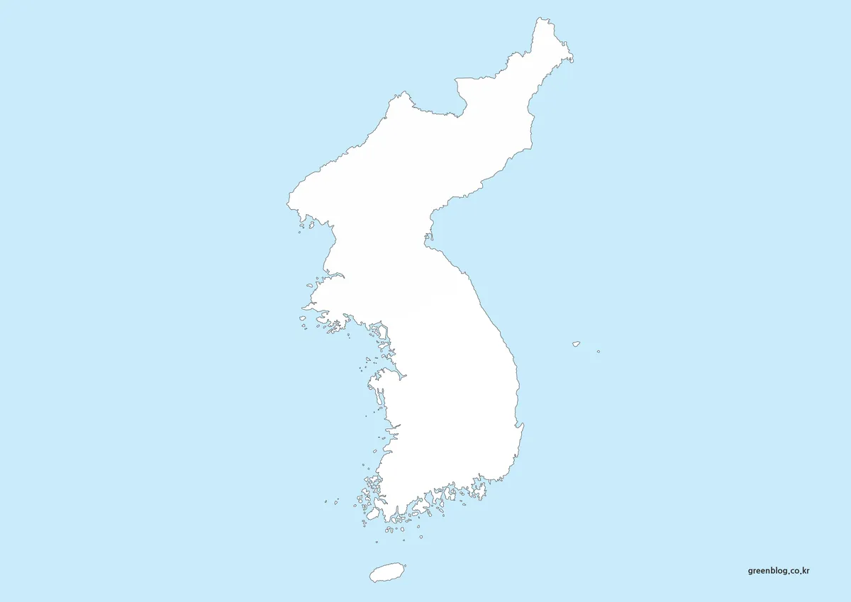
The peninsula outline removes all provincial divisions and names while retaining the continuous land shape, Jeju, Ulleungdo, Dokdo, and coastal islands. It is the most open map in the set, making it suitable for north–south orientation exercises, custom regional shading, language practice, and presentation backgrounds.
Because there is no internal border, the image does not indicate the Military Demarcation Line or distinguish the two states. Any added political boundary needs an appropriate current source and clear labeling. The blank form is intentionally neutral geographic space rather than a ready-made political map.
5️⃣ South Korea Flag
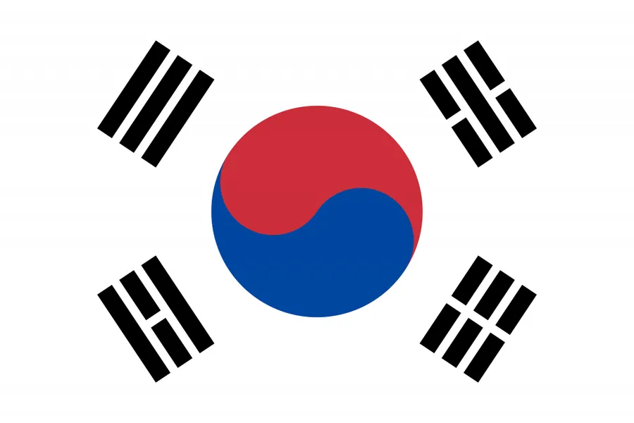
The fifth content image is the Taegeukgi. Its white field contains a red-and-blue taegeuk and four black trigrams. It can accompany a cover, worksheet, or comparison panel, but it is a flag rather than another map.
Choosing a South Korea Map for the Task
The labeled South Korea Map suits a general regional overview, the national outline suits coastline-based activities, the labeled peninsula view provides broad province context, and the peninsula outline works for custom north–south annotation. The flag can accompany one of these maps when a strong country identifier is useful. For current administrative analysis, an official 17-government reference is more appropriate alongside or instead of the labeled national image.
FAQ
Does this South Korea Map show all 17 metropolitan and provincial governments?
No. The labeled national map shows province boundaries and labels seven major city-level governments, but Sejong is not labeled. It also retains older regional naming. It is suitable for broad orientation and classroom illustration, but not as a fully current administrative directory. The official national structure has 17 metropolitan and provincial governments.
What can these Korea maps be used for?
Blog posts, education materials, presentations, printable handouts, and design projects all work well. The set is built for clear explanations rather than street-level navigation.
What size and resolution are included?
The primary workflow was based on A3-friendly layout and high-resolution export. Lines and labels stay crisp when zoomed in or printed.
Can I print these on A4 paper?
Yes. The printable-style versions and outline templates are suitable for A4 printing, and the full-resolution files preserve readable text at that size.
Can I use them on a personal blog or for study materials?
For personal blogs, study notes, and non-commercial educational content, these files are intended as reusable supporting visuals.
Download Guide
The downloadable ZIP contains the map collection. An untouched copy helps preserve the source artwork before resizing, recoloring, or adding labels. The Republic of Korea maps and full Korean Peninsula maps cover different geographic scopes, while the flag is a companion visual rather than a geographic file.
Map File Information
National and peninsula reference images for study, presentations, and custom annotation.
- File Type: image files
- Intended Use: general reference, worksheets, slides, and simple visual projects
Related Maps
Additional Resources
The official Korea.net guide to local governments provides an overview of the Republic of Korea’s current metropolitan and provincial structure.
Green Map creates custom-edited map images using open geographic data sources such as geoBoundaries, Natural Earth, OpenStreetMap, and government open data.
These maps are edited visual materials, not raw data files, and are provided for education, documents, presentations, and graphic reference.