A Netherlands Map has to explain more than a compact outline between Belgium and Germany. The European country stretches from the Wadden Islands and Groningen in the north to the narrow Limburg extension in the southeast, while North Sea coastlines, delta islands, and large inland waters interrupt the provincial shapes. This collection presents that structure in color, labeled monochrome, and blank outline formats.
The color preview measures 1,200 × 847 pixels; the black-and-white and outline previews measure 1,200 × 851 pixels. All use a landscape A3 composition with 12 provincial boundaries. Amsterdam receives the only city marker, a star in North Holland, while Belgium, Germany, and the North Sea provide external orientation.
Two cautions matter before reuse. The labeled maps mix English and Dutch provincial naming—“North Holland” appears beside “Zuid-Holland”—rather than following one language consistently. The blank outline also has a damaged top header: cropped pieces of the word “NETHERLANDS” remain along the upper edge. Correct those presentation issues when producing a polished worksheet or graphic.
Table of Contents
Netherlands Map Overview
The 12 provinces shown are Groningen, Friesland, Drenthe, Overijssel, Flevoland, Gelderland, Utrecht, North Holland, Zuid-Holland, Zeeland, North Brabant, and Limburg. For a consistent English list, use South Holland in place of Zuid-Holland. For an official Dutch-oriented list, use Fryslân, Noord-Holland, Zuid-Holland, and Noord-Brabant rather than mixing those forms with their English equivalents.
Reading clockwise from the northeast, Groningen meets Friesland and Drenthe; Drenthe lies above Overijssel; and Gelderland spans much of the east-central border with Germany. Limburg descends between Germany and Belgium. North Brabant and Zeeland occupy the south and southwest, with South Holland, Utrecht, North Holland, Flevoland, and Friesland forming the more water-fragmented western and central portion.
The Netherlands Map includes recognizable offshore island shapes along the Wadden coast and complex delta forms in Zeeland and South Holland. It also outlines central waters around Flevoland and between North Holland and Friesland, although those waters and islands are not individually named. A dashed line crosses part of the central water area, but the map provides no legend explaining its meaning.
The scope is the European Netherlands. Caribbean parts of the Netherlands do not appear. Roads, railways, rivers, dikes, elevation, terrain, municipal divisions, provincial capitals, coordinates, and a scale bar are absent. Amsterdam is the sole city point, so the artwork should not be described as a general city or transport map.
Included Map Versions
The Netherlands Map package keeps the same provincial framework across three visual treatments. This consistency makes it possible to use one image as a reference, another for economical printing, and the third for recall or customization.
Included Files
- Color labeled map: 12 provinces separated by muted categorical fills.
- Black-and-white labeled map: province names, Amsterdam, and surrounding context without color.
- Blank outline map: provincial geometry without geographic labels or fills.
File Information
The published previews are landscape WEBP images, while the protected download is a ZIP archive. The supplied page describes the collection as prepared for A3 printing, but the downloadable archive itself is not unpacked inside this rewrite package. Accordingly, the article does not promise vector source files, transparency, layers, or software-specific editability.
Keep the original aspect ratio when placing any version on a page. The small height difference between the color preview and the other two should not be corrected by stretching. Fit each image proportionally within the available A3 or slide area.
Regional Color Map
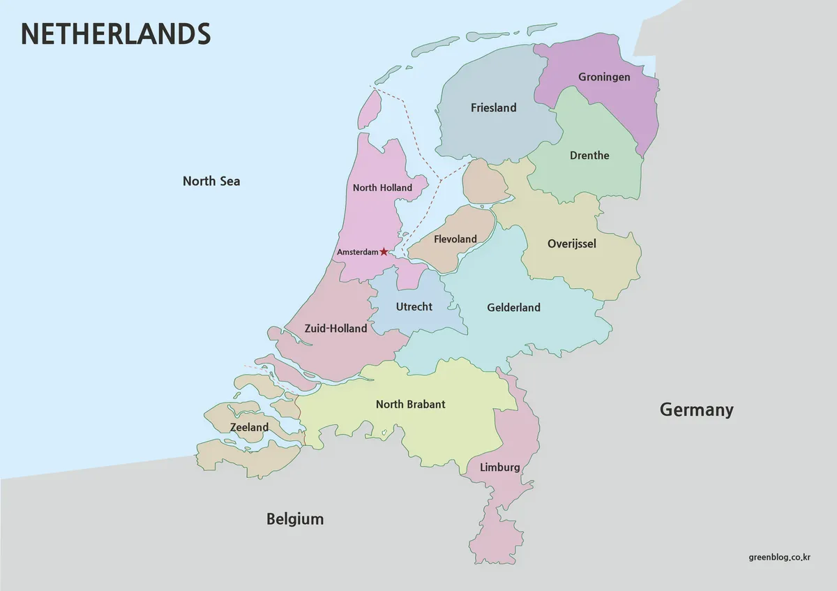
On the color Netherlands Map, neighboring provinces receive different soft fills. This is especially helpful around Utrecht, Flevoland, North Holland, South Holland, and Gelderland, where narrow connections and large water shapes complicate the center of the country. Groningen, Drenthe, Overijssel, North Brabant, and Limburg remain easy to distinguish along the land borders.
The palette is categorical, not statistical. It does not encode population, elevation, flood risk, land reclamation, economy, or political results. Anyone adapting the graphic for data should replace or mute the original colors, add a sourced legend, and state the reference year. Otherwise, viewers may read an accidental numerical meaning into the pastel scheme.
Amsterdam’s star provides a useful national-capital reference, but the city is not a province and is not the capital of the country’s provincial system. No other cities or provincial capitals are marked. The North Sea label and coastal silhouette help orientation, while the Wadden Sea, IJsselmeer, Markermeer, and Zeeland delta waters remain unnamed.
The mixed naming convention is most visible here. If an English-language presentation uses “North Holland” and “North Brabant,” change “Zuid-Holland” to “South Holland” and consider whether “Friesland” should remain the familiar English form or be replaced consistently with official Fryslân.
Black and White Printable Version
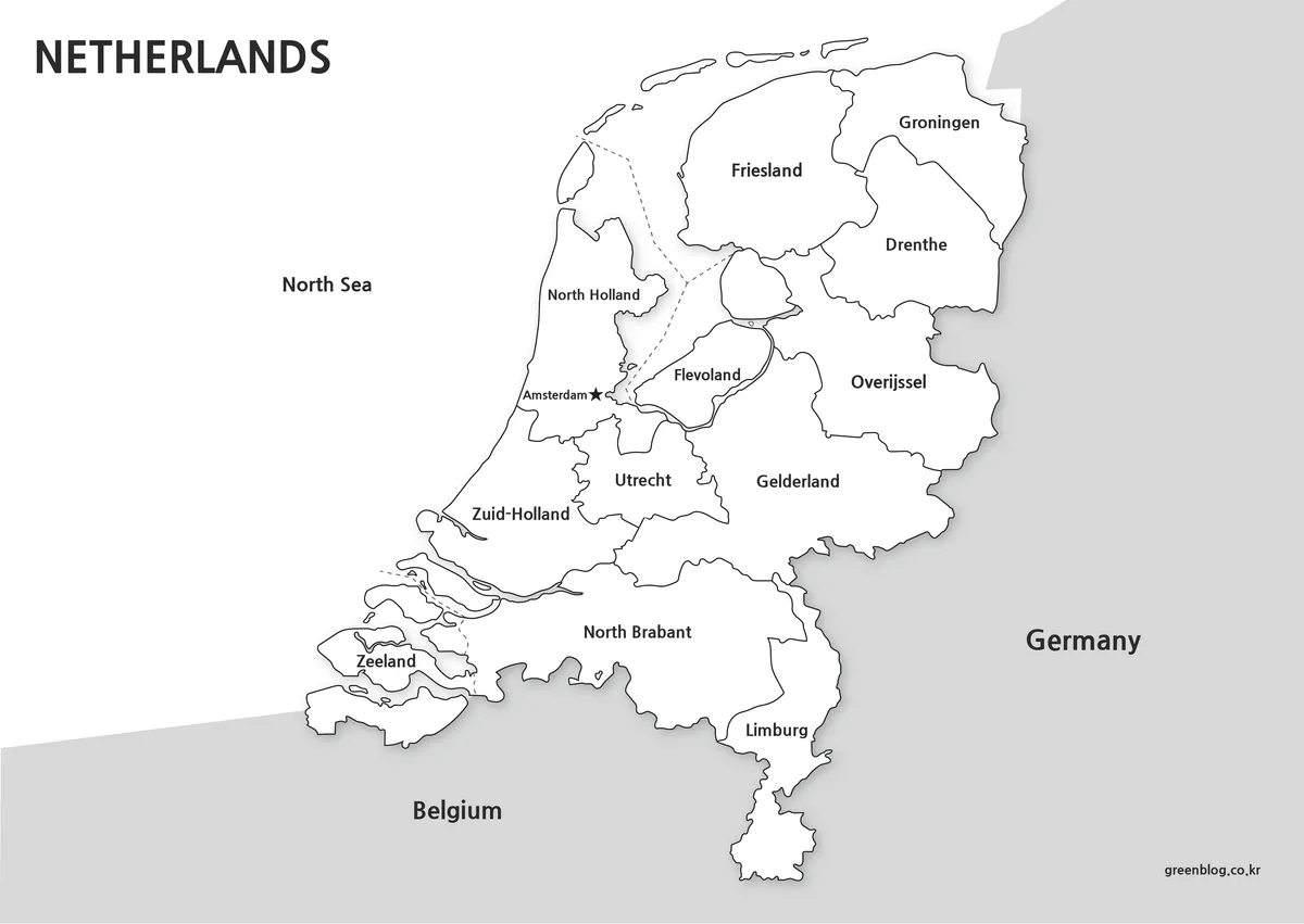
The black-and-white Netherlands Map retains the 12 province names, Amsterdam star, neighboring-country labels, North Sea text, island outlines, and dashed central line. Removing the pastel fills makes this edition suitable for photocopies, report inserts, answer sheets, or documents where color would compete with surrounding content.
Because water and land are both largely white, the coastline and internal shorelines carry more visual responsibility than in the color version. Print one test copy before producing a class set, particularly if the page is reduced. Small island outlines and narrow provincial borders around Flevoland can disappear more quickly than the large eastern regions.
This version can act as the answer key for an unlabeled exercise. Students can first identify provinces on the blank image, then check spelling and placement here. A separate note should still explain the language mixture and the fact that only Amsterdam is marked.
Blank Outline Map for Editing
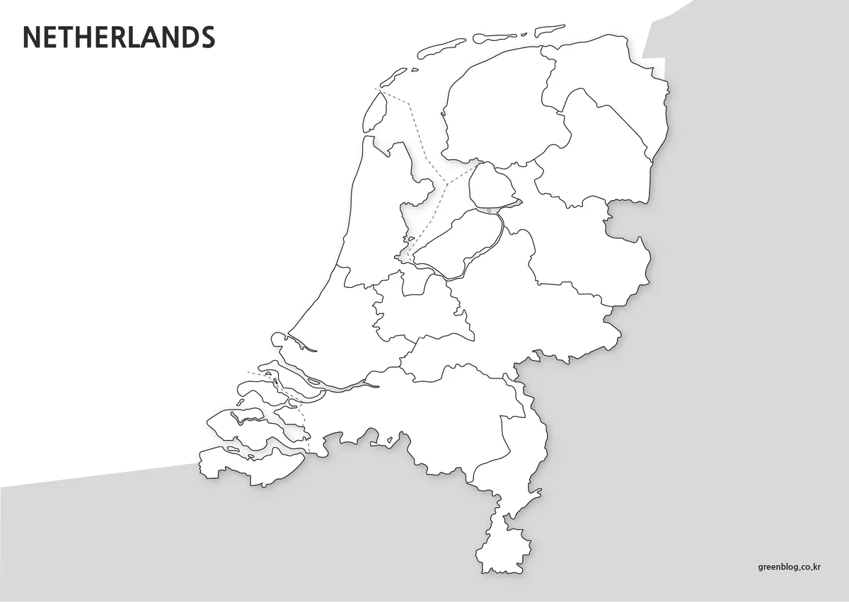
The blank Netherlands Map removes provincial names, Amsterdam, Belgium, Germany, the North Sea label, and all internal color. It preserves the provincial lines and surrounding gray context, creating a base for quizzes, custom legends, or sourced thematic overlays.
Its top edge needs correction before publication. Instead of a clean title, the image contains cropped text fragments—“RLANDS” at the far left and another “ANDS” fragment nearer the center. Crop the header strip, cover the fragments with a background matching the page, or place a new clean title above the map. Do not present the uncorrected version as finished artwork.
For a labeling sequence, begin with Groningen, Friesland, and Drenthe in the north; continue through Overijssel, Flevoland, Gelderland, Utrecht, North Holland, and South Holland; then finish with Zeeland, North Brabant, and Limburg. Coastal shapes and the long Limburg extension provide strong recall cues even after all text has been removed.
Work on a duplicate file. Add symbols and data only with a legend, date, and source, and avoid treating the raster preview as a precise geospatial layer. Exact municipal boundaries, coordinates, transport routes, or flood analysis require a current authoritative dataset.
Designed for Printing and Presentation Use
A3 landscape space helps preserve the Wadden Islands, Zeeland’s fragmented coastline, and the narrow area around Amsterdam and Flevoland. For a presentation, use the color version when the audience must distinguish provinces quickly. For a report or worksheet, choose monochrome. For an assessment or original infographic, start with the repaired outline.
The Netherlands Map can support several specific tasks:
- Learn all 12 provinces in a north-to-south sequence.
- Locate Amsterdam within North Holland.
- Compare the German and Belgian land borders.
- Identify the Wadden, central-water, and delta patterns.
- Standardize Dutch or English provincial naming.
Do not use these files for navigation or measurement. They lack roads, a scale, coordinates, and a projection statement. Their value is a clear provincial hierarchy and three coordinated treatments, not legal boundary precision or physical-geography detail.
Frequently Asked Questions
Can I print the Netherlands map in A3 size?
Yes. All files were created in high resolution specifically for A3 printing.
Does the map include roads and city-level detail?
No. The focus is on provincial structure and regional readability rather than transportation details.
Is the outline version editable?
Yes. The blank version was designed for editing, annotations, and custom graphic projects.
Are neighboring countries included?
Yes. Belgium and Germany appear as simplified background references to help show the geographic position of the Netherlands.
Does the blank Netherlands Map have a clean title?
No. The outline preview has clipped, duplicated title fragments along its upper edge. Remove or cover that strip and add a fresh heading before using the image in a finished worksheet, slide, or publication.
Map File Information
The ZIP archive contains color, black-and-white, and blank provincial map images prepared for A3 use.
- Included Versions: Color labeled, black-and-white labeled, and blank outline
- Printable Size: Prepared for an A3 landscape layout
- File Type: Image files in a ZIP archive
Related Maps
Additional Resources
- Government of the Netherlands: Provinces: official background on the provincial tier of Dutch public administration.
Green Map creates custom-edited map images using open geographic data sources such as geoBoundaries, Natural Earth, OpenStreetMap, and government open data.
These maps are edited visual materials, not raw data files, and are provided for education, documents, presentations, and graphic reference.