The Colombia Map collection brings together three administrative layouts for readers who need a clear view of the country’s departments: a labeled color map, a labeled black-and-white map, and an unlabeled outline map. Colombia’s shape is especially useful for geographic explanation because the country opens onto both the Caribbean Sea and the Pacific Ocean, narrows toward Panama in the northwest, and reaches into the Amazon basin in the southeast. Its international borders with Venezuela, Brazil, Peru, Ecuador, and Panama are visible around the mainland.
The maps show Colombia’s 32 departments together with Bogotá, Distrito Capital. They also reveal a strong contrast in administrative scale. Departments such as Vichada, Amazonas, Caquetá, Meta, and Guainía cover broad areas in the east and south, while Caldas, Risaralda, and Quindío occupy such compact spaces in the central Andes that the labeled maps identify them through a numbered key. That visual challenge is specific to Colombia and is one reason a carefully arranged national map is more informative than a plain alphabetical list.
The download collection is described as an A3 set of 4960 × 3508-pixel JPG files created with Adobe Illustrator and Photoshop. The three images supplied for page display are 1200 × 1277-pixel WEBP previews. Keeping those two roles separate allows the article page to load a practical preview while the archive provides the larger files intended for printing, slides, classroom reference, and image-based annotation.
Table of Contents
What the Colombia Map Shows
Colombia occupies the northwestern corner of South America. Venezuela lies to the east and northeast, Brazil to the southeast, Peru and Ecuador to the south, and Panama to the northwest. The Caribbean coast runs across the north past departments such as La Guajira, Magdalena, Atlántico, Bolívar, Sucre, and Córdoba, while the Pacific coast follows Chocó, Valle del Cauca, Cauca, and Nariño.
This two-coast position helps explain the country’s recognizable outline, but the administrative pattern is shaped just as strongly by the Andes. Many smaller departments gather through the western and central part of the country, where Antioquia, Caldas, Risaralda, Quindío, Tolima, Huila, Cundinamarca, and Boyacá form a dense network. Bogotá is marked separately inside Cundinamarca as the capital district, making it possible to distinguish the national capital from the surrounding department.
East of the Andes, the map becomes more open. Arauca and Casanare lead into Vichada across the Orinoco plains, while Meta, Guaviare, Guainía, Vaupés, Caquetá, Putumayo, and Amazonas extend toward the Amazonian and eastern borderlands. A Colombia Map therefore communicates more than names: it shows how compact Andean departments give way to much larger territories toward Brazil, Peru, and Venezuela.
Administrative Divisions and Label Density
Colombia is divided into 32 departments, and the map also identifies Bogotá, Distrito Capital. The supplied images focus on this first-level administrative structure rather than the country’s municipalities. Roads, airports, elevation, tourist attractions, and transport routes are intentionally absent, leaving room for department names and boundaries.
The most difficult labeling area lies in the Coffee Region west of Bogotá. Caldas, Risaralda, and Quindío are small and closely packed, so the labeled versions use the numbers 1, 2, and 3 with a separate key. This keeps the map readable without enlarging those three names until they overlap nearby Antioquia, Chocó, Valle del Cauca, or Tolima.
Other narrow or irregular departments require different label treatment. Atlántico is identified with a leader line on the Caribbean coast, while La Guajira follows the long northeastern peninsula. Putumayo stretches along the southern border, and Norte de Santander occupies a tall shape beside Venezuela. These visible differences make the map suitable for studying form and position as well as memorizing names.
Labeled Color Map for Regional Comparison
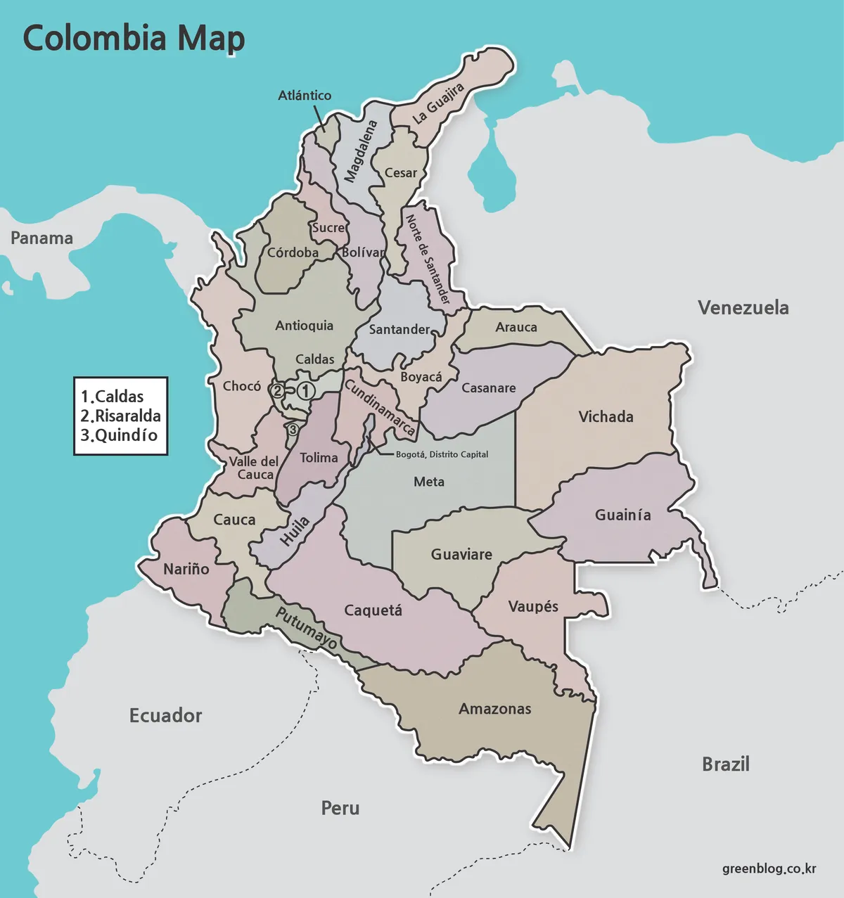
The first Colombia Map uses muted colors to separate adjacent departments while keeping neighboring countries in gray. The Caribbean and Pacific waters appear in blue, so Colombia’s access to both coastlines can be recognized immediately. Color is particularly helpful in the central belt, where many boundaries meet within a small portion of the page.
This version fits presentation slides, regional comparison graphics, and blog illustrations in which the audience must locate a department quickly. A teacher can move from the Caribbean departments to the Andean interior and then toward the eastern plains without asking students to rely only on thin boundary lines. The color blocks also make the size difference between compact Quindío and expansive Vichada or Amazonas visually direct.
Black-and-White Map for Printed Reference

The second Colombia Map retains department names, the numbered Coffee Region key, Bogotá’s capital-district label, and surrounding country names while removing the colored department fills. Strong dark boundaries remain clear against the white Colombian territory, and the neighboring countries use a light gray tone. This creates a cleaner hierarchy for reports, worksheets, and monochrome documents.
Readers looking up names may prefer this version because color does not compete with the text. It is also convenient when a worksheet asks students to identify selected coastal, border, or interior departments from a labeled reference. The page can be printed as supplied or used beside the blank version as an answer guide.
Outline Map as a Blank Activity Base
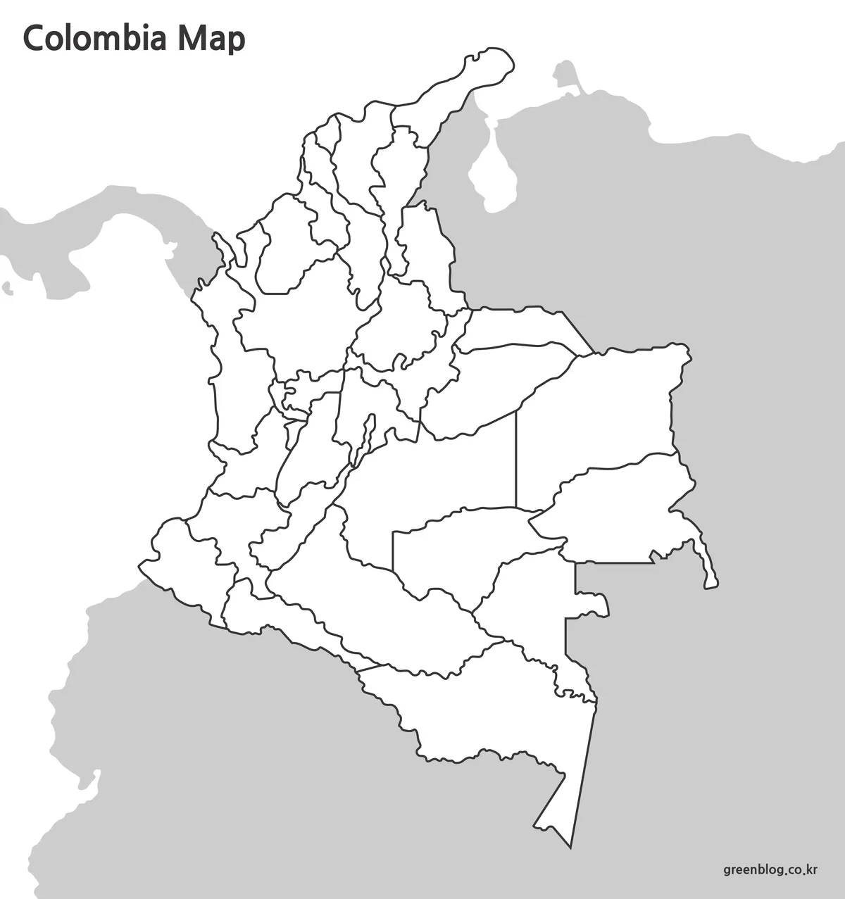
The third image removes all department names and color fills but preserves the national outline and internal boundaries. Its Colombia Map framework leaves open areas where users can add labels, symbols, arrows, or their own color categories. The central departments remain recognizable by shape even though the numbered key is no longer present.
Classroom activities can use the outline to mark Colombia’s five land neighbors, distinguish Caribbean departments from Pacific departments, or group Andean, Orinoco, and Amazonian areas. Designers can add statistical values or highlight a limited set of departments for an infographic. The downloaded outline is a JPG raster image, not an SVG or other vector source, so it supports ordinary image editing rather than individually selectable department paths.
Choosing the Right File
Choose the color map when viewers need to separate departments quickly on a screen. Choose the black-and-white Colombia Map when labels are the priority or the finished material will appear in a monochrome report. Select the outline version when students or editors will supply the information themselves through coloring, labeling, data markers, or route annotations.
The three versions can support one project without changing geographic frameworks. A lesson can introduce Colombia with the color image, provide the black-and-white map as a reference, and use the outline for assessment. A presentation can begin with the entire country and then reuse the blank base to emphasize departments connected to a particular topic.
Before printing, check whether the smallest labels remain readable at the selected paper size. The downloadable originals are described as 4960 × 3508-pixel A3 JPG files, while the images displayed on this page are smaller WEBP previews. For close study of the compact central departments, the larger archive files are the better choice.
Practical Map Projects Based on Colombia’s Geography
A useful border exercise can assign a different color to departments touching Panama, Venezuela, Brazil, Peru, and Ecuador. Another activity can compare the north coast with the Pacific side by marking La Guajira, Magdalena, Atlántico, Bolívar, Sucre, and Córdoba separately from Chocó, Valle del Cauca, Cauca, and Nariño. The Colombia Map provides the boundaries needed for both tasks without adding unrelated transport or terrain details.
The east–west contrast also supports thematic work. Students can compare the densely divided Andean core with the broad eastern departments, while presentation creators can use the outline to place population, environment, agriculture, or travel-related symbols. Because Bogotá is labeled separately within Cundinamarca, projects about the national capital can distinguish the capital district from the surrounding department rather than treating both as the same unit.
For a Coffee Region activity, the numbered key deserves special attention. Caldas, Risaralda, and Quindío should be matched carefully to numbers 1, 2, and 3 in the labeled maps. The outline version can then be used to color those three compact departments as a group without crowding the center of the page with extra text.
Frequently Asked Questions
How many departments appear on the Colombia Map?
The collection shows Colombia’s 32 departments and identifies Bogotá, Distrito Capital, separately within Cundinamarca. The maps present department-level boundaries rather than municipal divisions. This keeps the national pattern readable while still distinguishing the capital district from its surrounding department.
Why are Caldas, Risaralda, and Quindío shown with numbers?
These three departments are tightly grouped in Colombia’s central Coffee Region and leave little room for full labels. The key assigns 1 to Caldas, 2 to Risaralda, and 3 to Quindío. Numbering them prevents text from covering nearby department boundaries.
Which file should I use for a classroom worksheet?
Use the outline map when students need to supply names, colors, or categories themselves. Pair it with the black-and-white version when a labeled reference or answer sheet is needed. Both versions retain the same department boundaries, making them easy to use together.
Are roads, cities, and tourist attractions included?
No. The collection focuses on the national outline, department boundaries, department names, Bogotá’s capital-district label, and neighboring countries. It does not contain highways, airports, terrain, facility markers, or attraction locations, so it should not be used as a navigation map.
Are the files editable vectors?
No. The download is described as a set of JPG images. Users can add text, colors, markers, and other overlays in raster image software, but the departments are not delivered as independently selectable SVG or vector shapes.
Download the Colombia Map Files
The archive contains the labeled color map, labeled black-and-white map, and blank outline map described above. Download the larger originals when preparing a printed handout, presentation slide, classroom activity, document illustration, or custom annotated graphic.
Map File Information
This collection contains three department-level map images of Colombia for printed references, presentations, classroom activities, and annotation.
- Included Versions: Labeled color map, labeled black-and-white map, blank outline map
- Printable Size: A3 layout, 4960 × 3508 pixels
- File Type: JPG images in a ZIP archive
- Intended Use: Classroom handouts, presentation slides, reports, blog graphics, coloring, and image annotation
Related Maps
- Mexico Maps Download Collection
- United States Maps Download Collection
- United Kingdom Printable Map Collection
- France Maps Collection
- South America Map
Additional Resources
- Colombia Travel: Explore Colombia’s Caribbean, Pacific, Andean, Orinoco, Amazonian, and island regions through the country’s official tourism website.
Green Map creates custom-edited map images using open geographic data sources such as geoBoundaries, Natural Earth, OpenStreetMap, and government open data.
These maps are edited visual materials, not raw data files, and are provided for education, documents, presentations, and graphic reference.