The Paraguay map collection on this page provides three ways to examine a landlocked South American country whose internal geography is strongly shaped by rivers and an uneven pattern of administrative divisions. A softly colored department map, a labeled black-and-white edition, and an unlabeled outline version are included. Together, they support quick reference, monochrome printing, classroom exercises, presentation work, and custom annotation without forcing one design to serve every task.
Paraguay lies between Bolivia, Brazil, and Argentina, but its departments are not distributed evenly across the national territory. Three very large western departments occupy most of the Chaco, while a tighter group of smaller departments fills the east and south. That contrast makes a map especially valuable: a list of names cannot show how Alto Paraguay, Boquerón, and Presidente Hayes compare in scale with Central, Cordillera, Guairá, or the capital district around Asunción.
The source artwork was arranged for a high-resolution A3 landscape page, with the country enlarged while neighboring states remain visible as orientation references. The downloadable archive contains image files for the three designs. Readers can therefore select a finished labeled reference or begin with a cleaner boundary base, depending on whether the final result will be printed, projected, marked by hand, or incorporated into a graphic.
Table of Contents
Reading Paraguay’s Administrative Shape
The Republic of Paraguay covers about 406,752 square kilometers and is divided into 17 departments plus the capital district of Asunción. The supplied Paraguay map shows all 17 departmental boundaries and places the capital district within the compact southern cluster. It is a department-level reference rather than a road atlas or municipal map, so roads, district-level subdivisions, terrain, and travel routes should not be inferred from it.
One of the clearest visual patterns is the contrast between the Región Occidental, commonly called the Paraguayan Chaco, and the Región Oriental. Alto Paraguay, Boquerón, and Presidente Hayes form the broad western side. The eastern side contains the other 14 departments and Asunción, with much smaller shapes concentrated around the central, eastern, and southern portions of the country. The Paraguay River is the major geographic divider between these two natural regions, even though this collection is designed primarily around administrative boundaries rather than full hydrographic detail.
Border relationships also help readers orient the page. Bolivia appears northwest of the Chaco; Brazil follows the northern and eastern side; and Argentina borders Paraguay to the south and southwest. The Paraná River forms a substantial part of the eastern and southeastern international boundary with Brazil and Argentina. On the color artwork, waterways near the Alto Paraná area add geographic context without turning the design into a river-system map.
What the Paraguay map Collection Includes
The three versions share the same national outline and department structure, making direct comparison straightforward. The labeled designs identify Alto Paraguay, Boquerón, Presidente Hayes, Concepción, San Pedro, Amambay, Canindeyú, Cordillera, Central, Caaguazú, Guairá, Paraguarí, Caazapá, Alto Paraná, Itapúa, Misiones, Ñeembucú, and Asunción. Some labels in the artwork use simplified spellings without Spanish accent marks, so the standard spellings should be used in written assignments and formal captions.
The map set is organized around function rather than decorative variation. Color helps separate adjoining departments; black and white preserves names while reducing visual competition; and the outline removes labels so the reader can create a new information layer. The neighboring-country labels remain intentionally simple because the page focuses on Paraguay, not on the internal divisions of Bolivia, Brazil, or Argentina.
Color-Coded Department Reference
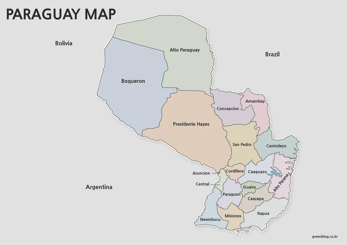
Muted fills make the extreme size contrast between western and eastern departments immediately apparent. They also help distinguish closely packed areas near Asunción, where Central, Cordillera, Paraguarí, and nearby departments would be harder to follow if every shape used the same fill. A thin light edge around the country keeps the national form legible against the gray surroundings.
This color Paraguay map is the strongest choice for a slide, country profile, or classroom display in which viewers need to recognize department shapes quickly. Because the palette is restrained, dark labels remain readable and the administrative pattern stays more important than the decoration. It can also support comparisons such as the three Chaco departments versus the more subdivided eastern region.
Labeled Black-and-White Version
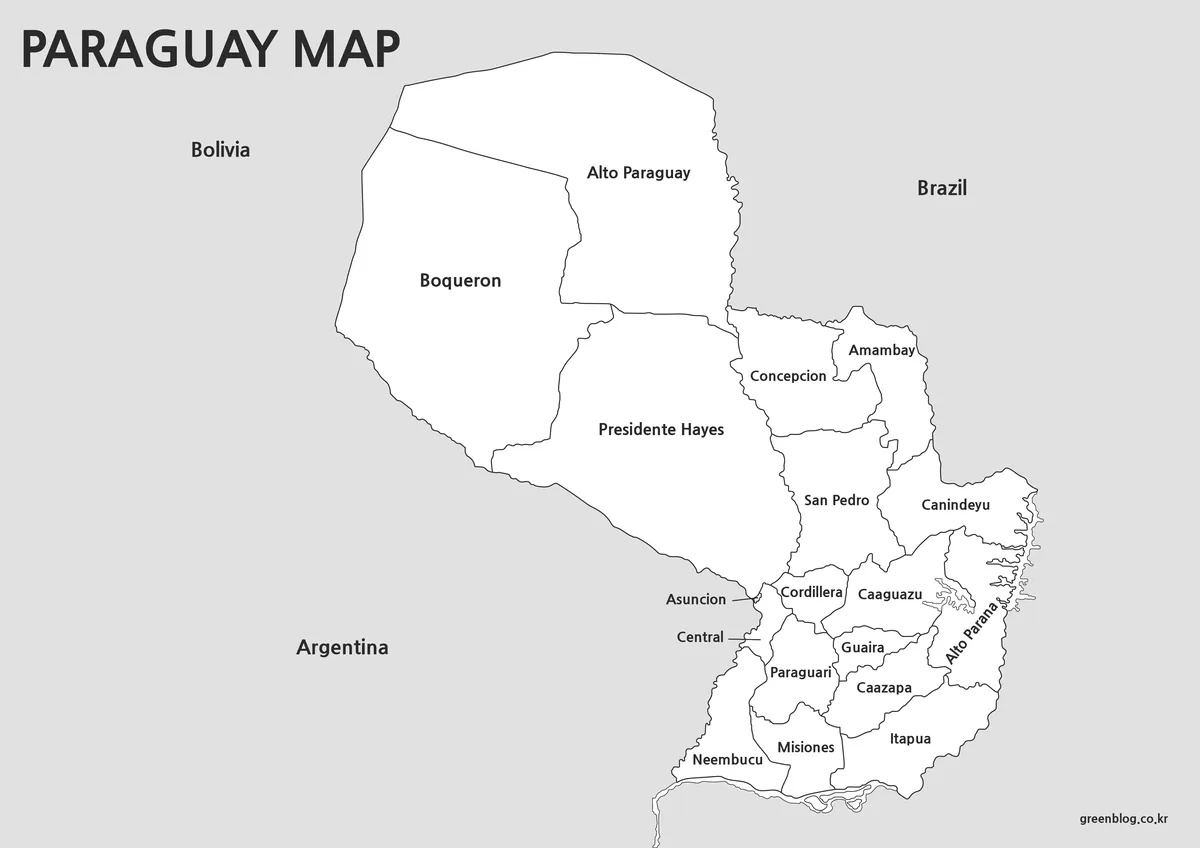
The monochrome Paraguay map retains department names, boundaries, surrounding countries, and the Asunción callout while removing the pastel fills. Large western labels have generous space, whereas the southern half illustrates the challenge of fitting names into narrower departments. Leader lines around Asunción and Central help separate two compact labels that might otherwise be confused.
Choose this version for reports, study sheets, document appendices, or classroom handouts where names must already be present. Students can still shade the departments, circle border areas, or mark the east–west regional division without having to write every label. Its pale background and dark linework also sit comfortably beside text in a printed project.
Unlabeled Department Outline
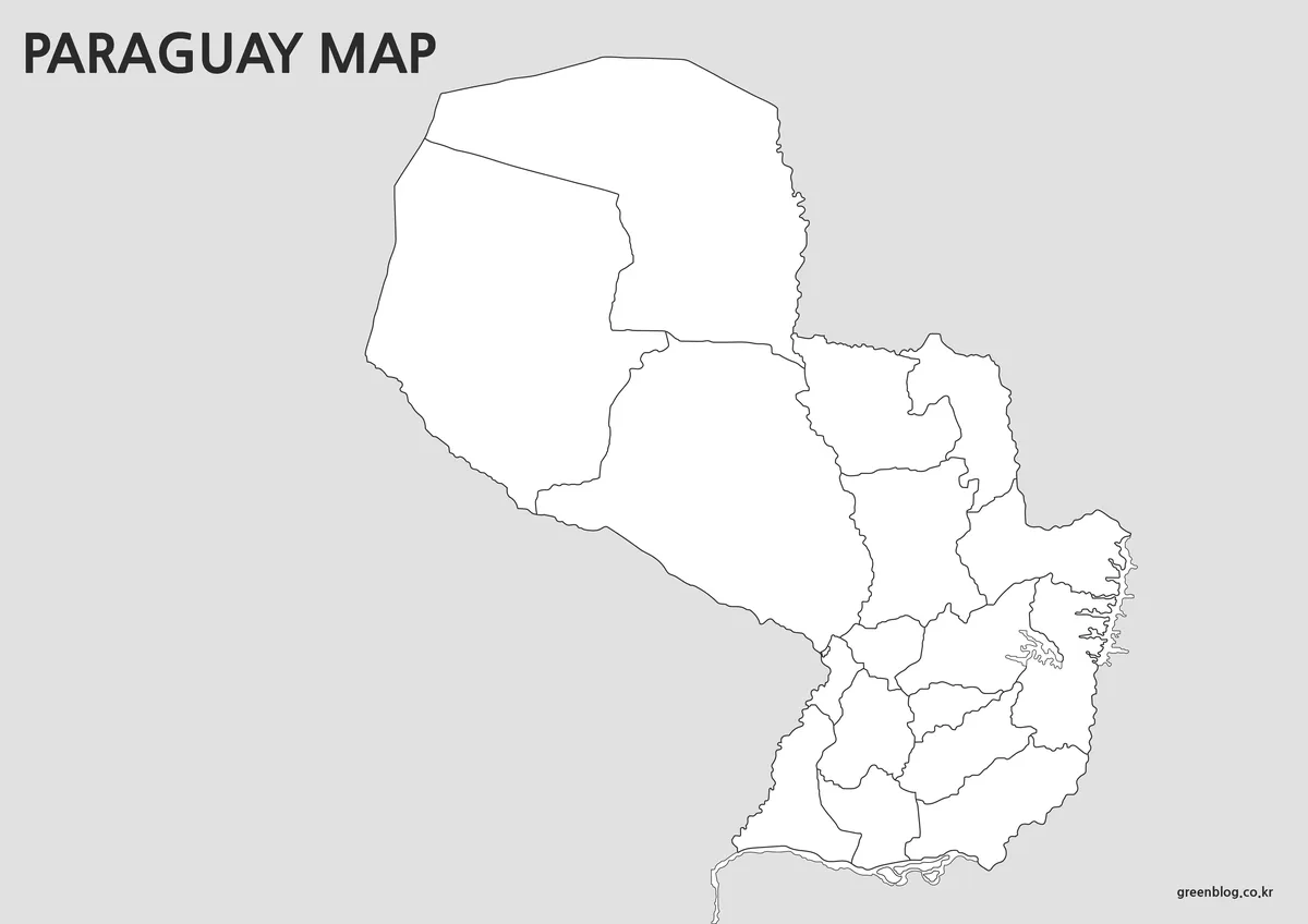
The outline edition preserves the external border and internal department lines but removes place names. It is not an empty national silhouette: the departmental framework remains available for coloring, numbering, grouping, and data-based annotation. That distinction matters when selecting a file for an activity.
A teacher could ask students to identify the three Chaco departments, add Asunción, or color every department bordering Brazil. A designer could use the same Paraguay map as a raster base for a regional statistic, placing symbols over selected departments or adding a route concept without competing with existing text. Since the supplied download is an image collection, it should not be described as an editable vector source.
Choosing a Version for Your Project
Start with the information that must already be visible in the finished work. Use color when department separation needs to be understood at a glance, especially during a projected presentation. Select black and white when names are required but the map will be printed inside a worksheet or report. Pick the outline when the assignment itself requires readers to supply labels, categories, colors, or markers.
Scale also affects the decision. At A3 size, the labeled versions provide more room for compact names around Asunción and the southern departments. If the Paraguay map is reduced substantially, the color edition may communicate the department pattern more effectively than small text, while the outline remains the clearest background for a limited set of custom annotations. Always check a print preview after resizing so no label is clipped by the page margins.
Practical Ways to Use the Files
In a geography lesson, the Paraguay map files can illustrate why the country is often discussed as two broad natural regions despite having 17 departments and a separate capital district. Learners can compare the expansive western Chaco with the denser eastern department pattern, then locate the three neighboring countries. The blank version can become an answer sheet or a labeling exercise, while the monochrome edition serves as the reference key.
Presentation creators can place the color artwork on an introductory slide and use the outline on later slides for a narrower topic. For example, selected departments can be highlighted for a travel sequence, a cultural comparison, or a statistical graphic, provided the added information comes from a suitable source. Bloggers and report writers can use the labeled Paraguay map to establish location before discussing a specific department, border corridor, or river relationship.
The layout was organized to keep the entire country prominent without removing the neighboring-country context that makes a landlocked nation easier to place. The unusual shift from enormous western polygons to closely packed southern shapes is preserved rather than artificially equalized. That makes the collection useful not only as a download but also as a visual explanation of Paraguay’s administrative geography.
Frequently Asked Questions
What administrative areas are shown on the Paraguay map?
The collection shows Paraguay’s 17 departments and the separate capital district of Asunción. It does not show municipalities, roads, terrain, or a full network of rivers. The labeled maps are best treated as department-level administrative references, while the outline retains the same boundaries without names.
Which version should I print for a classroom worksheet?
Choose the black-and-white edition when students need department names for reference or annotation. Select the outline when the task is to recall names, color regions, locate Asunción, or identify departments along an international border. Printing at the intended scale first helps confirm that the smaller southern divisions remain easy to distinguish.
Does the blank map include internal boundaries?
Yes. “Blank” in this collection means that labels and color fills have been removed; the departmental boundary network remains. This makes the file appropriate for department-based exercises, custom legends, numbered quizzes, and infographic overlays rather than activities requiring only the country’s outer silhouette.
Why are the western departments so much larger on the page?
Alto Paraguay, Boquerón, and Presidente Hayes cover the broad Chaco region west of the Paraguay River. The eastern and southern parts of the country are divided into many smaller departments. The difference is a real feature of the administrative layout, not a distortion introduced by the page design.
Can I use these files in a presentation or blog post?
The image versions are suited to presentations, educational documents, and illustrated articles, subject to the site’s stated usage terms. Select the labeled design when readers need immediate orientation and the outline when you plan to add your own information. Redistribution or resale of the original download files is not permitted.
Map File Information
This archive provides three high-resolution map images for department reference, monochrome printing, and custom annotation.
- Included Versions: Color administrative, labeled black-and-white, and unlabeled department outline maps
- Printable Size: High-resolution A3 landscape layout
- File Type: JPG and PNG images in a ZIP archive
- Intended Use: Education, printing, presentations, blog graphics, and raster annotation
Related Maps
- Argentina Map Pack – Color, Blank, and Printable A3 Maps
- Printable Bolivia Map Collection
- Printable Colombia Map Set – Regional, Blank, and Black & White Versions
- South America Map Collection
Additional Resources
- Paraguay: Political and Geographic Profile: This official government profile summarizes the country’s area, borders, natural regions, 17 departments, and capital district.
Green Map creates custom-edited map images using open geographic data sources such as geoBoundaries, Natural Earth, OpenStreetMap, and government open data.
These maps are edited visual materials, not raw data files, and are provided for education, documents, presentations, and graphic reference.