A Paysandú map is especially useful for understanding the contrast between Uruguay’s western river corridor and the broad inland districts that extend toward Tacuarembó. The department lies in western Uruguay, with the Uruguay River forming its boundary with Argentina. Salto borders it to the north, Río Negro to the south, and Tacuarembó to the east. The capital city, also named Paysandú, sits close to the river and concentrates much of the department’s population, commerce, and public services.
Covering 13,922 square kilometers, Paysandú had a population of 121,838 in the 2023 census. That works out to about 8.8 people per square kilometer, so the department combines one major riverside city with widely dispersed towns and rural communities. Guichón, Quebracho, Piedras Coloradas, Porvenir, Chapicuy, and other settlements are separated by large agricultural and natural areas. A simple city marker cannot explain that layout as clearly as a regional boundary map.
This printable collection includes color, black and white, and outline versions in A3 JPG format. Teachers can use the files for geography lessons and worksheets, while bloggers and presentation creators can compare municipalities, neighboring departments, thermal areas, and the river border. The blank version also works as a base for adding town markers, travel routes, population data, or project labels. Because the department is wide and its settlements are spread out, a Paysandú map gives each municipality enough room to remain readable.
Table of Contents
Nine Municipalities Across the Department
Paysandú contains nine municipalities: Piedras Coloradas, Quebracho, Lorenzo Geyres, Porvenir, Tambores, Chapicuy, Guichón, Cerro Chato, and El Eucalipto. They represent towns and rural service areas outside the departmental capital rather than nine equal sections centered on Paysandú city.
Chapicuy and Quebracho lie toward the northwestern side, close to the river corridor. Lorenzo Geyres occupies the north, while Porvenir sits southeast of the capital. Piedras Coloradas and Guichón are found farther inland, and Tambores, Cerro Chato, and El Eucalipto extend toward the eastern side near Tacuarembó.
The Paysandú map makes this distribution easier to follow because the western municipalities are connected to the Uruguay River and the capital, while the eastern municipalities are spread across larger inland spaces. It also shows why travel between settlements can involve long distances even within the same department.
A River Border Facing Argentina
The Uruguay River defines the entire western edge of Paysandú. Across the water lies Argentina’s Entre Ríos Province, and the Paysandú–Colón international crossing connects the two sides. This border gives the department a strong cross-river identity and makes the capital an important point for travel and regional movement.
The western corridor includes the capital, Chapicuy, and nearby river-oriented communities. Moving east reveals a different pattern of farms, woodland, thermal areas, and smaller inland towns. The contrast between these two zones is one of the main reasons a detailed regional map is more useful than a general map of Uruguay.
Color Paysandú Map for River and Inland Comparison
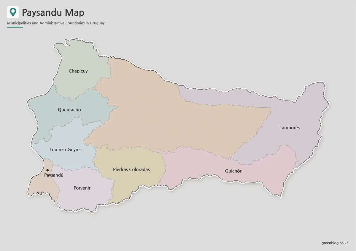
The color Paysandú map separates the nine municipalities so readers can compare their positions without relying only on long place names. Color is particularly helpful in the east, where Tambores, Cerro Chato, El Eucalipto, and Guichón occupy broad inland areas that may otherwise appear similar when viewed only as boundary lines.
It also supports fast comparison between the northwestern municipalities and the southern interior. On presentation slides, viewers can identify the main regional groups before reading every label. Teachers may use the color file to explain how settlement patterns change from the Uruguay River toward the interior.
Black and White Paysandú Map for Print Materials
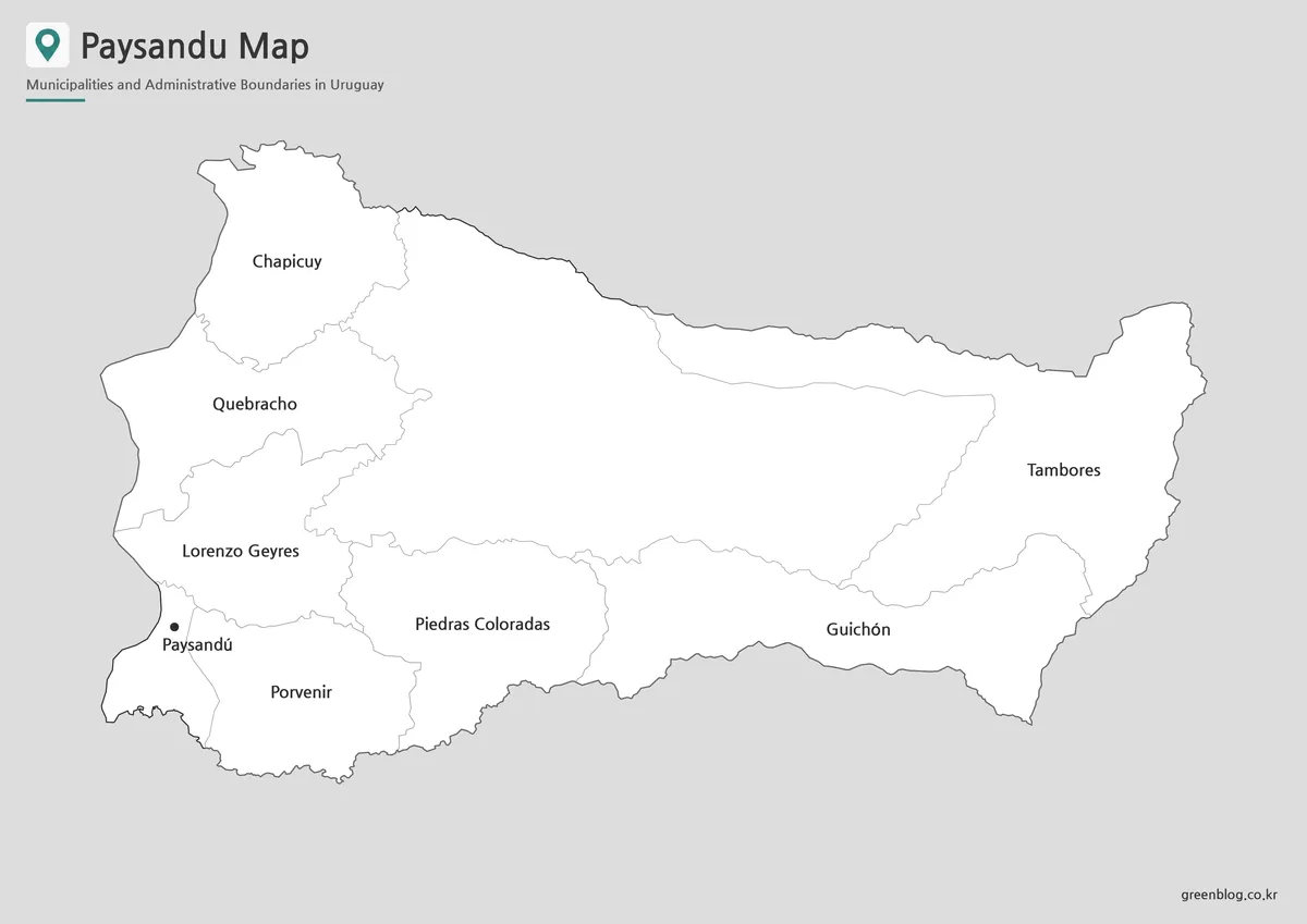
For worksheets, reports, and reference sheets, the black and white Paysandú map places more attention on names and boundaries. Several municipality names are relatively long, including Lorenzo Geyres, Piedras Coloradas, and El Eucalipto, so a cleaner background helps preserve label clarity.
The A3 layout gives the eastern and western areas enough space to remain distinct. This version works well beside written notes about neighboring departments, the international border, or the location of the capital. It can also be printed without depending on color to communicate the administrative structure.
Outline Paysandú Map for Custom Projects
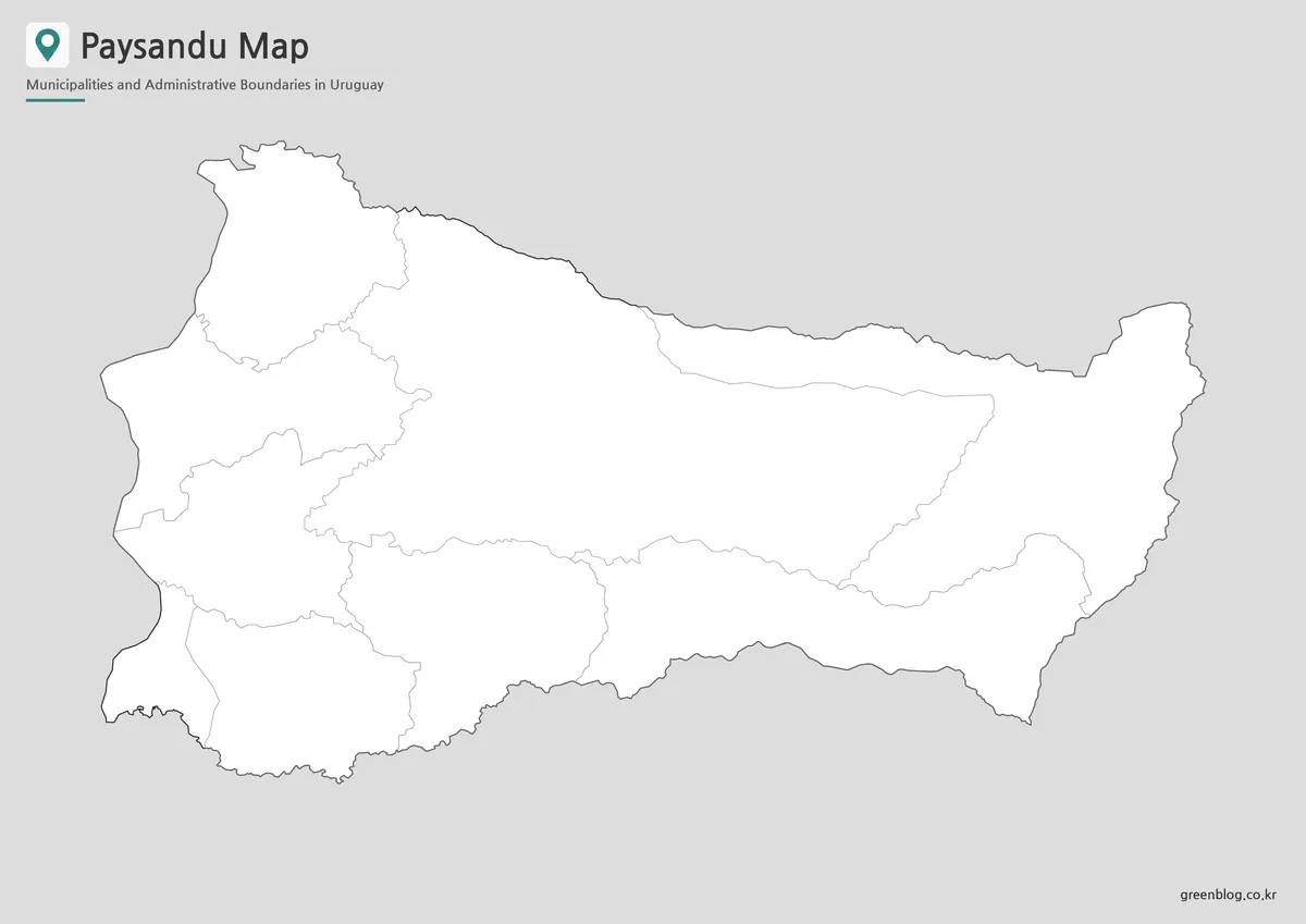
The outline Paysandú map removes labels and fills while keeping the department shape and municipal boundary lines. It is designed as a working base rather than a finished reference image.
Students can label all nine municipalities, mark the Uruguay River, or color the western and eastern zones differently. Designers may add population figures, thermal sites, natural areas, or routes between Paysandú city, Guichón, Quebracho, and Chapicuy. The blank layout also works well for highlighting only one municipality or grouping several areas for an infographic.
Thermal Areas and Natural Landscapes
Paysandú is one of Uruguay’s best-known thermal regions. Termas de Guaviyú lies in the northwestern part of the department, while Termas de Almirón is located near Guichón in the southeast. Their positions show how the department’s visitor destinations are distributed across very different parts of the region.
The Montes del Queguay protected landscape adds another inland reference point. For travel presentations, the map can connect the capital with hot springs, river areas, and natural landscapes. For classroom use, it helps explain why Paysandú is not organized around a single urban center even though the capital dominates population and services.
Choosing the Right Version
Use the color file when municipal comparison is the priority. Choose the black and white design for printing, written reports, or classroom handouts. Select the outline version when the project requires custom data, routes, town markers, or color categories.
All three files describe the same department, but they offer different levels of visual information. A Paysandú map can therefore work as a finished regional reference or as a base for a more specialized project.
Frequently Asked Questions
Where is Paysandú located?
Paysandú is in western Uruguay. It borders Salto, Tacuarembó, and Río Negro, while the Uruguay River separates it from Argentina.
How many municipalities are included?
The map includes nine municipalities: Piedras Coloradas, Quebracho, Lorenzo Geyres, Porvenir, Tambores, Chapicuy, Guichón, Cerro Chato, and El Eucalipto.
Is Paysandú both a city and a department?
Yes. Paysandú is the name of the department and its capital city. The city stands on the Uruguay River in the western part of the department.
Which thermal areas are found in Paysandú?
The main thermal destinations are Guaviyú Hot Springs in the northwest and Almirón Hot Springs near Guichón in the southeast.
Can the Paysandú map be printed at A3 size?
Yes. The JPG files use an A3 layout suitable for classroom displays, reports, worksheets, and presentation materials.
Map File Information
This download includes printable Paysandú map versions for educational use, presentation design, document printing, and editable graphic projects.
- Included Versions: Color map, black and white map, outline map
- Printable Size: A3 layout
- File Type: JPG image files
- Intended Use: Classroom handouts, presentations, blog graphics, infographic editing, and printable reference materials
Related Maps
Additional Resources
- Paysandú Tourism Guide : Uruguay’s Ministry of Tourism introduces Paysandú’s river landscapes, thermal destinations, natural areas, and visitor experiences.
More Printable Map Collections
Green Map creates custom-edited map images using open geographic data sources such as geoBoundaries, Natural Earth, OpenStreetMap, and government open data. These maps are edited visual materials, not raw data files, and are provided for education, documents, presentations, and graphic reference.