A Guyana Map reveals a geographic contrast that is easy to miss on a small map of South America: a narrow Atlantic frontage opens into a much broader interior, while ten administrative regions divide the country from north to south. This collection presents that structure in three distinct image-based versions—a color administrative map, a black-and-white labeled map, and a blank outline map with regional boundaries.
Teachers can introduce Guyana’s regional organization, students can practice locating divisions, and designers can build country profiles or data graphics on a consistent base. The portrait layout gives the long southern interior room to remain legible.
Table of Contents
How to Read the Guyana Map
Guyana occupies the northern edge of South America, facing the Atlantic Ocean and adjoining Brazil, Suriname, and Venezuela. Several compact regions meet the coast in the northeast, while large inland divisions extend across much of the center and south. That uneven scale makes the coastal labels harder to place than names such as Cuyuni-Mazaruni or Upper Takutu-Upper Essequibo.
The supplied Guyana Map emphasizes the ten regions rather than roads, cities, terrain, or river networks. Pomeroon-Supenaam, Essequibo Islands-West Demerara, Demerara-Mahaica, and Mahaica-Berbice occupy a crowded coastal sequence, while East Berbice-Corentyne reaches far down the east. Cuyuni-Mazaruni, Potaro-Siparuni, Upper Demerara-Berbice, and Upper Takutu-Upper Essequibo organize the broad interior.
Georgetown, the national capital, is in Demerara-Mahaica, commonly identified as Region 4. The city is not marked on these files, so the collection should be read as an administrative-region resource rather than a city locator. The maps also do not attempt to explain territorial claims or provide a legal boundary reference; their purpose is to show the regional arrangement used for general geographic learning and visual projects.
Ten Regions Across Coastland and Hinterland
The contrast between coastland and hinterland gives the regional boundaries practical meaning. Guyana’s low coastal plain is a narrow belt along the Atlantic, and official national geographic material notes that most of the population lives there. On the map, this concentration corresponds to the cluster of smaller northeastern regions, including the area around Georgetown. Their shapes can be difficult to distinguish when all boundaries use the same visual weight.
The names themselves also reward close reading. “Essequibo” appears in both Essequibo Islands-West Demerara and Upper Takutu-Upper Essequibo, while “Demerara” appears in three regional names. A labeled map reduces the chance of confusing these divisions in a report or lesson. In the most compact coastal area, leader lines connect several names to their regions so the text can sit outside narrow shapes without covering the borders.
Color-Coded Administrative Reference
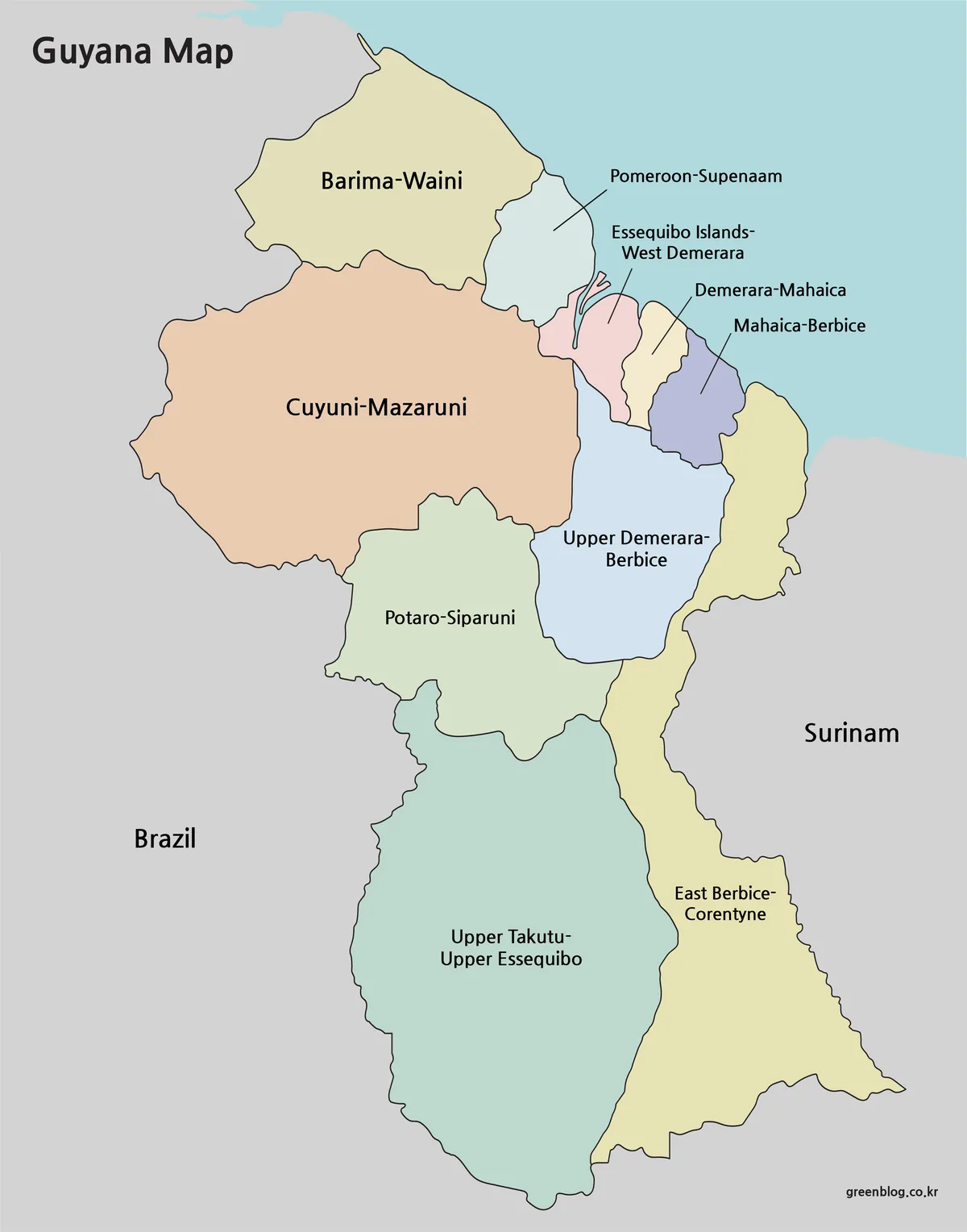
The color Guyana Map separates all ten regions with muted fills. This treatment is most valuable along the northeastern coast, where Essequibo Islands-West Demerara, Demerara-Mahaica, and Mahaica-Berbice meet in a small space. Their adjoining forms are faster to distinguish by fill color than by boundary lines alone, while the larger inland regions remain easy to compare at a glance.
Brazil and Surinam are labeled in the surrounding gray area, and the Atlantic is indicated through the blue background rather than a text label. Venezuela is not named on the supplied image, so viewers using the map for a continental-location lesson may wish to add that reference separately. The color edition is best suited to slides, country-profile graphics, and lessons where the audience needs to identify regional extent quickly.
Labeled Black-and-White Reference
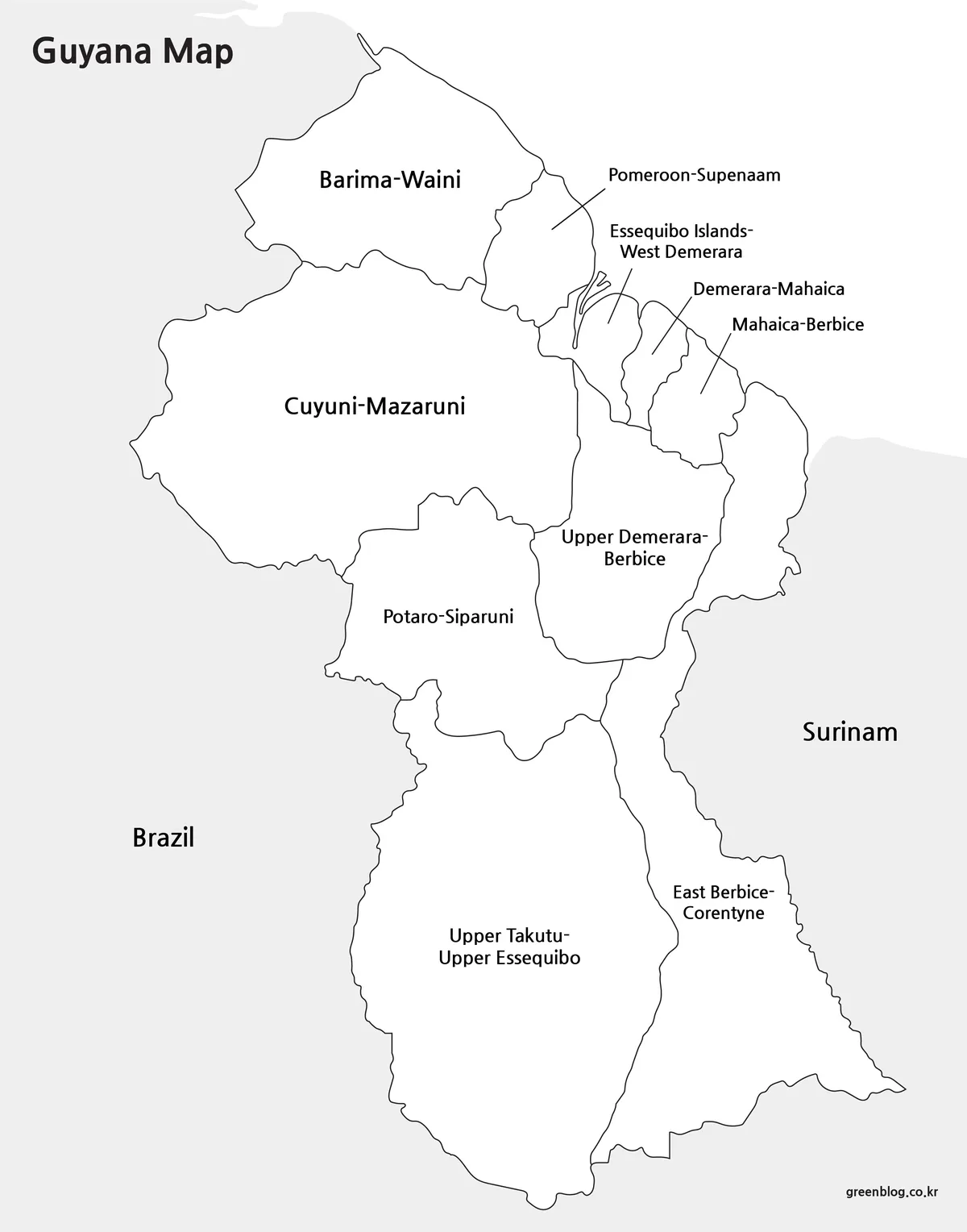
The black-and-white Guyana Map retains the same ten regional names and leader-line arrangement while removing the colored fills. White regions stand against light-gray neighboring land, allowing the country boundary and internal divisions to remain the main structure. This restrained appearance fits reports, worksheets, and presentation notes where a multicolor graphic would compete with surrounding text or charts.
Because several coastal names sit outside their small regions, the connecting lines are important and should remain visible when the image is resized. Before printing, check the page preview rather than relying only on the document’s on-screen view. A very small placement can make labels such as Essequibo Islands-West Demerara difficult to read even though the original image is clear.
Blank Regional Outline
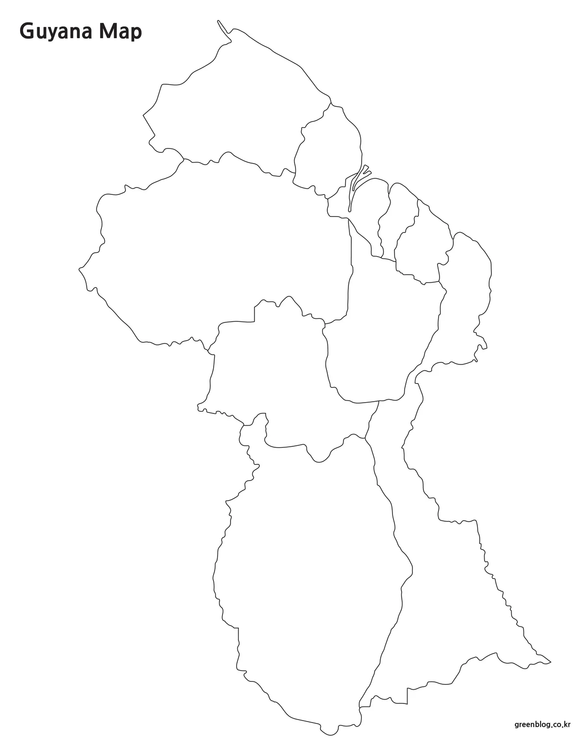
The outline Guyana Map removes place names, surrounding-country labels, and background shading. It preserves the national silhouette and the internal divisions, including the narrow coastal forms and the islands near the Essequibo estuary. The result is a true blank working image, but it is still a raster file rather than a vector editing source.
For a classroom exercise, learners can label the ten regions and then mark Georgetown inside Demerara-Mahaica. A geography project could group the smaller coastland regions separately from the larger interior, while an infographic creator could shade regions by a verified statistic. Users may also add rivers, transport routes, field-study locations, or settlement markers, provided those layers come from an appropriate current source.
Choosing a Version Without Losing Detail
Start with the intended output. Choose the color image when the audience must compare adjacent regions immediately, especially in a projected slide or a South America country profile. Select the black-and-white file when regional names must remain available in a printed handout, report, or study sheet. Use the blank outline when the activity depends on writing, coloring, grouping, or adding custom symbols.
Whichever Guyana Map you choose, keep the portrait proportions unchanged. Stretching it to fill a landscape frame would distort the country and make the relationship between the coast and southern interior misleading. If the page design requires a smaller image, test the long coastal labels first; they will reach the readability limit before the large central and southern labels.
The images measure 1200 pixels wide and approximately 1528 pixels high. Insert them at their original aspect ratio and avoid repeated compression; no A3 print specification was supplied.
Classroom, Presentation, and Design Applications
A regional lesson can begin with the labeled edition, then move to the blank version for recall. Students might locate the coastal cluster and explain why map area does not equal population. A second activity can ask them to distinguish the three names containing “Demerara” or the two containing “Essequibo,” turning label reading into an administrative exercise.
For presentations, the Guyana Map can serve as a base for a single topic rather than carrying every kind of information at once. The color version can introduce the regional structure; a duplicate slide using the outline can then add one set of markers or data values. Keeping each slide limited to one message preserves the visibility of the compact northeastern boundaries.
Designers adding statistics, project locations, or routes should verify that information independently. A legend should describe only the added layer because roads, terrain, and political-claim detail are not part of the original resource.
Frequently Asked Questions
What does the Guyana Map show?
The collection shows Guyana’s national outline and ten administrative regions. The color and black-and-white editions name them, while the blank edition keeps only the outlines. Roads, cities, terrain, and detailed rivers are not included; Georgetown is not marked.
Which file is easiest to use for learning the regional names?
Begin with the black-and-white labeled map because all ten names remain visible without color becoming the main cue. After reviewing it, use the outline version as a self-test. The leader lines around the northeastern coast help connect long names to regions that are too narrow for centered text.
Why do several regions look much smaller near the Atlantic coast?
Guyana’s settlement is strongly concentrated on the narrow coastal plain, and several administrative regions meet in that northeastern zone. Much larger regions extend across the less densely settled interior. The map therefore shows a real contrast in regional area, but it should not be used to infer population totals without accompanying statistics.
Can I add Georgetown and other places to the outline map?
Yes. Georgetown can be placed in Demerara-Mahaica, and other towns or project locations can be added from a current geographic source. Use a consistent marker key and verify coordinates before publication. If many points cluster near the coast, numbered markers with a separate key will preserve boundary visibility better than long labels.
Are all neighboring countries labeled on these maps?
No. The labeled versions show Brazil and use the spelling “Surinam,” but Venezuela is not named. The neighboring areas function mainly as subdued geographic context. If an assignment requires complete border labeling, add Venezuela and use the current English spelling “Suriname” in the accompanying text or annotation.
Map File Information
This download includes printable Guyana map versions for educational use, presentation design, document printing, and editable graphic projects.
- Included Versions: Color map, black and white map, outline map
- File Type: Image files
- Intended Use: Classroom handouts, presentations, blog graphics, infographic editing, and printable reference materials
Related Maps
- Download Uruguay Map Files for Printing, Editing, and Infographics
- Ecuador Map Download for Printing, Classroom Use, and Graphic Editing
- Argentina Map Pack – Color, Blank and Printable A3 Maps
- Printable Colombia Map Set – Regional, Blank, and Black & White Versions
Additional Resources
- Guyana Lands and Surveys Commission — Administrative Regions: Review the names of Guyana’s ten administrative regions and open individual regional reference pages from the national land agency’s public information site.
Green Map creates custom-edited map images using open geographic data sources such as geoBoundaries, Natural Earth, OpenStreetMap, and government open data.
These maps are edited visual materials, not raw data files, and are provided for education, documents, presentations, and graphic reference.