The Maldonado map collection provides a clear view of one of Uruguay’s best-known coastal departments, combining its inland municipalities with the urban and resort areas along the Río de la Plata and Atlantic coast. Maldonado lies in southeastern Uruguay, bordered by Lavalleja to the north, Canelones to the west, and Rocha to the east. Its southern edge includes a long coastline, while major population centers such as Maldonado, Punta del Este, and San Carlos form a more concentrated urban corridor near the coast.
A Maldonado map is especially useful because the department is not defined by a single city or tourism center. Its eight municipalities—Aiguá, Garzón, Maldonado, Pan de Azúcar, Piriápolis, Punta del Este, San Carlos, and Solís Grande—cover very different settings. Small, closely connected urban areas sit beside wide inland districts, and the eastern coast extends toward José Ignacio and Laguna Garzón. A labeled map makes these relationships easier to understand than a simple list of place names.
This printable set includes color, black and white, and outline versions in JPG format. Each file uses an A3 layout suited to classroom handouts, presentation slides, regional comparison sheets, blog graphics, and document printing. The blank boundary version also works as a base for adding city markers, travel routes, population notes, tourism points, or custom infographic labels.
Table of Contents
Eight Municipalities Across Coast and Inland Areas
The department is divided into eight municipalities. Maldonado and Punta del Este occupy relatively compact areas in the south, where urban development is more concentrated. Aiguá and San Carlos extend across much larger inland territories, while Garzón connects inland communities with the eastern coastal zone around José Ignacio.
On the western side, Solís Grande, Pan de Azúcar, and Piriápolis form a sequence of municipalities between the Canelones border and the central urban area. The Maldonado map helps readers compare these different shapes and sizes without losing sight of the coastline. It also makes it easier to see why the department’s population and services are more concentrated in the south than in the broad northern interior.
Coastline and Regional Layout
Piriápolis, Punta del Este, La Barra, Manantiales, and José Ignacio create a long chain of coastal destinations. Punta del Este sits on a peninsula between the Río de la Plata and the Atlantic Ocean, while Piriápolis lies farther west and José Ignacio is positioned to the east. Laguna Garzón and the surrounding waterways help define the transition toward Rocha Department.
Farther inland, Aiguá and parts of San Carlos include rural landscapes and rolling terrain rather than dense coastal development. This contrast gives the department a distinctive map layout: compact urban municipalities in the south, broad rural areas in the north, and a narrow sequence of coastal settlements along the water. For regional studies or travel presentations, the department map provides a practical way to explain that structure at a glance.
Color-Coded Maldonado Map
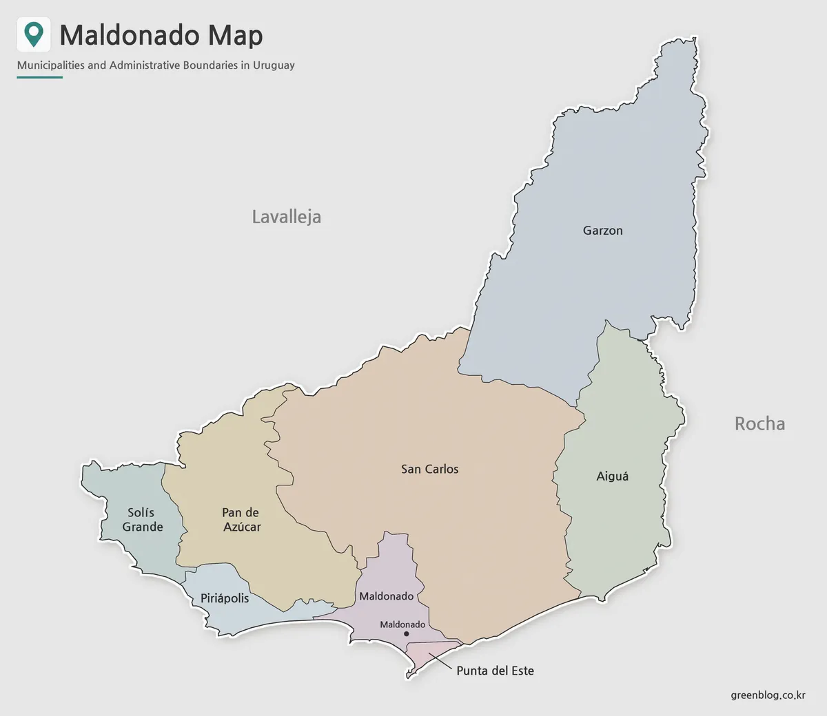
Color separation is particularly helpful in Maldonado because neighboring municipalities vary greatly in size. The smaller Maldonado and Punta del Este areas can be distinguished from the much larger Aiguá and San Carlos districts, while Garzón’s eastward reach toward the coast remains easy to follow.
The Maldonado map in color works well for presentation slides, classroom displays, and visual comparisons with other Uruguayan departments. It is also useful when explaining how the western municipalities connect Piriápolis and Pan de Azúcar with the central urban corridor.
Black and White Printable Version
For reports, worksheets, and documents printed without color, the black and white version keeps the municipality names and boundary lines visually clear. The cleaner layout draws attention to the labels, making it easier to compare the northern interior with the smaller coastal municipalities.
Because several place names are concentrated around Maldonado and Punta del Este, the simplified design is useful when the map must remain readable in a handout or printed reference sheet. The A3 layout also gives longer names such as Pan de Azúcar and Solís Grande enough room to remain legible.
Blank Outline Map for Custom Projects
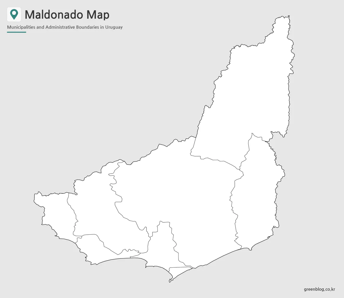
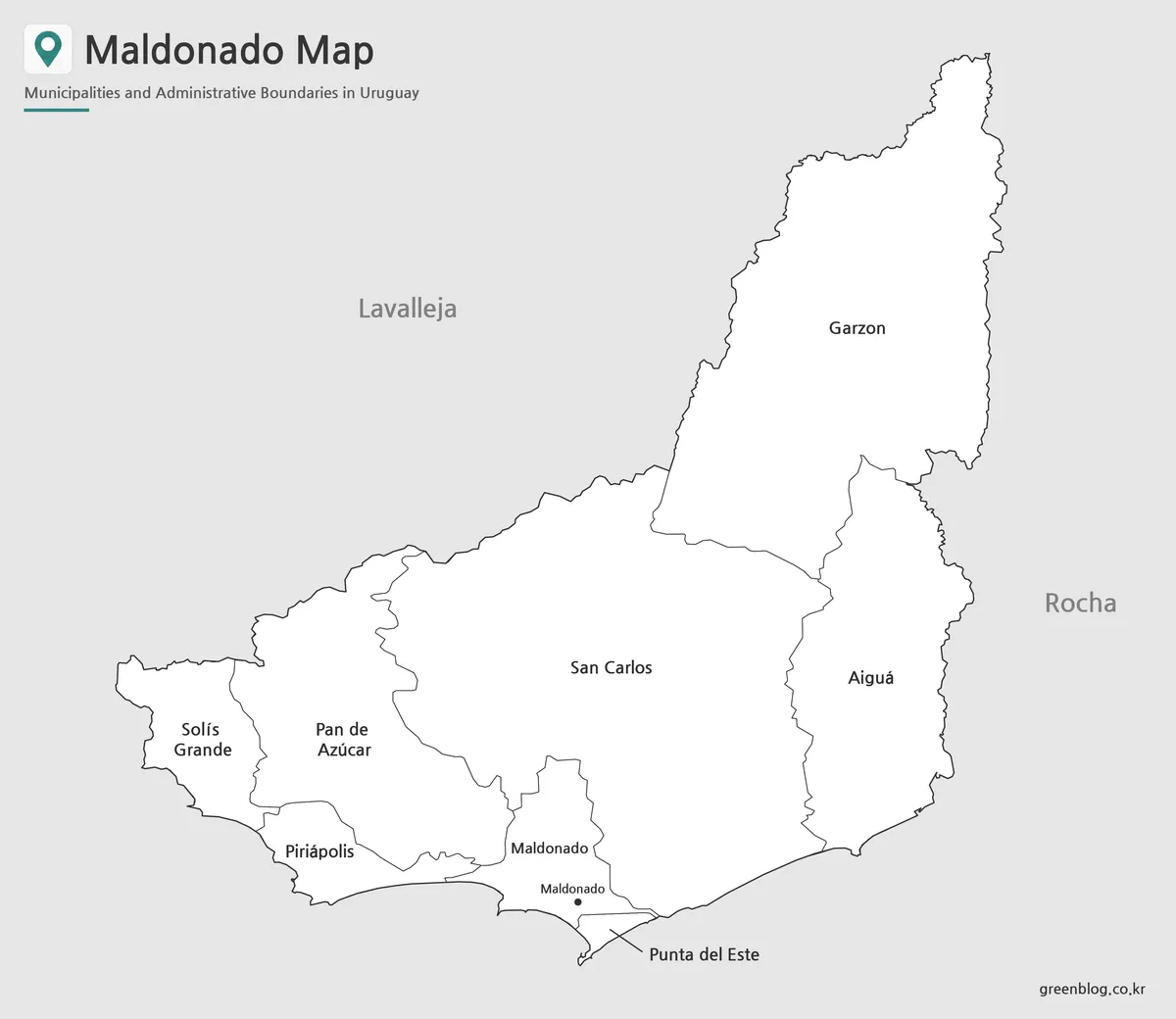
The outline file removes color and labels while keeping the department border and internal municipal divisions. Teachers can use it for labeling exercises, while designers can add route lines, population data, tourism locations, or highlighted coastal zones.
A blank Maldonado map is also useful for marking the relationship between Piriápolis, Punta del Este, and José Ignacio or for separating the Río de la Plata side from the Atlantic coast. Since the base contains only the essential boundary structure, it can support infographics and presentation graphics without competing with added information.
Choosing the Right Version
Choose the color file when quick visual separation is the main goal. The black and white version is better for printed reports, school worksheets, and documents where labels need to remain clear without color. The outline version offers the most flexibility for custom notes and graphic editing.
For a regional overview, the Maldonado map can support lessons about Uruguay’s departmental structure, travel presentations focused on the southeast coast, or comparisons between coastal and inland settlement patterns. Each version presents the same geography with a different level of visual detail.
Frequently Asked Questions
How many municipalities are shown on the Maldonado map?
Eight municipalities are included: Aiguá, Garzón, Maldonado, Pan de Azúcar, Piriápolis, Punta del Este, San Carlos, and Solís Grande.
Are Maldonado and Punta del Este the same municipality?
No. Maldonado is the departmental capital and an administrative center, while Punta del Este is a separate municipality centered on the peninsula and nearby coastal areas.
What can I add to the outline version?
You can add city names, tourism points, travel routes, population information, classroom labels, or custom color groups.
Can the files be printed in A3 size?
Yes. The supplied JPG files use an A3 layout designed for large-format reference, classroom, and presentation use.
Map File Information
This download includes printable Maldonado map versions for educational use, presentation design, document printing, and editable graphic projects.
- Included Versions: Color map, black and white map, outline map
- Printable Size: A3 layout
- File Type: JPG image files
- Intended Use: Classroom handouts, presentations, blog graphics, infographic editing, and printable reference materials
Related Maps
Additional Resources
- Maldonado Tourist Information : The official regional page introduces beaches, nature destinations, cultural sites, events, and visitor information across Maldonado.
More Printable Map Collections
Green Map creates custom-edited map images using open geographic data sources such as geoBoundaries, Natural Earth, OpenStreetMap, and government open data. These maps are edited visual materials, not raw data files, and are provided for education, documents, presentations, and graphic reference.