A Hungary Map makes the country’s administrative pattern easier to understand than its compact national outline alone. Hungary is a landlocked Central European country divided into 19 counties, while Budapest forms a separate capital-level unit surrounded by Pest County. The supplied set presents that structure in three ways: a labeled color map, a labeled black-and-white map, and an unlabeled outline map.
The images are arranged for A3 use and emphasize county boundaries, county names, Budapest, Lake Balaton, and selected neighboring countries. They do not show roads, detailed river courses, elevation, or city networks. That focused content makes the files suitable for geography lessons, regional-reference sheets, presentation slides, report illustrations, labeling exercises, and custom statistical graphics without the visual congestion of an atlas.
Hungary stretches farther east to west than north to south. Western counties connect visually with Austria, Croatia, and the Transdanubian region, while the broad eastern half extends toward Romania and Ukraine across the Great Hungarian Plain. The map therefore provides a practical framework for comparing the counties on either side of the country and locating the small capital area near the center.
Table of Contents
Reading the Hungary Map from West to East
Hungary shares borders with Austria, Slovakia, Ukraine, Romania, Serbia, Croatia, and Slovenia. Six of those neighbors—Austria, Slovakia, Ukraine, Romania, Serbia, and Croatia—are named on the labeled images. Slovenia is not labeled in the supplied layout, so readers using the page for a complete border-country exercise should add it at the short southwestern border between Austria and Croatia.
The western group includes Győr-Moson-Sopron, Vas, Zala, Veszprém, Somogy, Baranya, Tolna, and Fejér. Lake Balaton appears as a pale blue shape between Veszprém, Zala, and Somogy, giving readers a strong visual anchor in Transdanubia. The lake is retained even in the outline image, although other physical features are intentionally omitted.
Central orientation begins with Pest County and Budapest. Pest wraps around the capital, but Budapest is not administratively part of the county. East of this central area, Jász-Nagykun-Szolnok, Hajdú-Bihar, Békés, Csongrád-Csanád, and Bács-Kiskun cover much of the plain, while Szabolcs-Szatmár-Bereg occupies the northeastern corner.
The northern counties form another recognizable band. Nógrád and Heves sit above the central area, and Borsod-Abaúj-Zemplén extends across much of the northeast. On a Hungary Map, these long names require more space than labels such as Vas or Pest, which is one reason the landscape page orientation is important for readability.
Administrative Structure Shown
Hungary’s first-level framework consists of 19 counties and Budapest. The country also has cities with county rights, but those cities are not drawn as additional county-shaped divisions in these images. Readers should therefore interpret the internal polygons as the county framework plus the separate capital area, not as a complete municipal or city map.
The counties shown are Bács-Kiskun, Baranya, Békés, Borsod-Abaúj-Zemplén, Csongrád-Csanád, Fejér, Győr-Moson-Sopron, Hajdú-Bihar, Heves, Jász-Nagykun-Szolnok, Komárom-Esztergom, Nógrád, Pest, Somogy, Szabolcs-Szatmár-Bereg, Tolna, Vas, Veszprém, and Zala. Accents and hyphens are meaningful parts of several Hungarian names, so retaining them is preferable in formal labeling activities.
For quick national context, Hungary covers 93,012 square kilometers and had a population of 9,539,502 in the European Union’s 2025 figures. Budapest is the capital, Hungarian is the official language, and the Hungarian forint is the currency. These facts help frame the map, but the downloadable resource itself remains an administrative reference rather than a demographic or political map.
Three Map Versions and Where to Place Them
The three images use the same national shape and county geometry, allowing a reader to switch versions without relearning the layout. Place each image directly beneath its matching subsection below. This order moves from immediate visual comparison to a restrained reference sheet and finally to a blank working base.
Color-Coded Hungary Map for County Comparison
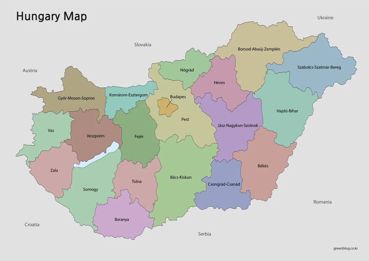
Pastel fills separate adjacent counties while keeping the black boundary lines and names readable. Budapest is highlighted in a distinct warm color and identified by a leader line because its area is too small for a large internal label. The contrast is especially helpful around Pest, Nógrád, Heves, Fejér, and Jász-Nagykun-Szolnok, where several boundaries converge near the center.
Use the color image when the main task is to compare locations quickly on a screen. It can introduce western and eastern county groups, support a presentation about regional statistics, or serve as a location key before readers work with a blank copy. Lake Balaton remains visually separate from the county fills, preventing the lake from being mistaken for another administrative unit.
Labeled Black-and-White Reference Map
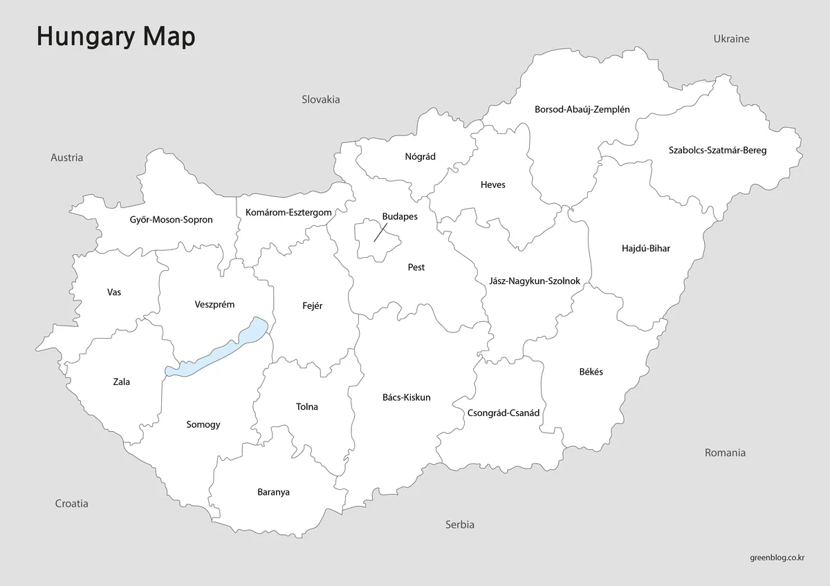
The black-and-white Hungary Map removes the county colors but preserves all county labels, internal boundaries, the Budapest callout, Lake Balaton, and the six visible neighboring-country names. With less competition from colored areas, the spelling and placement of compound names such as Borsod-Abaúj-Zemplén and Szabolcs-Szatmár-Bereg become the primary content.
This version suits monochrome handouts, report pages, quizzes with reference labels, and worksheets that ask students to mark selected counties without identifying every area from scratch. Users can add one or two highlight colors, circle Budapest, or draw regional groupings while keeping the printed names available for checking.
Outline Base for Labeling and Custom Data
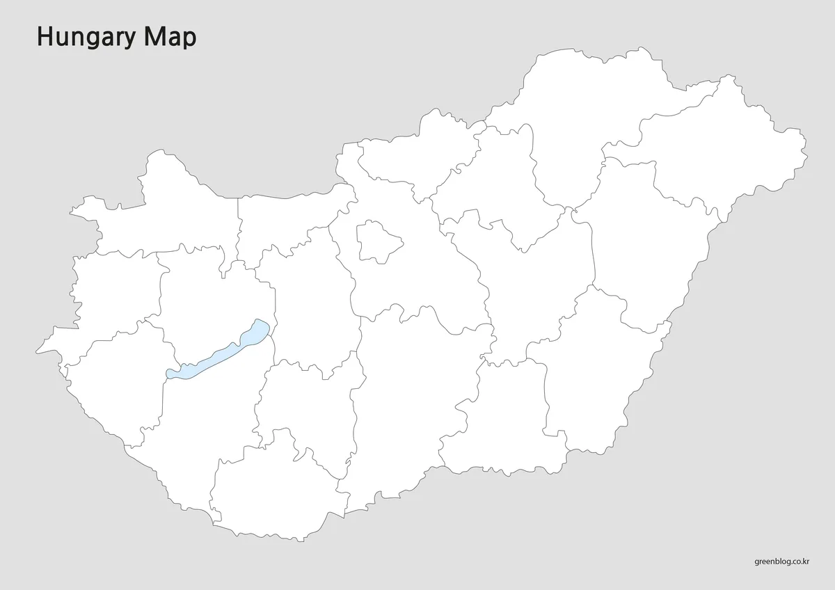
The outline Hungary Map removes county names and surrounding-country labels while retaining the national border, internal county lines, Budapest’s small central boundary, and Lake Balaton. It provides the most open space for handwritten or digital additions and does not predetermine how the counties should be grouped.
Students can write the 19 county names, add Budapest, identify the seven bordering countries, or color counties by region. For data projects, the same base can display population categories, agricultural themes, travel stages, or a west-to-east comparison. Because the supplied item is an image rather than a confirmed vector source, extensive enlargement or shape-level editing should not be assumed.
Choosing the Best Version for the Task
Choose the color map when county separation must be understood immediately, particularly on a presentation screen or in a regional comparison graphic. Choose the labeled monochrome version when names are essential but color is unnecessary. Select the outline when the reader needs to supply labels, create a legend, draw a route, or apply a new thematic color scheme.
A combined classroom sequence can use all three files. Begin with the color Hungary Map to establish the layout, move to the black-and-white sheet for name recognition, and finish with the outline for recall. This progression is particularly effective for distinguishing Budapest from Pest County and for learning where the long northeastern and eastern counties sit relative to the compact western group.
When reducing the A3 layout to A4, check the longest labels before printing. Hyphenated names occupy considerable horizontal space, and the small Budapest callout can become harder to read at aggressive scaling. The outline remains more tolerant of reduction because it contains no county text, although fine central boundaries still need adequate print clarity.
Practical Ways to Use the Files
In a Central Europe lesson, the labeled versions can support a border exercise using Austria, Slovakia, Ukraine, Romania, Serbia, Croatia, and the omitted Slovenia label. A physical-geography extension may add the Danube and Tisza rivers by hand; those river courses are relevant to Hungary but are not drawn in the supplied images. Lake Balaton is already visible and can anchor a discussion of western Hungary.
Travel planners can mark Budapest, Debrecen, Szeged, Pécs, and Győr on an outline copy, then connect the cities without confusing the route with preprinted road data. Presentation creators may add one value per county or use a simple color legend. The Hungary Map also provides a clean base for comparing counties associated with Transdanubia, the Great Plain, and the northern part of the country without presenting those broader regions as formal county boundaries.
Frequently Asked Questions
How many administrative areas appear on the map?
The layout represents Hungary’s 19 counties and the separate capital area of Budapest. Budapest is enclosed by Pest County but is not part of it. Cities with county rights are not displayed as an extra layer, so the map should be read as a first-level county reference rather than a detailed municipal map.
Does the Hungary Map show all seven neighboring countries?
The labeled color and black-and-white images name Austria, Slovakia, Ukraine, Romania, Serbia, and Croatia. Hungary also borders Slovenia, but Slovenia is not named in the supplied layout. The blank version removes all neighboring-country names, making it suitable for a complete border-labeling exercise.
Are the Danube and Lake Balaton included?
Lake Balaton is visibly shown in pale blue in all three images. The Danube is not drawn, despite its major geographic role and its course through Budapest. Add the river separately if the project requires physical geography, river-basin study, or a visual division between western and eastern parts of the country.
Which version should I use for a worksheet?
Use the labeled black-and-white image when students need county names as a reference. Choose the outline for memory tests, coloring, border-country labeling, or thematic data. The color version is better suited to an introductory key or a projected explanation in which adjacent counties must be distinguished quickly.
Can the files be printed smaller than A3?
They can be scaled to a smaller sheet, but label readability should be checked in the print preview. Long names and the compact Budapest area are the first elements likely to become difficult to read. For small-format activities, the outline or a selectively labeled crop may produce a clearer result.
Map File Information
This set provides three A3-oriented images of Hungary’s county framework for reference, printing, labeling, and custom graphics.
- Included Versions: Labeled color map, labeled black-and-white map, and unlabeled outline map
- Printable Size: A3
- File Type: Image files
- Intended Use: Classroom materials, presentations, document illustrations, annotations, and regional statistics
Related Maps
- Serbia Map with Administrative Boundaries
- Austria Map for A3 Printing
- Romania Map with County Boundaries
- Croatia Map with Counties and Coastal Areas
Additional Resources
- Hungary — European Union Country Profile: Check the country’s capital, area, 2025 population, currency, EU membership, and administrative overview.
Green Map creates custom-edited map images using open geographic data sources such as geoBoundaries, Natural Earth, OpenStreetMap, and government open data. These maps are edited visual materials, not raw data files, and are provided for education, documents, presentations, and graphic reference.