A Moldova Map has to make sense of a long, narrow country squeezed between Romania and Ukraine while leaving enough room for many compact interior labels. The portrait-oriented maps in this collection answer that challenge with three administrative-boundary views: a pastel color edition, a labeled black-and-white edition, and an unlabeled outline. A separate Moldovan flag image completes the set.
The two labeled maps identify districts and other areas from Briceni and Ocnita in the north to Cahul and Taraclia in the south. They also mark Chisinau, Balti, Bender, and Tiraspol, show Romania and Ukraine for orientation, and place the Black Sea beyond the country’s southeastern corner. Gagauzia appears in the south, while the long area labeled Transnistria follows the eastern side.
Choose the color sheet when quick visual separation matters, the monochrome sheet when names must remain central, or the outline when learners and designers need an open annotation base. The vertical A3-oriented composition suits geography lessons, reports, display slides, regional comparisons, and map-based exercises without pretending to be a road, terrain, or travel-navigation map.
Table of Contents
Moldova Map Overview
Moldova lies in Eastern Europe, northeast of Romania, with Ukraine wrapping around its northern, eastern, and southeastern sides. Its border pattern explains why the neighboring labels matter: Romania gives readers the western reference, while Ukraine frames most of the remaining perimeter. The country has no Black Sea coastline, even though the sea is shown nearby in the lower-right background of these sheets.
The national outline runs mainly north to south, so a landscape page would either waste space or shrink the internal names. Here the tall page gives the territory room to breathe. Small central districts such as Calarasi, Straseni, Criuleni, and Ialoveni remain distinguishable, and the narrow eastern strip can be shown without compressing the rest of the country.
Readers should treat the Moldova Map as a visual reference to the boundary scheme and spellings drawn in the supplied artwork. Some names are displayed without Romanian diacritics, including Chisinau and Balti, and the maps separately label Transnistria and Gagauzia. Those design choices are important when comparing the sheet with another source or preparing a lesson that requires current official terminology.
Printable Map Collection Included
The collection contains three portrait map images and one landscape flag image. All three maps preserve the same outer silhouette and internal boundary network, which makes side-by-side comparison straightforward. Their differences are purposeful rather than decorative: one uses color and labels, one removes the fills but keeps the names, and one removes the names as well.
- Pastel color map with regional names and surrounding-country context
- Black-and-white map with the same labeled boundary arrangement
- Blank outline map retaining internal divisions
- Blue, yellow, and red Moldova flag image with the central coat of arms
Because the map sheets share a 1200-by-1696-pixel portrait canvas, a teacher can introduce the labeled edition and then distribute the outline without changing the spatial frame. The page design was organized for A3-size use, but final clarity still depends on the software, printer, scaling setting, and paper. A test page is sensible when small district names must remain legible.
Color Moldova Map for Regional Comparison
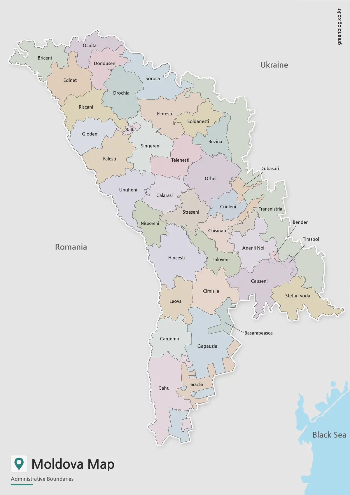
Muted colors help adjacent units separate at a glance without overpowering the labels. This is especially effective through the crowded center, where Orhei, Straseni, Criuleni, Chisinau, and nearby areas meet in a relatively small part of the page. The larger northern and southern shapes can then be compared with those compact divisions immediately.
The Moldova Map also uses a distinct fill for the eastern territory labeled Transnistria and a blue-gray treatment for Gagauzia in the south. Leader lines connect the labels for Dubasari, Bender, Tiraspol, and Basarabeasca to small or awkwardly positioned areas. On a slide, these cues help an audience follow a regional explanation before reading the finer names.
Select this edition for a classroom demonstration, a country-profile panel, or a comparison in which neighboring units must be identified quickly. It is not a thematic map: the colors do not encode population, politics, elevation, or another data scale. They serve only to distinguish adjacent shapes in the supplied boundary drawing.
Basic Moldova Map for Printing
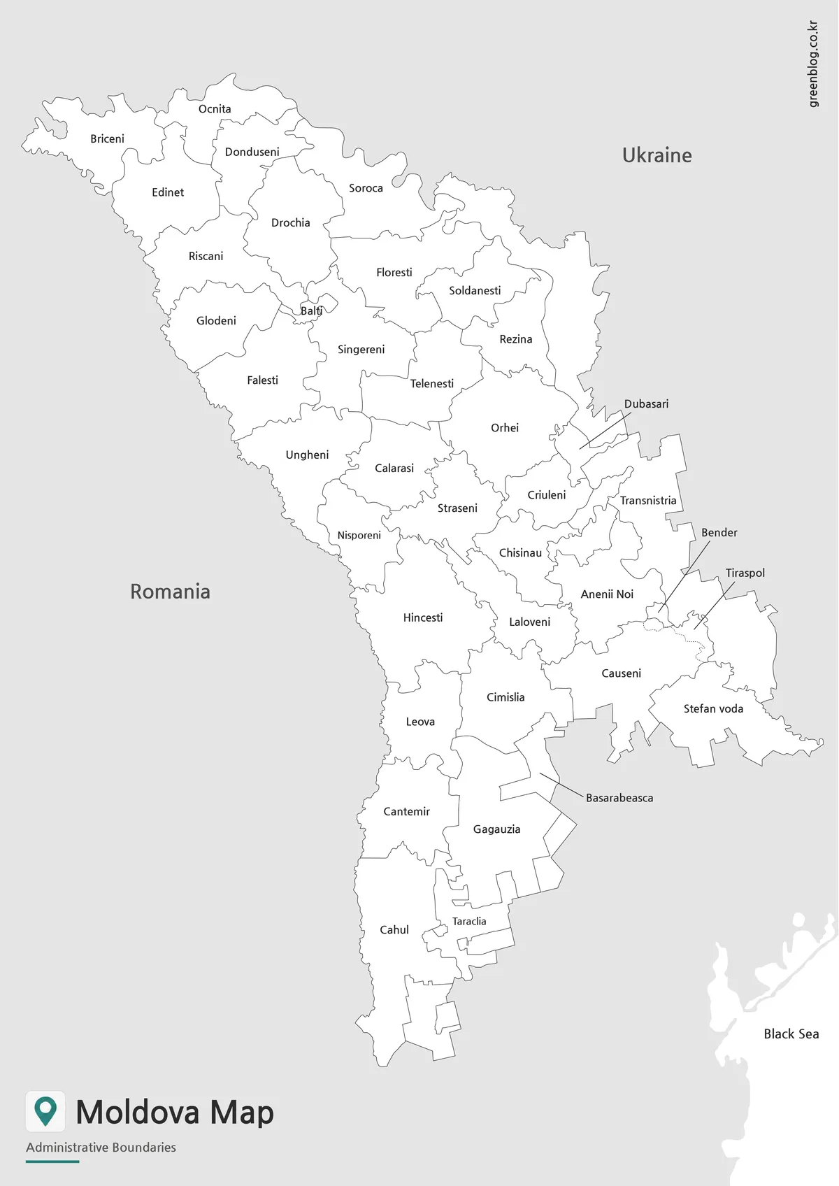
The black-and-white sheet keeps the district names, neighboring countries, callout lines, and internal borders while replacing the pastel fills with white. That quieter treatment lets the text do most of the work. It fits reports with restrained styling, photocopied reference pages, or worksheets where students need to locate a named area before completing a separate task.
Its label hierarchy provides several levels of orientation. Romania, Ukraine, and the Black Sea sit outside the national shape; regional names fill the interior; and callouts resolve places along the eastern and southern edges. When using this Moldova Map in a document, preserve the portrait ratio so thin boundaries and leader lines are not distorted.
This edition is the better choice when readers must recognize names immediately but color would compete with surrounding charts or text. It also supports simple manual highlighting: a student can shade Cahul, trace the western border, or circle Chisinau while the remaining locations stay visible.
Blank Moldova Outline Map for Editing
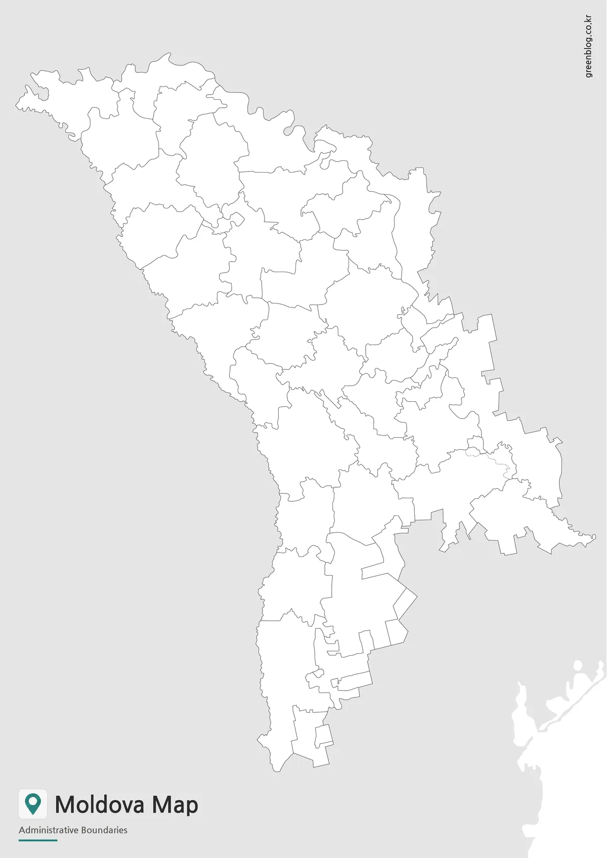
With labels and color removed, the outline becomes an activity surface rather than a ready-made reference. The internal divisions remain, including the complex shapes around the center and the separated eastern geometry, so learners can match them against the labeled sheet. Blank space can hold names, numbers, arrows, or a project-specific legend.
A geography exercise might ask students to add Romania and Ukraine, identify the north-south direction, mark Chisinau, or color Gagauzia and the area shown as Transnistria. A designer could instead group districts by a classroom category or place a route across selected units. Such additions are annotations layered on the image; the supplied file is not described as a vector or editable source document.
Before writing directly on a printed Moldova Map, compare the intended answer key with the labeled version. Several small shapes are easy to confuse when names are absent. For digital use, add marks on a duplicate so the untouched outline remains available for another exercise.
Moldova Flag Image
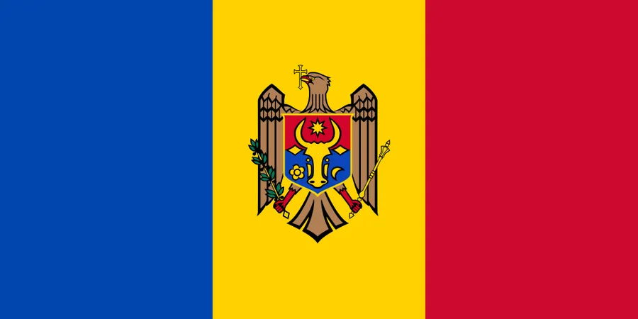
The fourth image shows Moldova’s vertical blue, yellow, and red tricolor with the national coat of arms centered on the yellow band. Its 900-by-450-pixel landscape shape contrasts with the tall maps, so it works best as a header, identification panel, or supporting element rather than as a same-size companion page.
Pairing the flag with a labeled map can give a country profile two distinct visual references: one identifies the state symbol, while the other explains location and internal layout. Keep enough space around the central emblem when cropping or placing text nearby.
Practical Uses for This Moldova Map
For teaching, the three-stage sequence is particularly practical. Begin with the color view to establish the whole shape, move to the monochrome labels for location work, and finish with the outline as a recall exercise. Students can compare the compact center with the longer northern and southern sections or explain how the Romanian and Ukrainian borders frame the country.
Presentation creators can use the color edition as an overview and reserve the outline for custom callouts. Report writers may prefer the basic map because its neutral appearance sits beside tables without adding another color scheme. Bloggers can crop only when the crop retains the geographic context needed for the accompanying text, especially near the eastern strip and the Black Sea reference.
Whichever version you select, check the visible labels against the purpose of the finished work. The artwork is suited to general orientation and administrative-boundary study, not turn-by-turn directions or legal boundary determination. A current authoritative source should accompany any project that depends on official names, jurisdiction, or recent administrative change.
Frequently Asked Questions
What versions are included in this Moldova Map collection?
The collection includes a color map, a basic labeled map, a blank outline map, and a Moldova flag image.
Is this Moldova Map suitable for A3 printing?
Yes. The map was prepared for A3-size use, making it suitable for classroom handouts, reports, and presentation materials.
Why is Transnistria shown separately?
Transnistria is visually important when reading Moldova’s map structure. Showing it separately helps users understand its location along the eastern side of the country.
Which version is best for editing?
The blank outline map is best for editing. It gives users a clean base for adding colors, labels, arrows, data points, or custom notes.
Can I use the map for classroom materials?
Yes. The basic and outline versions work especially well for worksheets, classroom reference sheets, and geography activities.
Map File Information
The download brings together the three Moldova administrative-boundary map views and the accompanying flag image shown on this page.
- Included Versions: Color labeled map, black-and-white labeled map, blank outline map, and flag image
- Printable Size: Maps arranged for A3-size use
- File Type: Image files
- Intended Use: Classroom reference, worksheets, presentations, reports, and annotation projects
Related Maps
Additional Resources
- Moldova Ministry of Foreign Affairs: General Information: Review official background on the country’s location, borders, rivers, and geographic extremes.
Green Map creates custom-edited map images using open geographic data sources such as geoBoundaries, Natural Earth, OpenStreetMap, and government open data. These maps are edited visual materials, not raw data files, and are provided for education, documents, presentations, and graphic reference.