This Finland Map shows the country’s 19 regional boundaries in a tall layout that keeps Lapland, the southern regional cluster, and the Åland archipelago on one page. The shape stretches from the Gulf of Finland north toward the Norwegian border, while Sweden appears to the west and Russia to the east. That long extent makes a regional map more useful than a simple national silhouette.
The download is represented by three 1200 by 1697 pixel WebP previews. A color edition separates the regions with muted fills, a monochrome edition preserves the geographic labels without regional color, and an outline edition removes all labels while retaining the same borders. The shared geometry supports classroom comparison, print reference, slide design, labeling practice, and custom annotation.
There is an important label limitation. All 19 region shapes are present, but only 17 region names are printed in the labeled versions. Kanta-Häme and Päijät-Häme are the two unlabeled polygons in the compact south-central area. Readers using the Finland Map as a regional reference should add or verify those names rather than assuming every internal shape already has text.
The artwork also uses a few English forms that differ from Statistics Finland’s current classification wording. For example, it prints Northern Savonia and Southern Savonia where the official English list uses North Savo and South Savo. These are recognizable alternative names, but a report should follow one naming standard consistently.
Table of Contents
Finland Map Collection Overview
The mapped divisions are Uusimaa, Southwest Finland, Satakunta, Kanta-Häme, Pirkanmaa, Päijät-Häme, Kymenlaakso, South Karelia, South Savo, North Savo, North Karelia, Central Finland, South Ostrobothnia, Ostrobothnia, Central Ostrobothnia, North Ostrobothnia, Kainuu, Lapland, and Åland. That count follows Statistics Finland’s 2026 region classification.
Lapland occupies most of the northern half of the national shape. North Ostrobothnia and Kainuu form the next broad band, after which the regional pattern becomes progressively denser toward the south. Åland is separated from mainland Finland and appears as a small island group at the lower left. This scale contrast is one of the clearest lessons available from the Finland Map.
Neighboring countries and surrounding waters provide orientation. Sweden, Norway, and Russia are named, as are the Gulf of Finland and the Barents Sea. The Barents Sea sits in the wider northern context; Finland does not have a Barents Sea coastline. The western water label is visibly misspelled as “Guof of Bothnia” in both labeled images, so captions and added text should use the correct name, Gulf of Bothnia.
No cities, regional capitals, roads, railways, terrain, scale bar, compass, or internal lake network is shown. Finland’s many lakes are therefore not part of this simplified administrative design. Use a current topographic or transport source for those subjects, and treat these images as regional-boundary references.
Regional Color Map
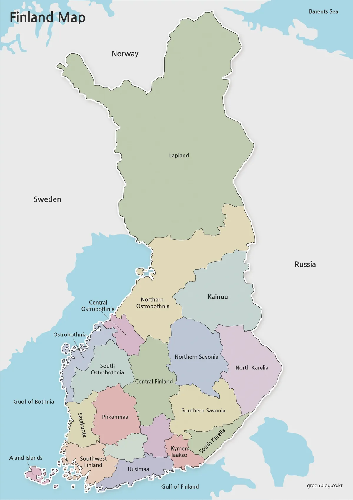
The color Finland Map makes the change from large northern regions to compact southern regions easy to scan. Lapland receives one broad fill, while Uusimaa, Kymenlaakso, South Karelia, Southwest Finland, and nearby inland regions require much smaller areas. The colors separate adjacent polygons but do not represent population, language, economy, climate, or political affiliation.
Coastal and island detail is especially visible along Ostrobothnia, Southwest Finland, Uusimaa, and Åland. Central Ostrobothnia uses a leader line because its label cannot fit comfortably inside the narrow coastal region. Several southern names are rotated or split across lines to preserve readable boundaries.
For a presentation, the color version offers the fastest orientation. A caption should still note the two missing region labels and the Gulf of Bothnia typo. If every official 2026 name is required, add Kanta-Häme and Päijät-Häme and use the current Statistics Finland terminology consistently.
Black and White Printable Version
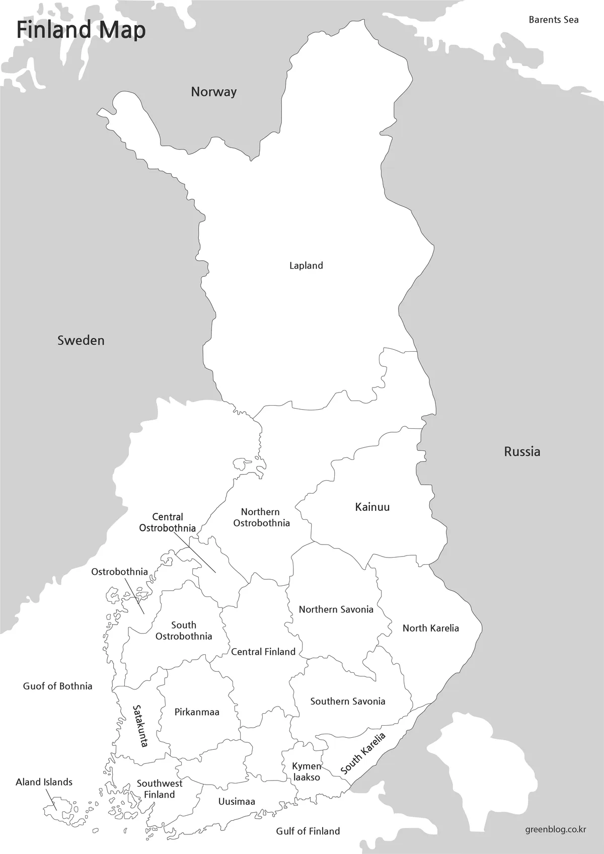
The monochrome Finland Map retains the same 17 printed region names, country labels, sea labels, and boundary geometry. Removing the pastel fills directs attention to the outlines and makes handwritten notes easier to distinguish. It remains a labeled reference rather than a completed answer key for all 19 names because the same two south-central labels are absent.
This treatment suits reports or classroom sheets where neighboring charts already use color. Before printing multiple copies, check Åland’s small islands, the narrow southwestern coast, the Central Ostrobothnia leader line, and the close boundaries around Uusimaa. Heavy photocopy contrast may thicken those fine details.
A regional-identification exercise can ask learners to supply Kanta-Häme and Päijät-Häme, correct the western sea name, and compare the official North Savo and South Savo forms with the alternative labels on the page. That turns the image’s limitations into a source-checking activity rather than silently repeating them.
Blank Outline Map for Editing
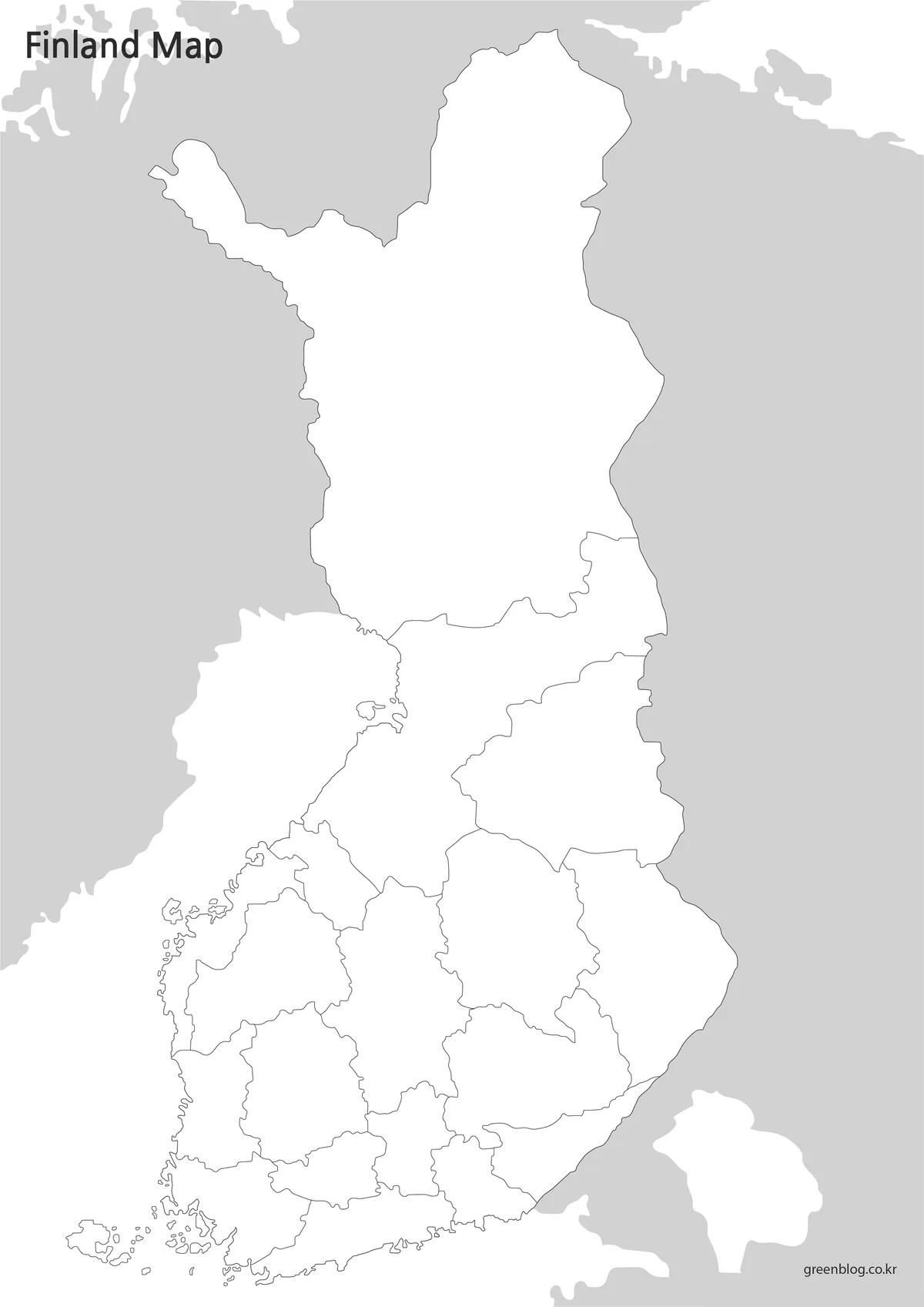
The blank Finland Map removes region names, neighboring-country names, sea labels, and regional fills. It keeps the national outline, internal regional borders, the Åland group, and gray surrounding land. Because all names are absent, learners and editors can build a complete 19-region labeling layer without first erasing existing text.
Possible additions include regional capitals, statistical categories, travel markers, or groups based on an assigned dataset. Those elements do not come with the base image and need independent verification. Keep Åland visible when cropping or resizing, because its detached position makes it easy to lose from a tight mainland-only frame.
The preview is a raster WebP image rather than a vector source with separately selectable regions. Text, arrows, and translucent colors can be placed over a duplicate in common document or graphics software, but extreme enlargement may soften island and coastal linework. Preserve an unchanged original before editing.
Built for Printing and Presentation Use
The vertical format follows Finland’s natural north-south proportions and reduces unused side space. A Finland Map slide can begin with the color image for orientation, move to monochrome for name review, and finish with the outline for recall or thematic annotation. Keeping all three images at the same displayed width makes their shared geometry clear.
Choose color when immediate regional separation matters, monochrome when printed names and boundaries are the priority, and outline when participants will provide labels or data. For formal work, attach a source date and identify the 19-region classification. Do not use the images for navigation, property boundaries, precise distance measurement, or lake-level analysis.
The most reliable workflow pairs the downloaded image with an official reference. Check the region list before publication, correct the Gulf of Bothnia spelling in any added caption, and state whether alternative or official English regional names are being used. These small steps make the resource clearer without altering its useful boundary layout.
Frequently Asked Questions
Can I print the maps in A3 size?
Yes. The files were prepared with high-resolution output suitable for A3 printing.
Which version is best for presentations?
The color map is usually the best choice because regional divisions are easy to identify.
Is the outline version editable?
Yes. The blank outline map is ideal for editing, annotation, and infographic projects.
Are regional names included?
Yes. The labeled versions include regional names for easier identification.
Map File Information
The archive contains the three Finland regional-boundary images presented above.
- Included Versions: Labeled color, labeled black-and-white, and blank outline
- Printable Size: Prepared for A3 printing
- Intended Use: Regional reference, classroom work, printing, slides, and annotation
Related Maps
Recommended Authority Sources
- Statistics Finland: Regions 2026 — Check the current English region names and their major-region classification.
Green Map creates custom-edited map images using open geographic data sources such as geoBoundaries, Natural Earth, OpenStreetMap, and government open data.
These maps are edited visual materials, not raw data files, and are provided for education, documents, presentations, and graphic reference.