A Korean version of this map page is available. View Korean Page
A Norway map can be surprisingly difficult to find in a format that works equally well for printing, presentations, and graphic editing. Norway stretches across a long north-south axis, contains one of the world’s most complex coastlines, and includes Arctic territories such as Svalbard that are often omitted from simplified maps. Because of this unique geography, a carefully organized map can be much more useful than a standard location reference.
This printable map collection was created for users who need a clear visual overview of Norway rather than a detailed atlas. Whether you are preparing a classroom handout, building an infographic, creating travel-related content, or designing educational materials, the collection includes multiple map styles suited to different purposes. The files were prepared in high-resolution A3 format and reviewed for readability when enlarged or printed.
The collection includes three map versions:
- Color administrative map
- Black and white labeled map
- Blank outline map
All files are image-based resources intended for printing, presentations, educational worksheets, blog graphics, and design projects.
Table of Contents
Norway Map Collection Overview
Norway is located in Northern Europe and shares a long border with Sweden while also connecting to Finland and Russia in the far northeast. Its dramatic fjord coastline, scattered islands, and elongated shape make it one of the most visually distinctive countries in Europe.
During the map preparation process, special attention was given to preserving the country’s recognizable shape while maintaining readable regional boundaries. The layout was adjusted for large-format printing, and labels were reviewed to remain legible when displayed in presentations or classroom materials.
Included map resources:
- Regional color map
- Labeled printable map
- Blank editing map
- Svalbard inset map
- High-resolution A3 format
Norway Map with Regional Color Divisions
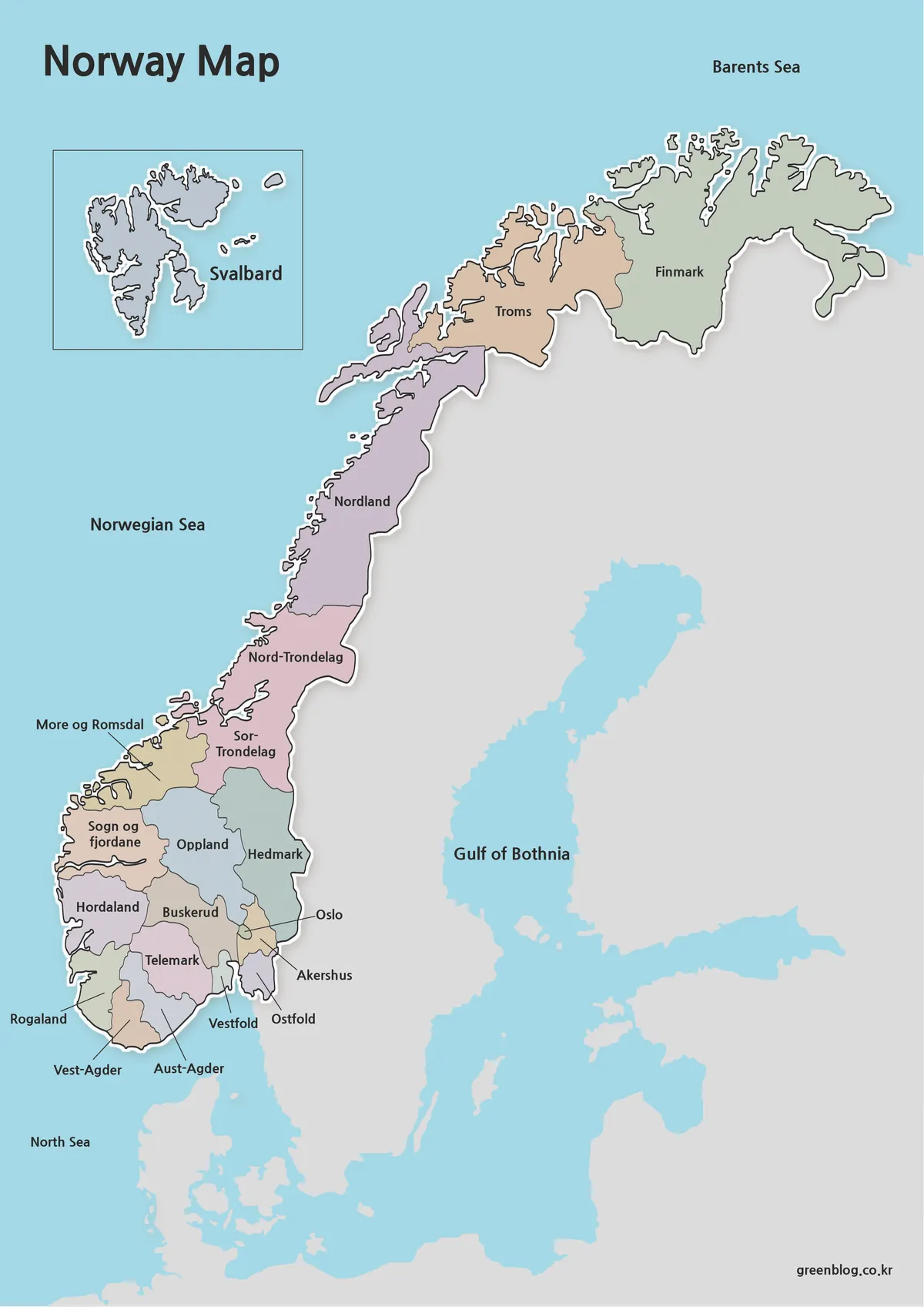
The color version was designed for situations where regional differences need to be understood quickly. Administrative areas are separated using contrasting colors, making it easier to identify individual regions and compare locations across the country.
Because Norway covers a very large north-south distance, visual separation becomes especially important. The color scheme helps readers distinguish between southern population centers, central regions, and Arctic territories without relying entirely on labels.
Useful for:
- Geography lessons
- Presentation slides
- Travel planning materials
- Blog graphics
- Regional comparison projects
Black and White Printable Version
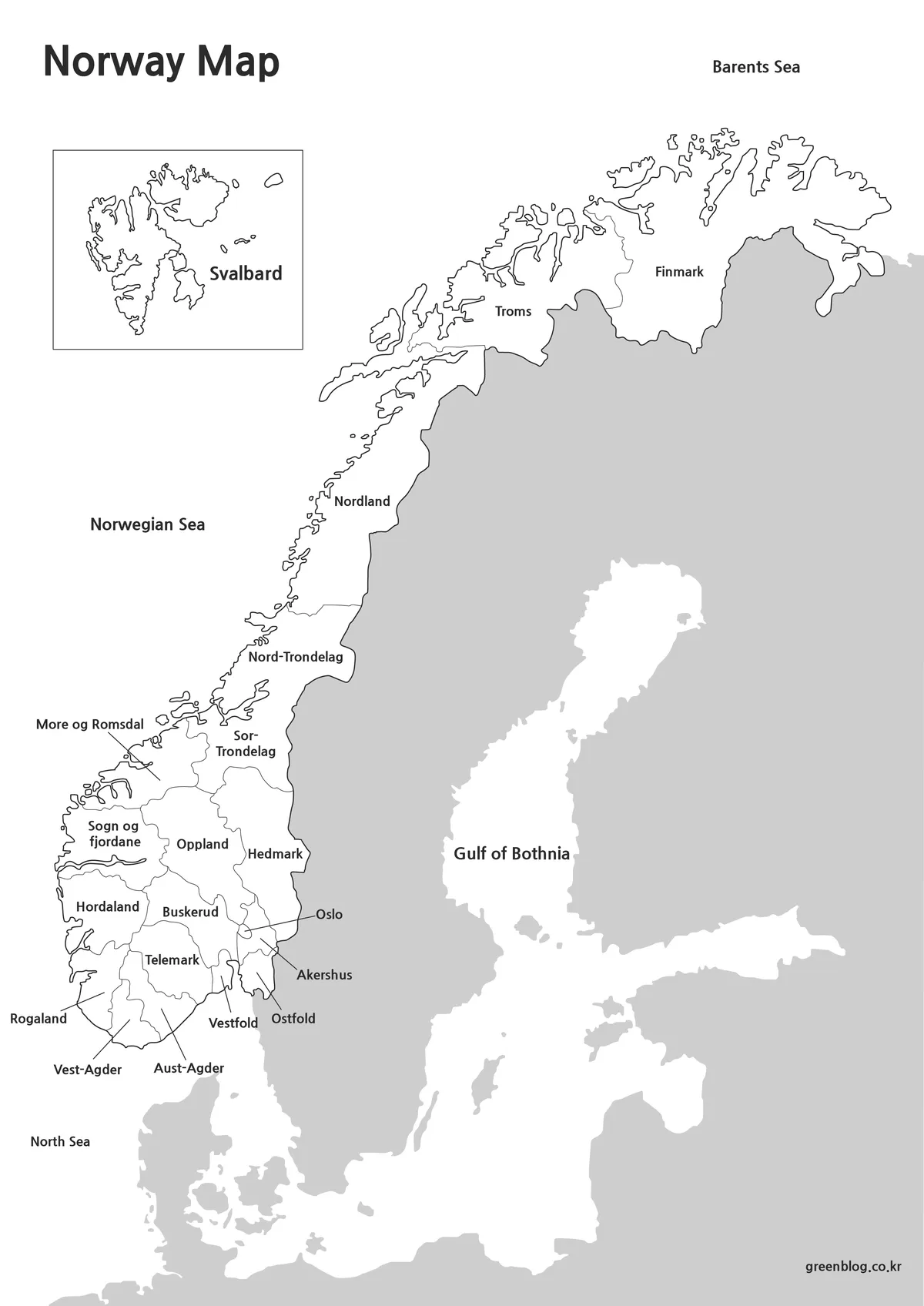
For printing and document preparation, the black and white map offers a cleaner alternative. Regional labels remain visible while color distractions are removed.
Large printed materials often benefit from a simplified design. During testing, label readability was checked at larger print sizes to ensure that region names remained easy to read even when used in handouts or educational packets.
This version works particularly well for:
- Classroom worksheets
- Printed reports
- Study materials
- Educational reference sheets
- Annotation and note-taking
Blank Outline Map for Editing
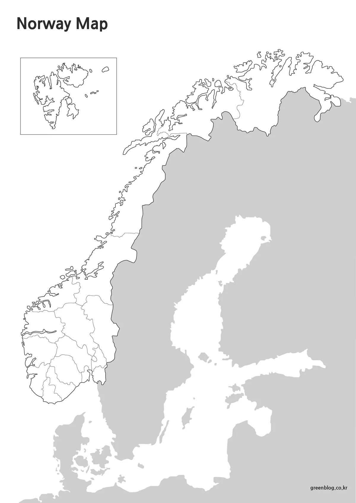
The outline version removes colors and labels, leaving only the regional boundary structure.
Designers, educators, and content creators frequently need a neutral base map when adding their own information. Population data, tourism routes, climate zones, transportation networks, or custom color schemes can all be added more easily when the map starts from a clean outline.
The boundary lines were reviewed to ensure they remain clear during editing and enlargement.
Recommended uses include:
- Infographics
- Graphic design projects
- Educational exercises
- Data visualization
- Custom regional maps
Built for Printing and Presentation Use
One challenge with Norway maps is maintaining readability while representing the country’s long shape and fragmented coastline. The layout was adjusted to make better use of vertical space, which helps preserve detail without reducing label size excessively.
The inclusion of Svalbard provides a more complete national overview and helps users understand Norway’s broader geographic extent. Many simplified maps exclude this Arctic territory, but including it gives a more accurate visual reference.
The files are suitable for:
- Classroom presentations
- Geography lessons
- Educational posters
- Travel presentations
- Regional comparison charts
- Blog and website graphics
Frequently Asked Questions
Can I print the maps in A3 size?
Yes. The collection was prepared with high-resolution printing in mind and is suitable for A3 output.
Does the collection include Svalbard?
Yes. Svalbard is included as a separate inset map to provide a more complete representation of Norway.
Which version is best for graphic editing?
The outline map is the preferred choice because it removes labels and colors while keeping regional boundaries.
Is the black and white version suitable for worksheets?
Yes. It was designed specifically for printing, note-taking, and classroom activities.
Norway Map Download
The Norway map files are available through the link below. Choose from the color map, black and white map, or outline map version and save the file that best suits your needs.
- File Format: JPG / PNG / ZIP
- Use: Printing · Presentations · Editing
- Size: A3 High-Resolution
The files are provided in ZIP format. After downloading, extract the archive to access the individual map files.
Related Maps
- Printable Slovenia Map in Color, Grayscale, and Outline Formats
- Ireland Map Set with Color, Basic and Outline Versions
- Poland Map Download – Labeled, Printable and Editable Map Pack
- High-Resolution Czech Republic Maps for Education and Design Projects
Additional Resources
- Google Maps Norway : An online map service that helps users explore Norway’s regions, administrative areas, and major cities.
Green Map creates custom-edited map images using open geographic data sources such as geoBoundaries, Natural Earth, OpenStreetMap, and government open data.
These maps are edited visual materials, not raw data files, and are provided for education, documents, presentations, and graphic reference.