A Korean version of this map page is available. View Korean Page
This Liberia map collection was created for users looking for a clear visual reference rather than a lengthy country overview. Whether you need a printable classroom map, a presentation graphic, a regional comparison resource, or an editable outline map, the collection includes several versions designed for different purposes.
Located on the West African coast, Liberia shares borders with Sierra Leone, Guinea, and Côte d’Ivoire. Although the country covers a relatively modest area compared to many African nations, its regional divisions, coastal geography, and county structure make maps especially useful for education, travel presentations, and infographic projects. Monrovia, the capital city, is located in Montserrado County, which is also the country’s most populated region.
The collection includes three map styles: a color administrative map, a black and white labeled map, and a blank outline map. All versions were prepared with high-resolution printing in mind and reviewed for readability at larger print sizes. During the design process, particular attention was given to county boundaries and label visibility so the maps remain easy to read when used in slides, handouts, or educational materials.
The files are intended for students, teachers, bloggers, researchers, content creators, and designers who need a practical Liberia map resource without spending time searching for separate map formats.
Table of Contents
Map Collection Overview
Included in this Liberia Map collection:
- Color administrative map
- Black and white printable map
- Blank outline map
- High-resolution format
- A3 print-friendly layout
- County boundary references
- Monrovia location marker
Each version serves a different purpose depending on how the map will be used.
Regional Layout and Administrative Structure
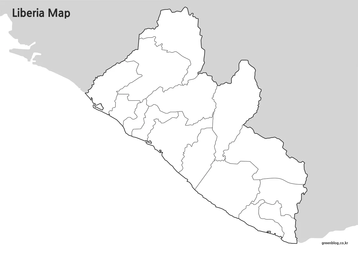
Liberia is divided into 15 counties stretching from the Atlantic coastline into the interior regions bordering neighboring countries. Understanding the county layout helps users quickly identify regional relationships and population centers.
Montserrado County contains Monrovia and represents the country’s largest population concentration. Other counties extend across coastal, forested, and inland areas, making this Liberia map useful for educational discussions, regional comparisons, and geographic reference materials.
To keep the layout clean, neighboring countries are labeled without adding unnecessary visual clutter along the border areas.
Color Administrative Map
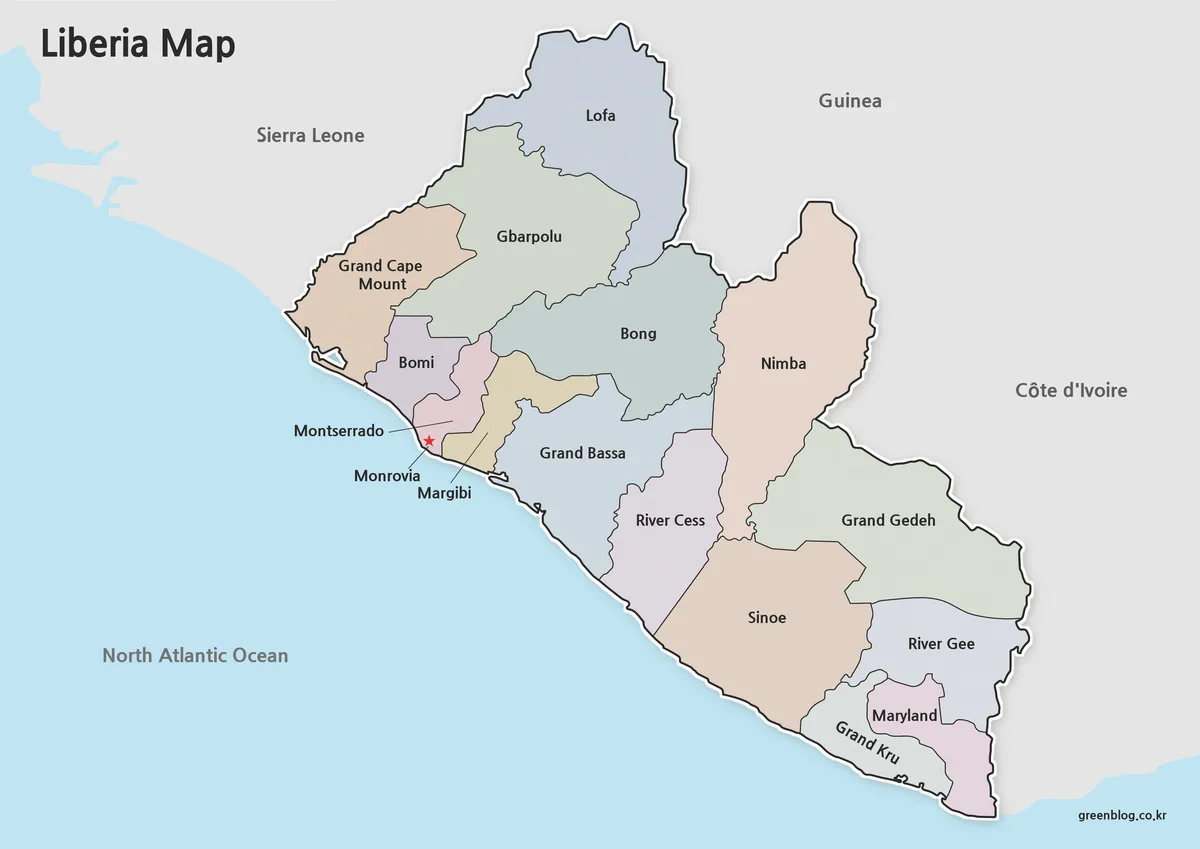
The color version was designed for users who want to identify county boundaries quickly. Distinct color separation makes it easier to compare regions and recognize the overall structure of the country at a glance.
County names are labeled in both Korean and English in the original design source, reducing the need for additional reference materials when studying regional divisions. Monrovia is highlighted with a visible marker so the capital city can be located immediately.
Extra attention was given to color balance during preparation. Strong colors can sometimes reduce readability when printed, so the final palette was adjusted to keep labels clear while preserving regional contrast.
Black and White Printable Version
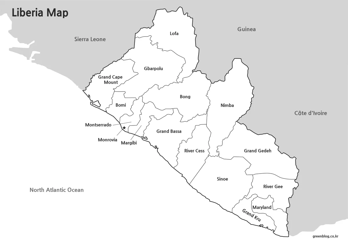
Not every project requires color. The black and white version focuses on boundaries and labels while reducing visual distractions.
This format works particularly well for:
- Classroom handouts
- Worksheets
- Printed reports
- Study materials
- Regional annotation projects
During print testing, boundary lines and labels were reviewed to ensure they remained readable even when printed without color.
Blank Outline Map for Editing
The outline version removes both colors and labels, leaving only the county boundary structure.
This format is useful when creating:
- Infographics
- Data visualizations
- Educational worksheets
- Presentation graphics
- Custom thematic maps
Boundary lines were cleaned and checked so users can add colors, symbols, statistics, or annotations without needing to redraw regional divisions.
Designed for Practical Use
This Liberia map can be useful in a variety of situations beyond simple location reference.
Common uses include:
- Geography lessons
- West Africa regional studies
- Educational presentations
- Blog graphics
- Travel-related content
- Historical and political map comparisons
- Population and resource visualization projects
- Graphic design mockups
The outline version is especially helpful when creating custom educational resources or presentation visuals that require additional annotations.
Country Flag Option
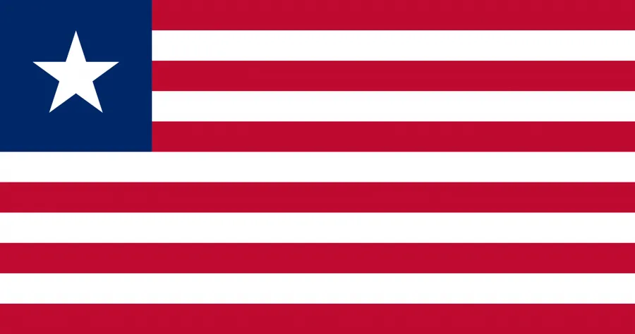
Many users prefer combining a map with a national flag when creating educational or presentation materials. Pairing the Liberia flag with the map can make country identification easier, particularly in Africa-focused comparison projects where multiple countries are displayed together.
The combination works well in classroom slides, infographic layouts, and educational posters.
Frequently Asked Questions
Can I print the Liberia map in A3 size?
Yes. The maps were prepared with high-resolution printing in mind and are suitable for larger print formats.
Which version is best for presentations?
The color map is usually the easiest to read during presentations because county divisions are immediately visible.
Is the outline version editable?
Yes. The blank outline format is intended for graphic editing, annotations, and custom visual projects.
Does the map include Monrovia?
Yes. The capital city is clearly marked on the administrative color map.
Liberia Map Download
This Liberia map collection includes three versions in a single download package: a color map, a black and white map, and an outline map. Each version can be used for education, presentations, printing, and graphic design projects.
- Included: Color Map · Black and White Map · Outline Map
- Usage: Printing · Education · Presentation · Editing
- Size: High-Resolution A3 Format
The files are provided in ZIP format. After downloading, extract the archive to access all map versions.
Additional Resources
- OpenStreetMap Liberia – Explore roads, cities, and geographic locations across Liberia.
Related Maps
- Printable Slovenia Map in Color, Grayscale, and Outline Formats
- Ireland Map Set with Color, Basic and Outline Versions
- Printable Paraguay Map Collection for Education and Design Projects
- Poland Map Download – Labeled, Printable and Editable Map Pack
Green Map creates custom-edited map images using open geographic data sources such as geoBoundaries, Natural Earth, OpenStreetMap, and government open data.
These maps are edited visual materials, not raw data files, and are provided for education, documents, presentations, and graphic reference.