An Angola Map needs to show more than a continuous block of land: Cabinda sits apart from the country’s main territory, while the mainland stretches from a narrow Atlantic coast toward broad eastern provinces. This collection presents that distinctive layout in three coordinated views—a labeled color map, a labeled monochrome map, and an unlabeled outline. Teachers, students, editors, and presentation designers can move between them without relearning the placement of the shapes.
The images require two important cautions. Their internal boundaries depict Angola’s former 18-province arrangement, which preceded the 21-province political-administrative division that took effect on January 1, 2025. Both labeled versions also repeat “Cuanza Norte” in two places; the larger west-central province south of Bengo should be labeled Cuanza Sul. These are useful historic reference graphics, but they are not current administrative answer sheets.
Each preview measures 1,200 × 849 pixels and is supplied as a WebP image. The maps identify Luanda, Cabinda, neighboring countries, and the South Atlantic Ocean in the labeled editions, but they omit roads, rivers, terrain, coordinates, a scale bar, and secondary cities. Use them for broad geographic orientation, classroom comparison, simple graphics, or annotation—not navigation, surveying, legal boundary work, or present-day government decisions.
Table of Contents
How to Read the Angola Map
Angola lies on the South Atlantic side of southern Africa. Namibia borders the mainland to the south, Zambia lies to the east, and the Democratic Republic of the Congo reaches along the north and northeast. The labeled maps place those three neighbors around the national outline, giving readers immediate directional context even though the Republic of the Congo, north of Cabinda, is not named.
Cabinda appears as a detached northern shape because Congolese territory separates it from mainland Angola. It is an exclave, not an island, and the space between the two Angolan areas is land rather than open ocean. That relationship is one of the strongest reasons to use an Angola Map instead of relying on a province list: the separation is apparent at a glance.
Luanda is shown with a red star and leader line on the Atlantic coast. Around it, Luanda and Bengo occupy compact spaces compared with Lunda Norte, Lunda Sul, Moxico, and the former Cuando Cubango in the east. The map therefore communicates a sharp scale contrast between small coastal units near the capital and the expansive provinces toward Zambia.
The visible province names belong to the older system: Cabinda, Zaire, Uíge, Bengo, Luanda, Cuanza Norte, Malanje, Lunda Norte, Lunda Sul, Moxico, Bié, Huambo, Benguela, Huíla, Namibe, Cunene, Cuando Cubango, and Cuanza Sul. Some labels in the artwork omit Portuguese diacritics. More significantly, Cuanza Sul is shown as a second Cuanza Norte, so readers should correct or disclose that error before using either labeled sheet for assessment.
Regional Color Map
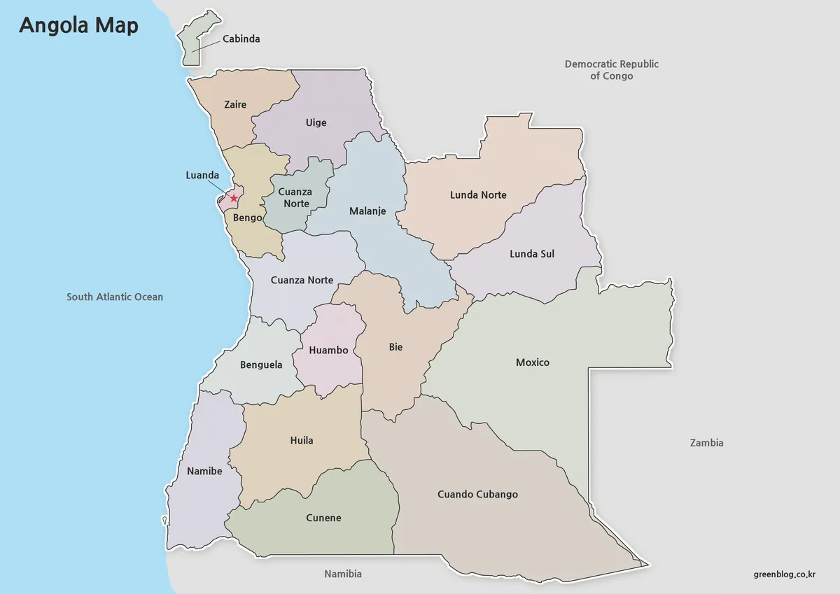
The color Angola Map assigns pale blue, green, tan, pink, and violet fills to adjoining provinces. These colors are categorical: they separate neighboring shapes but do not represent population, language, elevation, climate, political affiliation, or any measured value. Gray surrounding land and blue ocean help the national territory stand out, while black labels remain readable against the muted palette.
This edition is the quickest reference for comparing relative area and position. A lesson can trace the Atlantic provinces from Cabinda south to Namibe, identify which former provinces touched Zambia, or contrast the eastern expanse of Moxico and Cuando Cubango with the clustered west-central areas. On a presentation slide, the fills also make it easier for an audience to follow a spoken regional comparison from a distance.
Best Uses
Choose the color view for a first explanation, a locator graphic, or a prompt that asks learners to group coastal, inland, northern, or eastern provinces. If you add data, place it in a separate legend and provide a source year. The existing fills already look meaningful, so an added statistical layer must clearly distinguish authored information from the base artwork.
Clean Labeled Version
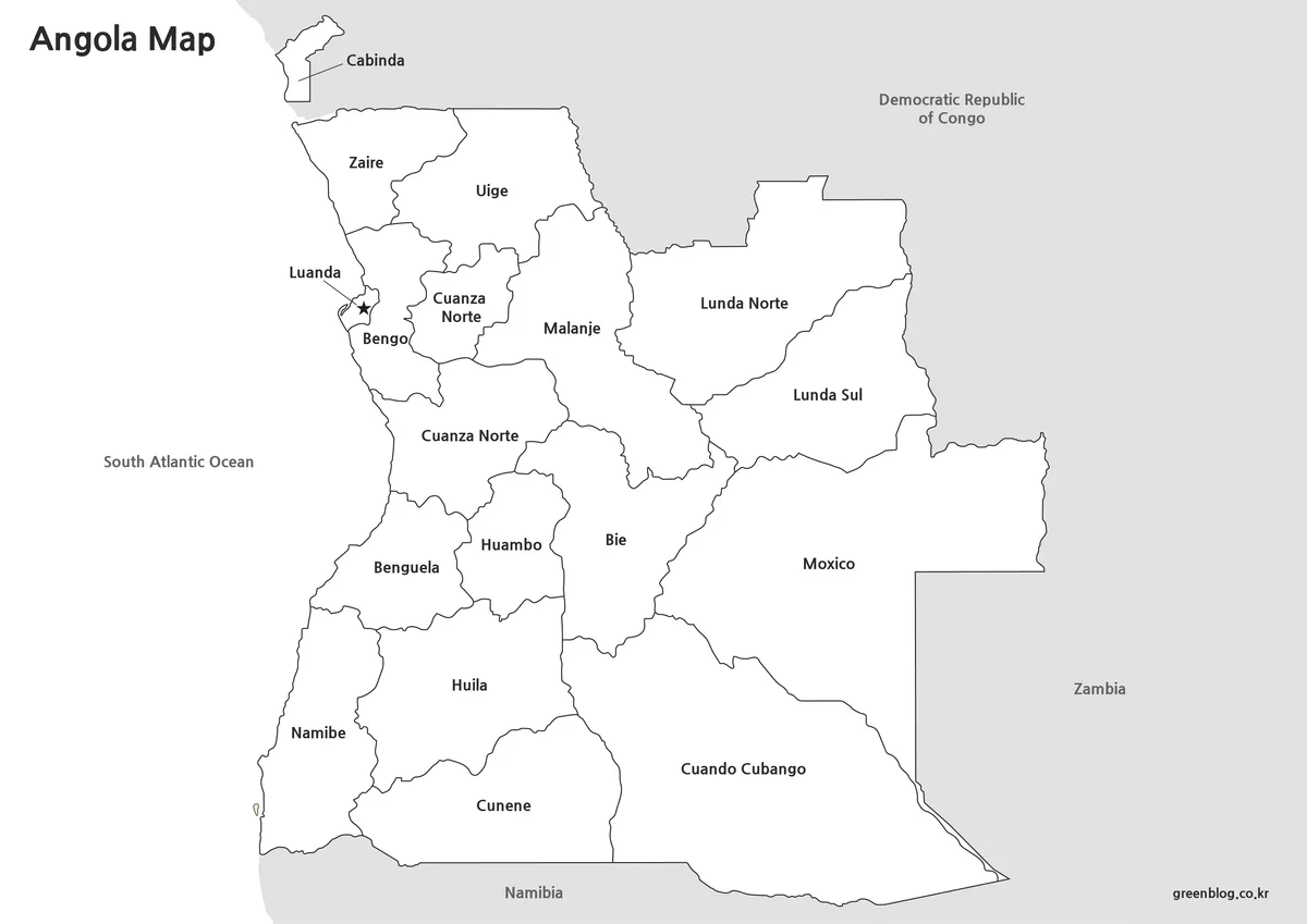
The monochrome Angola Map preserves the province names, neighboring-country labels, ocean label, Cabinda callout, and Luanda marker while removing the colored interiors. The resulting white fields reduce visual competition when the map is placed beside text, inserted in a restrained report, or printed on a black-and-white device. Boundary lines, rather than fill contrast, carry the main visual structure.
Because this version looks like a clean reference sheet, its label limitations are especially important. Uige, Bie, and Huila appear without the diacritics used in Uíge, Bié, and Huíla, and the duplicate Cuanza Norte remains. Add a small correction note or change the lower label to Cuanza Sul before students use it as a province-name guide.
When Monochrome Is the Better Choice
Use this sheet as the answer-side companion to the blank outline, as a reference panel in a worksheet, or as a simple figure in a document where color has no instructional purpose. The open interiors can accept brief notes, but dense symbols will compete with province labels. For longer annotations or thematic shading, begin with the blank version instead.
Editable Angola Outline Map
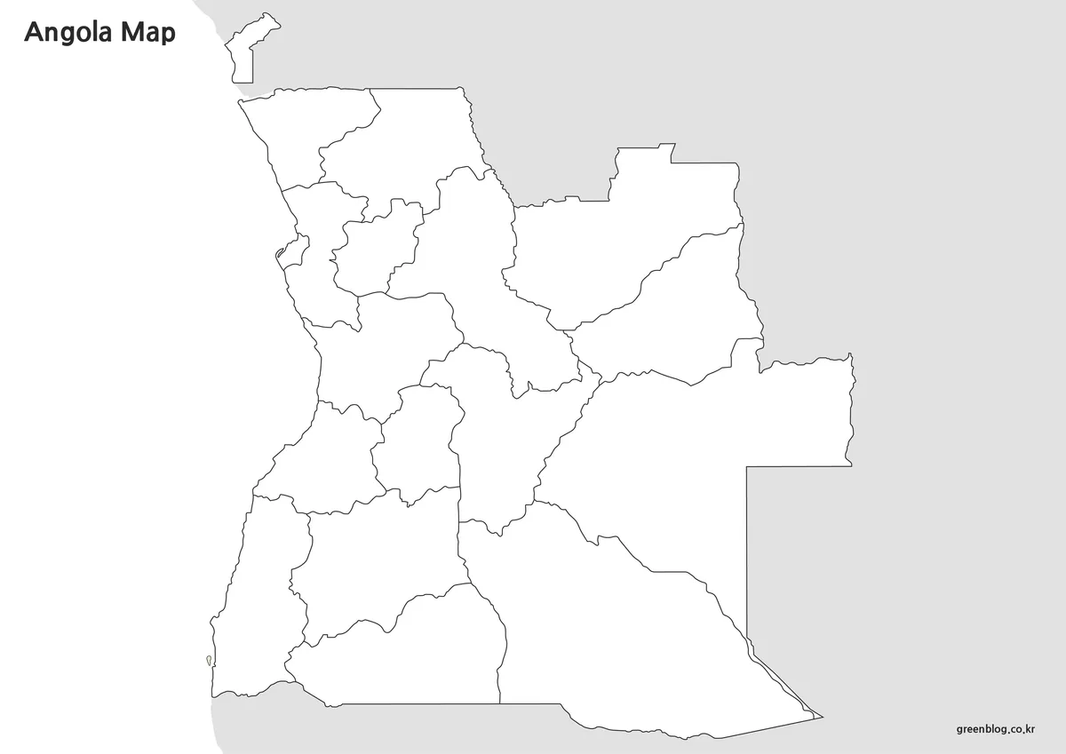
The outline removes place names, the Luanda star, neighboring-country text, and color fills while retaining the former internal boundaries, national coastline, and separated Cabinda shape. Although the heading reflects its use as an editing base, the supplied preview is a raster image rather than a confirmed vector source. Enlarging it far beyond 1,200 × 849 pixels may soften the narrow boundary lines.
Students can label Cabinda, place Luanda, name the South Atlantic Ocean, and add Namibia, Zambia, and the Democratic Republic of the Congo. A more advanced exercise can compare the historic outline with a current 21-province source, marking where Icolo e Bengo, Cuando, Cubango, and Moxico Leste belong. That task turns the blank Angola Map into a lesson about why administrative dates matter.
Useful Annotation Ideas
Other activities include shading the former Atlantic-facing provinces, distinguishing international-border provinces from interior ones, or comparing the compact Luanda area with the broad east. Designers may add location markers, service areas, or sourced statistics, but every data overlay should include a legend, units, source, and date. Keep an untouched original so the boundary base and later additions remain distinguishable.
Preparing the Files for Print and Slides
All three images share a landscape ratio, which keeps the long mainland, Cabinda, and neighboring labels on one page. Preserve that ratio when resizing; stretching the image vertically or horizontally will distort the coastline and province shapes. A wide slide gives the map comfortable breathing room, while a printed handout should leave enough margin that the western coast and eastern border are not clipped.
When preparing an Angola Map for print, run a single proof at the intended size before making multiple copies. Check the small coastal provinces, the Luanda leader line, the Cabinda label, and the thin boundaries around west-central Angola. The color edition needs enough contrast to keep adjacent fills distinct, whereas the monochrome and outline editions depend mainly on clean line reproduction.
The Angola Map files are best treated as finished image bases. They do not provide editable paths, transparent backgrounds, or separate geographic layers. If a project requires precise scaling, automated data joins, modern administrative analysis, or legal-quality boundaries, use an authoritative current dataset instead of tracing these previews.
Choosing a Version for a Specific Task
Select color when the audience must distinguish provinces quickly, monochrome when names should lead the reading, and outline when the user will supply labels or data. A classroom sequence can begin with color for orientation, move to monochrome for checking names, and finish with the blank sheet for recall. A report or presentation usually needs only the version that supports its single visual purpose.
Historical scope should remain visible wherever the image appears. Add wording such as “former 18-province layout” and note that Cuanza Sul is mislabeled as Cuanza Norte in the labeled editions. If a table or chart accompanies an Angola Map, confirm that its data uses compatible boundaries; figures organized under the post-2025 system cannot be transferred to the older shapes without reconciliation.
General orientation, classroom discussion, and simplified design work can tolerate this stated historic scope. Current elections, public administration, logistics, emergency planning, and official statistics cannot. In those settings, province names and jurisdictional lines must be checked against an up-to-date Angolan government source for the required date.
Frequently Asked Questions
Before using this Angola Map collection, remember that the answers below describe how the three supplied graphics are presented. They do not certify the older boundaries as the country’s current administrative system.
How is the capital city identified on the map?
Luanda is highlighted with a visible marker, making it easy to locate quickly.
When is the color version most useful?
The color version works best when regional differences need to be identified quickly in presentations or educational materials.
Which version is best for printing?
The labeled version is often the most practical choice because it provides strong readability without relying on color.
Why is a separate outline version included?
The outline version allows users to begin editing immediately without removing labels or color elements first.
Download Information
Map File Information
The ZIP archive contains the three coordinated historic province-map images shown above.
- Included Versions: Color labeled, monochrome labeled, and blank outline maps
- Printable Size: 1,200 × 849 pixels per preview
- File Type: WebP image files in a ZIP archive
- Intended Use: Historic reference, lessons, presentations, printing, and annotation
Related Maps
Additional Resources
- Government of Angola Province Directory — Check current province names and administrative information before using a map for present-day reference.
Green Map creates custom-edited map images using open geographic data sources such as geoBoundaries, Natural Earth, OpenStreetMap, and government open data.
These maps are edited visual materials, not raw data files, and are provided for education, documents, presentations, and graphic reference.