A Korean version of this map page is available. View Korean Page
A Cameroon Map is useful for much more than locating the country on a map of Africa. Teachers preparing geography lessons, students working on classroom projects, bloggers creating travel or educational content, and designers producing infographics often need a printable map that is clear, easy to read, and simple to edit. Because Cameroon stretches from the Gulf of Guinea toward Central Africa and borders several neighboring countries, a well-organized map also makes regional comparisons much easier.
This printable Cameroon Map collection includes three versions: a color administrative map, a black and white printable map, and a blank outline map. The files were prepared in high resolution for A3 printing, making them suitable for classroom handouts, presentation slides, educational worksheets, infographic projects, and graphic editing work. Each version was created with a different purpose in mind so users can quickly choose the layout that best matches their project.
Located in west-central Africa, Cameroon shares borders with Nigeria, Chad, the Central African Republic, Equatorial Guinea, Gabon, and the Republic of the Congo, while its southwestern coastline faces the Atlantic Ocean. The country’s long north-to-south shape and varied geography make regional organization especially important when explaining locations or comparing administrative areas.
While preparing this Cameroon Map collection, extra attention was given to maintaining readability at large print sizes and simplifying the overall layout without removing essential geographic information.
Table of Contents
Map Collection Overview
Rather than creating a map filled with roads, terrain details, and dense labels, this collection focuses on administrative boundaries and visual clarity. The maps are intended for users who need practical reference materials that work equally well for printing, presentations, classroom activities, and editing projects.
During the design process, regional labels were reviewed after enlargement to confirm they remained readable. Administrative boundaries were also adjusted where necessary to create a cleaner appearance when printed or displayed on presentation slides.
Color Administrative Map
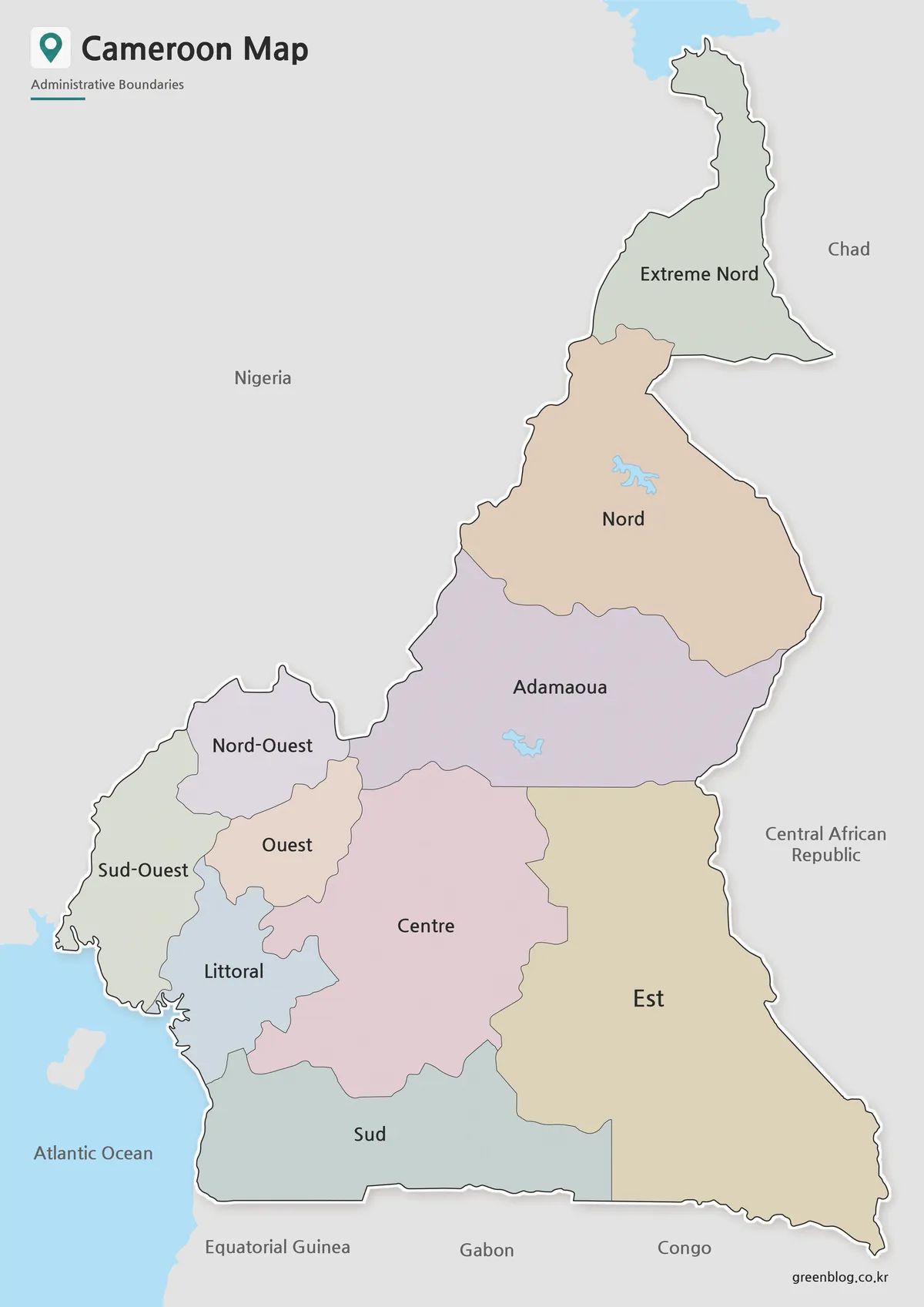
The color version is designed to make Cameroon’s administrative regions easy to distinguish at a glance. Different colors separate each region while keeping the overall layout simple enough for educational materials, country profiles, travel presentations, and blog graphics.
Cameroon is officially divided into ten regions. Displaying every smaller administrative subdivision would make the map considerably more crowded, so this version focuses on regional divisions to maintain clarity. Neighboring countries are identified with labels only, helping users understand Cameroon’s location without distracting from the primary map.
Black and White Printable Version
The black and white version removes color while keeping labels and administrative boundaries clearly visible. This format works particularly well for classroom printing, worksheets, reports, and presentation handouts where readability is more important than color distinction.
Removing background colors also makes it easier to annotate the map, highlight specific regions, or add custom notes without visual distractions. During preparation, the layout was checked to ensure labels remained easy to read after grayscale printing.
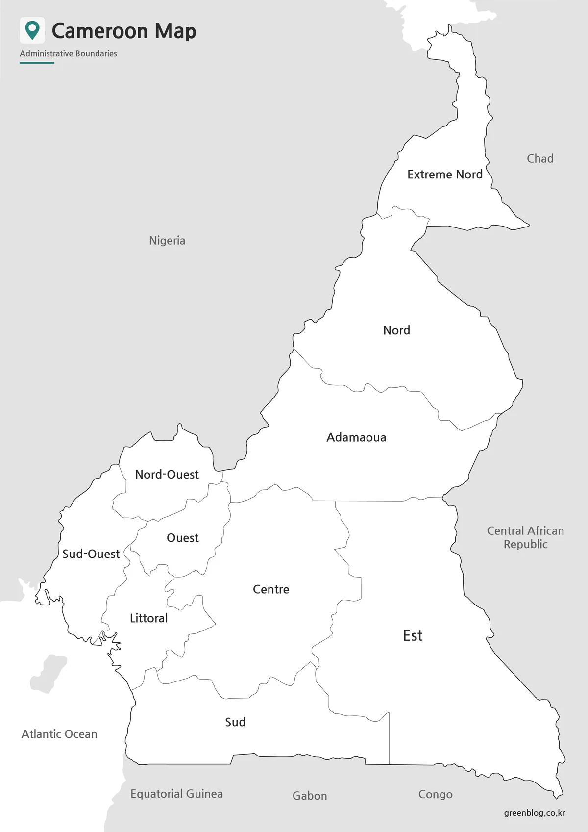
Blank Outline Map for Editing
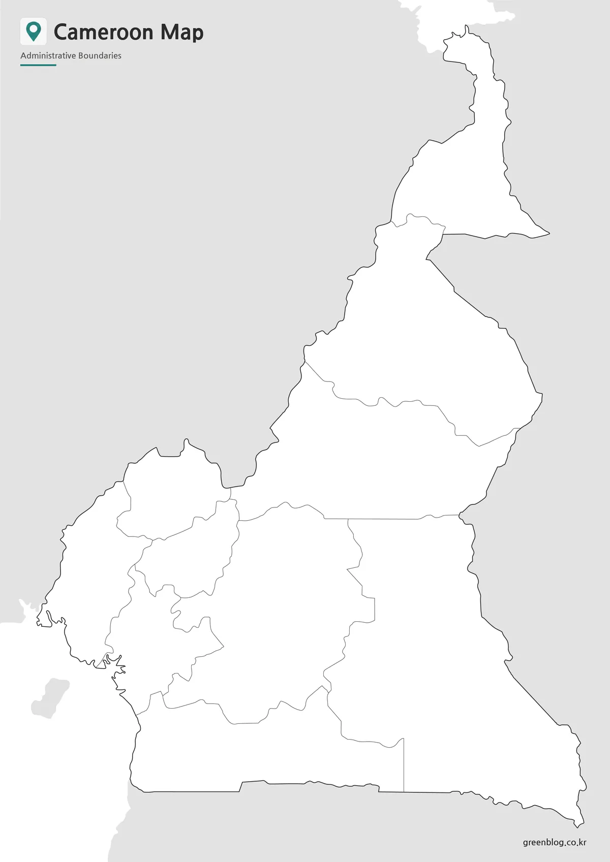
The outline version includes only the administrative boundary lines, creating a clean base map for custom editing. Labels and color fills have been removed, allowing designers, educators, and researchers to add their own information directly.
This Cameroon Map outline is suitable for infographic creation, statistical maps, educational exercises, regional comparisons, and presentation graphics. Because the boundary lines were reviewed for continuity, users can easily apply custom colors without additional editing before beginning their projects.
Practical Uses
This map collection works well for:
- Printable study resources
- Geography lessons and classroom handouts
- Presentation slides and educational reports
- Travel planning materials
- Regional comparison graphics
- Blog illustrations
- Infographic design
- Graphic editing projects
Frequently Asked Questions
What map versions are included?
The collection includes a color administrative map, a black and white printable map, and a blank outline map.
Is the Cameroon Map suitable for A3 printing?
Yes. The maps were prepared in high resolution for large-format printing while maintaining label readability.
Which version is best for editing?
The outline version is the most flexible because it contains only administrative boundary lines.
Can I use these maps in presentations?
Yes. All three versions are designed for presentations, educational materials, and visual reference projects.
Cameroon Map Download
This Cameroon Map collection includes color, black and white, and outline versions for printing, classroom use, presentations, blog graphics, and editing projects.
- File Format: JPG
- Included Versions: Color Map, Black and White Map, Outline Map
- Intended Use: Printing, education, presentations, infographics, and editing
Additional Resources
- OpenStreetMap – Cameroon : Interactive map resource for checking cities, roads, and geographic features in Cameroon.
Related Maps
- Printable Burkina Faso Map for Education, Design and Presentations
- Free Albania Map Download – Color, Black and White, and Outline Versions
- Tunisia Map Download – Printable Color, Black and White, and Outline Maps
- Printable Angola Map Set for Classroom, Presentation and Editing Projects
Green Map creates custom-edited map images using open geographic data sources such as geoBoundaries, Natural Earth, OpenStreetMap, and government open data.
These maps are edited visual materials, not raw data files, and are provided for education, documents, presentations, and graphic reference.