This Senegal Map shows all 14 administrative regions, marks Dakar, and makes the country’s unusual relationship with The Gambia immediately visible. Senegal curves around the narrow Gambian territory, which reaches inland from the Atlantic and separates much of the southern Casamance area from the north. That shape is the central geographic idea in all three images.
The collection provides a colored regional reference, a monochrome labeled version, and a blank boundary sheet. Each image measures 1200 × 849 pixels and uses the same landscape composition, so a teacher or designer can move between a completed example and an activity copy without changing the geographic frame.
The labeled views name Dakar, Thiès, Diourbel, Fatick, Kaolack, Kaffrine, Louga, Saint-Louis, Matam, Tambacounda, Kédougou, Kolda, Sédhiou, and Ziguinchor. The Senegal Map therefore works at the regional level: it does not divide the country into departments or communes, and it does not add roads, rivers, terrain shading, or a distance scale. Knowing that scope helps prevent the image from being used as a street, navigation, or relief map.
Table of Contents
Senegal Map Versions Included
The three versions share identical national and regional boundaries but answer different needs. The colored sheet is fastest for comparing neighboring regions. The black-and-white sheet retains the names while reducing ink and visual weight. The blank sheet removes names and the Dakar symbol, leaving a base for recall exercises, custom labels, or simple thematic overlays.
- Color reference: fourteen regions in contrasting fills, with labels and a red star for Dakar.
- Monochrome reference: the same names and boundaries in grayscale, with Dakar marked by a black star.
- Blank outline: regional borders without region names or a capital marker, ready for annotation.
The Gambia is shown as a gray corridor in every version rather than as one of Senegal’s regions. This distinction matters when students label the southern districts: Ziguinchor, Sédhiou, and Kolda belong to Senegal even though the inset territory makes them appear detached from much of the country on a flat page.
Regional Color Map
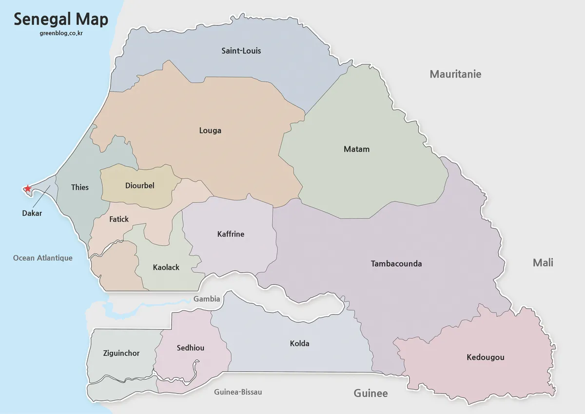
The color Senegal Map separates adjoining regions without suggesting a data scale: the fills are categorical, not measures of population, elevation, or political status. In the north, Saint-Louis, Louga, and Matam form a broad band. Dakar occupies the small western peninsula, while Thiès, Diourbel, Fatick, Kaolack, and Kaffrine create a compact central sequence where careful boundary reading is especially useful.
Farther east, Tambacounda covers the largest visual area and meets Kédougou in the southeast. Below The Gambia, Ziguinchor lies along the southwest, Sédhiou sits to its east, and Kolda continues toward the interior. A red star identifies Dakar inside its small namesake region; no other regional capitals or cities are marked, so the symbol should not be read as part of a complete city network.
The surrounding labels are not consistently English. The image uses forms such as “Mauritanie,” “Guinée,” and “Océan Atlantique,” alongside familiar names such as Mali and Gambia. Keep those printed forms when using the artwork as supplied, or standardize them in an added English caption if language consistency is important. The regional names themselves remain recognizable in English-language geography work.
Black and White Printable Version
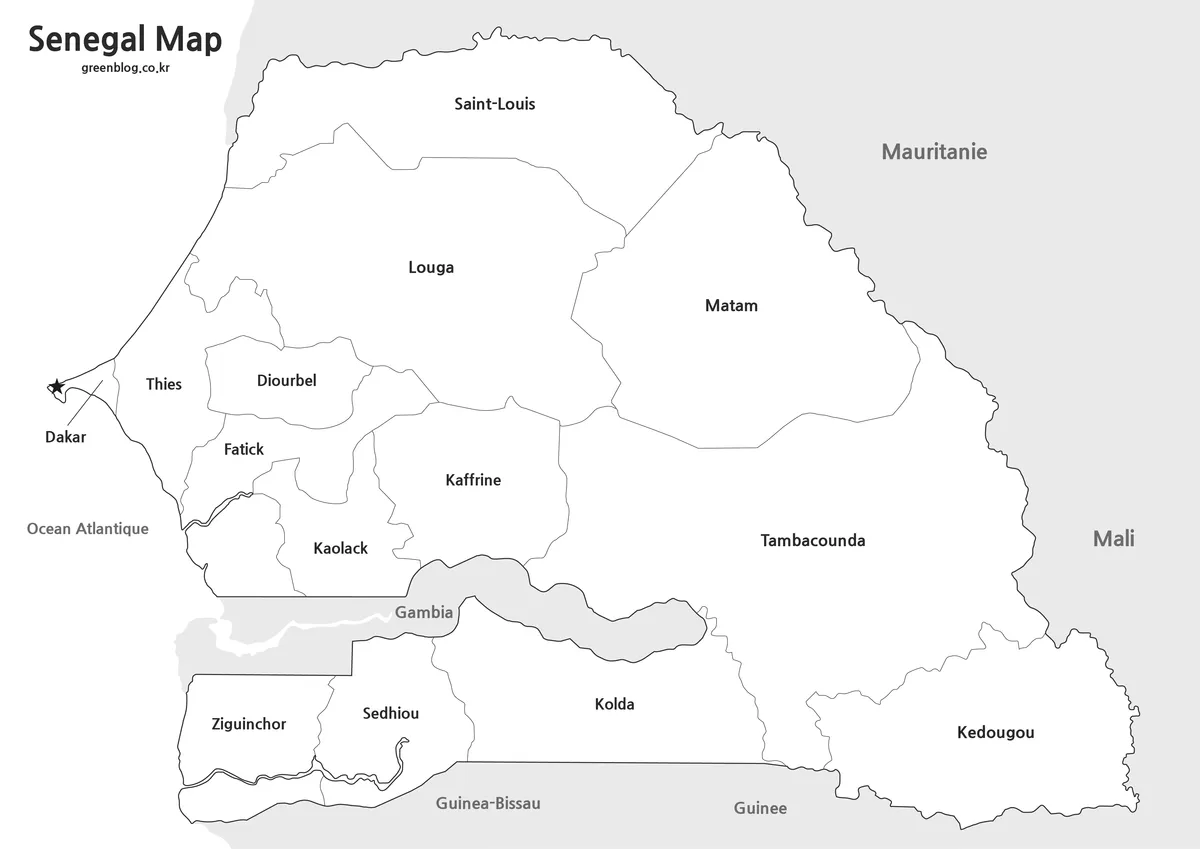
The monochrome Senegal Map keeps the completed labeling but replaces the colored regions with white interiors and dark outlines. It is well suited to answer keys, low-ink handouts, reports, and slides that already use a limited palette. The black Dakar star remains distinct from the surrounding boundary lines, and The Gambia stays shaded gray to preserve the main spatial relationship.
Before printing, inspect the narrow Dakar peninsula, the short borders among the central regions, and the thin stretches above and below The Gambia. Those are the areas most likely to lose definition if the image is reduced too far or printed with aggressive toner-saving settings. A test page is also useful when regional names must remain legible from a classroom wall or presentation screen.
Blank Outline Map for Editing
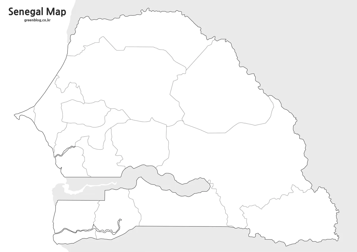
The blank Senegal Map removes every region name and the Dakar star but preserves the fourteen internal divisions. The Gambia remains visible in gray, which gives learners an essential orientation cue without supplying the regional answers. Because this is a raster image rather than a confirmed vector file, “editing” is best understood as adding text, color, arrows, or notes in an image editor or document layout.
A useful labeling sequence starts with Dakar on the far western tip, continues through the northern trio, then fills the dense central cluster. Learners can finish with Tambacounda and Kédougou in the east and the Casamance regions south of The Gambia. Another exercise can ask students to use one color family for regions north of the corridor and another for Ziguinchor, Sédhiou, and Kolda, while making clear that this is a learning device rather than an administrative classification.
Built for Printing and Presentation Use
Choose the colored reference when quick region recognition matters, the monochrome version when names are needed with restrained styling, and the outline when the audience should supply the information. For a worksheet, place the blank image on the activity page and keep the labeled view as the answer key. For a presentation, the color version can introduce the national pattern before a later slide focuses on the Casamance area or Dakar.
The Senegal Map can also support regional sorting, capital-location practice, border-country discussions, and simple infographic planning. It should not be stretched beyond its evidence: coastlines and boundaries are generalized for a clean educational display, and there is no legend for quantitative interpretation. If precise administrative data or a more detailed hierarchy is required, compare the artwork with a current official reference before publishing analytical conclusions.
For clean output, preserve the original aspect ratio, avoid cropping the western peninsula or the southern strip, and leave enough margin around the outer labels. On A3 paper, use a landscape page and fit the image proportionally rather than enlarging one dimension. These steps protect the recognizable outline and keep the small central regions from appearing distorted.
Frequently Asked Questions
Does the map show The Gambia?
Yes. The maps clearly display the geographic relationship between Senegal and The Gambia.
Are administrative regions included?
Yes. Regional boundaries are included in both the color and black and white versions.
Can the maps be printed in A3 size?
Yes. The collection was prepared with high-resolution printing in mind and works well at A3 size.
Is the outline version editable?
Yes. The outline map is intended for editing, annotation, coloring activities, and graphic projects.
Which version should I use to check an activity? Use the labeled color or monochrome view as the reference, then give learners the blank copy. This keeps the Senegal Map geometry consistent while changing how much information is supplied.
Download Information
Map File Information
The bundle contains the three confirmed regional map views shown above for reference, printing, labeling, and presentation work.
- Included Versions: Color labeled, monochrome labeled, and blank outline maps
- Printable Size: A3
- File Type: Image files
- Intended Use: Lessons, worksheets, reports, slides, and annotations
Related Maps
Additional Resources
For an official administrative reference with additional territorial detail, consult GeoSenegal’s administrative map of Senegal.
Green Map creates custom-edited map images using open geographic data sources such as geoBoundaries, Natural Earth, OpenStreetMap, and government open data. These maps are edited visual materials, not raw data files, and are provided for education, documents, presentations, and graphic reference.