A Korean version of this map page is available. View Korean Page
Estonia may be a relatively small country on the map of Europe, but it is a useful location to show when explaining the Baltic region, Northern Europe, or the countries around the Baltic Sea. A clear Estonia map is especially helpful for classroom materials, travel presentations, blog graphics, and regional comparison projects because the country sits between Latvia, Russia, the Gulf of Finland, and the Baltic Sea.
This printable Estonia map collection was prepared for users who need a clean visual resource rather than a long country profile. The set includes a color regional map, a black and white printable map, and a blank outline map for editing. Each version was created as a high-resolution JPG file suitable for A3 printing, presentation slides, educational worksheets, and simple graphic design work.
While preparing the map, the main focus was readability. Estonia has a compact shape, but its coastline, nearby sea areas, and neighboring countries can make the layout feel crowded if too much information is added. For that reason, unnecessary details were reduced, while key regional boundaries and labels were kept clear enough for printing and screen use.
The map was created using Illustrator for the base layout and Photoshop for final color adjustment. The color version is useful when users need quick visual separation between regions, while the black and white version works better for printing or document insertion. The outline version is the most flexible choice for people who want to add their own colors, labels, icons, or statistics.
Table of Contents
Map Collection Overview
This Estonia map set includes three main versions:
- Color regional map
- Black and white labeled map
- Blank outline map
The files are designed for practical use in classrooms, blogs, presentations, infographics, and printable study resources. The maps focus on Estonia’s regional layout, neighboring areas, and visual readability rather than heavy geographic detail.
Why an Estonia Map Is Useful
Estonia is located in northeastern Europe along the Baltic Sea. It borders Latvia to the south and Russia to the east, while the Gulf of Finland separates it from Finland to the north. Tallinn, the capital city, is one of the most commonly referenced locations when explaining Estonia’s position in the Baltic region.
For students and content creators, a map helps show Estonia’s relationship with Latvia, Russia, the Baltic Sea, the Gulf of Finland, and the wider Baltic states. This is useful when preparing geography worksheets, regional comparison slides, travel notes, or blog posts about Northern Europe.
Color Estonia Map for Regional Reference
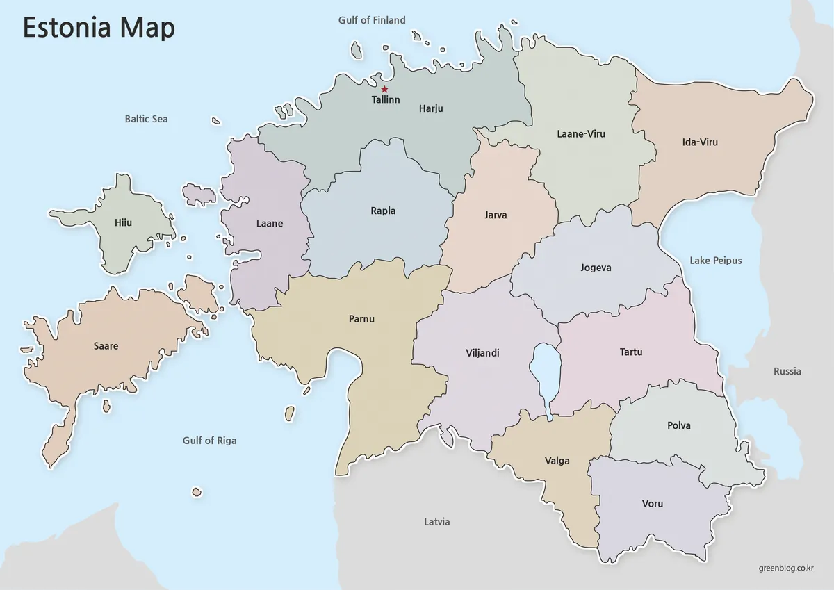
The color map is designed for quick visual understanding. Different areas are separated with soft color tones so the regional layout can be seen without overwhelming the labels.
During the design process, the color balance was adjusted so that place names would remain readable on top of the background. Strong colors can make small labels harder to read, so this version uses a more controlled palette suited for presentation slides and educational materials.
Tallinn is marked clearly, making it easier to identify the capital at a glance. Neighboring areas such as Latvia, Russia, the Baltic Sea, the Gulf of Finland, and the Gulf of Riga are included to help users understand Estonia’s location more naturally.
Black and White Estonia Map for Printing
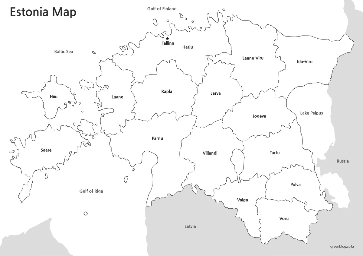
The black and white version is intended for users who need a clean printable map. Without color fills, the map is easier to print, annotate, and insert into documents.
This version works well for classroom handouts, worksheets, reports, and simple reference materials. It is also useful when users want to add their own highlights or notes without the background colors getting in the way.
The layout was reviewed with printing in mind, especially label visibility and boundary clarity. For users who do not need color-coded regions, this version is often the most practical choice.
Blank Estonia Outline Map for Editing
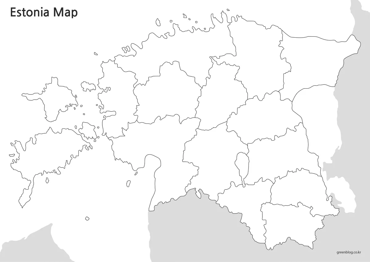
The outline map removes both color and text, leaving only the basic boundary structure. This makes it useful for editing, coloring, and custom map design.
Designers, teachers, and students can use the outline version as a base map for their own projects. It works well for infographic layouts, regional data visuals, classroom coloring activities, and custom presentation graphics.
Because the map is kept simple, it provides enough space for adding icons, labels, travel routes, statistics, or other visual information.
Practical Uses for These Maps
This Estonia map collection can be used in several types of projects:
- Classroom geography handouts
- Baltic states comparison materials
- Blog graphics about Estonia or Northern Europe
- Travel presentation slides
- Printable study resources
- Infographic projects
- Custom map coloring activities
- Educational worksheets
The color map is best for quick visual explanation. The black and white map is better for printing and note-taking. The outline map is the most flexible option for editing and custom design work.
FAQ
Can I print the Estonia map in A3 size?
Yes. The map was prepared as a high-resolution file for A3-size printing.
Which version is best for classroom use?
The black and white map is usually best for handouts, while the color map works well for slides and visual explanations.
Is the outline map useful for editing?
Yes. The blank outline version is designed for adding custom colors, labels, routes, or infographic elements.
Does the map show nearby countries and sea areas?
The labeled versions include nearby geographic references such as Latvia, Russia, the Baltic Sea, the Gulf of Finland, and the Gulf of Riga.
Estonia Map Download
Download the Estonia map collection and choose the version that fits your project. The set includes color, black and white, and outline maps for printing, classroom use, presentations, and graphic editing.
- File Format: JPG
- Print Size: A3 high-resolution
- Use: Printing · Classroom reference · Presentation graphics · Editing projects
Additional Resources
- Estonian Land Board Maps – Estonia’s official mapping authority providing national maps, geographic information, and administrative boundary resources.
Related Maps
- Free Norway Map Collection with Color, Labeled and Outline Versions
- Printable Slovenia Map in Color, Grayscale, and Outline Formats
- Ireland Map Set with Color, Basic and Outline Versions
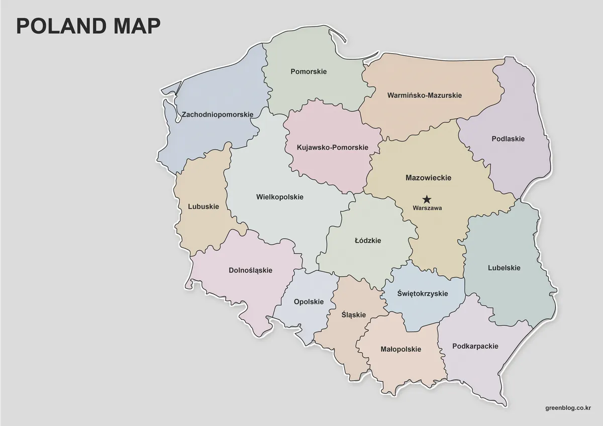
- Poland Map Download – Labeled, Printable and Editable Map Pack
Green Map creates custom-edited map images using open geographic data sources such as geoBoundaries, Natural Earth, OpenStreetMap, and government open data.
These maps are edited visual materials, not raw data files, and are provided for education, documents, presentations, and graphic reference.