A Korean version of this map page is available. View Korean Page
Panama sits at one of the most geographically unique locations in the Americas. Stretching between Costa Rica and Colombia, the country connects North and South America while touching both the Caribbean Sea and the Pacific Ocean. Because of its long, narrow shape and distinctive coastline, a map often explains Panama’s layout far more effectively than text alone.
This printable Panama map collection was prepared for users who need more than a simple country outline. Whether you are creating a classroom worksheet, building a travel presentation, designing an infographic, or adding geographic references to a blog post, having multiple map styles available makes the process much easier. The collection includes three versions: a color administrative map, a black and white labeled map, and a blank outline map for editing.
All maps were created at A3 size and prepared for high-resolution printing. During the design process, extra attention was given to regional boundaries, label placement, and overall readability. The maps were also reviewed at larger print sizes to ensure that province names and boundary lines remain clear when enlarged.
The files are available in JPG, PNG, and ZIP formats, making them suitable for both printing and digital use. Different versions serve different purposes, allowing users to select the format that best fits their project.
This Panama map collection was created to provide flexible options for printing, education, and graphic editing projects.
Table of Contents
What’s Included in the Collection
The map package contains:
- Color administrative map
- Black and white labeled map
- Blank outline map
- High-resolution A3 layout
- JPG and PNG image files
- ZIP archive for easy download
The collection was designed for educational, presentation, and editing purposes rather than simple location reference alone. Each Panama map version was created to support different use cases, from classroom activities to professional design projects.
Understanding Panama’s Regional Layout
One reason a Panama map is particularly useful is the country’s unusual geography. The territory stretches horizontally across Central America, creating a layout where coastal regions, inland provinces, and indigenous territories are distributed across a long corridor of land.
Panama is divided into provinces and indigenous autonomous regions, making administrative maps more informative than a simple country outline. This structure is especially useful when preparing regional comparison materials or explaining the country’s geographic organization.
A detailed Panama map makes it easier to visualize how provinces and indigenous regions are distributed across the country.
Color Administrative Version
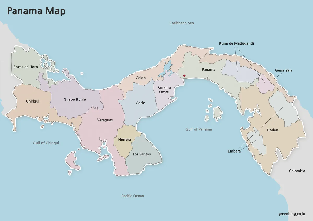
The color version focuses on visual clarity. Provinces and indigenous regions are separated using different colors, making regional distinctions easier to understand at a glance.
While preparing this map collection, the color palette was adjusted several times to maintain readability. Strong colors can make labels harder to read, so a balanced approach was used to keep regional divisions visible without overwhelming the text.
This version works particularly well for:
- Educational presentations
- Geography lessons
- Country profile pages
- Regional comparison graphics
- Travel reference materials
The color-coded layout allows viewers to quickly identify how different areas relate to one another across the country.
Black and White Printable Version
Not every project requires color. The black and white version was created for users who prefer a cleaner appearance or need to print large quantities of materials.
Labels and administrative boundaries remain visible while unnecessary color elements are removed. This improves readability on printed pages and leaves space for notes, annotations, and classroom exercises.
Useful applications include:
- Classroom handouts
- Study materials
- Research documents
- Presentation printouts
- Regional labeling activities
The map was reviewed for black and white printing to ensure that boundaries remain distinguishable without relying on color differences.
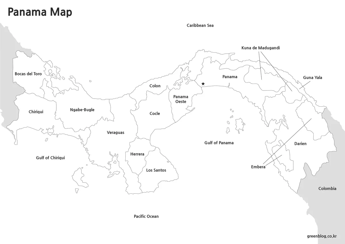
Blank Outline Version for Editing
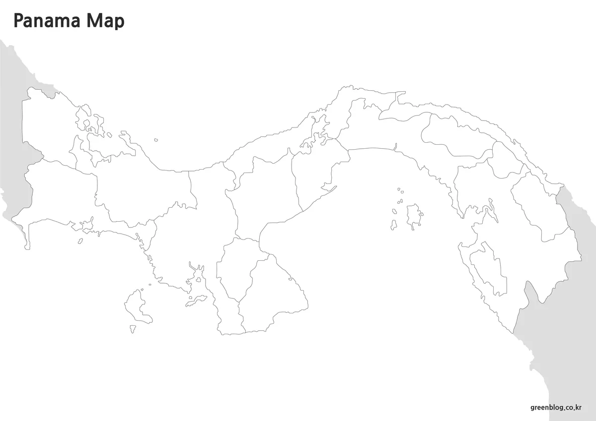
The outline version removes colors and labels, leaving only the boundary structure. This format is intended for users who want maximum flexibility.
Graphic designers, teachers, and content creators often prefer outline maps because they can add custom colors, icons, statistical data, routes, or annotations without first removing existing design elements.
Common uses include:
- Infographic design
- Custom travel maps
- Educational worksheets
- Regional highlighting
- Presentation graphics
- Data visualization projects
Special attention was given to keeping boundary lines connected and clean, making region selection easier in graphic editing software.
Built for Printing and Presentation Use
This Panama map collection was designed with practical usage in mind rather than simple online viewing. The A3 layout allows the maps to remain readable when printed at larger sizes, while the high-resolution format supports use in slides, posters, and educational displays.
The combination of color, labeled, and outline versions provides flexibility for different audiences. Teachers may prefer the printable map, designers may choose the outline version, and bloggers may find the color map most useful for visual content.
Frequently Asked Questions
Does the collection include administrative regions?
Yes. The color and labeled versions show Panama’s provinces and indigenous regions.
Which version is best for editing?
The outline map is the most suitable option for graphic editing and custom projects.
Can the maps be printed in A3 size?
Yes. The collection was prepared specifically for high-resolution A3 printing.
Are the maps useful for classroom activities?
Yes. The labeled and black and white versions work well for educational handouts and geography exercises.
Panama Map Download
The Panama map files can be downloaded using the link below. Select the version you need, including the color map, black and white map, or outline map.
- File Format: JPG / ZIP
- Use: Printing · Reference · Editing
- Size: High-resolution A3 format
The files are provided in ZIP format. After downloading, extract the archive to access and use the map files.
Related Maps
- Printable New York City Map Collection – Color, Black and White & Outline Maps
- Washington State Map Download – Color, Blank, and Printable Map Pack
- 5 United States Maps for Download (Color, Black & White, Outline)
Additional Resources
- OpenStreetMap Panama Map View — Interactive map of Panama useful for comparing locations, regions, and transportation routes.
Green Map creates custom-edited map images using open geographic data sources such as geoBoundaries, Natural Earth, OpenStreetMap, and government open data.
These maps are edited visual materials, not raw data files, and are provided for education, documents, presentations, and graphic reference.