A Washington State Map must handle two very different boundary patterns on the same page. Around Puget Sound and the Pacific coast, islands, peninsulas, inlets, and compact counties create an irregular western layout. East of the central mountain corridor, many county boundaries are broader, straighter, and easier to separate. A county map makes this contrast much clearer than a plain state silhouette.
This collection contains three county-level versions built on the same landscape layout: a pastel color map with county names, a black-and-white map with names, and an unlabeled outline map. The ZIP archive contains three CMYK JPEG files prepared at approximately A3 dimensions. Each version supports a different task, from quick county identification to printed reference and custom data shading.
Teachers, students, bloggers, presentation designers, and infographic creators can use the set to explain Washington’s 39 counties without introducing roads, cities, terrain, or legislative districts. The maps keep the county framework prominent, but users should understand their limits: Seattle, Spokane, Olympia, highways, mountain ranges, and travel routes are not pre-marked.
Table of Contents
Reading the State from the Pacific to Idaho
Washington occupies the northwestern corner of the contiguous United States. Canada lies to the north, Oregon to the south, Idaho to the east, and the Pacific Ocean to the west. The images show portions of surrounding land in gray, but Canada, Oregon, and Idaho are not labeled. Only the Pacific Ocean is named on the two labeled editions.
The western coastline gives the Washington State Map much of its visual complexity. Clallam and Jefferson occupy the Olympic Peninsula, while San Juan County appears as a group of islands in the northwest. Island and Kitsap counties are shaped by the waters of Puget Sound, and King, Pierce, Snohomish, Thurston, and Mason sit around the same intricate coastal system.
Farther east, large counties such as Okanogan, Yakima, Grant, Lincoln, Adams, and Whitman create a more open pattern. The southeastern corner becomes compact again around Walla Walla, Columbia, Garfield, and Asotin. These changes in county size and shape explain why one text size or label arrangement would not suit the entire state.
The 39 Counties Shown on the Washington State Map
Washington State has 39 counties, and all 39 appear in the supplied boundary layout. County names are included on the color and black-and-white maps, while the outline edition retains the same divisions without text. This is a county reference rather than a city, census-tract, ZIP-code, school-district, or legislative-district map.
Several western counties require more coastline detail than their inland counterparts. San Juan consists of separated island shapes, Island County spans Whidbey and Camano islands, and Kitsap projects into Puget Sound. Small Wahkiakum County occupies a narrow section of the lower southwestern area, while Pend Oreille forms a slim county along the northeastern edge.
The county map also makes regional comparisons possible without defining unofficial regions as though they were administrative units. A reader can group coastal, Puget Sound, central, eastern, or border counties for a project, but those categories are not encoded in the original files. Any custom grouping should therefore be explained with a legend.
Three County Map Versions
Pastel Color County Map
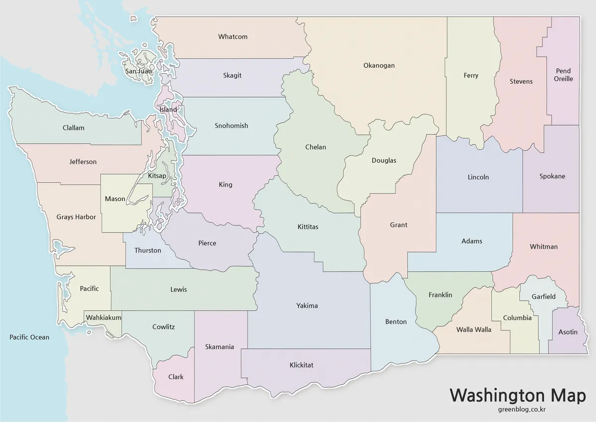
WashiThe color Washington State Map assigns neighboring counties different pastel fills, making shared boundaries easier to follow at a glance. The approach is especially effective around Puget Sound, where King, Kitsap, Pierce, Snohomish, Island, and nearby counties meet irregular shorelines. Pale blue water and gray surrounding land keep the state separated from its context.
Every county name remains visible, but the colors are decorative rather than statistical. They do not represent population, political results, climate, transportation zones, or official regions. This edition is most appropriate for introductory slides, county comparison graphics, and reference pages where fast visual separation matters more than adding new information.
Black-and-White Labeled Map
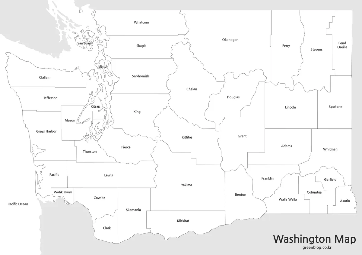
The monochrome Washington State Map removes the county fills while preserving the county names, boundary lines, coastline, and Pacific Ocean label. Its lighter appearance makes it easier to place beside paragraphs, tables, or charts in a report. It also leaves room for circles, arrows, and handwritten notes without requiring users to cover existing colors.
Label size varies with the available space. Names such as Okanogan and Yakima fit comfortably inside broad counties, while Pend Oreille, Wahkiakum, San Juan, Island, and Garfield require tighter placement. Check these smaller labels at the final print size before distributing a large set of worksheets.
Blank County Outline Map
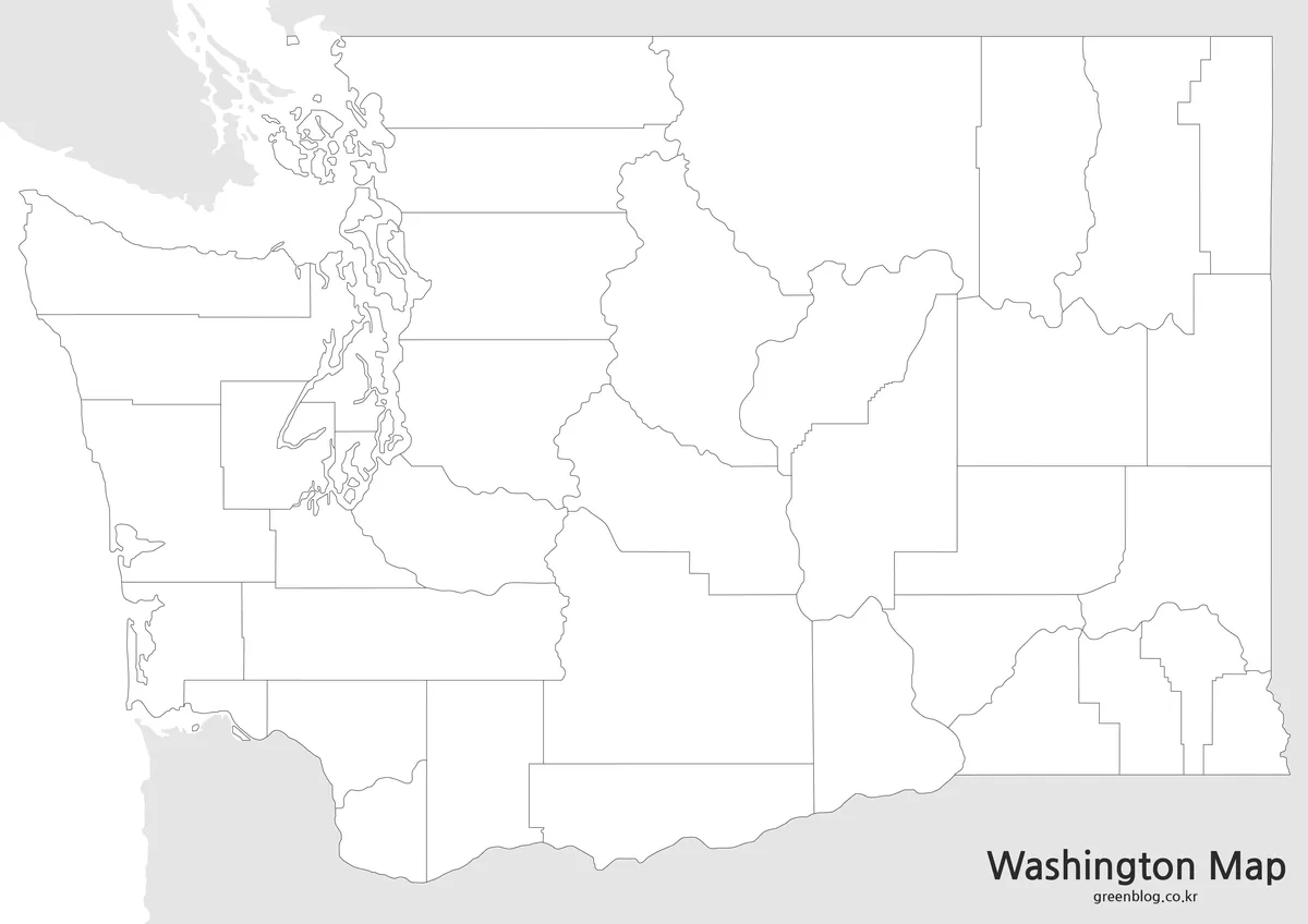
The outline Washington State Map removes county names, color fills, and the Pacific Ocean label while retaining the state coastline and all county divisions. Gray surrounding areas remain visible, so the file is not a transparent or vector source. It is a clean raster base for annotation, coloring, or data design.
Students can label all 39 counties, mark the Canadian border, identify counties touching Oregon or Idaho, or distinguish the Olympic Peninsula from the Puget Sound area. Designers can add Seattle and Olympia markers, county population data, sales territories, travel stops, or emergency-planning zones. New information should include a legend, source, and reference date.
Selecting the Best File and Print Size
Choose the color Washington State Map for screen presentations and quick county recognition. Use the black-and-white edition when county names must remain available in a worksheet, report, or document insert. Select the outline map when the assignment requires learners or designers to add their own names, categories, routes, or values.
The downloadable ZIP contains three JPEG files. The black-and-white and outline maps measure 4962 × 3508 pixels, while the color map measures 4962 × 3509 pixels. All three use CMYK color and a landscape proportion suited to an A3-style page. The smaller WEBP previews attached to the post are approximately 1200 pixels wide and should not be mistaken for the full-size archive files.
Preserve the original aspect ratio when resizing a Washington State Map. Vertical stretching would distort the Olympic Peninsula, Puget Sound, and the broad eastern counties. For A3 printing, use the JPEG files from the ZIP rather than enlarging a compressed webpage preview, and check that the printer or document workflow handles CMYK images correctly.
Classroom, Presentation, and Data Uses
A geography lesson can use the three maps as a progression. Begin with the color edition to introduce the county pattern, move to the monochrome reference for closer name study, and finish with the blank outline as a recall exercise. Students can compare the island counties with the rectangular eastern counties or identify the counties along each state border.
For a thematic graphic, the blank Washington State Map provides the least visual competition. County-level statistics can be shaded with a sequential scale, while categories can use distinct colors. Compact western and southeastern counties may need numbered callouts or an accompanying table when labels and values cannot fit inside the boundaries.
Travel presentations can add route lines or city markers, but the original maps provide no road network or distance scale. They should not be used to measure driving distance or choose a navigation route. Their strength is administrative orientation: showing which counties adjoin one another and how the county framework fits the state’s coastline and borders.
Frequently Asked Questions
How many counties appear on the Washington State Map?
All 39 Washington counties are represented. The color and black-and-white versions include county names, while the outline version shows only their boundaries. The files do not include cities, county seats, ZIP codes, legislative districts, or smaller census geography.
Does the collection show Seattle, Spokane, or Olympia?
No. The labeled maps identify counties rather than cities. Seattle can be added within King County, Spokane within Spokane County, and Olympia within Thurston County when a project requires city markers. Verify marker locations with a suitable current geographic source before publishing the edited image.
Which version is best for county data?
Start with the outline edition because it has no labels or pastel fills competing with a new data layer. Add a clear legend, units, source, and year. If values are difficult to place around Puget Sound or southeastern Washington, use callouts or a separate table.
Are the files suitable for A3 printing?
The ZIP contains landscape JPEG files measuring about 4962 × 3508 pixels, which aligns with an A3-oriented high-resolution layout. Use those originals rather than the smaller WEBP previews. Print results can still vary with scaling, printer settings, paper, and CMYK handling, so test one page first.
Is Washington State the same as Washington, D.C.?
No. Washington State is on the Pacific coast in the northwestern United States. Washington, D.C., is the federal capital on the East Coast between Maryland and Virginia. Using the full phrase “Washington State” in titles and captions helps prevent confusion between the two places.
Map File Information
This ZIP archive contains three county maps of Washington State for labeled reference, printing, classroom exercises, presentations, and custom data graphics.
- Included Versions: Pastel color map, black-and-white labeled map, and unlabeled county outline map
- Printable Size: A3-oriented landscape layout at approximately 4962 × 3508 pixels
- File Type: Three CMYK JPEG images in a ZIP archive
- Intended Use: County reference, classroom handouts, reports, presentation graphics, annotation, and thematic mapping
Related Maps
- United States Map Collection with State Names and Outlines
- Oregon Map Collection for Printing, Editing, and Classroom Use
- Idaho County Map Collection with Color, Labeled, and Outline Maps
- Printable Alaska Map Collection for Education, Travel, and Design
Additional Resources
- Washington State County Road Administration Board — County Map: Use the state’s interactive county map to confirm all 39 counties and open high-level county road information.
Green Map creates custom-edited map images using open geographic data sources such as geoBoundaries, Natural Earth, OpenStreetMap, and government open data.
These maps are edited visual materials, not raw data files, and are provided for education, documents, presentations, and graphic reference.