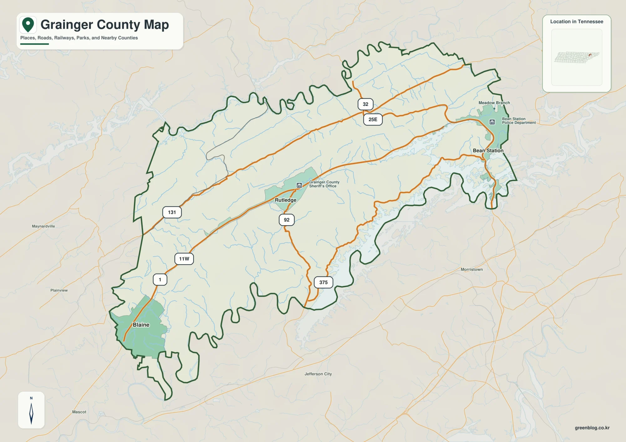
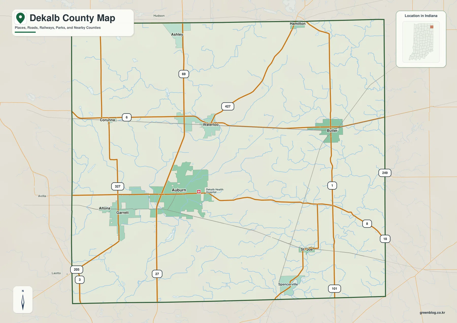
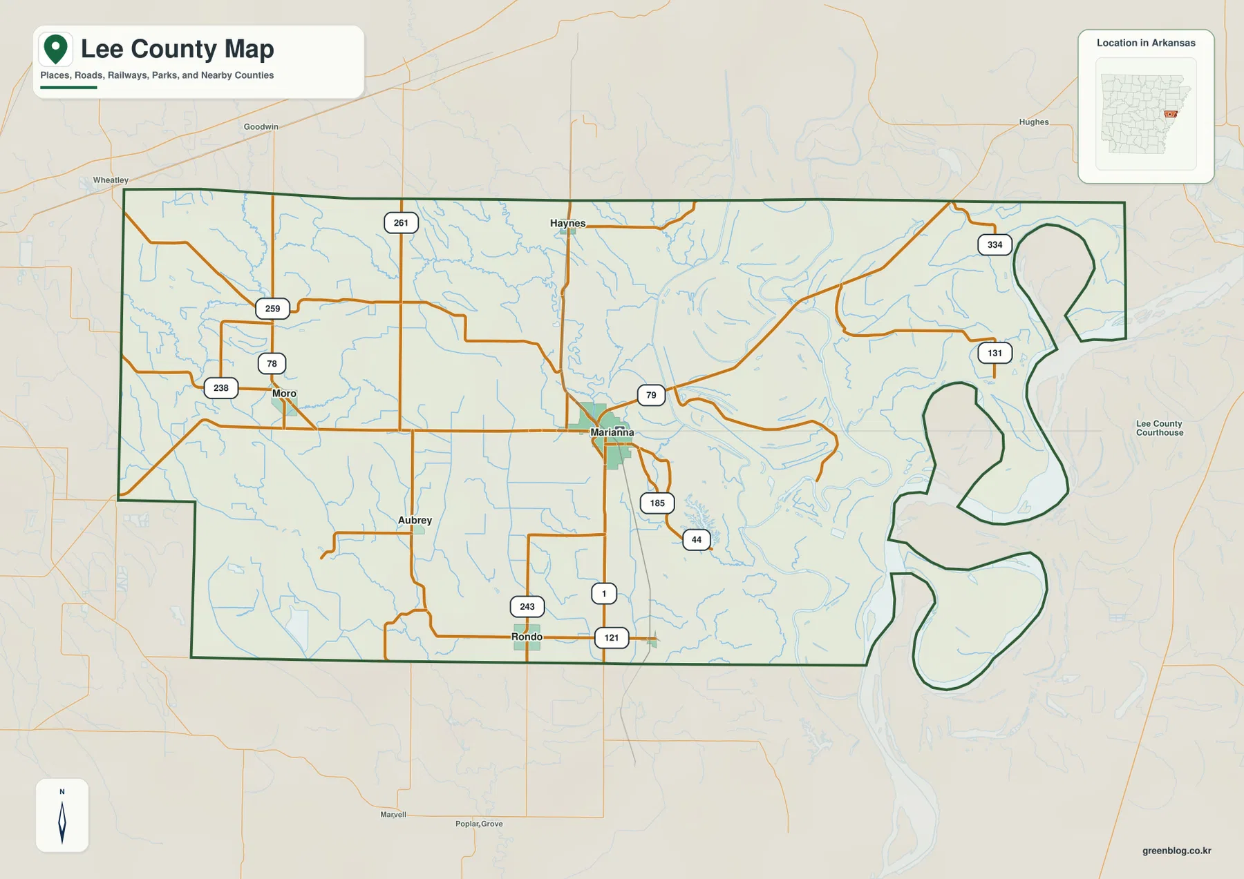
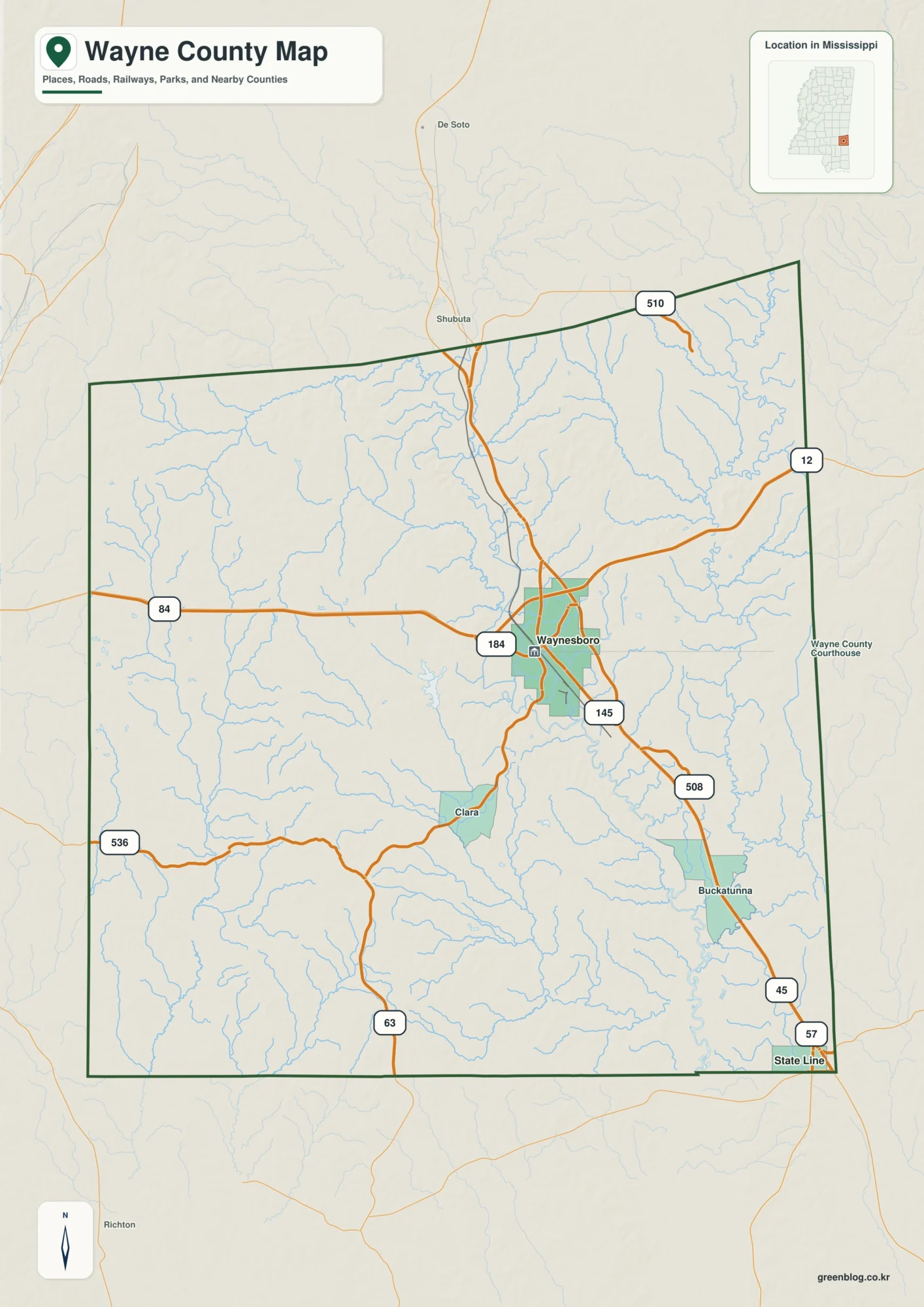
Download the St. Clair County Alabama Map as one ZIP containing four A3 high-resolution JPGs: a county-and-roads map, a ranked-city map, a water map, and an elevation map. Pell City anchors the southern side and Ashville serves as the northern county seat, while western communities face the Birmingham direction and the eastern side follows the Coosa River system. Long Appalachian ridges and valleys separate some of those travel patterns, so the four files are useful both for quick reference and for larger printable work.
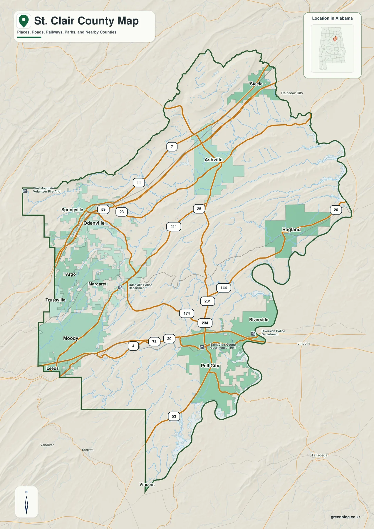
The general county map is the best place to begin because it puts Pell City, Ashville, Moody, Springville, Ragland, Riverside, Steele, and other communities into one road-and-boundary view. The ranked city map then simplifies the settlement pattern to six selected places. A separate water map reveals the Coosa River, major creeks, and numerous named lakes, while the elevation map shows an actual range from 93 to 472 meters with a mean of 208 meters. Taken together, the maps explain why the western growth corridor, the northern high ground, and the eastern river country do not share one uniform landscape.
Table of Contents
Pell City and Ashville provide two very different county-seat reference points
St. Clair County occupies north-central Alabama between the Birmingham side of the state and the Coosa River valley. The supplied source material lists Jefferson, Shelby, Talladega, Calhoun, Blount, and Etowah among the neighboring counties. That setting puts metropolitan growth, an inland ridge-and-valley landscape, and a major river-reservoir system within the same county boundary. The outline itself is irregular enough that the road, water, and elevation maps are more informative than a simple rectangular location diagram would be.
| State | Alabama |
|---|---|
| County | St. Clair County |
| County seats | Ashville and Pell City |
| Largest city | Pell City |
| 2025 population estimate | 98,206 |
| 2020 census population | 91,103 |
| Major routes | I-20, I-59, U.S. 231, U.S. 11, and state highways |
| Water references | Coosa River, Logan Martin Lake, Big Canoe Creek, Little Canoe Creek, and smaller waters |
| Elevation shown | Actual 93-472 m, mean 208 m |
The supplied population background gives a July 1, 2025 estimate of 98,206 residents and a 2020 census count of 91,103. Those figures are not plotted as density on the maps, but they help explain why the western and southern communities receive so much attention in a county that continues to connect with the Birmingham side. The road and city maps are best used for position first, with population data serving as context rather than being mistaken for a mapped layer.
St. Clair County’s two-seat arrangement is one of the most useful facts for reading the map. The existing source material describes Ashville as the long-standing northern administrative center and Pell City as the additional judicial and administrative center for the southern district. It also links that development to the ridge country between the two areas, including Backbone Mountain, which historically made travel to one central courthouse difficult for some residents. The dual seats therefore reflect physical geography as well as government organization.
I-20, I-59, and U.S. 231 organize different travel corridors
The southern side is easiest to orient with I-20. The supplied material connects Moody and Pell City with this Birmingham-to-Atlanta corridor, so the interstate provides a clear east-west reference through the lower half of the county. The northwestern side follows a different line: I-59 and U.S. 11 serve the Springville-Steele direction. These routes explain why western communities can belong to the same broad Birmingham-facing side of the county while still being organized around different highways.
U.S. 231 is especially valuable because it links the two county-seat areas. It runs north-south through the interior between Pell City and Ashville and connects with several state highways shown on the general map. Routes 25, 144, 174, 234, and 411 provide additional interior and eastern references. In many places the roads curve through valleys or around higher ground rather than forming a regular grid, a pattern that becomes much easier to understand after viewing the elevation map.
Springville, Odenville, Argo, Margaret, and Moody form a recognizable western and northwestern cluster, but their highway relationships differ. Pell City and Riverside occupy a southeastern position closer to the Coosa water landscape. Ragland supplies an eastern inland reference, while Ashville and Steele help orient the north. The communities therefore make more sense as several road-and-terrain groups than as one continuous urban strip.
Six ranked cities highlight the western growth corridor and Pell City
The city map ranks six selected places. Pell City is printed at 13,587 and Moody at 13,488, making them nearly equal at the top of this particular map index. Margaret follows at 5,877, Odenville at 5,197, Springville at 5,081, and Argo at 4,479. These are the values printed on the supplied graphic, so they are best used to compare the selected places rather than as a substitute for a separately dated population table.
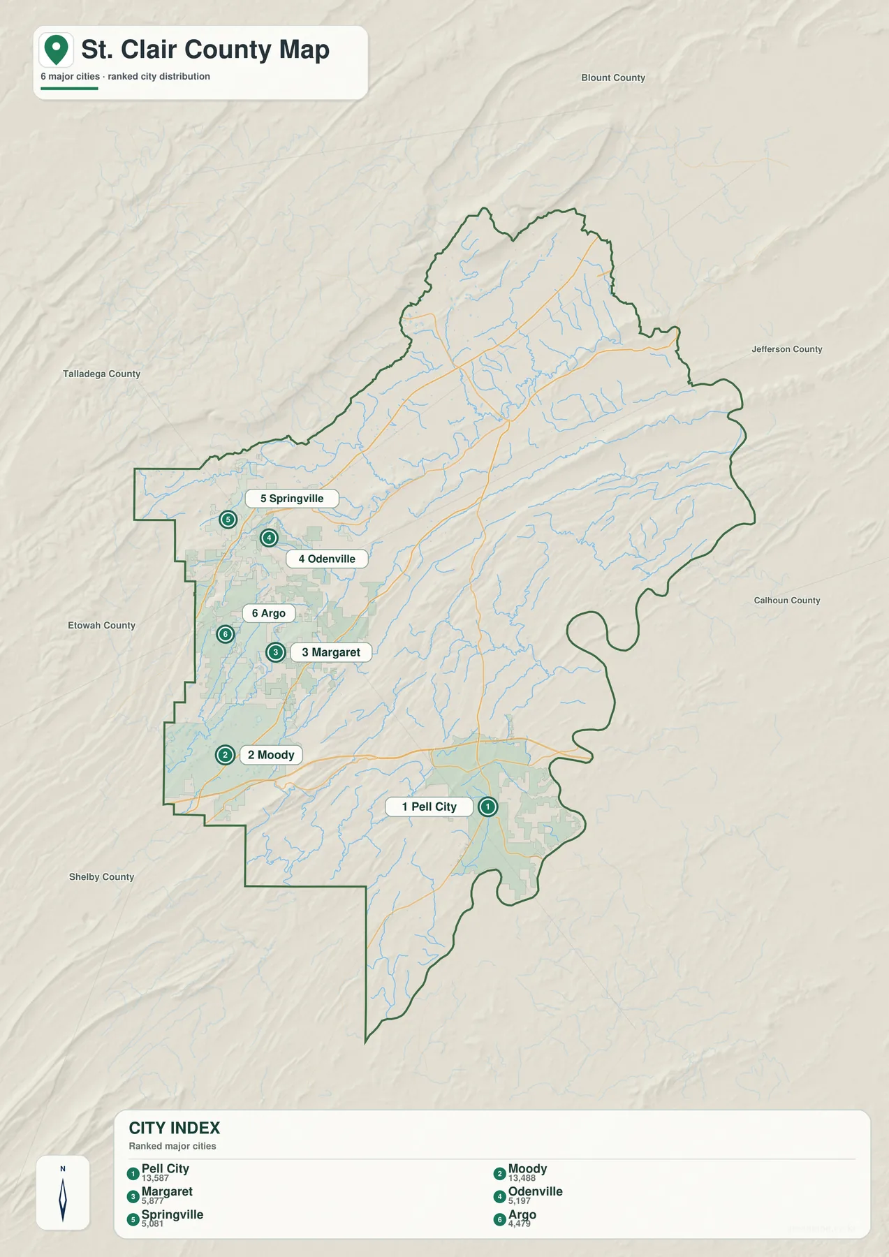
Pell City’s first-place position fits the existing description of it as the county’s largest city, but the ranking does not make it the only administrative center. Ashville remains a county seat even though it does not appear in this six-place graphic. Moody is nearly equal to Pell City in the printed ranking, yet it lies much farther west along the I-20 side. The two leading places therefore represent different parts of St. Clair County rather than one shared local center.
Margaret, Odenville, Springville, and Argo are useful for reading the Birmingham-facing side in more detail. Springville belongs to the northern I-59/U.S. 11 direction, while Moody is tied more directly to I-20. Odenville and Margaret fill the interior between those major corridors, and Argo is close to the western edge. The map turns that complex collection of names into a simpler six-place distribution without suggesting that these are the county’s only municipalities.
Several important places remain outside the ranking, including Ashville, Ragland, Riverside, Steele, and Vincent. Use the city graphic when relative size and selected-place distribution are the main questions, but return to the general county map for administrative centers, the eastern river communities, or a broader view of roads and place labels.
The Coosa River contrasts with a dense interior network of creeks and lakes
The water map gives the eastern edge a much stronger presence than the road map alone. The Coosa River system runs along that side of the county, with broad reservoir-shaped water visible in several sections. H Neely Henry Lake is labeled in the northeast. The existing article also identifies Logan Martin Lake around the Pell City and Riverside side farther south, reinforcing the idea that eastern St. Clair County is defined by large river and reservoir water as well as local creeks.
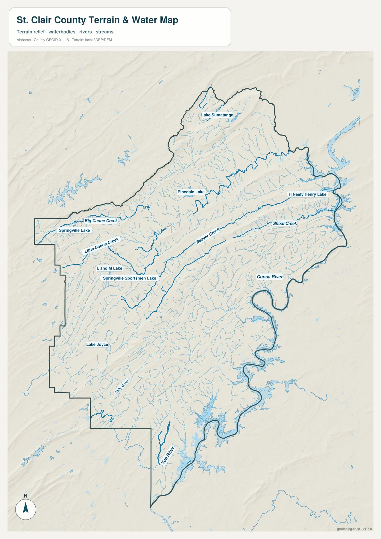
Inside the county, the water network becomes much finer. Big Canoe Creek and Little Canoe Creek are labeled in the northwest, while Beaver Creek and Shoal Creek extend across the central and eastern sections. Lake Sumatanga and Pinedale Lake appear in the north. Near Springville, the map labels Springville Lake, L and M Lake, and Springville Sportsman Lake, while Lake Joyce provides another named reference farther southwest.
Kelley Creek and Toe River appear farther south, and many unnamed tributaries fill the valleys between the larger labels. Removing the city symbols and focusing on water makes the contrast between the broad eastern river system and the smaller western and interior drainage much easier to see. It also helps explain why road routes and settlement do not follow one simple pattern across the county.
This map is intended for geographic water reference. It is useful for finding named rivers, creeks, and lakes and for comparing drainage across the county, but it is not a flood-risk map, parcel boundary source, navigation chart, or site-specific drainage study. Those tasks require more specialized and current data.
Elevation rises sharply into the northern Appalachian ridge country
The elevation map provides the clearest explanation for the county’s divided road and settlement pattern. Its legend reports an actual elevation range from 93 to 472 meters and a mean of 208 meters. The highest brown terrain occupies large parts of the north, while long, narrow ridges also run through the west and center. Lower green terrain becomes more common along the eastern and southeastern Coosa side.
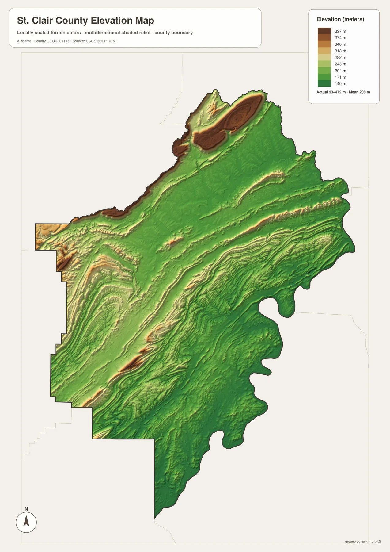
The supplied background places St. Clair County at the southern end of the Appalachian system in Alabama’s Valley and Ridge setting. The relief image matches that description with long parallel bands rather than isolated round hills. Backbone Mountain and the Chandler Mountain area are part of the source material’s explanation for the county’s physical character. Roads often follow lower passages between ridges, so a highway line that bends on the general map can make more sense once the terrain is visible.
The terrain also adds context to the two-county-seat history. Ashville and Pell City are separated by more than a straight map distance; the interior includes ridges and valleys that historically affected travel. On the eastern side, the broad Coosa water landscape occupies lower ground than much of the northern high country. This combination of ridge, valley, river, and reservoir terrain prevents the county from behaving like a uniformly flat metropolitan fringe.
The elevation graphic is designed for countywide comparison, not precise site measurement. It works well when the goal is to identify high and low parts of St. Clair County, explain ridge directions, or add terrain context to road and water maps. Surveying, engineering, construction, or parcel-level elevation work requires more precise data.
Western growth, northern high ground, and eastern water form three useful map regions
The western and southwestern side contains several of the places emphasized by the ranked-city map, and major Birmingham-facing roads reinforce that importance. Moody, Margaret, Odenville, Springville, and Argo can be compared as one broad side of the county even though they do not all use the same highway. The population-growth background in the source package adds context for why these communities matter, but the map remains primarily a geographic rather than demographic reference.
The east and southeast are defined much more strongly by water. Pell City and Riverside sit close to the Coosa reservoir landscape, while Ragland and other eastern areas remain tied to the same river system and its tributaries. The ranked city map makes Pell City look primarily like a population center; the water map adds the equally important fact that it is part of a large river-and-lake setting.
The north has another character again. Ashville and Steele are close to some of the county’s highest terrain, and the elevation map shows long ridge bands extending through that part of St. Clair County. Springville occupies a useful transition between the Birmingham-facing west and the northern ridge country. Keeping these regional differences in mind prevents the county from being reduced to a list of towns.
Choose the map according to the detail you need
Use the general county map when boundaries, major roads, county seats, and a broad selection of communities need to appear together. It is the best all-purpose image for finding Pell City and Ashville while keeping I-20, I-59, U.S. 231, and eastern place references in view. The ranked city map is more efficient when the question is simply how Pell City, Moody, Margaret, Odenville, Springville, and Argo compare and where they sit relative to each other.
Choose the water map when the Coosa River, Big Canoe Creek, Beaver Creek, or named lakes are the focus. The dedicated layer makes smaller water features much easier to find than they are on the general map. Choose the elevation map when ridge direction, high ground, or the contrast between northern uplands and the eastern river side matters more than place labels.
For teaching, printing, regional comparison, or personal cartography, the four maps work well as a sequence. Start with roads and place names, simplify the settlement pattern with the city ranking, then add water and elevation when the physical landscape becomes important. Separating those functions keeps each image readable while still allowing the set to describe the county in considerable detail.
Frequently Asked Questions
Why does St. Clair County have two county seats?
The supplied county background describes Ashville as the long-standing northern administrative center and Pell City as the additional judicial and administrative center serving the south. Ridge terrain between the two areas historically made travel to a single seat difficult, so the two-center arrangement reflects geography as well as government organization.
Does the ranked city map include every municipality in St. Clair County?
No. The ranking selects Pell City, Moody, Margaret, Odenville, Springville, and Argo. Other important places such as Ashville, Ragland, Riverside, Steele, and Vincent appear on the general county map but are not part of the six-place ranking. Use the city map for selected-place comparison rather than as a complete municipal list.
How do the water and elevation maps explain St. Clair County together?
The eastern Coosa River system occupies generally lower terrain, while the north and parts of the interior rise into much higher ridge country. Comparing the maps makes it easier to see how large water bodies follow lower ground and how smaller creeks occupy the valleys between the county’s long ridges.
Map File Information
St. Clair County map files
- Included Versions: county, city, water, elevation
Related Maps
- Abbeville, Headland, and Lake Eufaula on the Henry County Alabama Map
- Athens to Wheeler Reservoir on the Limestone County Alabama Map
- Autauga County Map
Sources and references
- St. Clair County official website — county government and local information
- U.S. Census Bureau QuickFacts — population background
- Encyclopedia of Alabama – St. Clair County — two-county-seat history and regional background
- Alabama Department of Transportation map resources — highway reference
- USGS National Hydrography — water-feature reference
- USGS 3D Elevation Program — elevation reference
Green Map creates custom-edited map images using open geographic data sources such as geoBoundaries, Natural Earth, OpenStreetMap, and government open data. These maps are edited visual materials, not raw data files, and are provided for education, documents, presentations, and graphic reference.