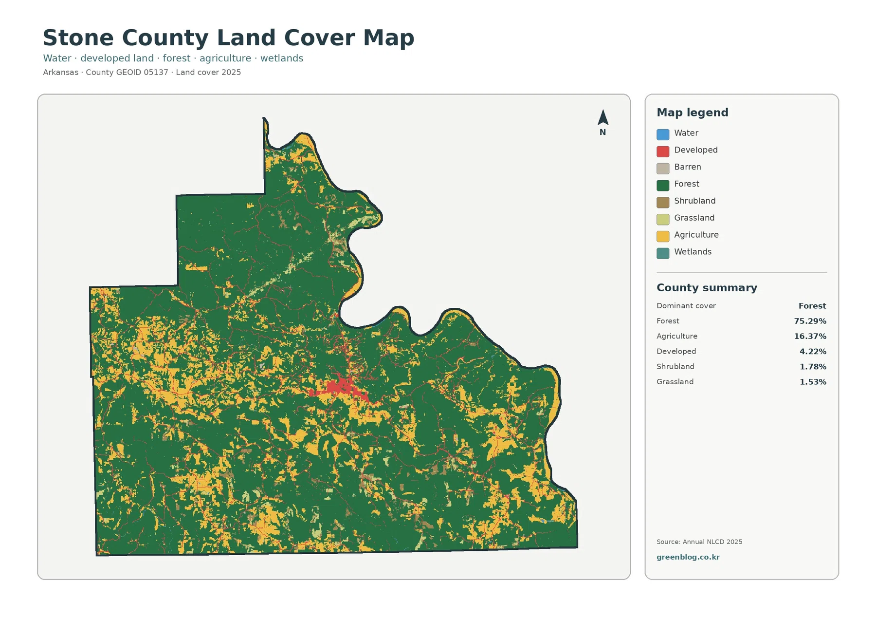
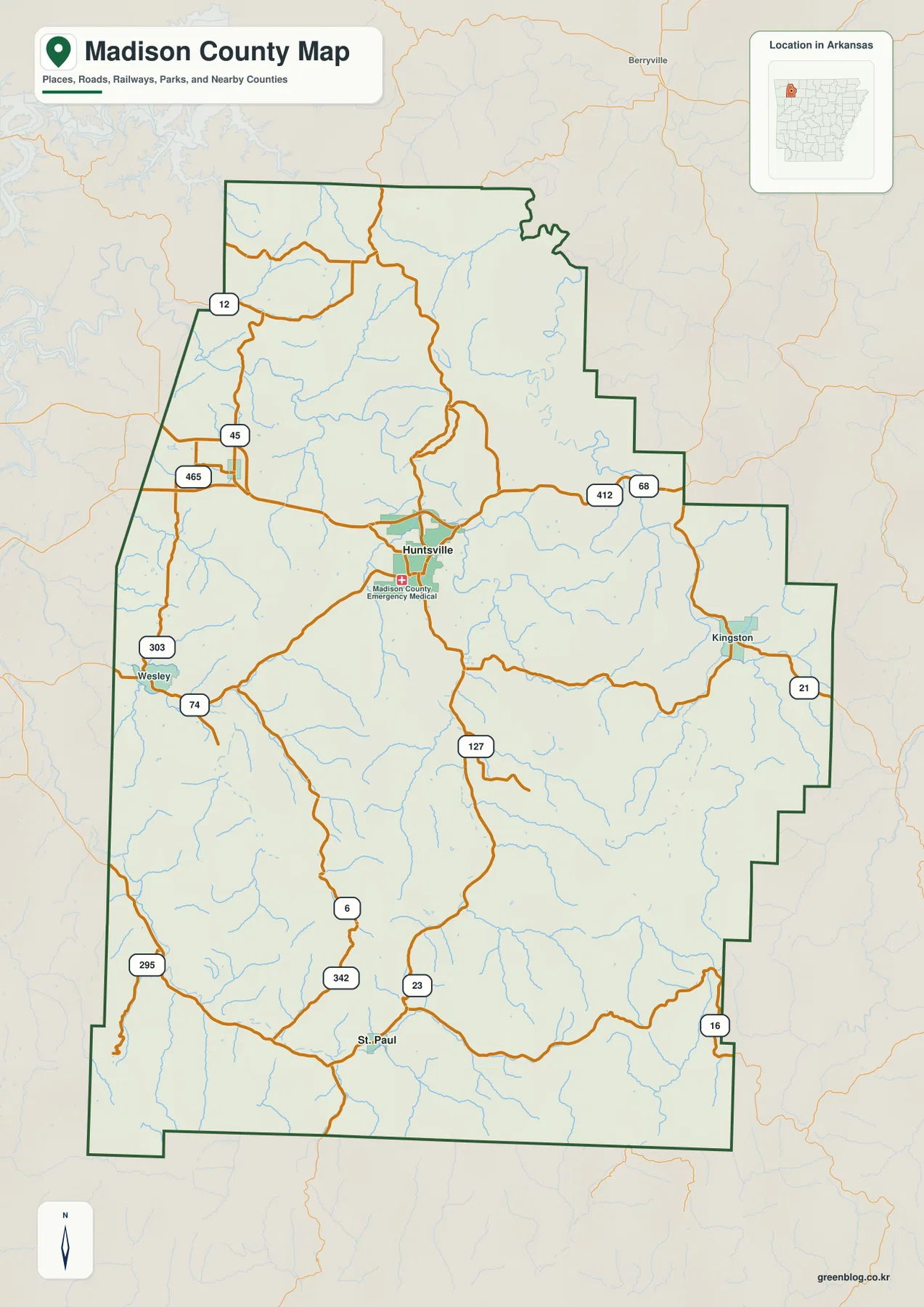
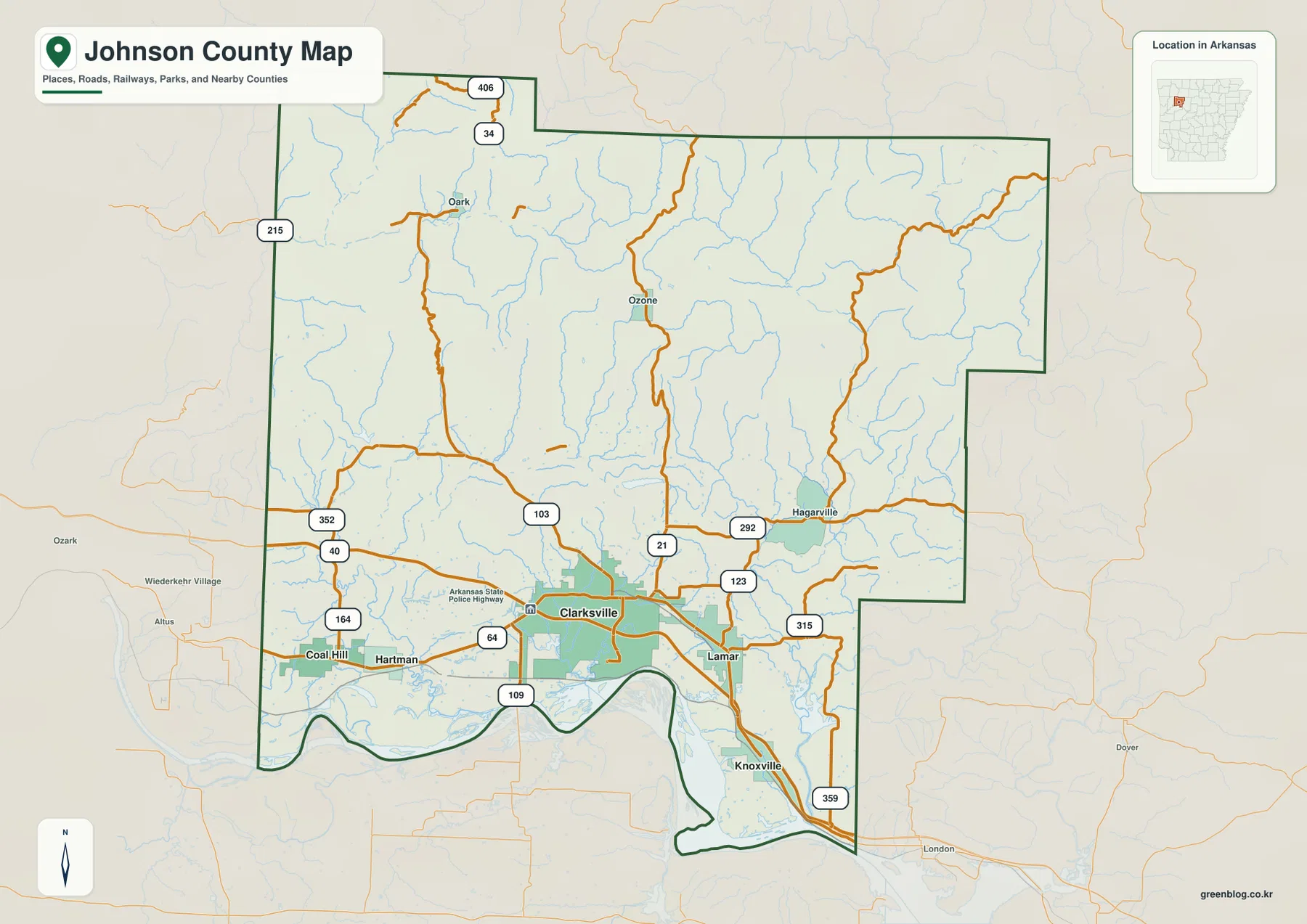
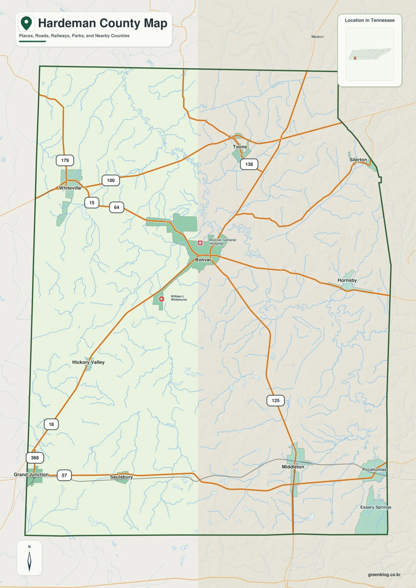
Download the Sumter County Alabama Map as one ZIP containing four original A3 high-resolution JPGs: a county-and-roads map, a six-place ranked city map, a terrain-and-water map, and an elevation map. The county is framed by the Mississippi state line on the west and the Tombigbee River side on the east, with Livingston near the middle. York and Cuba help orient the western transportation side, while Gainesville and Epes mark the river-facing east. Separating roads, communities, water, and relief into individual maps makes this rural county much easier to understand.
Sumter County does not have one continuous urban center. Livingston is the county seat and home to the University of West Alabama, York forms another important western community, and Cuba sits near the I-20/I-59 crossing at the Mississippi line. Geiger and Emelle help define the northwestern side. Gainesville and Epes occupy a very different setting near the Tombigbee corridor. The maps are most useful when those places are read as separate border, central, and river-side groups connected by a relatively small number of major roads.
Table of Contents
A county stretched between the Mississippi border and the Tombigbee side
Sumter County lies in western Alabama along the Mississippi state line. The supplied source material identifies Noxubee, Kemper, and Lauderdale counties on the Mississippi side, with Pickens County to the north and Greene, Marengo, and Choctaw counties around the Alabama side. The western boundary is comparatively straight because it follows the state line for a long distance, while the eastern outline is much more irregular around the river and tributary landscape.
| State | Alabama |
|---|---|
| County | Sumter County |
| County seat | Livingston |
| 2020 census population | 12,345 |
| 2025 population estimate | 11,588 |
| Major travel references | I-20/I-59, U.S. 11, U.S. 80, AL 17, and local routes |
| Major water references | Tombigbee River, Sucarnoochee River, Noxubee River, and many creeks and lakes |
| Elevation shown | Actual 10-136 m, mean 54 m |
The supplied demographic background gives a 2020 census population of 12,345 and a July 1, 2025 estimate of 11,588. Those numbers fit the broad spacing visible on the county map: communities are separated by large rural areas rather than merging into a dense urban strip. For map reading, the relative positions of Livingston, York, Cuba, Gainesville, Epes, Geiger, and Emelle are therefore more useful than expecting street-level density across the county.
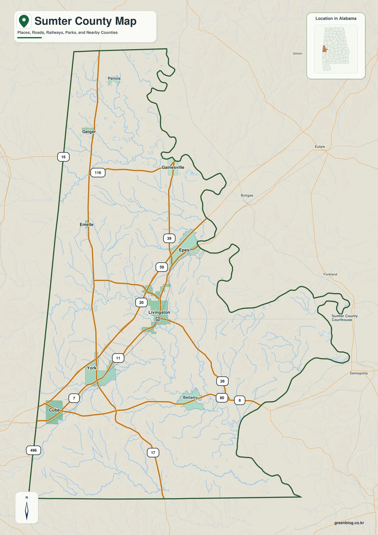
The strongest transportation reference crosses the southern half of the county from the Cuba area toward Livingston and farther east. The existing source material identifies this as the I-20/I-59 corridor. U.S. 11 also helps connect the Cuba-York-Livingston side, while U.S. 80 heads east from the southwestern junction toward the Demopolis direction. Alabama 17 forms a useful north-south reference along the western side through the Geiger, Emelle, and Cuba area. On the eastern half, roads shown around Gainesville and Epes provide access toward the Tombigbee side.
Six ranked places separate the central, border, and river-side communities
The ranked city map selects six places and prints a comparison value for each. Livingston appears first at 4,672 and York second at 2,056. Cuba is shown at 368, followed closely by Epes at 354, while Gainesville is 236 and Geiger 174. These are the values printed on the supplied graphic, so they are best used to compare the selected places on this map rather than as a substitute for a separately dated population table.
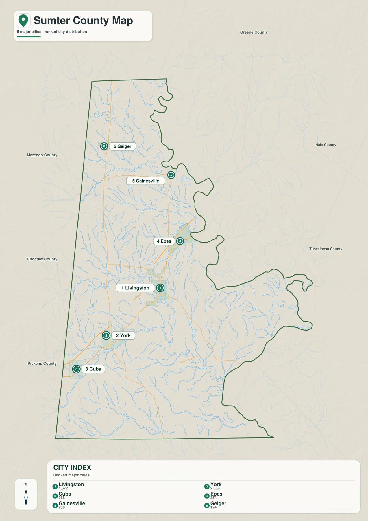
Livingston’s first-place position matches its central role in the county. The source package identifies it as the county seat, notes the Sumter County Courthouse and the University of West Alabama, and states that Livingston was selected as the seat when Sumter County was created in 1832. York lies west of Livingston and provides another strong reference for the central-western side. Their positions make the two communities useful for understanding the interior before moving outward toward the state line or river.
Cuba and Geiger belong to the border-oriented side of the county. Cuba is close to the Mississippi state-line crossing of I-20/I-59, while Geiger anchors the northwest near Alabama 17 and a dense network of small streams. Gainesville and Epes form a contrasting eastern pair near the Tombigbee corridor. Looking at the six selected places by location rather than only by rank reveals three broad patterns: western border communities, the Livingston-York interior, and the eastern river side.
The ranked graphic is intentionally simpler than the general county map. Emelle, Panola, Bellamy, and other labels remain visible on the main map but are not part of the six-place index. Use the ranked map when relative size and distribution are the main questions; use the general map when a broader set of place names and roads is needed.
The Sucarnoochee River ties Livingston to a much denser water network
The Sucarnoochee River is the clearest central water reference on the dedicated terrain-and-water map. The existing source material says the river enters from Mississippi, passes the Livingston area, and continues east toward the Tombigbee River. A USGS monitoring location at Livingston is described with a drainage area of about 607 square miles, showing that the river gathers water from a broad part of the county rather than functioning as a small local creek.
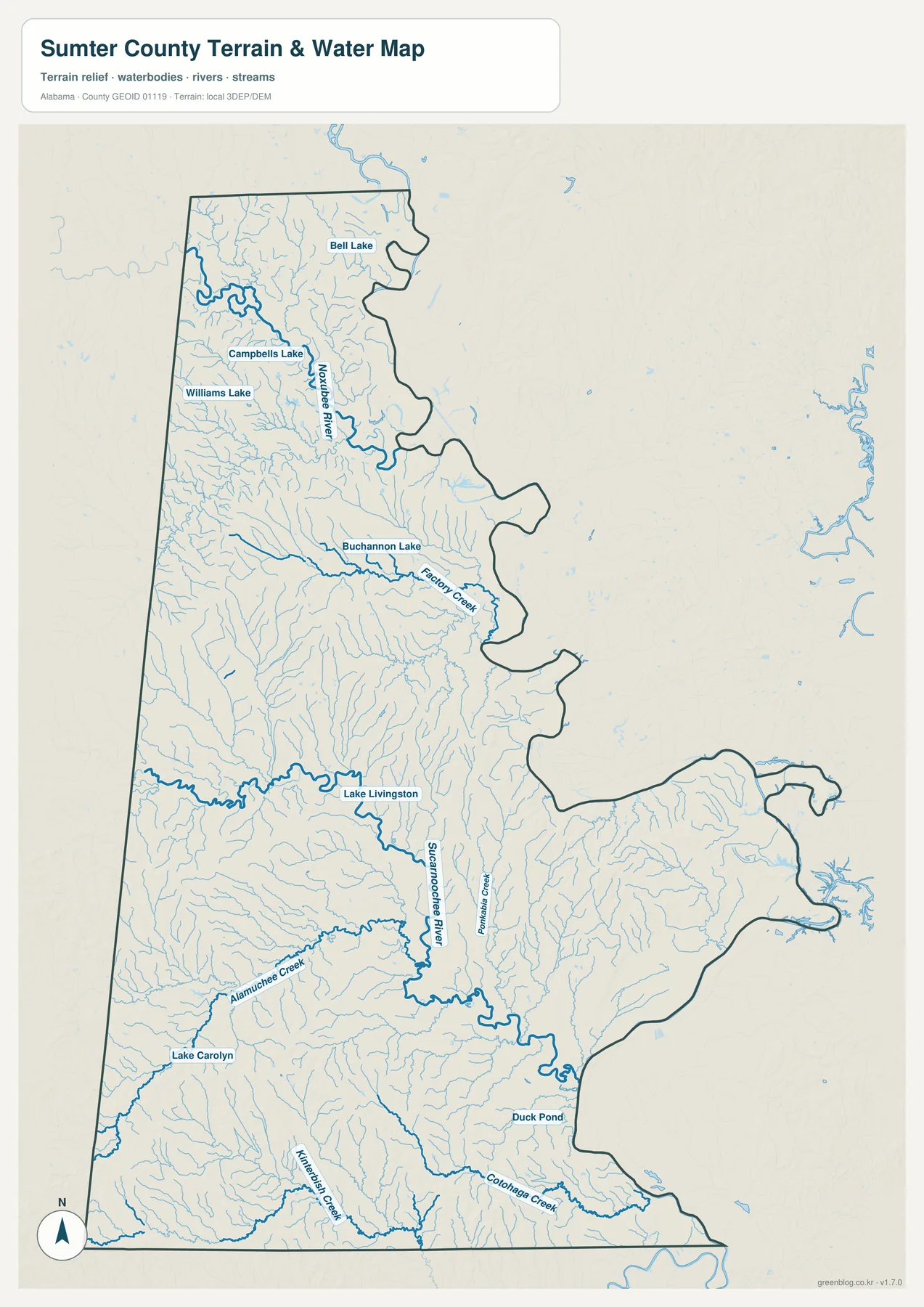
The northern half contains the Noxubee River along with Bell Lake, Campbells Lake, and Williams Lake. Farther south, Buchannon Lake sits near Factory Creek. Lake Livingston is placed beside the central Sucarnoochee system, while Alamuchee Creek and Lake Carolyn provide southwestern references. Kinterbish Creek and Coalinga Creek run through the southern part of the map, and Duck Pond appears as a smaller named water feature near the southeast.
The eastern edge connects to the Tombigbee River system. Gainesville and Epes are the key communities on that side of the general map, and the older article material also refers to Gainesville Lake and Demopolis Lake within the larger navigation-water context. Compared with the straight Mississippi border, the river side is physically more complicated, with tributaries converging toward broad low water and an irregular county edge.
This water map is designed for geographic reference. It is useful for locating rivers, creeks, lakes, and the direction of local drainage, but it should not be used as a flood-risk map, parcel-boundary source, navigation chart, or site-specific drainage study. Those purposes require more specialized data.
Low river country contrasts with rolling western and southern uplands
The elevation map shows why Sumter County should be described as rolling rather than mountainous. Its legend reports an actual elevation range from 10 to 136 meters and a mean of 54 meters. Broad low green areas are common along the eastern river side and in stream valleys, while higher brown and tan ground appears in parts of the west-central, southwestern, and southern county.
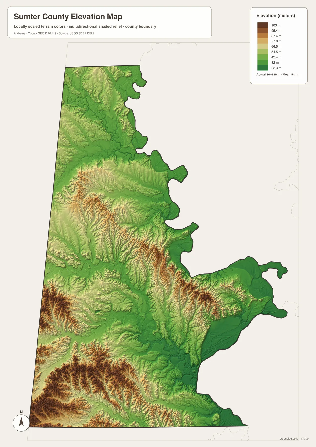
The supplied background places Sumter County in Alabama’s Black Belt and the East Gulf Coastal Plain. It describes rolling prairie and coastal-plain terrain rather than the steep mountain relief found in northeastern Alabama. The elevation image supports that distinction: the higher areas appear as bands and clusters of modest ridges rather than tall isolated mountains, while low stream valleys cut through much of the county.
Livingston and York sit within a mixed landscape of stream valleys and gentle uplands. Some of the stronger high-color terrain appears toward the western interior and the south, including areas closer to the Mississippi side. Moving east toward Gainesville, Epes, and the Tombigbee corridor, lower elevations become more widespread. With a countywide maximum of 136 meters on this map, the most useful comparison is not mountain versus plain but rolling upland versus low river and creek country.
The relief image is intended for county-scale comparison rather than exact site measurement. It works well for explaining which parts of Sumter County are relatively high or low and for adding terrain context to the road and water maps. Surveying, engineering, construction, or parcel-level elevation work requires more precise source data.
Cuba, York, and Livingston provide a practical west-to-center travel framework
A simple way to orient the county is to start at Cuba on the southwest. The community lies near the I-20/I-59 state-line crossing and therefore provides the clearest connection to Mississippi. Moving northeast brings York and then the Livingston area into view. U.S. 11 reinforces that relationship, while U.S. 80 turns east from the southwestern junction toward the Demopolis direction.
Alabama 17 organizes a different movement pattern along the western side, connecting the Geiger, Emelle, and Cuba area from north to south. Gainesville and Epes do not fit that same border corridor because their stronger geographic relationship is with the Tombigbee side. Livingston occupies the interior between those two patterns and serves as a useful midpoint for countywide orientation.
The general map also prints several additional route numbers around Livingston, Gainesville, Epes, and the southern county. Those local roads are useful once a specific community is selected, but they are easier to understand after the major corridors are identified. Beginning with I-20/I-59, U.S. 11, U.S. 80, and Alabama 17 keeps the map readable before moving to smaller route details.
Choose the Sumter County map that matches the detail you need
Use the general county map when boundaries, roads, and a broad set of place names need to remain visible together. It is the best all-purpose reference for locating Livingston, York, Cuba, Gainesville, Epes, Geiger, and Emelle while keeping the Mississippi border and the eastern river side in view. The ranked city map is faster when the task is simply to compare the six selected places and see how widely they are separated.
Choose the water map when the Sucarnoochee River, Noxubee River, Factory Creek, Alamuchee Creek, Kinterbish Creek, Coalinga Creek, or named lakes are the focus. Choose the elevation map when the main question is terrain rather than labels. Its clearest message is the transition between low eastern river country and the rolling uplands that become more visible across the western interior and south.
For teaching, printing, regional comparison, or a personal map project, the four files work well as complementary references. Start with location and roads, simplify the settlement pattern with the ranked map, then add water and elevation when the physical landscape matters. Keeping those subjects separate avoids the clutter that would result from placing every label and terrain layer into one image.
Frequently Asked Questions
Where is the county seat of Sumter County?
Livingston is the county seat. The supplied background says Sumter County was created in 1832 and Livingston was selected as the seat that same year. Its central position makes it a useful reference between the Mississippi-facing west and the Tombigbee-facing east.
Which river is most useful for understanding the Livingston area?
The Sucarnoochee River is the main central reference. It enters from Mississippi, passes the Livingston area, and continues toward the Tombigbee River. The supplied material also gives a drainage area of about 607 square miles at a USGS monitoring location in Livingston, showing the river’s importance beyond the immediate town.
Is Sumter County mountainous?
No. The elevation map reports an actual range of 10 to 136 meters and a mean of 54 meters. The county is better described as rolling Black Belt and coastal-plain terrain, with low river and creek valleys and modest uplands rather than steep mountain relief.
Map File Information
Sumter County map files
- Included Versions: county, city, water, elevation
Related Maps
- Abbeville, Headland, and Lake Eufaula on the Henry County Alabama Map
- Athens to Wheeler Reservoir on the Limestone County Alabama Map
- Autauga County Map
Sources and references
- U.S. Census Bureau QuickFacts – Sumter County, Alabama — 2020 population and 2025 estimate background
- Alabama Department of Transportation – Sumter County Highway Functional Classification — major-road reference
- Sumter County Alabama official website — county government and community information
- Encyclopedia of Alabama – Sumter County — county history and Black Belt/Coastal Plain background
- USGS National Hydrography — water-feature reference
- USGS 3D Elevation Program — elevation reference
Green Map creates custom-edited map images using open geographic data sources such as geoBoundaries, Natural Earth, OpenStreetMap, and government open data. These maps are edited visual materials, not raw data files, and are provided for education, documents, presentations, and graphic reference.