An Alaska map is useful when a standard United States map does not provide enough detail. Alaska is separated from the contiguous United States and covers a very large geographic area, so its regional layout can be difficult to understand from a small inset map. For classroom materials, travel presentations, geography worksheets, blog graphics, or infographic projects, a dedicated Alaska map gives much clearer visual context.
Alaska is located in the far northwestern part of North America. It borders Canada to the east, faces the Arctic Ocean to the north, and stretches toward the Pacific Ocean in the south. It is the largest U.S. state by land area, yet its population is relatively small and spread across a wide region. Major places such as Anchorage, Fairbanks, Juneau, and coastal communities are often far apart, which makes a clear regional map more helpful than a simple location marker.
This printable Alaska map collection includes three versions: a color map, a black and white labeled map, and a blank outline map. The files were prepared for high-resolution printing and practical visual use. They work well for classroom handouts, presentation slides, blog images, travel planning materials, regional comparison graphics, and editable design projects.
The collection is designed for users who need more than a quick reference image. The color version helps separate boroughs and regional divisions, the black and white version keeps the layout clean for documents, and the outline version provides a simple base for editing, highlighting, and custom annotations.
Table of Contents
Alaska Map Overview
Alaska has a different administrative structure from most U.S. states. Instead of a standard county system, Alaska uses boroughs and census areas. For users unfamiliar with this structure, a visual map can make the regional layout easier to understand.
Because the state is so large, scale and spacing matter. A map that works well for a small state may not be clear enough for Alaska. During the design process, extra attention was given to boundary visibility, label placement, and print readability so the map remains useful when enlarged for A3 printing or inserted into a presentation slide.
Included Printable Map Versions
This Alaska map collection includes several visual styles for different purposes.
The color map is best for quick regional comparison. The black and white map is better for printing, worksheets, and document layouts. The outline map is intended for editing, coloring, infographic work, and custom map projects.
Each version serves a different purpose, so users can choose the file that fits their project instead of editing a single image repeatedly.
Color Alaska Map for Regional Comparison
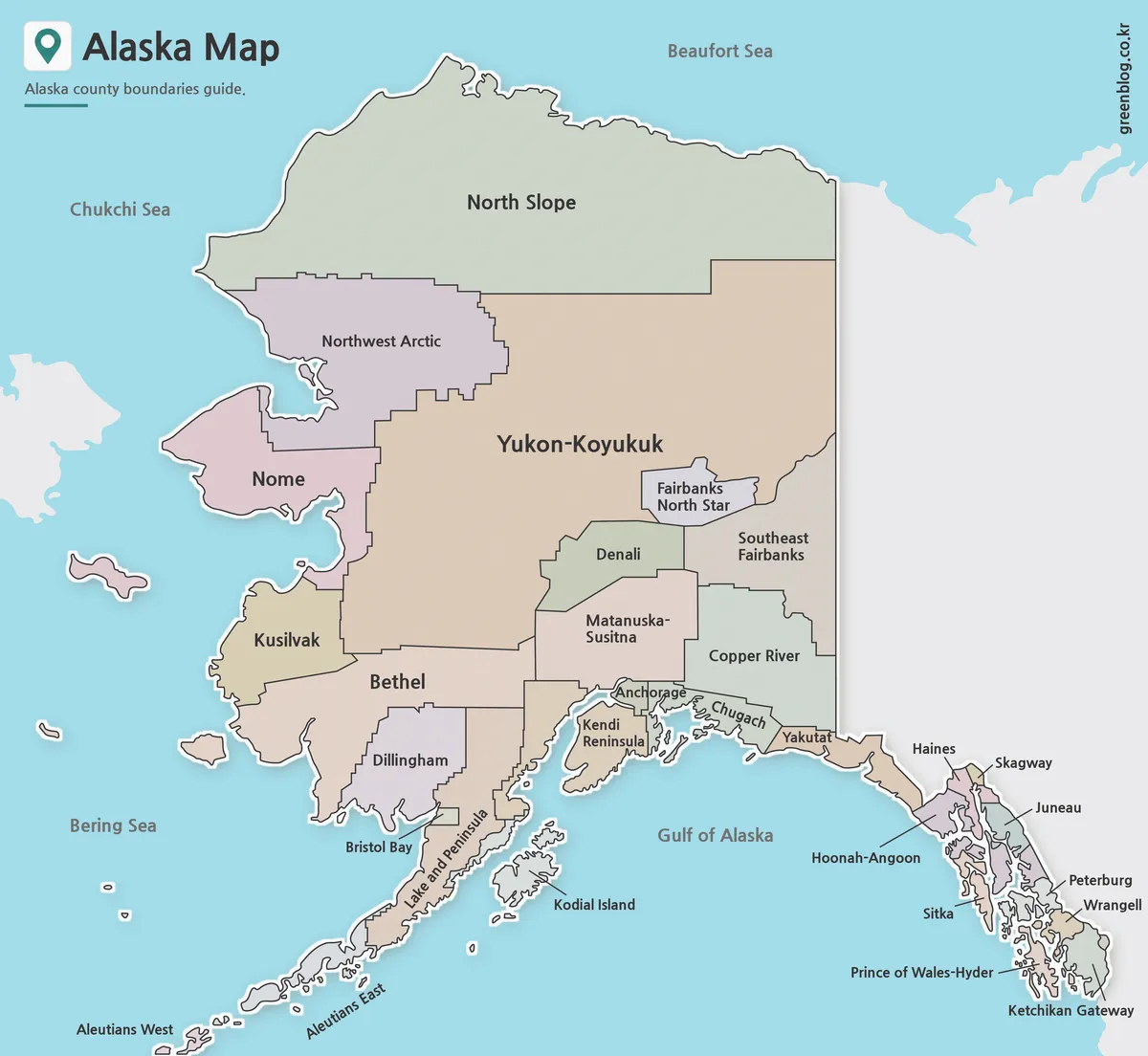
The color Alaska map separates boroughs and regional areas with different colors. This makes it easier to compare large regions at a glance, especially when explaining Alaska’s administrative layout in a classroom or presentation.
Alaska’s size can make the map feel visually uneven if the colors are not balanced. For that reason, the color version was adjusted so neighboring regions remain easy to distinguish. Areas such as Anchorage, Fairbanks North Star Borough, Juneau, and Matanuska-Susitna are easier to locate when the boundaries are visually separated.
This version works well for geography lessons, educational slides, regional explanation pages, and blog posts that need a clear visual reference.
Black and White Alaska Map for Printing
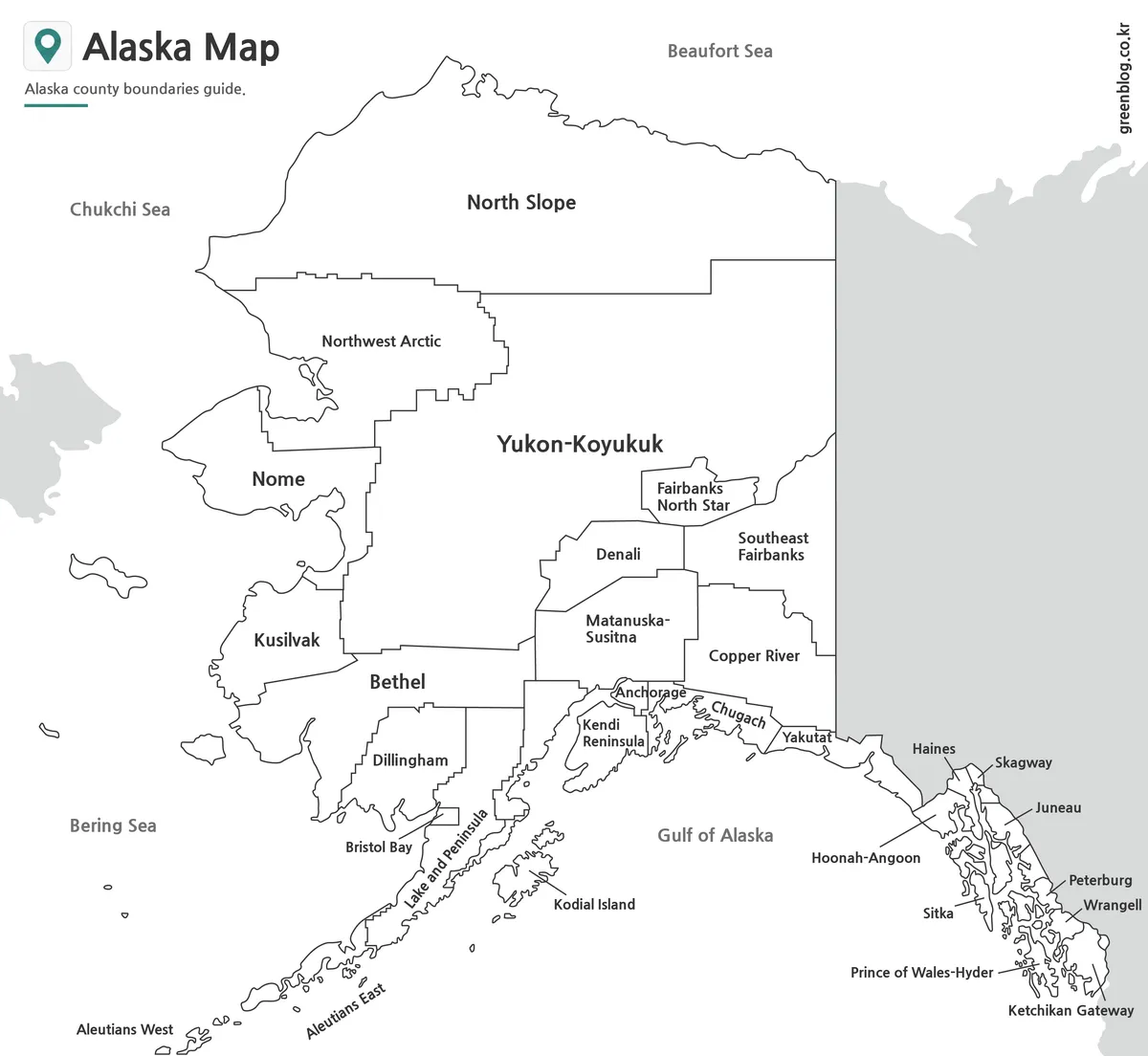
The black and white Alaska map uses boundary lines and labels without strong color elements. It is useful when the map needs to fit naturally into a document, report, worksheet, or printed handout.
This version was reviewed with printing in mind. The line weight was adjusted so boundaries remain visible, and the layout was kept simple enough for black and white output. It is a good choice for classroom packets, study materials, presentation notes, and reference documents where color is not necessary.
A clean labeled map is often easier to read when users need to focus on place names, regional divisions, or general location relationships.
Blank Alaska Outline Map for Editing
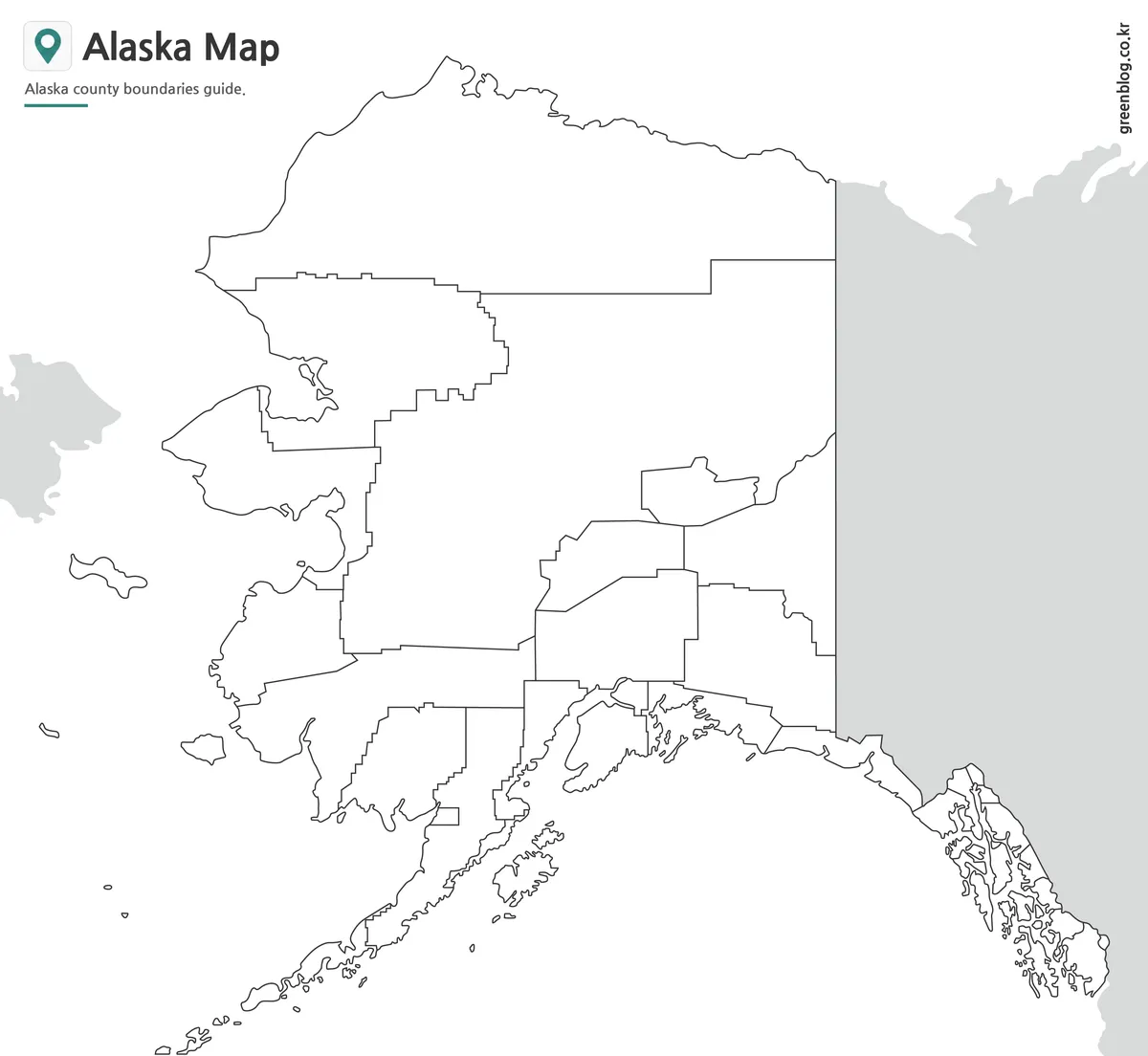
The blank outline version removes most visual distractions and keeps the boundary structure as the main element. It is useful for editing, coloring, annotation, and custom design work.
Teachers can use it for worksheets or map labeling activities. Designers can place icons, data points, routes, or highlighted regions on top of it. Bloggers and presentation creators can also use the outline map as a base layer for infographic-style visuals.
Because Alaska has a wide and irregular shape, the outline version gives users more flexibility than a finished labeled map. It leaves enough visual space for custom notes, markers, and regional highlights.
Practical Uses for the Alaska Map
A printable Alaska map can be used in many types of projects. Teachers may use it for U.S. geography lessons, students may add it to reports, and bloggers may include it in travel or regional information posts.
It is also helpful for presentation creators who need to explain Alaska’s location, borough structure, or distance from the mainland United States. The outline version is especially useful for editable graphic projects, while the labeled version works better as a quick reference map.
Common use cases include:
- editable map design work
- classroom handouts
- geography worksheets
- travel presentation slides
- regional comparison graphics
- blog images
- printable study resources
- infographic projects
Choosing the Right Version
Choose the color Alaska map when you need a quick visual comparison between regions. It is the easiest version to read at a glance and works well in presentation slides.
Choose the black and white map when you need a clean printable reference. It fits better in reports, worksheets, and documents where strong colors may feel distracting.
Choose the outline map when you plan to add your own information. It is the most flexible option for editing, coloring, labeling, or building a custom infographic.
FAQ
Is this Alaska map printable?
Yes. The map files are prepared for high-resolution printing and can be used for classroom materials, reports, and presentation handouts.
Does the Alaska map include borough boundaries?
Yes. The collection includes versions that show Alaska’s regional and borough-style administrative boundaries.
Can I use the outline map for editing?
Yes. The outline version is designed for editing, coloring, annotation, and custom graphic work.
Which version is best for classroom use?
The black and white map is usually best for worksheets, while the color map works better for visual explanation and slides.
Is the Alaska map useful for presentations?
Yes. The color and labeled versions are suitable for presentation slides, regional comparison, and educational visuals.
Alaska Map Download
Download the Alaska map collection and choose the version that fits your project. Color, black and white, and outline maps are included for printing, classroom use, presentations, and editing.
- File Format: JPG / PNG / ZIP
- Image Size: A3 high-resolution
- Color Mode: RGB
- Intended Use: Printing · Education · Presentation · Editing
Additional Resources
- USGS National Map – A useful official map resource for U.S. geographic reference and national map data.
Related Maps
- Printable Tennessee Map Download | County Boundaries and Outline Maps
- Printable Utah Map Collection | Color, Black & White, Outline Maps
- Printable Indiana State Map Collection | County, Labeled & Outline Maps
- Printable Wisconsin Map Collection | County, Labeled & Outline Maps
Green Map creates custom-edited map images using open geographic data sources such as geoBoundaries, Natural Earth, OpenStreetMap, and government open data.
These maps are edited visual materials, not raw data files, and are provided for education, documents, presentations, and graphic reference.