A Belize map is useful when a simple Central America locator does not provide enough detail about the country’s coastline, districts, and neighboring borders. Belize lies south of Mexico and east of Guatemala, with the Caribbean Sea forming its eastern edge. Although the country is relatively small, its long north-to-south shape, offshore islands, river mouths, coastal inlets, and reef areas make the national outline more detailed than it first appears. Belmopan is the capital, while Belize City remains the best-known coastal city and an important reference point for travel and regional geography.
This printable collection includes three versions: a color district map, a black and white labeled map, and a blank outline map. The files are prepared for A3 printing and are provided as image files for classroom handouts, presentation slides, blog graphics, regional comparison materials, infographic work, and custom editing. The three layouts are not simple color variations. Each one serves a different purpose, from quickly comparing the six districts to building a new graphic on a clean boundary base.
The maps use Belize’s six first-level administrative districts rather than the more detailed set of 31 electoral constituencies. During the early stage of preparing the resource, the constituency boundaries made the map appear much busier than a general administrative reference needed to be. Using Belize, Cayo, Corozal, Orange Walk, Stann Creek, and Toledo provides a clearer overview of the country while preserving the detailed coastline and offshore shapes.
Print readability was checked at the A3 layout size, with particular attention given to the difference between the simple inland borders and the more irregular Caribbean coast. The result is a practical map set for students, teachers, travelers, bloggers, and designers who need both a finished reference image and a flexible working map. The English page is based on the original Korean resource and its map specifications.
Table of Contents
Belize Map and Regional Structure
Belize has a straightforward administrative structure, but its geography creates several distinct regional areas. Corozal and Orange Walk occupy the north near the Mexican border. Belize District and Cayo form much of the central part of the country, while Stann Creek and Toledo extend through the south.
Cayo is the largest inland district and shares a long boundary with Guatemala. Belize District includes Belize City and part of the eastern coastal zone. Stann Creek and Toledo are closely associated with the southern coastline, where the country narrows and the land pattern becomes more elongated.
The eastern edge is much more irregular than the western border. Bays, coastal channels, small islands, and offshore landforms create a detailed outline that can disappear on overly simplified maps. Keeping these features visible gives the Belize map a more recognizable and realistic shape.
Color-Coded District Map
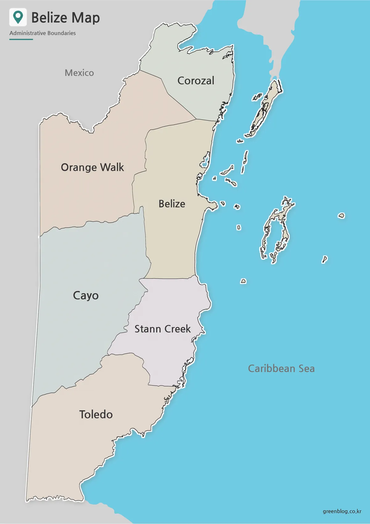
Color separation makes the difference between the wider inland districts and the narrower coastal areas easy to recognize. Cayo and Toledo occupy large sections of the country, while Corozal covers a smaller area in the far north. The central position of Belize District and the long southern shape of Stann Creek also become clear at a glance.
This layout works well for a presentation about Central America because readers can first identify Belize between Mexico and Guatemala and then move directly into the internal district structure. It is also helpful for travel graphics that place Belmopan, Belize City, San Ignacio, Dangriga, or Punta Gorda within their wider regional setting.
Unlike a plain national silhouette, the color map preserves the contrast between the inland border and the detailed Caribbean coast. That makes it more useful for visual reference and regional comparison.
Clean Black and White Version
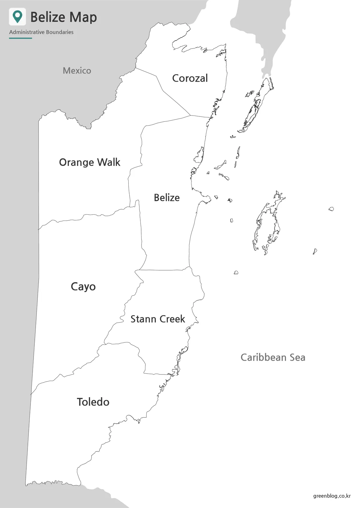
For printed reports and educational worksheets, the black and white map gives more emphasis to district names and boundary lines. With the color fills removed, the page remains clear when placed beside written notes, tables, or assignment questions.
Belize has only six districts, so the labeled layout does not become crowded even in monochrome. Students can add the capital, major cities, neighboring countries, or travel routes directly onto a printed copy. The cleaner design is also suitable for documents where bright colors would compete with other charts or graphics.
At A3 size, the main district boundaries remain distinct from the outer coastline. The offshore details are visible enough to explain the country’s full geographic extent without overwhelming the labeled areas.
Blank Belize Outline Map for Editing
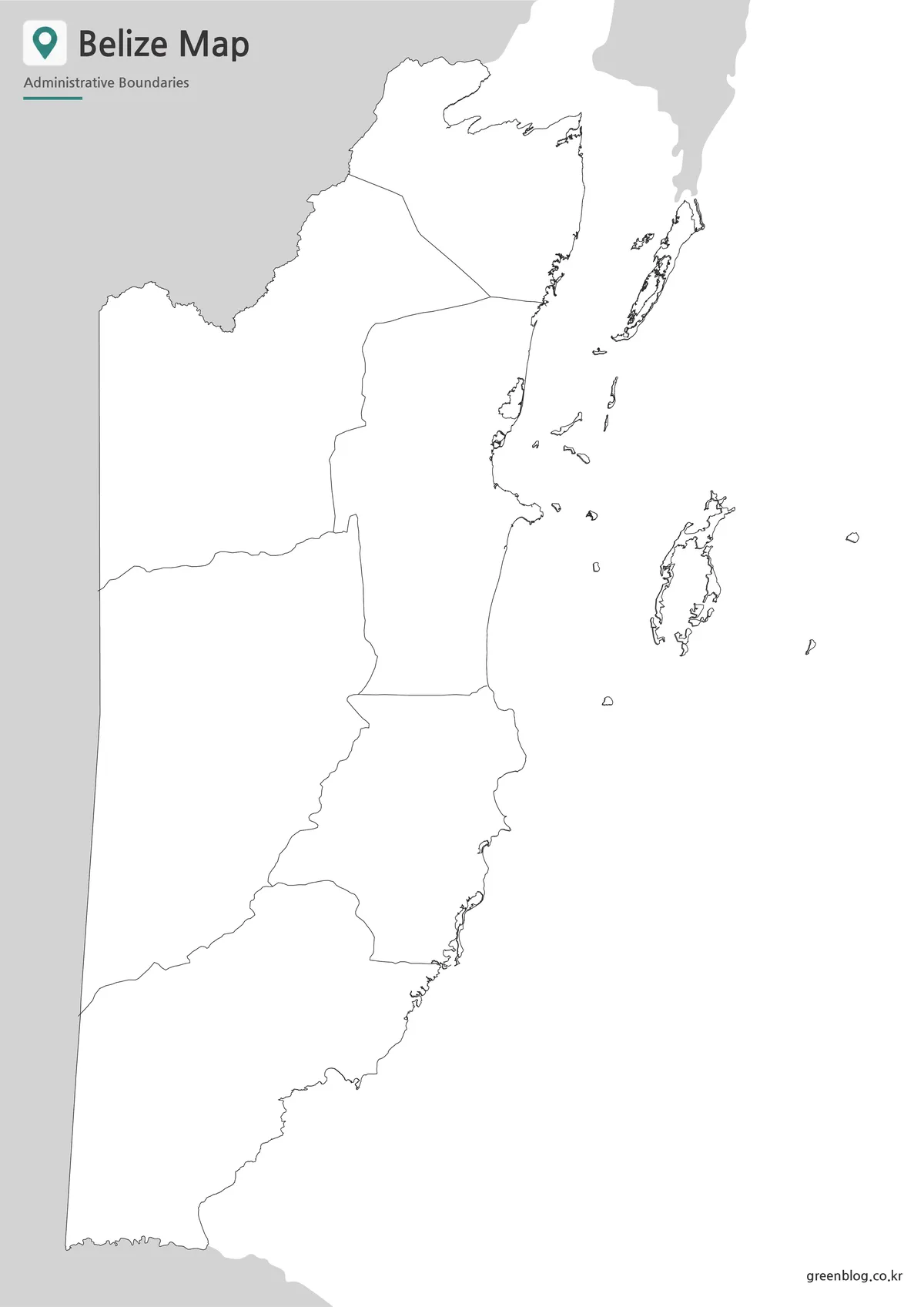
The outline version retains the national border and six district boundaries while removing labels and color. It works as a practical base for projects that require original data, symbols, or annotations.
Teachers can turn the blank Belize map into a district-labeling or coloring activity. Designers may add population data, tourism areas, protected land, transport routes, or city markers. Travel writers can trace a route between Belize City, Belmopan, San Ignacio, Dangriga, and Punta Gorda without having to remove existing labels first.
The detailed outer shape comes from the more precise boundary data, while the internal divisions remain limited to the six districts. This combination avoids the crowded appearance of the 31-constituency version while keeping the coastline closer to its actual form.
Practical Uses for the Map Collection
A Belize map can support several kinds of projects:
- classroom lessons about Central America
- district comparison worksheets
- travel itinerary graphics
- country profile presentations
- population or tourism infographics
- blog posts about Belize geography
- printable regional reference sheets
- editable visual projects
The color version is best when readers need to recognize district differences immediately. The black and white map fits printed documents and handwritten assignments, while the outline map gives the most freedom for new labels and data.
Frequently Asked Questions
How many districts are included in the Belize map?
The Belize map uses the country’s six first-level administrative districts: Belize, Cayo, Corozal, Orange Walk, Stann Creek, and Toledo.
Why does the map not show 31 constituencies?
The 31 boundaries represent electoral constituencies. This collection uses six districts because they provide a clearer general administrative overview.
Does the outline map include offshore islands?
Yes. The national outline includes coastal and offshore features visible in the source boundary data.
Can the files be printed in A3 size?
Yes. The map collection was prepared for A3 layout printing and enlarged digital viewing.
Which version is best for editing?
The outline map is the most flexible choice for adding colors, city markers, travel routes, statistics, and project labels.
Download Information
Choose the version that best fits your project. The collection includes a completed reference map, a clean printable layout, and a blank base for custom work.
Map File Information
This download includes printable Belize map versions for educational use, presentation design, document printing, and editable graphic projects.
- Included Versions: Color map, black and white map, outline map
- Printable Size: A3 layout
- File Type: Image files
- Intended Use: Classroom handouts, presentations, blog graphics, infographic editing, and printable reference materials
Additional Resources
- Belize National Spatial Data Infrastructure — Official geographic and spatial data portal for Belize map information and GIS resources.
Related Maps
- Jamaica Map Download Pack for Printing, Education and Design Projects
- Panama Map Collection – Color, Labeled, and Outline Maps for Printing
- Honduras Map Download – Printable & Editable Map Collection
- Printable Nicaragua Map for Classroom and Presentation Use
Green Map creates custom-edited map images using open geographic data sources such as geoBoundaries, Natural Earth, OpenStreetMap, and government open data.
These maps are edited visual materials, not raw data files, and are provided for education, documents, presentations, and graphic reference.