A Connecticut map is useful when a general map of the northeastern United States does not provide enough local detail. Connecticut is one of the smaller states in New England, yet its location between New York, Massachusetts, Rhode Island, and Long Island Sound makes it important in regional travel, population, and commuting discussions. The state has a compact shape, a densely settled coastline, and inland areas that connect with several different metropolitan regions.
This printable collection includes a color map, a black and white map, and a blank outline map. The files are prepared for A3 printing and are available as JPG, PNG, and ZIP resources. They are designed for classroom handouts, blog graphics, presentation slides, regional comparison materials, infographic projects, and custom editing. Each version serves a different purpose, so users can choose between quick visual comparison, clean printed reference, or a simple working base.
Connecticut borders Massachusetts to the north, Rhode Island to the east, and New York to the west. Long Island Sound forms the southern edge of the state and gives the coastal region a different character from the wooded interior. Hartford sits near the center of the state, while cities such as New Haven, Bridgeport, Stamford, and New London are closely tied to transportation and coastal activity.
While preparing the maps, the main challenge was not fitting a large number of counties into a huge area, but keeping the labels and boundaries readable in a relatively compact state. Connecticut’s traditional county layout is simple enough to understand quickly, yet the smaller shape means text and line spacing still matter when the image is reduced. The final files were checked for enlarged viewing and large-format printing so that boundaries remain clear in both digital and printed materials. The original Korean article and its file details were used as the source for this rewritten English page.
Table of Contents
Connecticut Map and Its New England Setting
Connecticut is located in the northeastern United States within the New England region. Its position places it between the New York metropolitan area and the rest of southern New England, which is why the state often appears in maps about commuting, regional business, education, and travel.
The southern shoreline faces Long Island Sound rather than the open Atlantic Ocean. This coastal edge includes several important cities and ports, while the northern and western parts of the state contain more forested and rural areas. A Connecticut map makes these differences easier to explain than a simple state name or location marker.
Hartford is the state capital and a major center for insurance and finance. New Haven is known for education and cultural institutions, Bridgeport is the largest city by population, and Stamford has strong connections with the New York economy. These cities help explain why Connecticut’s small geographic size does not mean that the state has a simple regional structure.
Traditional County Divisions
Connecticut is traditionally divided into eight counties:
- Fairfield County
- Hartford County
- Litchfield County
- Middlesex County
- New Haven County
- New London County
- Tolland County
- Windham County
On a Connecticut map, these eight traditional counties provide a clear way to compare the state’s coastal, central, and inland regions.
These counties remain widely used on maps, in historical reference, and in everyday regional descriptions. Connecticut no longer operates county governments, but the eight-county layout is still familiar to most map users.
Fairfield County is closely linked with New York City and the southwestern commuter belt. Hartford County covers the capital region, while New Haven County includes one of the state’s major urban and educational centers. Litchfield County occupies a broad northwestern area with more rural landscapes, and New London County includes much of the southeastern coast.
Color Map for Regional Comparison
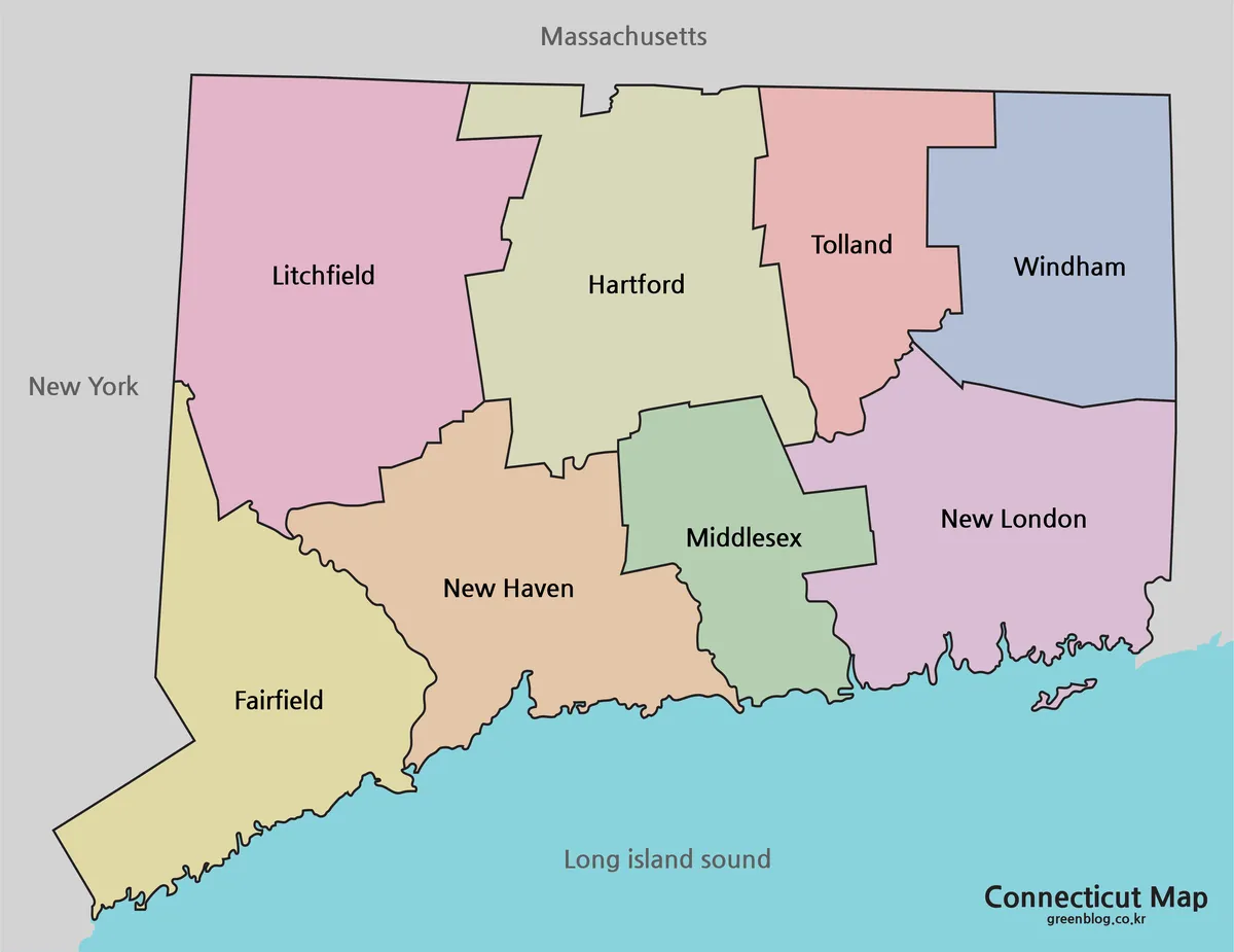
Color coding helps separate Connecticut’s compact county areas without making the map difficult to scan. This is especially useful in the southwestern and central parts of the state, where metropolitan areas and county boundaries are closely connected.
A presentation about New England population patterns, commuting zones, or coastal development benefits from a version where the traditional county divisions can be identified immediately. The color layout also works well in blog posts that compare Connecticut with neighboring Massachusetts, Rhode Island, or New York.
Because the state is small, a clear county-by-county distinction gives more visual value than adding too many roads or minor place names. The result is a cleaner map for quick reference.
This Connecticut map works particularly well when county locations need to be recognized quickly on a presentation slide or blog graphic.
Black and White Map for Printing
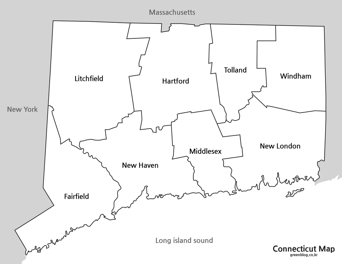
For reports, worksheets, and printed reference sheets, the black and white map places more emphasis on names and boundary lines. Removing the fill colors keeps the page visually lighter and makes it easier to combine the map with text, tables, or notes.
This style is useful for classroom assignments about New England geography, travel planning documents, and business reports that divide Connecticut into regional markets. Users can also write directly on a printed copy without competing with strong background colors.
The files were prepared at a large enough size for A3 printing, with a source image measuring 4551 × 3509 pixels. This gives the county labels and state outline enough room to remain readable when enlarged.
Blank Connecticut Outline Map for Editing
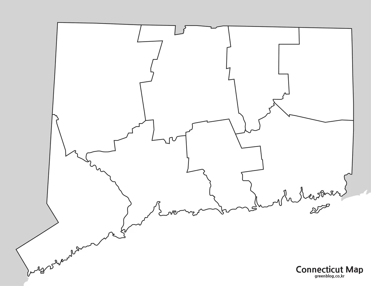
The outline map removes labels and fills, leaving the state border and county boundaries as a practical base. It works well when the goal is to build a custom graphic rather than use a finished reference map.
A blank Connecticut map gives teachers, designers, and researchers more space to add their own labels and regional data.
Possible additions include:
- travel routes between Hartford, New Haven, and the coast
- county population or income data
- school district or service-area notes
- highlighted tourism regions
- classroom coloring activities
- business territory markers
- infographic labels and icons
The simplified format is also helpful for video graphics and presentation backgrounds because users can place text wherever it fits best.
Why Connecticut Maps Are Useful
Connecticut is often included in larger discussions about New England, the New York metropolitan area, and the northeastern transportation corridor. A map helps show how the state connects with neighboring areas instead of treating it as an isolated location.
Teachers may use the map to explain traditional counties, state borders, or the difference between inland and coastal regions. Bloggers and travel writers can mark destinations such as Hartford, Mystic, New Haven, or the Long Island Sound shoreline. Designers can use the outline version for charts, regional statistics, and comparison graphics.
The map collection is also helpful when one project needs several styles. The color version provides quick recognition, the black and white version fits printed documents, and the outline version gives more freedom for custom editing.
Frequently Asked Questions
Can I print the Connecticut map in A3 size?
Yes. The files were prepared for A3 printing and enlarged viewing.
Does the Connecticut map use counties?
Yes. It shows Connecticut’s traditional eight-county layout, which remains widely used in maps and regional reference.
Which version is best for a worksheet?
The black and white version is usually the clearest for printed worksheets and handwritten notes.
Can I add my own colors and labels?
Yes. The outline map works well for custom colors, routes, statistics, icons, and project labels.
Are the files provided in multiple formats?
Yes. The original resource lists JPG, PNG, and ZIP files.
Download Information
Choose the version that matches your project. The collection includes printable reference maps as well as a blank base for editing and annotations.
Map File Information
This download includes printable Connecticut map versions for educational use, presentation design, document printing, and editable graphic projects.
- Included Versions: Color map, black and white map, outline map
- Printable Size: A3 layout
- File Type: JPG, PNG, and ZIP files
- Intended Use: Classroom handouts, presentations, blog graphics, infographic editing, and printable reference materials
Related Maps
- High-Resolution New Hampshire Map for Printing and Presentations
- US East Coast Map Download – Printable Coastal States Map
- Rhode Island Map Download – Printable State and Outline Maps
- Oklahoma Map Download with County Boundaries for Printing
Additional Resources
- Connecticut Towns and Counties : The Connecticut State Library provides additional information about the state’s towns, counties, and geographic boundaries.
Green Map creates custom-edited map images using open geographic data sources such as geoBoundaries, Natural Earth, OpenStreetMap, and government open data.
These maps are edited visual materials, not raw data files, and are provided for education, documents, presentations, and graphic reference.