The Jamaica Map collection turns the island’s long east-to-west outline into a clear parish-level reference. Jamaica lies south of Cuba and west of Hispaniola, but these maps concentrate on the island itself. The closer view compares the administrative pattern from Hanover and Westmoreland in the west to Portland and Saint Thomas in the east.
Three versions are included: a color parish map, a black-and-white labeled map, and a blank outline. The source package identifies a high-resolution A3 JPG in CMYK color mode within a ZIP archive. The files support visual comparison, monochrome reference, and classroom labeling rather than road navigation.
The artwork displays 14 parishes and marks Kingston with a red star near the southeastern coast. Government action concerning Portmore as a proposed 15th parish makes that scope date-sensitive. The maps are a 14-parish reference, not confirmation of later legal or boundary changes.
Table of Contents
An Island Organized from West to East
Jamaica’s elongated form gives the parish layout a strong directional pattern. Hanover and Westmoreland occupy the west, with Saint James and Trelawny across the northwest. Saint Elizabeth covers much of the southwest, Manchester and Clarendon form a central-southern sequence, and Saint Ann occupies the north-central coast.
The eastern half becomes more compact around the capital. Saint Catherine reaches the southern coast west of Kingston, Saint Andrew covers much of the inland side, and Kingston Parish occupies a small coastal area. Saint Mary, Portland, and Saint Thomas complete the northeast and southeast.
The maps focus on parish boundaries. They omit traditional county groupings, other parish capitals, roads, rivers, terrain, airports, and attractions. They suit parish orientation rather than route planning or physical geography.
Reading the Jamaica Map and Its Labels
The labeled versions display Hanover, Westmoreland, Saint James, Trelawny, Saint Ann, Saint Mary, Portland, Saint Thomas, Saint Andrew, Kingston, Saint Catherine, Clarendon, Manchester, and Saint Elizabeth. Kingston is both a parish label and the capital marker, so readers should distinguish the small parish from the wider urban area associated with Kingston and Saint Andrew.
A Jamaica Map at this scale is especially helpful around Kingston, where several boundaries meet along the southeast coast. The star provides an orientation point, while Saint Andrew and Saint Catherine show the capital’s neighbors. Larger western shapes accommodate their labels directly.
White space above and below keeps the coastline prominent without forcing names into narrow margins. The color and monochrome versions use the same label positions, allowing them to be exchanged in a worksheet without changing the visual reference.
Three Jamaica Map Versions in the Collection
All images share the same boundaries and extent. The Jamaica Map collection changes only the visual guidance: color separates areas, monochrome retains labels, and the outline removes names and the capital symbol.
Color Parish Map
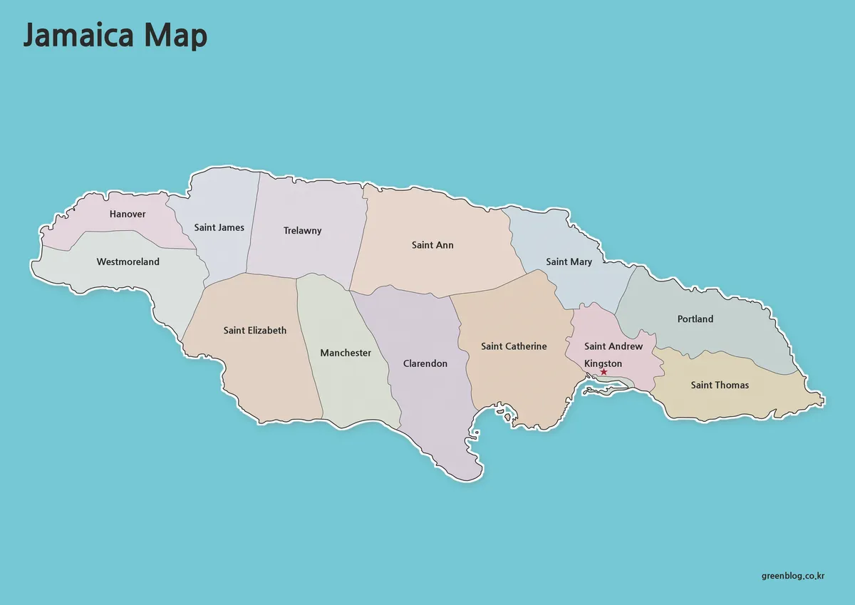
The color Jamaica Map assigns soft contrasting fills to the 14 parishes. This makes the north-coast sequence easy to follow and separates Kingston–Saint Andrew from Saint Catherine and Saint Thomas. Blue water and a white coastal edge reinforce the island outline.
Kingston’s red star provides a focal point without competing with parish colors. This edition suits classroom projection, introductory slides, and parish comparisons. The muted palette keeps black labels readable.
Black-and-White Labeled Map
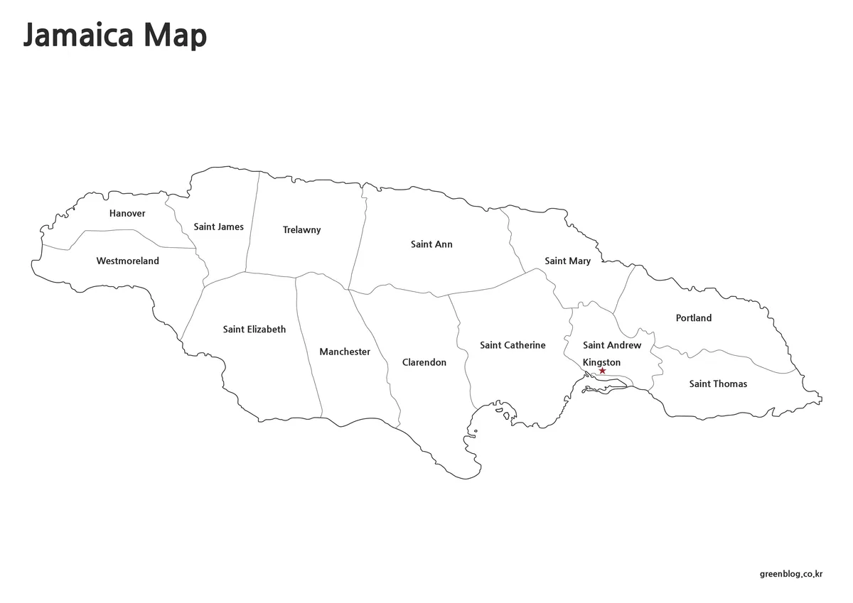
The monochrome map relies on boundary lines, text, and the capital marker. It fits reports, lesson notes, and assessment sheets reproduced without color. Matching label positions let it serve as a key for the blank outline.
Students can add arrows, group parishes, or underline coastal areas while keeping the original labels visible. The image remains a parish reference and is not a source for roads or exact local boundaries.
Blank Parish Outline
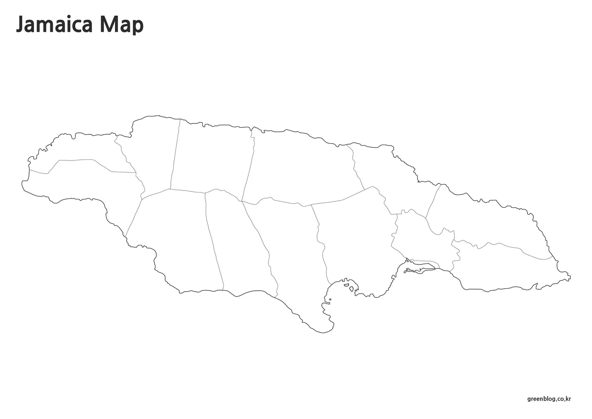
The outline removes names, colors, and the Kingston star while preserving internal divisions. Students can recall all 14 names, color western and eastern groups, place the capital, or identify parishes on each coast.
The raster outline can support icons, statistics, or category colors. It is not identified as an SVG or vector source, so use annotations or overlays. Avoid dense data around Kingston and Saint Andrew, where space is limited.
Choosing a Version for the Intended Audience
The most suitable Jamaica Map depends on what the reader is expected to do. Select color for immediate parish recognition on a screen, black and white when labels must remain visible in a restrained printed document, and the outline when the project requires users to supply names or data themselves. None of the three replaces a street, terrain, or current legal boundary map.
The versions support a progressive lesson: begin with the outline, check answers with labels, and finish with color for comparison. A presentation can start with color and then use the outline to highlight selected parishes.
Printing and Practical Project Ideas
The A3 landscape format gives Jamaica’s long shape room across the page. Preserve the proportions when resizing. If reducing to A4, preview the small Kingston and Saint Andrew labels because readability depends on final placement and printer quality.
A Jamaica Map can introduce parish geography, provide a locator for a regional report, or serve as a base for a simple islandwide dataset. Teachers might compare western and eastern parishes, bloggers can identify the parish connected to a destination, and presentation creators can place numbered markers over the outline. These tasks remain most effective when the amount of added information matches the map’s parish-level scale.
Boundary Date and the Portmore Question
The images show Saint Catherine undivided and do not label Portmore. In March 2025, Jamaica’s Office of the Prime Minister reported that an injunction blocking the Counties and Parishes (Amendment) Act, 2025 had been lifted and described further work toward Portmore as the 15th parish. The artwork therefore reflects a 14-parish arrangement.
For general education, historical comparison, and design projects based on that arrangement, the collection can still be used with an appropriate note. Anyone preparing current government, electoral, statistical, cadastral, or legal material should verify whether Portmore boundaries and related administrative changes have been formally implemented in the source required for that project.
Frequently Asked Questions
How many parishes are displayed on the Jamaica Map?
The supplied maps display 14 parishes. They show Kingston separately from Saint Andrew and retain Saint Catherine without a separate Portmore parish. Because the Portmore process makes the subject date-sensitive, describe this collection as a 14-parish map and consult current government information for legal or administrative work.
Which version is best for learning parish names?
Use the blank outline as a recall worksheet and the black-and-white labeled edition as an answer reference. The shared boundary arrangement makes comparison straightforward. The color map can then help students see how adjoining parishes form western, central, northern, and eastern patterns across the island.
Is Kingston marked on every version?
Kingston is labeled and marked with a red star on the color and black-and-white maps. The blank outline removes both the label and symbol, allowing students or designers to place the capital themselves. No other parish capital or major city is marked in the collection.
Can the maps be reduced from A3 to A4?
They can be scaled down, but final readability should be checked before printing. The island outline remains recognizable, while the smallest labels around Kingston and Saint Andrew may become less comfortable to read depending on the document margins, printer, and amount of reduction applied.
Is the outline map a vector file?
No vector format is confirmed in the supplied package. Treat the outline as a raster image that can accept labels, colors, markers, and overlays in image-editing or presentation software. It should not be advertised as an SVG, infinitely scalable source, or precise boundary dataset.
Map File Information
Download three Jamaica parish map versions for printing, classroom activities, presentations, geographic reference, and image-based editing.
- Included Versions: Color parish map, black-and-white labeled map, and blank parish outline
- Printable Size: High-resolution A3 landscape layout
- File Type: JPG image in a ZIP archive
- Color Mode: CMYK
- Intended Use: Education, printing, presentations, annotations, blog graphics, and parish comparison
Related Maps
- Dominican Republic Map Collection
- Dominica Map
- Panama Map Collection
- Honduras Map Collection
- Guatemala Map Collection
Additional Resources
- Government Update on the Portmore Parish Law: This official government statement explains the 2025 legal development involving Portmore and the continuing work toward establishing it as Jamaica’s 15th parish.
Green Map creates custom-edited map images using open geographic data sources such as geoBoundaries, Natural Earth, OpenStreetMap, and government open data. These maps are edited visual materials, not raw data files, and are provided for education, documents, presentations, and graphic reference.