The Dominica map collection is designed for readers who need a clear view of this small Caribbean island and its internal administrative divisions. Dominica is often confused with the Dominican Republic because the country names sound similar, but they are separate nations in different parts of the Caribbean. This resource focuses on the Commonwealth of Dominica, the mountainous island located in the eastern Caribbean between Guadeloupe and Martinique.
Small island countries are difficult to study on a standard world map because their coastlines and internal boundaries appear at a very small scale. An enlarged map makes the island shape easier to recognize and gives more room for parish names, boundary lines, and visual comparisons. The files are intended for classroom handouts, country reports, presentation slides, blog graphics, and regional comparison projects.
The collection includes a color map, a black and white map, an outline map, and a national flag image. The confirmed files are provided in JPG, PNG, and ZIP formats and were prepared for an A3 layout. Roads, airports, ports, tourist attractions, and transportation routes are not included, so the page remains focused on the island outline and administrative structure.
Table of Contents
Why a Dominica Map Is Useful
Dominica belongs to the Lesser Antilles and consists mainly of one compact island with a long, irregular coastline. Its mountainous interior and narrow coastal areas give the country a more complex outline than its size might suggest. A simple dot on a world map cannot show how the island is divided or how the parishes extend from the coast toward the interior.
The map therefore works best as an administrative and visual reference rather than as a road or travel-navigation map. Teachers can use it to introduce Caribbean geography, while students can compare Dominica with nearby island states. Designers and bloggers can also use the map as a clean base for country profiles, regional infographics, and presentation graphics.
What the Map Files Include
The map set contains the national outer boundary, internal administrative boundaries, major administrative names, color-coded regions, a simplified black and white version, and a blank outline version. A flag image is also included for country introduction pages and educational materials.
The Dominica map does not include airport symbols, port locations, road networks, attraction markers, or travel routes. Keeping these details out of the layout makes the administrative divisions easier to read at print size.
Color-Coded Administrative Map
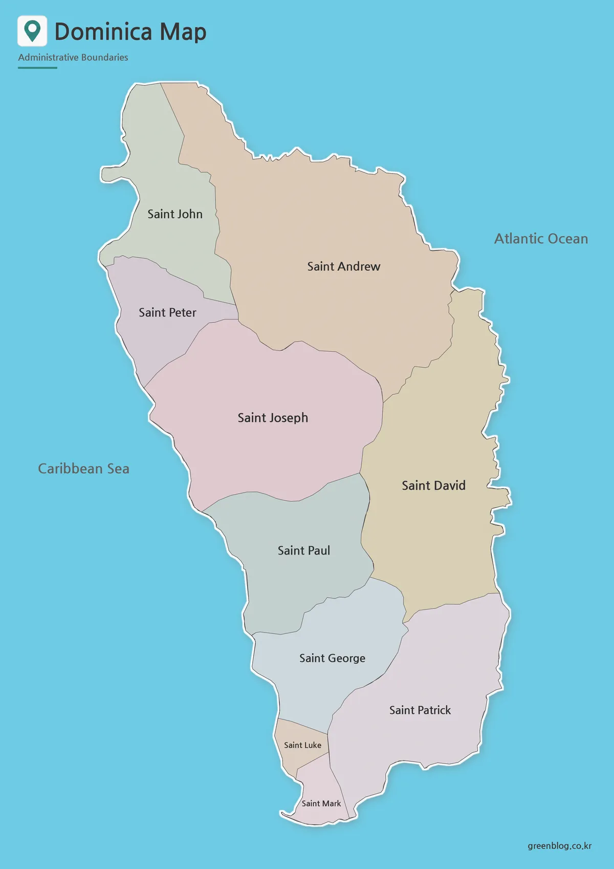
Color helps separate the island’s neighboring administrative areas, which are closely connected within a relatively small space. On a compact island, boundaries can blend together when every area uses the same fill, especially when the map is viewed on a presentation slide or reduced inside a document.
For a Dominica map used in slides or country comparison materials, separate regional colors make the internal layout easier to explain. The color version is a practical choice for classroom presentations, country fact sheets, blog graphics, and Caribbean island comparison projects.
Black and White Map for Printing
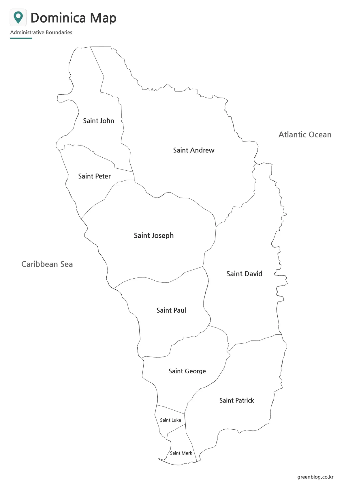
The black and white version removes the color fills and gives greater emphasis to labels and boundary lines. This cleaner style is useful for reports, worksheets, and handouts that will be printed on standard office printers.
Because Dominica has a compact shape and closely spaced regional labels, a simplified layout can make the names easier to scan. The map also leaves enough visual space for notes, arrows, or short explanations without competing with strong background colors.
Dominica Map Outline for Custom Projects
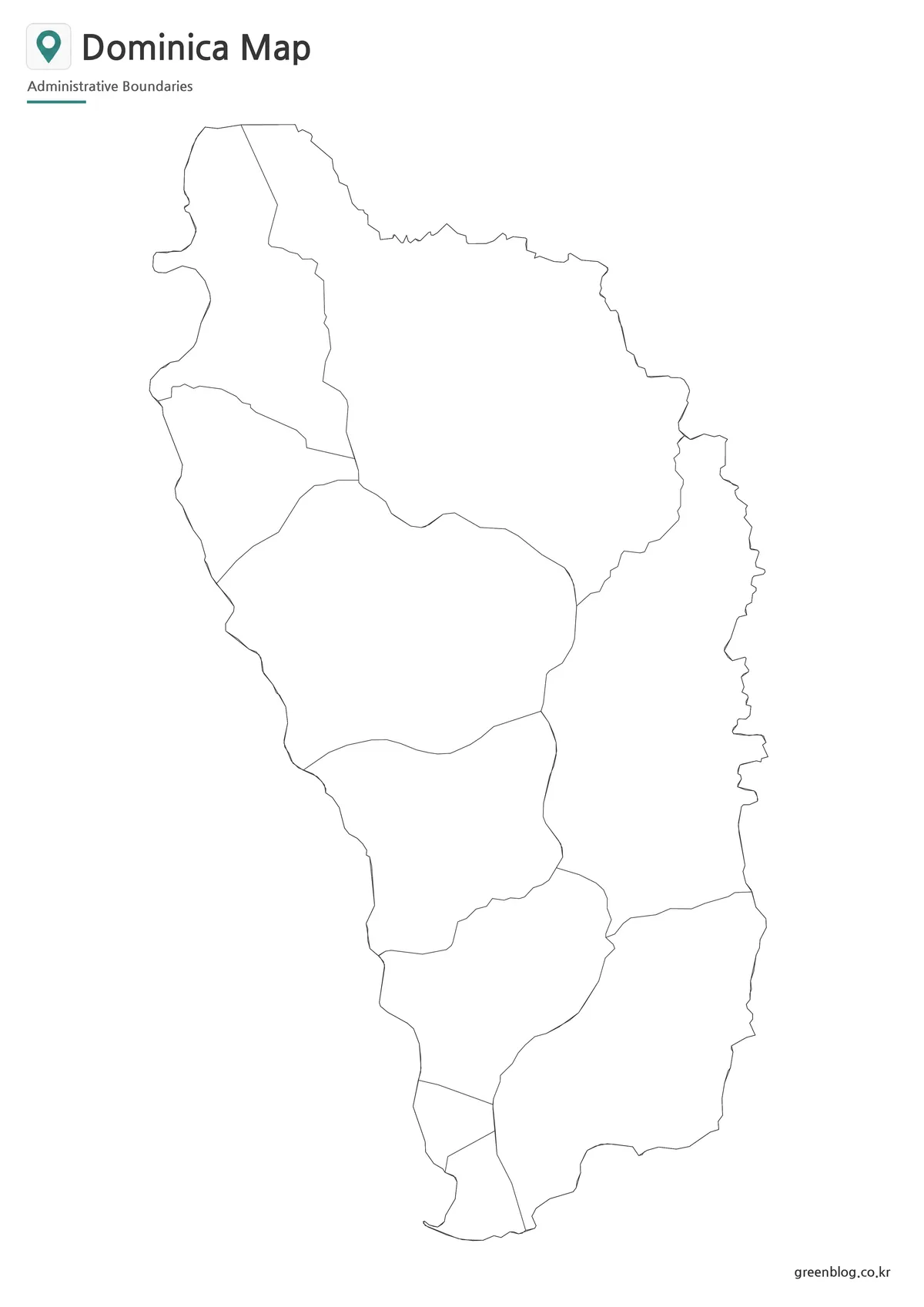
The outline version keeps the island shape and internal boundaries while removing the color and most decorative elements. It can serve as a working base for adding population figures, project labels, travel routes, classroom coloring, presentation highlights, or custom regional groupings.
A Dominica map outline is especially useful when the goal is to build an infographic rather than display a finished reference map. The simplified boundary structure allows users to add their own information without first removing existing colors or background details.
The Dominica Flag Included with the Maps
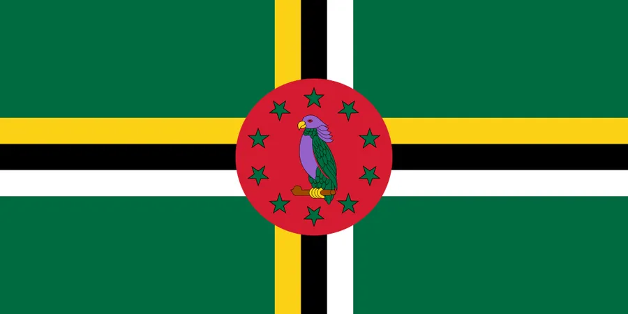
Dominica’s flag is easy to distinguish from other Caribbean flags because of its green background and the Sisserou parrot in the center. The parrot is a national symbol closely associated with the island, while the surrounding stars and cross pattern create a highly recognizable design.
The flag image can be placed beside the maps in classroom materials, country profile pages, or presentation slides. Including both the map and flag helps readers connect the country’s geographic shape with its national identity.
Dominica and the Dominican Republic Are Different Countries
The Dominican Republic occupies the eastern part of Hispaniola and shares a land border with Haiti. Dominica, by contrast, is a separate island country in the eastern Caribbean. The two countries differ in location, land area, neighboring territories, and administrative structure.
For English searches, the island country is normally identified as “Dominica” or “Commonwealth of Dominica.” The larger country on Hispaniola is called the “Dominican Republic.” Checking the full country name prevents the wrong map from being downloaded or used in a project.
Practical Uses for the Dominica Map
This map collection is suitable for Caribbean geography lessons, school assignments, island-country comparisons, country presentation slides, blog articles, and printable study sheets. The color version is strongest for visual explanation, the black and white map is better for straightforward printing, and the outline map is the best choice when additional information needs to be added.
The Dominica map can also support travel presentations or regional introductions, but it should be paired with a separate transportation or tourism map when roads, airports, ports, or attractions are required.
Frequently Asked Questions
Is this a map of the Dominican Republic?
No. It is a map of Dominica, the island country in the eastern Caribbean. The Dominican Republic is a different country located on Hispaniola.
What information appears on the map?
The files show the national outline, internal administrative boundaries, and major regional names. Roads, airports, ports, and tourist attractions are not shown.
Can the maps be printed in A3 size?
Yes. The files were prepared around an A3 layout and are suitable for classroom materials, reports, and presentation use.
Which Dominica map version should I choose?
Use the color map for quick visual comparison, the black and white version for printing, and the outline map for adding labels, statistics, routes, or classroom activities.
Map File Information
This download includes printable Dominica map versions for educational use, presentation design, document printing, and custom graphic projects.
- Included Versions: Color map, black and white map, outline map, national flag
- Printable Size: A3 layout
- File Type: JPG, PNG, and ZIP
- Map Content: National outline, administrative boundaries, and major regional names
- Intended Use: Classroom handouts, presentations, blog graphics, country comparisons, and printable reference materials
Additional Resources
- Government of Dominica Country Profile : A government overview covering Dominica’s official name, geographic location, national profile, and general country information.
Related Maps
- Printable El Salvador Map Collection with 14 Departments
- Printable Belize Map Collection|Six Districts and Caribbean Coastline
- Central America Map Download – Printable Country Map Collection
- US East Coast Map Download – Printable Coastal States Map
- Printable Nicaragua Map for Classroom and Presentation Use
Green Map creates custom-edited map images using open geographic data sources such as geoBoundaries, Natural Earth, OpenStreetMap, and government open data.
These maps are edited visual materials, not raw data files, and are provided for education, documents, presentations, and graphic reference.