A Saint Lucia Map becomes more informative when it shows how ten administrative districts share one narrow Caribbean island. The supplied collection presents that framework in three portrait-oriented versions: a pastel color map, a labeled black-and-white map, and an unlabeled outline. Each view uses the same coastline and internal divisions, allowing readers to move from orientation to print study and then to an independent labeling activity.
The labeled editions place the Caribbean Sea west of the island and the Atlantic Ocean east of it. Gros Islet occupies the north, Castries stretches through much of the central-western area, and Dennery and Micoud form the two large eastern districts. Smaller western and southern districts create a tighter sequence from Anse la Raye and Canaries through Soufrière, Choiseul, Laborie, and Vieux Fort.
Use this Saint Lucia Map as an administrative reference rather than a road or tourism guide. The artwork does not plot towns, the capital, airports, highways, mountain relief, the Pitons, beaches, ports, or visitor attractions. It also omits scale, coordinates, a north arrow, and neighboring islands. Every supplied preview measures 1,200 × 1,697 pixels, with a tall canvas that suits portrait handouts and vertical presentation layouts.
Table of Contents
Saint Lucia Map Collection Overview
Saint Lucia’s official statistical materials describe ten administrative districts. The names represented here are Gros Islet, Castries, Anse la Raye, Canaries, Soufrière, Choiseul, Laborie, Vieux Fort, Micoud, and Dennery. The color and monochrome editions label all ten, while the outline retains their boundaries without names. This makes the three files complementary rather than merely cosmetic variations.
The Saint Lucia Map shows a clear contrast between the island’s two sides. Six districts meet the west or southwest coast in a comparatively compact chain, while Dennery and Micoud cover broad areas on the east. Gros Islet spans the northern end, and Vieux Fort reaches the southern tip. Castries extends inland between Gros Islet, Anse la Raye, Dennery, and a narrow junction near the center.
District labels identify administrative areas, not the precise locations of settlements with the same names. For example, the word “Castries” is centered within the district rather than marked with a city symbol. The same caution applies to Vieux Fort, Soufrière, and the other names. Add a separate point layer if a lesson or graphic must distinguish a town from the district surrounding it.
Color-Coded Administrative Map
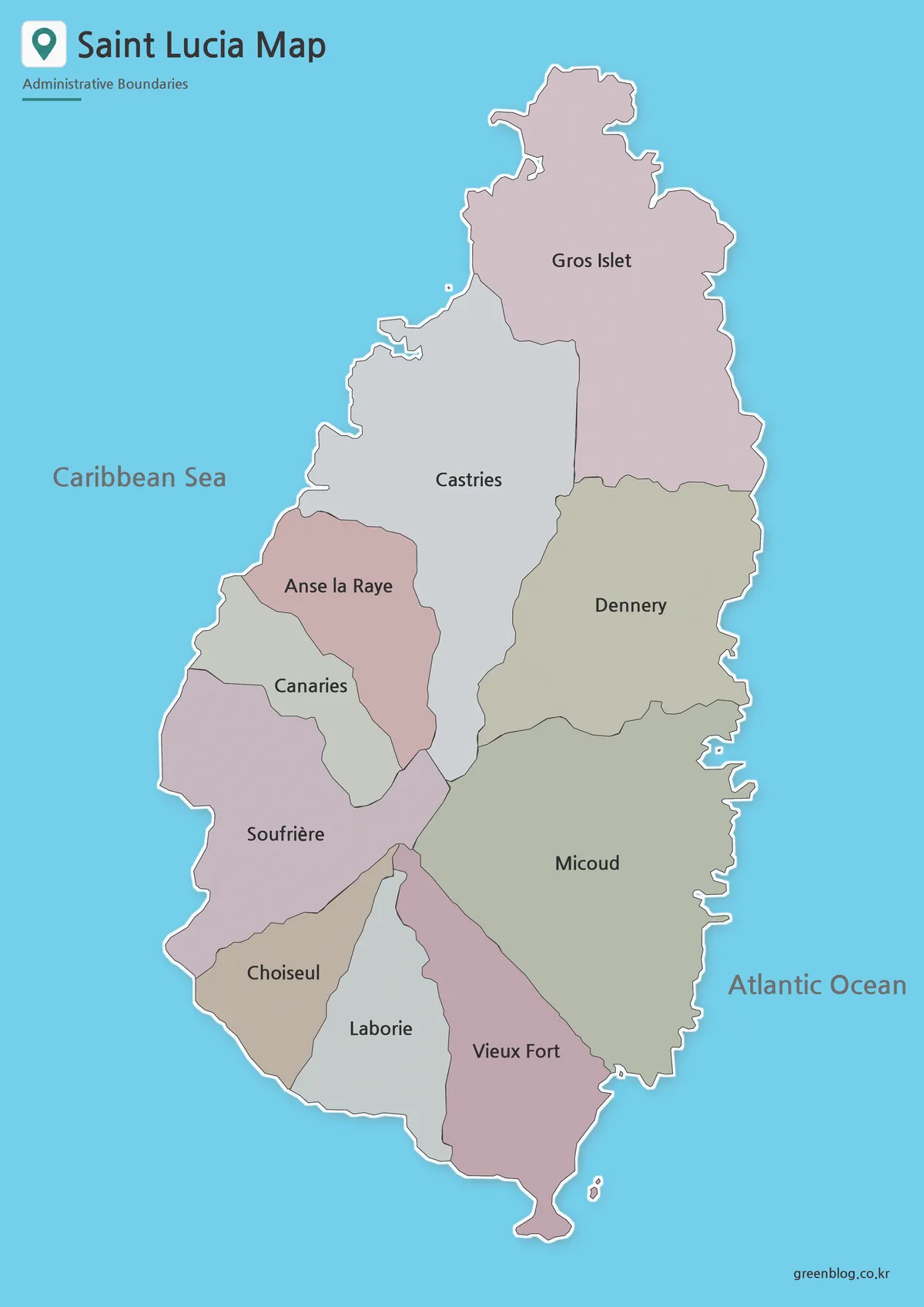
The color Saint Lucia Map is the quickest option for comparing adjoining districts. Alternating muted fills separate the narrow western units, where Anse la Raye, Canaries, Soufrière, and Choiseul can otherwise blend into one coastal strip at reduced size. The larger shapes of Gros Islet, Castries, Dennery, and Micoud remain easy to follow from the coast toward the island’s interior.
These colors are categorical, not a data scale. They do not communicate population, elevation, land cover, rainfall, or economic values. If you add statistics, create a new legend and apply a deliberate sequence of colors based on the cited data. Keeping decorative fills separate from thematic encoding prevents readers from drawing conclusions that the original artwork does not support.
Black and White Map for Printing
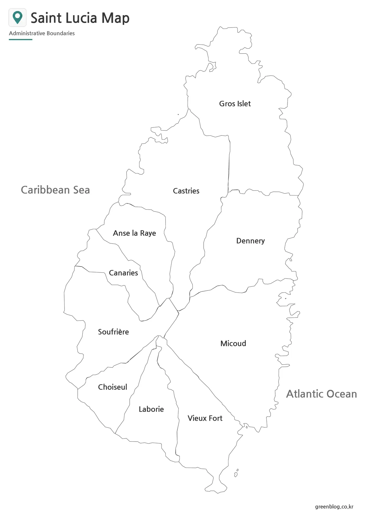
The black-and-white Saint Lucia Map keeps every district name and both sea labels while removing interior color. White space within the boundaries is useful for numbers, symbols, short annotations, or a teacher’s answer key. It also avoids relying on color differences when documents are photocopied or viewed on a monochrome printer.
Print one test copy before producing a class set. The labels for Canaries, Laborie, and the smaller western districts need enough physical space to remain comfortable to read. Preserve the original aspect ratio when reducing the page, and use portrait orientation so the island is not compressed. For a grayscale data exercise, distinguish categories with patterns or clearly separated tones instead of several similar grays.
Outline Map for Editing and Custom Projects
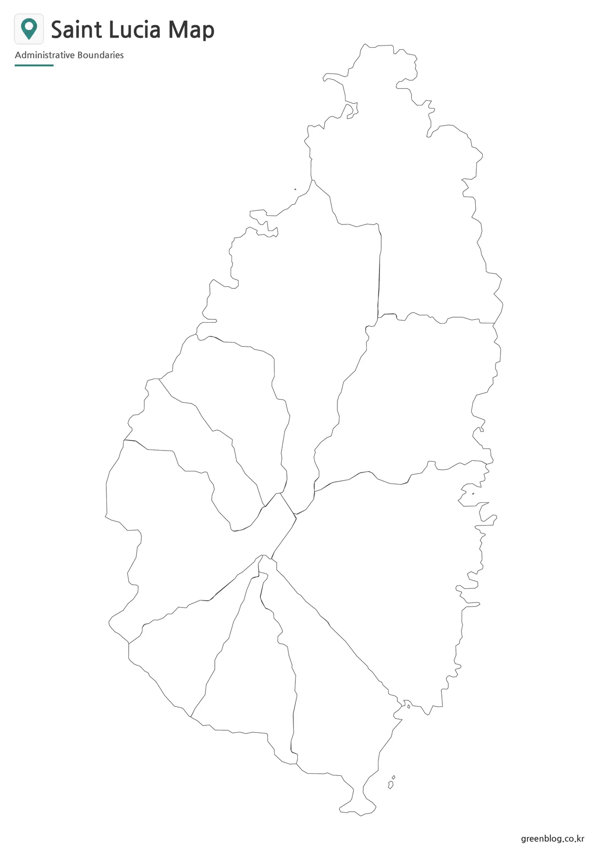
The outline Saint Lucia Map removes district and sea names while preserving the coastline and all internal divisions. Students can label the ten districts from memory, color western and eastern groups, or use the labeled edition as an answer key. The open areas also provide a neutral base for sourced statistics, project-specific symbols, or a simple route diagram.
Keep one untouched copy before editing. On a duplicate, add a title that states the subject, a legend that explains every color or symbol, and a source note for any imported data. Where the narrow west coast leaves too little room, place text outside the island and use a short leader line. This protects both the district shape and the readability of the annotation.
The blank map should not be treated as a surveyed boundary dataset. It has no scale bar, projection statement, coordinates, or accuracy note. Projects that require legal boundaries, distance measurement, precise routes, or geographic analysis should use authoritative spatial data. The outline is intended for clear communication and learning activities.
Administrative Layout Shown on the Maps
- North: Gros Islet forms the island’s northern end.
- Central west: Castries occupies a large area above Anse la Raye.
- West-coast chain: Anse la Raye, Canaries, Soufrière, and Choiseul descend toward the southwest.
- South: Laborie and Vieux Fort divide the lower end, with Vieux Fort reaching the tip.
- East: Dennery lies above Micoud along the Atlantic side.
This grouping is a reading aid, not a separate official regional system. Its purpose is to help users remember relative positions and adjacency. A useful exercise is to start at Gros Islet, trace clockwise down the Atlantic side through Dennery and Micoud to Vieux Fort, and then return northward through the smaller western districts to Castries.
The sea labels add another reliable cue: west faces the Caribbean Sea and east faces the Atlantic Ocean. However, the map does not show a compass, so the top of the conventional page should be understood as north only in the context of this prepared orientation. Do not infer currents, depth, coastline access, or marine boundaries from the blue background.
Practical Ways to Use the Files
Choose the map style after defining what the audience must do. The color edition supports fast district recognition, the monochrome edition supports careful reading and annotation, and the outline supports recall or original data design. A three-step lesson can introduce the island with color, review names in monochrome, and finish with an unlabeled assessment.
- Identify every district and describe which districts share a boundary.
- Compare the compact western chain with the broader eastern districts.
- Mark the Caribbean and Atlantic sides without adding unsupported marine detail.
- Create a district-level infographic using a cited table and a new legend.
- Use the outline for a labeling quiz and the monochrome sheet as its key.
- Place the island beside a regional map to explain its Caribbean position.
When the Saint Lucia Map is placed in a slide, keep the island tall and leave room beside it for notes rather than shrinking it beneath a long paragraph. In print, maintain white margins and avoid placing binding holes over the west coast. In either medium, identify whether district names refer to areas or settlement points, especially when the same name could be read both ways.
For tourism or transport topics, use this collection only as a base. The supplied images cannot locate Hewanorra International Airport, Castries city center, the Pitons, specific beaches, or road connections. Adding verified points above the outline can support a custom graphic, but the administrative map alone should never be presented as a navigational guide.
Frequently Asked Questions
Can the Saint Lucia Map be printed at A3 size?
Yes. The files were prepared around an A3 layout so the island shape, district boundaries, and labels remain easier to read in large-format printing.
Which version is best for a classroom worksheet?
The black and white version is suitable for reference sheets. The outline version works better for labeling, coloring, and student activities.
Does the collection include roads or tourist attractions?
No. The maps focus on administrative districts, district names, and the island coastline. This keeps the layout clean and flexible.
Which version should I use for a presentation?
Choose the color map for fast visual comparison. Use the black and white version when the map needs to match a simple or formal slide design.
Can I add my own labels to the outline map?
Yes. The outline version can serve as a base for custom text, city markers, travel routes, statistics, and infographic annotations.
Map File Information
The package contains color, monochrome, and blank district views for printing, reference, and customization.
- Included Versions: Color labeled, black-and-white labeled, and blank outline
Related Maps
Additional Resources
- Saint Lucia Central Statistical Office Maps: official national, district, settlement, and constituency map references.
Green Map creates custom-edited map images using open geographic data sources such as geoBoundaries, Natural Earth, OpenStreetMap, and government open data.
These maps are edited visual materials, not raw data files, and are provided for education, documents, presentations, and graphic reference.