A Nicaragua Map becomes easier to understand when the narrow Pacific-side departments, the two large interior lakes, and the expansive Caribbean autonomous regions appear together. Honduras frames the north, Costa Rica the south, the Pacific Ocean the west, and the Caribbean Sea the east. The landscape layout preserves all of those relationships while marking Managua with a star.
The Nicaragua Map set contains three 1,200 × 849-pixel WebP administrative views and one separate 900 × 539-pixel flag image. The color and monochrome maps label 15 departments and two autonomous regions; the outline keeps the same 17-unit geometry without names. These resources support regional reference, classroom labeling, presentation graphics, print handouts, and custom annotation.
The two labeled maps also show the shapes of Lake Managua, also known as Lake Xolotlán, and the much larger Lake Nicaragua, or Lake Cocibolca, although neither lake is named on the artwork. Roads, elevations, population values, municipal subdivisions, and tourist facilities are outside the scope of these maps. A separate current source is necessary for travel planning or any task below the first administrative level.
Table of Contents
Printable Nicaragua Map Overview
The country’s administrative pattern is uneven. Most departments cluster through the west and center, where several compact units surround the lakes and the capital. By contrast, the North Caribbean Coast Autonomous Region and South Caribbean Coast Autonomous Region occupy most of the broad eastern side. That size difference is one reason a national map communicates more than a list of names.
Along the northwestern border, Nueva Segovia, Madriz, and Estelí form a compact group below Honduras. Jinotega extends eastward from them, while Matagalpa lies farther south. Chinandega reaches the northwestern Pacific coast, and León continues down the coast toward the lake-and-capital area.
Managua, Masaya, Granada, and Carazo are small enough that several names need leader lines. The star marks the national capital within the Managua department rather than creating a separate capital district. Rivas wraps around the southwestern side of Lake Nicaragua, while Río San Juan follows the southern border toward the Caribbean.
Boaco and Chontales form the central transition between the western department cluster and the South Caribbean Coast Autonomous Region. The northern autonomous region stretches from the interior to the long northeastern shore. This Nicaragua Map makes the east–west contrast, the two-coast setting, and the relationship between the lakes and departmental boundaries visible in one frame.
The artwork uses simplified English-friendly spellings for some labels: Esteli, Leon, and Rio San Juan appear without the diacritics in Estelí, León, and Río San Juan. It also shortens the autonomous-region labels to “North Caribbean Coast Autonomous” and “South Caribbean Coast Autonomous.” When preparing an answer key, use the visible forms or explain the complete official names so students do not treat the difference as a separate place.
Color Nicaragua Map with Regional Boundaries
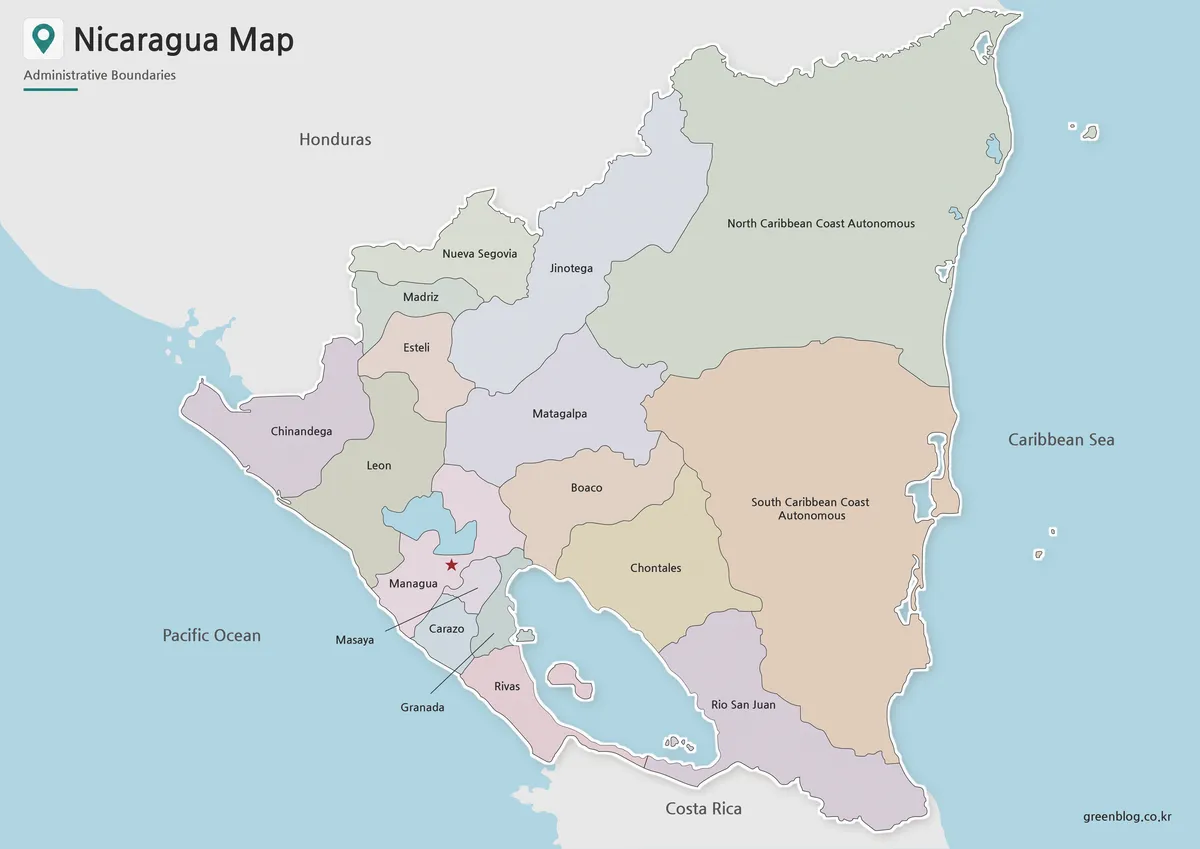
The color Nicaragua Map uses muted fills to separate neighboring units without overpowering the boundary lines. The two Caribbean regions are visually dominant because of their area, while the smaller departments near Managua require closer reading. Blue water distinguishes both coasts and the two major interior lakes, and a red star isolates the capital location.
This version suits a first reference, a lesson answer key, or a country-introduction slide. It quickly shows that Nicaragua is not divided into 17 similarly sized areas: the eastern autonomous regions are far larger than Masaya, Granada, Carazo, or Managua. The colors are categorical only and do not encode population, climate, elevation, or economic values.
The surrounding-country labels also help orient the national shape within Central America. Honduras remains visible above the irregular northern border, and Costa Rica sits below the southern edge. The ocean labels clarify the dual-coast setting, but no ports, border crossings, roads, or shipping routes are marked.
Black and White Nicaragua Map for Printing
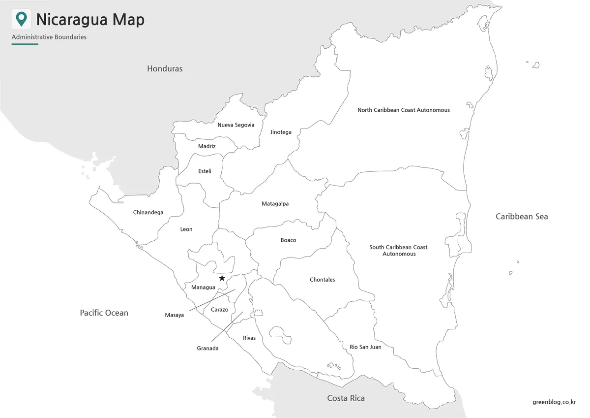
The black-and-white Nicaragua Map retains every first-level label, boundary, lake shape, neighboring country, coast name, and the Managua star while removing regional color fills. This produces a restrained reference for worksheets, study guides, and document layouts. Readers can add their own highlights without competing with the original palette.
This version works when answers remain on the page. Students can trace the Pacific department chain, compare the two autonomous regions, or identify which units meet Lake Nicaragua. For a recall test, the blank version is more appropriate because the monochrome map already supplies all regional names.
A test page helps reveal print-size problems before multiple copies are produced. Automatic reduction can compress the leader lines around Managua, Masaya, Granada, and Carazo, and the capital star can merge with nearby boundaries. The 1,200 × 849 landscape ratio preserves the intended composition, while cropping surrounding labels can remove national-location context.
Blank Nicaragua Outline Map for Editing
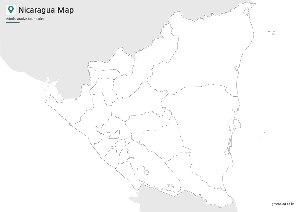
The blank Nicaragua Map removes all place names, sea labels, lake labels, and the capital star while preserving the national outline, internal divisions, and visible water shapes. Gray land beyond the border still provides context. This makes the file an activity base rather than a finished reference sheet.
Teachers can ask learners to restore the 15 department names, add the two autonomous regions, mark Managua, and identify both oceans. A second exercise can label Lake Xolotlán and Lake Cocibolca or compare the narrow western departments with the broad Caribbean side. Designers can apply new category colors, with a clear legend and data year identifying the added information.
The outline version is a raster WebP preview rather than a vector or layered source file. It accepts annotations in common image-editing and presentation software, but very large enlargement can soften small boundaries around the capital area. Test the final display size before adding dense labels, routes, or numerical symbols.
Nicaragua Flag Image
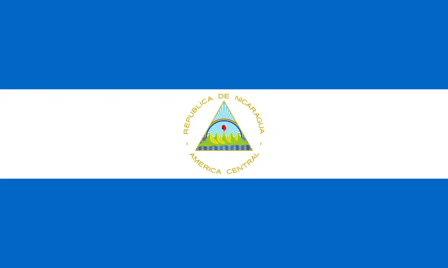
The fourth body image is the national flag, not another map style. It shows blue bands above and below a white central band, with the national coat of arms in the middle. The 900 × 539-pixel image is a separate horizontal resource for national identification.
The flag can sit beside a map on a country-profile cover, classroom card, or regional presentation. Separation from the map legend prevents its blue and white bands from being mistaken for data categories. The flag supplies a national symbol, while the maps explain boundaries, coasts, lakes, and administrative structure.
Best Uses for This Nicaragua Map Collection
The color version favors quick separation, monochrome provides a labeled print reference, and the outline version suits recall or custom categories. The flag complements national profiles but carries no geographic information. Each version serves a different reader task, so a single image is not intended to cover every project.
- Build a 17-unit labeling worksheet with the monochrome map as its answer key.
- The Pacific department cluster contrasts with the two Caribbean autonomous regions.
- Mark Managua and distinguish the capital city from the department sharing its name.
- The two major lakes provide another comparison point near the western departments.
- Pair the flag with a Central America country card or opening slide.
- Roads, terrain, ports, or municipal data require a current specialized source.
The main strength of the set is consistent geometry across three levels of guidance. A reader can begin with the color reference, move to monochrome for notes, and finish with the blank outline for recall. This sequence preserves the same coastlines, lakes, and boundaries throughout the activity.
Nicaragua Basic Information
Nicaragua lies in Central America between Honduras and Costa Rica and opens to both the Pacific Ocean and Caribbean Sea. Its 17 first-level divisions consist of Boaco, Carazo, Chinandega, Chontales, Estelí, Granada, Jinotega, León, Madriz, Managua, Masaya, Matagalpa, Nueva Segovia, Río San Juan, Rivas, and the North and South Caribbean Coast autonomous regions.
A Nicaragua Map is particularly helpful because administrative area, population concentration, and visual scale do not align evenly. The two Caribbean regions occupy a large share of the map, while the capital and several compact departments sit close together on the western side. The large interior lakes create additional boundary and coastline shapes that a simple national silhouette would omit.
Managua is the capital, and the red star on the labeled maps places it near the southern shore of Lake Xolotlán. The marker does not provide street-level precision and is unsuitable for measuring distance. Navigation, border crossings, and current transport require an authoritative route map designed for those purposes.
Frequently Asked Questions
What is included in this Printable Nicaragua map collection?
The collection includes a color map, a black and white map, a blank outline map, and a Nicaragua flag image.
Which Nicaragua map version works best as a first reference?
The color map is best for quickly understanding regional divisions and the capital location.
Can I print the map for classroom use?
Yes. The files are prepared for A3 high-resolution use and can also be reduced for smaller classroom handouts.
Is the outline map suitable for editing?
Yes. The blank outline version works well for adding custom colors, labels, travel routes, statistics, or infographic elements.
Does the map show roads or detailed tourist facilities?
No. The map focuses on Nicaragua’s administrative regions, coastline, capital marker, and general national layout.
Map File Information
The download includes three consistent administrative map views suited to reference, lessons, print, and annotation.
- Included Versions: Color map · Black and white map · Outline map
- Printable Size: Maps prepared for A3 output
- File Type: Image files
Additional Resources
- National Tourism Map of Nicaragua — The official tourism map introduces departments, autonomous regions, destinations, and geographic context across the country.
Related Maps
Green Map creates custom-edited map images using open geographic data sources such as geoBoundaries, Natural Earth, OpenStreetMap, and government open data. These maps are edited visual materials, not raw data files, and are provided for education, documents, presentations, and graphic reference.