A Guatemala Map has to connect a very large northern department with a denser band of smaller departments stretching toward two coastlines. Petén dominates the upper half of the country, while most other administrative areas are concentrated from the western highlands through the central interior and southeastern border. The shape becomes easier to understand when Mexico, Belize, Honduras, El Salvador, the Pacific Ocean, and the Caribbean Sea remain visible around it.
The collection contains three administrative map styles and one separate flag image. The color, black-and-white, and blank maps share a 1,200 × 849-pixel landscape layout; the flag preview measures 900 × 563 pixels. All four supplied body images are WebP files. They support department reference, classroom labeling, presentation graphics, document inserts, and custom thematic work, but they are not road, terrain, population, or navigation maps.
The labeled maps show all 22 departments. Several compact southwestern names require small text or leader lines, while Petén has enough room for a centered label. This contrast is one reason a full-country departmental map is more useful than a simple outline: it reveals how unevenly the administrative areas fit within the national silhouette.
Table of Contents
Guatemala Map Collection Overview
The three map views use identical department boundaries, so readers can move from a labeled reference to an activity sheet without changing orientation. The color and monochrome versions include department names, neighboring countries, and the two surrounding water bodies. The outline removes those labels but retains the national edge, internal divisions, and gray context beyond the border.
- Color administrative map: pastel fills separate the 22 departments and blue water distinguishes the Pacific and Caribbean sides.
- Black-and-white labeled map: names, borders, coastlines, and surrounding-country context remain without regional color fills.
- Blank department outline: the same divisions provide open space for labels, categories, symbols, or classroom coloring.
- Flag image: a separate blue-white-blue national flag with the central coat of arms supports country-profile layouts.
The previews do not show department capitals, individual city markers, roads, a scale bar, north arrow, elevation, or heritage locations. The label “Guatemala” identifies the department in the central part of the map; it should not be interpreted as a dedicated marker for Guatemala City. Add a separate city or transport source when those details matter.
Choosing the Right Guatemala Map Version
Start with the reader’s task. Color gives the fastest department-by-department separation, monochrome keeps labels available for low-color documents, and the outline asks the reader to supply information. The flag is not a fourth map type; it is an independent national-symbol graphic that can accompany one of the maps on a cover page, country card, or introductory slide.
A labeled Guatemala Map is especially helpful for explaining the country’s two very different coastal connections. The long southern edge meets the Pacific Ocean, while the short Caribbean outlet lies in Izabal to the east. Belize is shown northeast of Petén and Izabal, and Honduras and El Salvador frame the southeastern side.
For formal administrative work, verify current boundary data and accent marks against a government source. The artwork uses unaccented forms such as “Peten,” “Quiche,” and “Sacatepequez,” whereas standard Spanish spellings are Petén, Quiché, and Sacatepéquez. Keeping the visible spellings in the ALT text is unnecessary; descriptive metadata can use standard names and explain the map honestly.
Color Guatemala Map for Regional Understanding
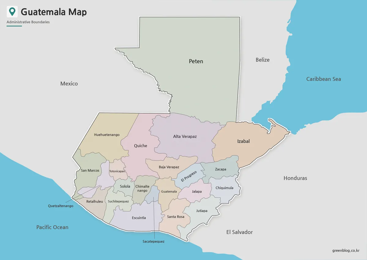
The color version makes the uneven department sizes immediately visible. Petén forms the broad north; Alta Verapaz, Quiché, Huehuetenango, and Izabal create a middle tier; and many smaller departments cluster toward the southern highlands, Pacific slope, and southeast. Contrasting fills prevent adjoining areas from merging visually on a presentation screen.
This view is the best opening graphic for a country profile or a lesson comparing departments. It also works as an answer key beside the blank outline. The colors have no statistical meaning, so a designer adding population, agriculture, climate, or travel categories should replace or clearly distinguish the original palette and provide a new legend.
Black and White Guatemala Map for Printing
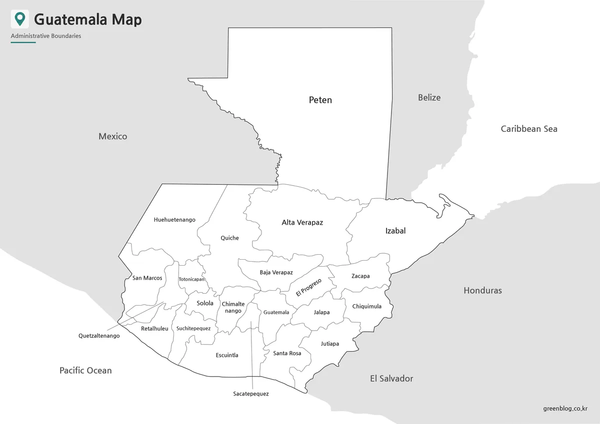
The black-and-white edition preserves the administrative labels and regional context while removing the colored department fills and blue seas. That makes it practical for photocopies, grayscale reports, study packets, and documents where readers need to highlight selected areas. Petén, Izabal, and the Verapaces remain easy to identify, while the southwestern cluster still depends on small text and leader placement.
Because the published preview is 1,200 × 849 pixels, output quality depends on the chosen print size and scaling. Keep the aspect ratio, avoid repeated compression, and print a proof before producing a large batch. The smallest labels—especially Totonicapán, Chimaltenango, Quetzaltenango, and Sacatepéquez—should be checked at the final size.
Blank Guatemala Outline Map for Editing
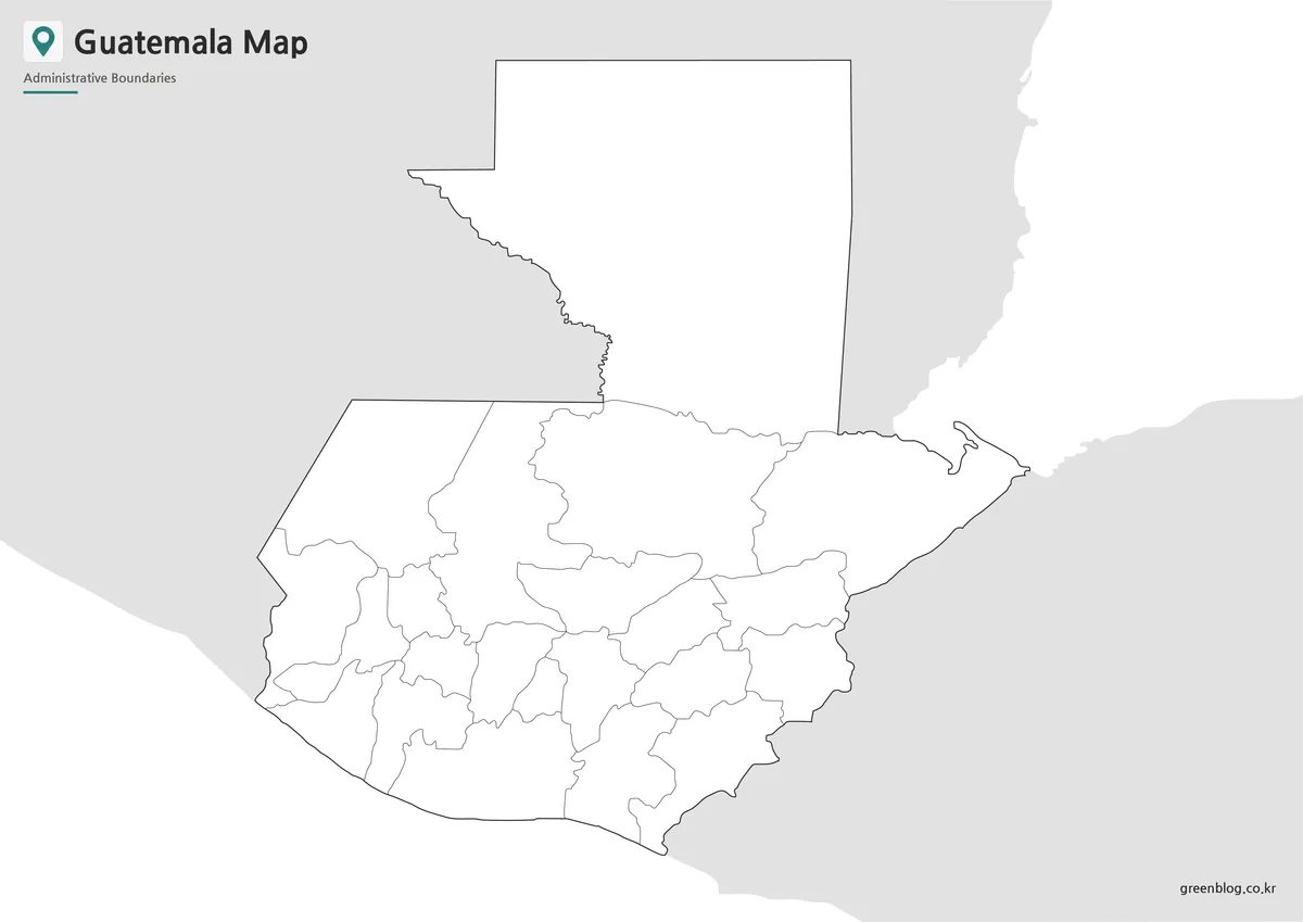
The blank Guatemala Map keeps the 22 department shapes but removes names, water labels, and neighboring-country text. A teacher can turn it into a labeling or coloring exercise, while a designer can group departments by a chosen dataset. The open northern space in Petén and the compact southwestern areas create different annotation challenges, so label size should be planned region by region.
This file is a flat raster image, not a confirmed vector or layered source. It can be placed in presentation and image-editing software, but extreme enlargement may soften the boundary lines. Work from a copy, add a legend and source date to any thematic version, and do not crop away the surrounding gray shapes if border context is part of the lesson.
Guatemala Flag Reference
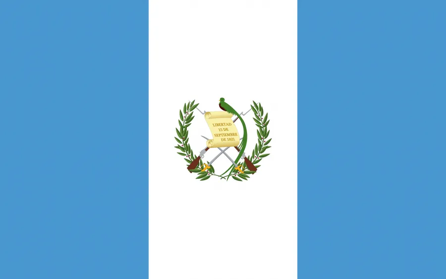
The fourth image is the national flag rather than another administrative map. It shows blue vertical bands on both sides of a white center containing the coat of arms. Pair it with the color map when an introductory slide needs both territorial and national-symbol context, or use it independently in a country-comparison card.
Its 900 × 563-pixel canvas has a different aspect ratio from the three maps, so it should not be forced into the same image frame without checking for distortion or unwanted cropping. Keep the coat of arms centered and preserve the vertical band proportions when resizing.
Practical Uses for a Guatemala Map
The collection supports several concrete workflows. In a geography lesson, students can first identify Guatemala’s four land neighbors and two coastal sides, then transfer the 22 department names from the labeled map to the outline. In a presentation, the color version can introduce national structure before a second slide enlarges the crowded southwestern departments.
- Use the color map as a department-reference sheet or answer key.
- Choose monochrome for report inserts, photocopies, and note-taking activities.
- Build a custom department dataset on the blank version with a new legend.
- Add a separate city map when Guatemala City, department capitals, or routes must be located precisely.
- Place the flag beside a map for country-profile covers and comparison cards.
For travel planning, supplement these files with a current road or transport map because no routes, distances, border crossings, or attraction markers appear here. For classroom and design use, the strength of the set is consistency: all three map views preserve the same department framework while offering different levels of visual guidance.
Frequently Asked Questions
Can I print the Guatemala Map on A4 paper?
Yes. The original layout is prepared for A3 high-resolution use, but it can also be reduced for A4 printing.
What file formats are included?
The map files are prepared in JPG and PNG formats, with files provided together in a ZIP archive.
Which Guatemala Map is best for classroom use?
The black and white map is best for worksheets and handouts. The outline map is useful for labeling or coloring activities.
Is the outline version editable?
Yes. The blank outline map is designed for editing, coloring, annotations, and infographic projects.
Map File Information
Choose the color reference, labeled monochrome map, blank department outline, or separate flag image for your print, lesson, presentation, or annotation project.
- Included Versions: Color map · Black and white map · Outline map · Flag image
- File Type: Image files
Related Maps
Additional Resources
- INGUAT Maps of Guatemala — The national tourism institute provides additional official reference and visitor maps for the country.
Green Map creates custom-edited map images using open geographic data sources such as geoBoundaries, Natural Earth, OpenStreetMap, and government open data.
These maps are edited visual materials, not raw data files, and are provided for education, documents, presentations, and graphic reference.