A Wisconsin Map is useful for much more than locating the state in the upper Midwest. Teachers often use county maps in geography lessons, researchers need them for regional comparisons, and content creators frequently include them in articles, presentations, and infographics. Because Wisconsin combines large forested regions, agricultural areas, major lakeshore cities, and river communities, county boundaries help explain the state’s layout much more clearly than a simple state outline.
Located between Lake Superior and Lake Michigan, Wisconsin borders Minnesota, Iowa, Illinois, and Michigan. The state covers roughly 170,000 square kilometers and has a population of around six million people. Madison serves as the state capital, while Milwaukee is the largest city and the center of the state’s largest metropolitan area. Northern Wisconsin is known for forests and lakes, central Wisconsin contains extensive agricultural land, and the southeastern portion of the state includes the most densely populated urban areas.
This printable Wisconsin Map collection was created for users who need clear county boundaries, readable labels, and flexible editing options. The collection includes three versions: a color county map, a black and white labeled map, and a blank outline map. All files were prepared in high-resolution A3 format for printing, educational use, presentations, blog graphics, worksheets, and design projects.
While preparing the maps, special attention was given to county label placement and boundary visibility. Several public map resources become difficult to read when enlarged or printed. To avoid that problem, labels were adjusted and checked at larger print sizes so that county names remain readable on both screen and paper.
Table of Contents
Why a Wisconsin Map Is Useful for Regional Understanding
Wisconsin has noticeable regional differences across the state. Northern counties contain large forest and recreation areas, while southern counties include many of the state’s major population centers. Western Wisconsin follows the Mississippi River corridor, and eastern Wisconsin connects to important Lake Michigan communities.
Viewing county boundaries alongside major cities helps explain how these regions connect. A Wisconsin Map is often easier to understand than a simple city list because it shows geographic relationships across the entire state.
Included File Information
| Item | Details |
|---|---|
| File Format | JPG |
| Print Size | A3 High Resolution |
| Color Mode | CMYK |
| Included Maps | Color Map · Black and White Map · Outline Map |
| Intended Use | Printing · Education · Presentation · Editing |
Color County Map for Regional Comparison
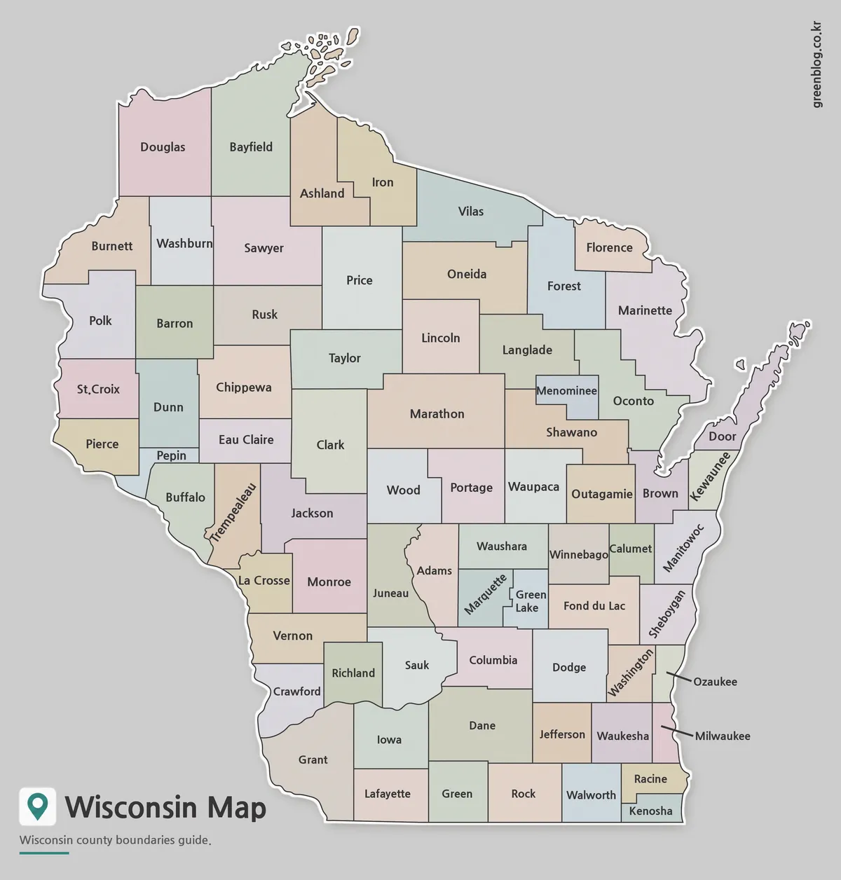
The first Wisconsin Map separates counties using contrasting colors. This makes neighboring counties easier to distinguish and helps users quickly identify regional boundaries.
During the design process, county labels were checked at A3 size to ensure readability after printing. This version works particularly well for presentations, educational materials, regional comparison graphics, and blog content where visual clarity is important.
County-level statistics, population data, transportation networks, and tourism information can also be added directly to this version without making the layout difficult to read.
Black and White Wisconsin Map for Printing
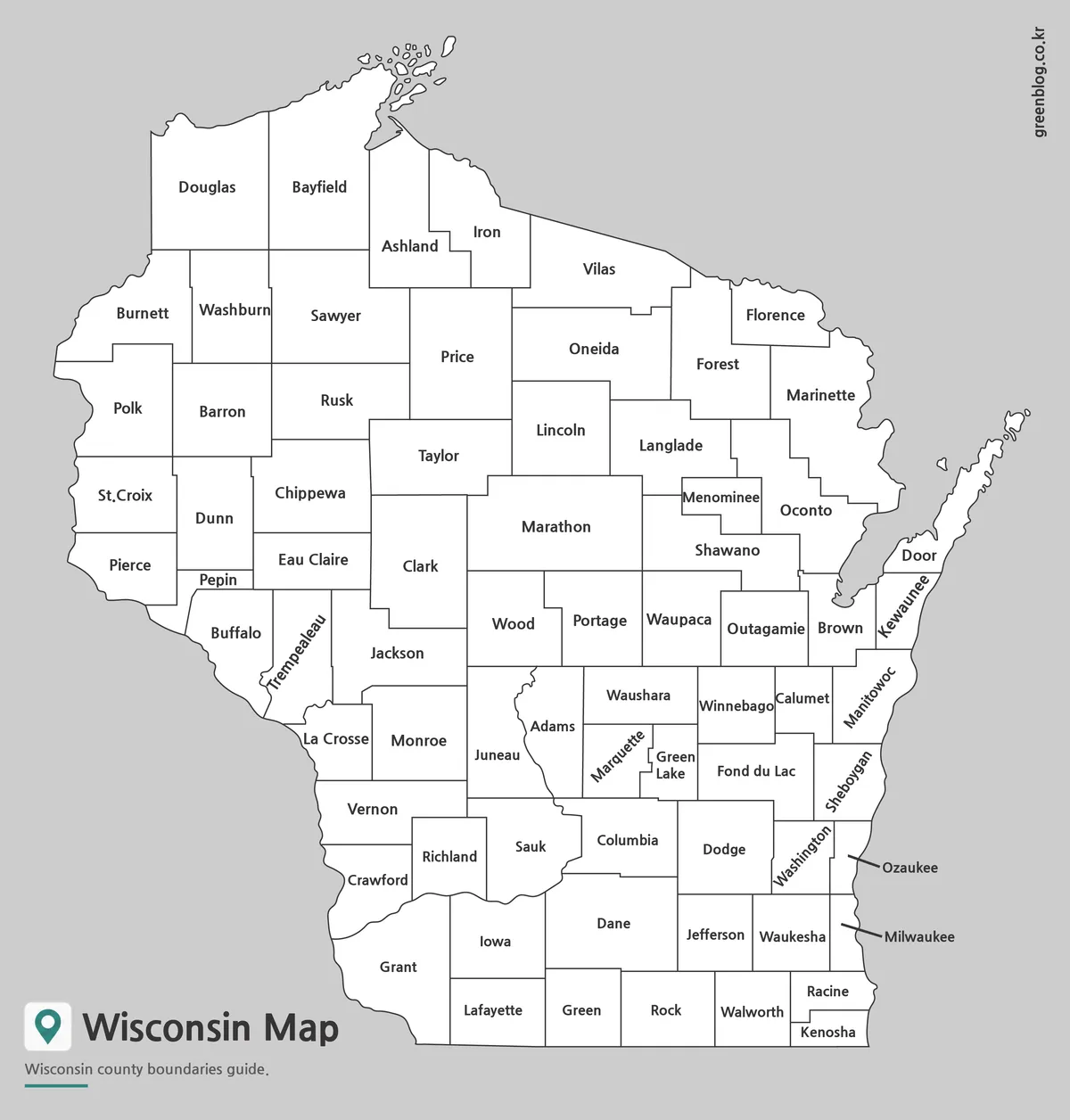
The labeled black and white Wisconsin Map focuses on county names and boundary lines without color fills. This cleaner design fits naturally inside reports, worksheets, and classroom handouts.
Because color information has been removed, users can add their own notes, symbols, or highlighted regions. The map was reviewed for readability in grayscale printing environments, making it a practical choice for educational and office documents.
Blank Outline Map for Editing Projects
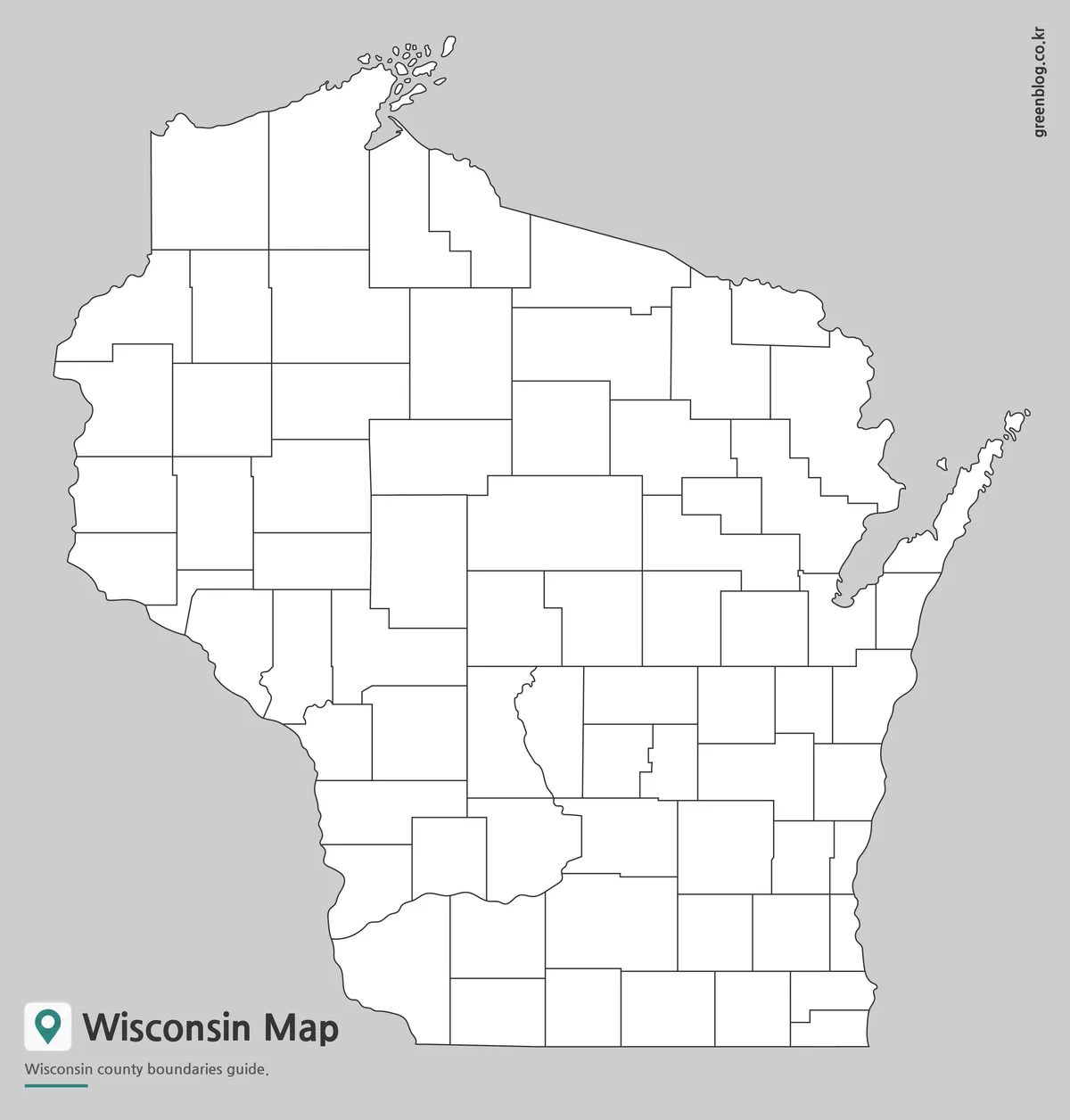
The outline Wisconsin Map removes labels and color while keeping county boundary lines intact. Designers, educators, and researchers often prefer this format because it allows complete customization.
Counties can be highlighted individually, travel routes can be added, and statistical data can be visualized without removing existing labels first. The simple layout also works well for infographic projects, classroom worksheets, election maps, and custom regional studies.
Designed for Practical Use
A printable Wisconsin Map can support many different projects:
- Educational handouts and study materials
- Geography lessons and classroom worksheets
- County-level statistical visualization
- Travel planning and route presentations
- Blog graphics and website content
- Business and regional comparison reports
- Infographic and design projects
Frequently Asked Questions
Can I print the Wisconsin Map in A3 size?
Yes. The files were prepared as high-resolution A3 resources for printing.
Does the map include county boundaries?
Yes. All versions include Wisconsin county boundary lines.
Which Wisconsin Map is best for editing?
The outline version is the most flexible choice for editing, custom coloring, and data visualization.
Wisconsin Map Download
Wisconsin map files are available from the link below. Check the color map, basic map, or outline map version and download the file you need.
- File Format: JPG / ZIP
- Purpose: Printing · Presentations · Editing
- Size: A3 High-Resolution
The file is provided in ZIP format. After downloading, extract the archive before use.
Additional Resources
- Wisconsin State Cartographer’s Office – A specialized mapping and geographic information resource that provides access to Wisconsin maps, boundary data, GIS resources, and regional geographic information for research, education, and planning purposes.
Related Maps
- North Carolina State Map Collection (Printable County, Labeled & Outline Maps)
- Georgia State Map Download | Printable County Maps in 3 Styles
- Printable Michigan Maps in A3 Size | County and Outline Map Set
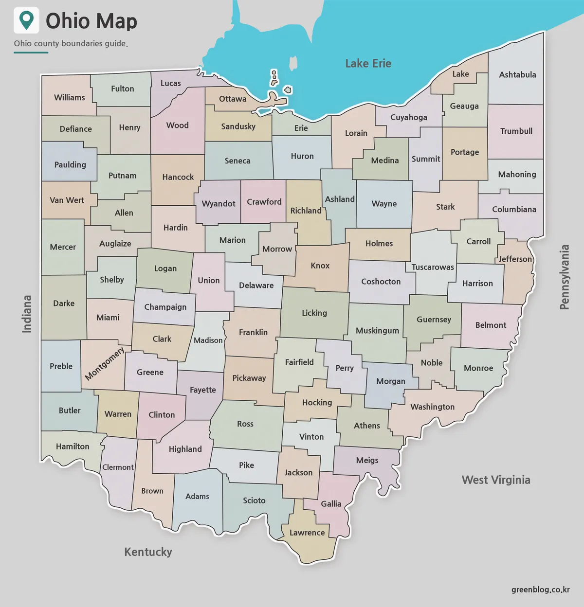
- Ohio Map Collection Free Download | Printable County Maps
Green Map creates custom-edited map images using open geographic data sources such as geoBoundaries, Natural Earth, OpenStreetMap, and government open data.
These maps are edited visual materials, not raw data files, and are provided for education, documents, presentations, and graphic reference.