A Korean version of this map page is available. View Korean Page
A Serbia Map is useful when you need a clear visual reference for the central Balkan region rather than a simple country locator. Serbia is a landlocked country in southeastern Europe, bordered by countries such as Romania, Bulgaria, Croatia, Bosnia and Herzegovina, Montenegro, Albania, and Hungary depending on the regional framing. Because it sits near several Balkan countries and includes a complex administrative layout, a printable Serbia map can help students, teachers, bloggers, and presentation creators explain regional relationships more clearly.
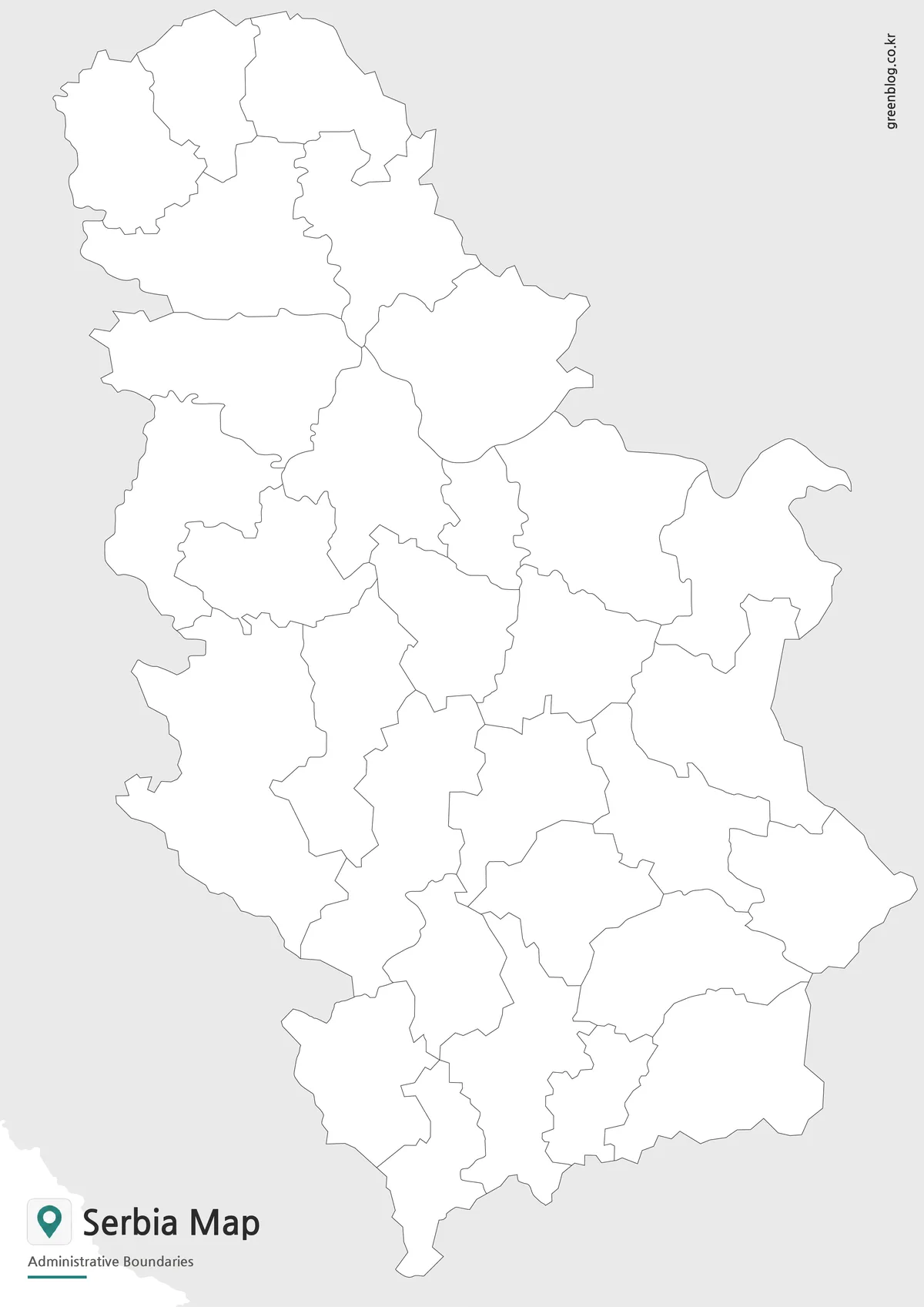
This printable Serbia map collection includes three versions: a color map, a black and white map, and an outline map. The files are prepared as image files for classroom handouts, presentation slides, blog graphics, printable study materials, and editable map projects. The color version is made for quick regional comparison, the black and white version is easier to use in printed documents, and the outline version gives users a clean base for adding labels, route arrows, data marks, or custom colors.
Serbia’s capital, Belgrade, is one of the most important reference points on the map because it connects the country’s administrative layout with its urban and regional structure. The original Korean draft noted that the map was organized around Serbia’s districts, the special city structure, surrounding countries, and the inclusion of Kosovo in the overall regional layout for context. This English version keeps that practical map purpose while rewriting the page as a printable resource for English-speaking users.
Table of Contents
Serbia Map Overview
Serbia is located in the central part of the Balkan Peninsula, where several national borders meet within a relatively compact area. That regional setting makes a map especially useful for explaining neighboring countries, travel direction, historical geography, or classroom topics about southeastern Europe. A written description can list Serbia’s neighbors, but a map makes the surrounding structure easier to understand at a glance.
The map collection is designed for practical use rather than long background reading. It works well for school assignments, country comparison slides, regional geography lessons, travel-related content, and infographic projects. During the map preparation process, the layout was simplified so that Serbia’s administrative regions, Belgrade, surrounding country names, and boundary structure could remain readable without making the page visually crowded.
Included Map Versions
The Serbia Map set includes color, black and white, and outline versions. Each version serves a different type of project. The color map is best for quickly comparing administrative areas, the black and white map is better for printing and note-taking, and the outline map is intended for custom editing.
Because Serbia is often discussed in relation to surrounding Balkan countries, the map layout keeps regional context visible without overloading the design. This is helpful for users who need a clean visual reference for reports, educational worksheets, presentation slides, or blog images.
Color Serbia Map for Regional Comparison
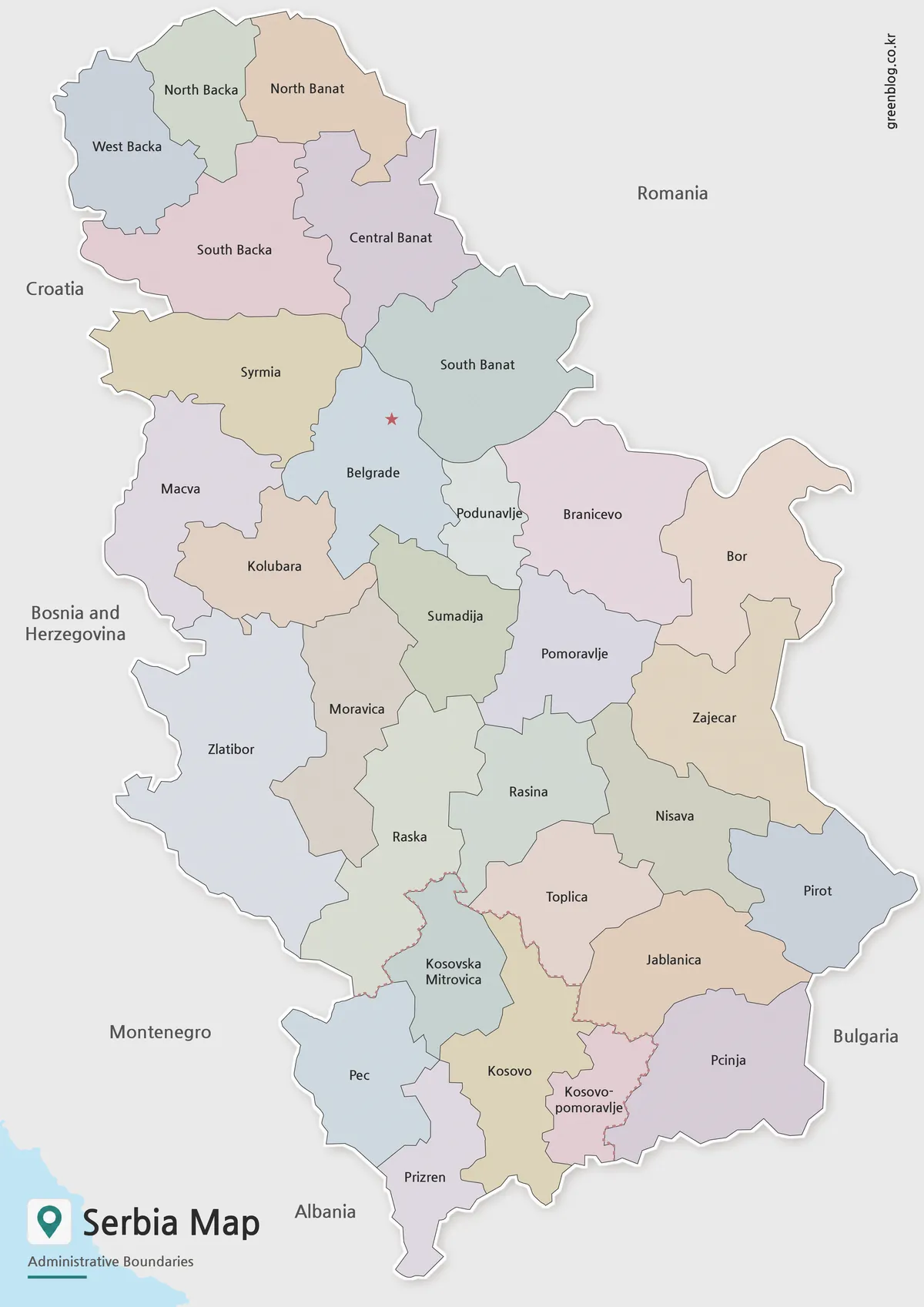
Designed around Serbia’s administrative layout, the color map separates regions with clear visual contrast. This helps users understand the country’s internal structure more quickly, especially when comparing Belgrade with the surrounding districts and southern regional areas.
The color-coded version works well for presentation slides, regional overview graphics, and blog posts about the Balkans. Since Serbia connects with several neighboring countries, color separation also helps the country’s internal divisions stand out from the surrounding regional labels.
Black and White Printable Serbia Map
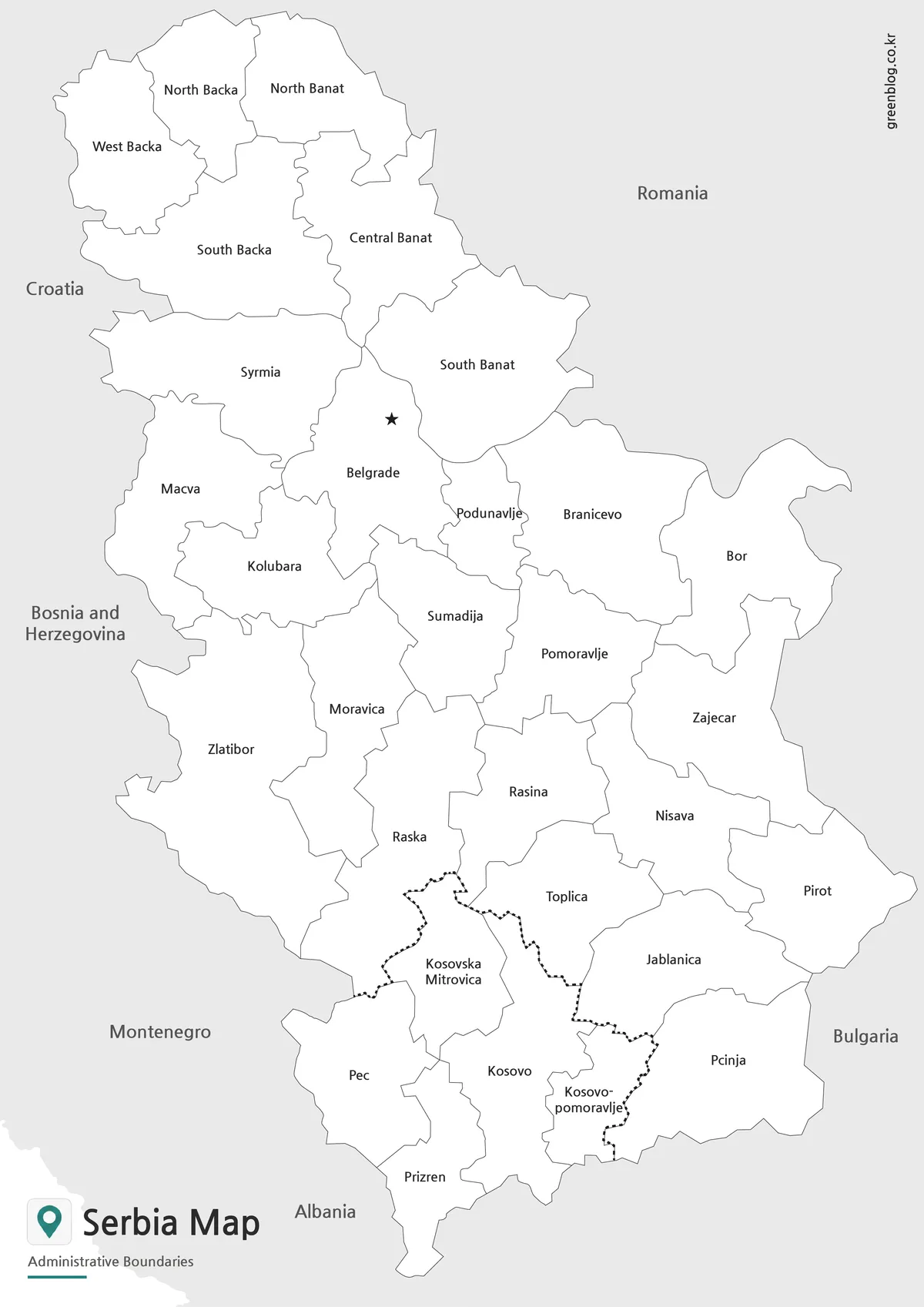
For printed materials, the black and white version keeps the design cleaner. It removes color while preserving the administrative boundaries and place labels, making it easier to use in handouts, reports, worksheets, and document inserts.
This version is useful when users want to write notes directly on the map or highlight selected areas by hand. The simpler style also works well for classroom activities where students may label neighboring countries, mark Belgrade, or compare Serbia with nearby Balkan states.
Blank Serbia Outline Map for Editing
The outline map provides a clean base for custom work. It removes color and labels so users can add their own information, such as route lines, city markers, highlighted regions, classroom coloring, or infographic annotations.
For Serbia, the blank version is especially useful when preparing materials about Balkan geography, regional comparison, travel routes, administrative divisions, or historical context. Designers can use it as a base map for presentation graphics without needing to remove existing text or color first.
Practical Uses for the Serbia Map
A printable Serbia Map can support several types of projects. Teachers can use it for European geography lessons, students can include it in country reports, and bloggers can use it as a visual reference when writing about Serbia, Belgrade, or the Balkan Peninsula. It also works well in presentation slides where users need to show Serbia’s position among Romania, Bulgaria, Croatia, Bosnia and Herzegovina, Montenegro, Albania, and other nearby areas.
For infographic work, the outline map gives the most flexibility. Users can add population data, travel routes, regional labels, or highlighted administrative areas. The color map is better when a quick visual overview is needed, while the black and white map is more practical for printed worksheets and study materials.
Choosing the Best Version
Choose the color map when the goal is quick visual comparison. It works well for screens, slides, blog graphics, and regional overview pages.
Choose the black and white map when printing is the main purpose. It keeps the layout simple and leaves space for notes, labels, and hand-drawn marks.
Choose the outline map when you need a working base for editing. It is the best choice for custom labels, data visualization, classroom coloring, travel route marking, and infographic projects.
Frequently Asked Questions
What is included in this Serbia Map collection?
The collection includes a color map, a black and white map, and an outline map. Each version is prepared for a different use, such as printing, presentations, classroom materials, or editing.
Is this Serbia Map useful for classroom projects?
Yes. The black and white and outline versions are especially useful for worksheets, geography activities, and country comparison assignments.
Can I edit the outline map?
Yes. The outline version is designed as a blank base map, so users can add labels, colors, routes, city markers, or regional data.
Why is Serbia’s regional context important on a map?
Serbia is located in the central Balkan region and connects with several neighboring countries. A map helps users understand those relationships much faster than text alone.
Map File Information
This download includes printable Serbia map versions for educational use, presentation design, document printing, and editable graphic projects.
- Included Versions: Color map, black and white map, outline map
- Printable Size: A3 layout
- File Type: Image files
- Intended Use: Classroom handouts, presentations, blog graphics, infographic editing, and printable reference materials
Related Maps
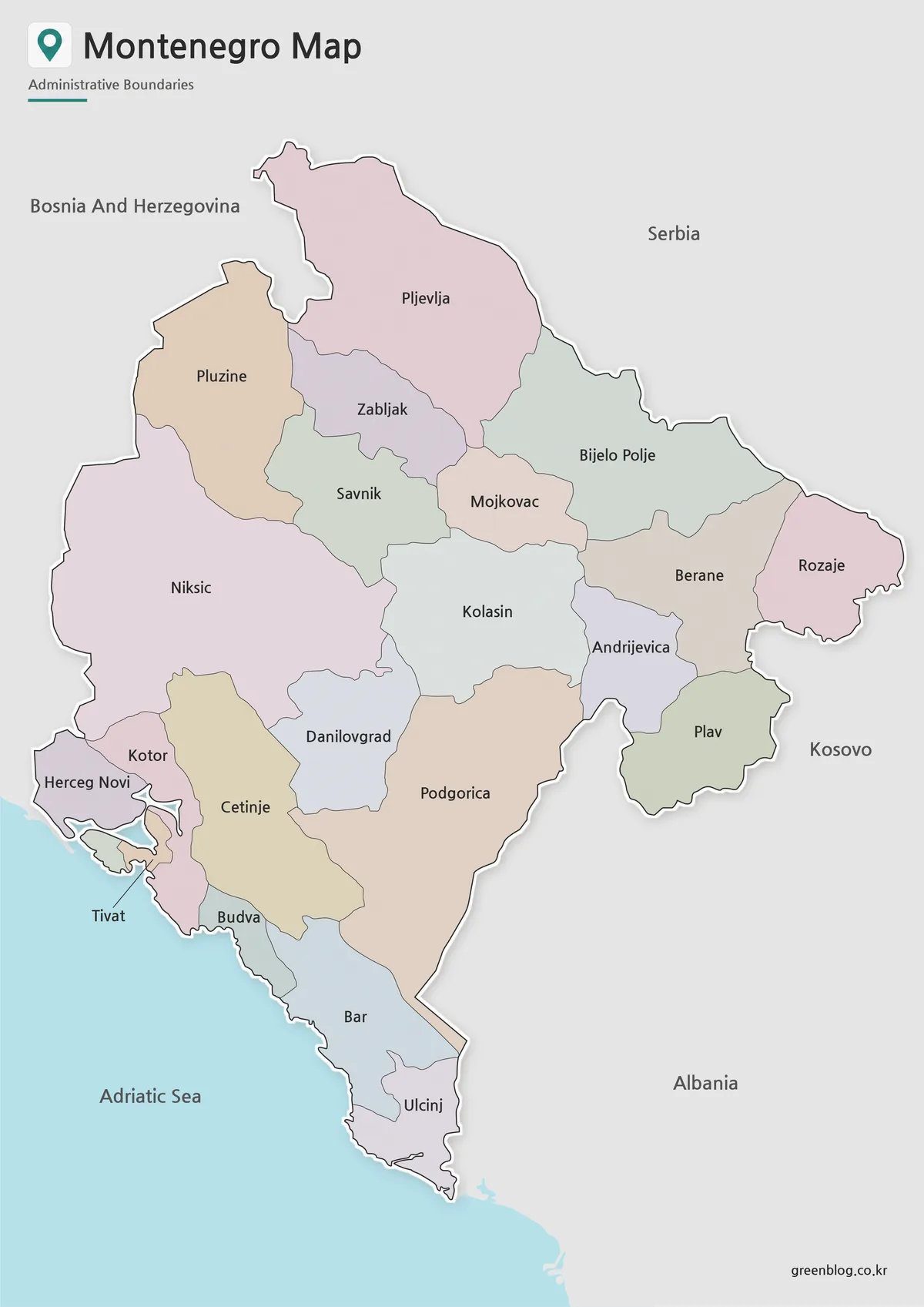
- Montenegro Map Download – Labeled, Basic, and Blank Outline Maps
- Moldova Map Download – Printable Country Map Collection
- Printable North Macedonia Map for Classroom, Presentation, and Editing Use
- Free Lithuania Map Resource with Labeled and Blank Versions
Additional Resources
- Humanitarian Data Exchange – Serbia Administrative Boundaries : This resource is useful for checking Serbia’s administrative boundary structure and comparing district-level map divisions.
Green Map creates custom-edited map images using open geographic data sources such as geoBoundaries, Natural Earth, OpenStreetMap, and government open data.
These maps are edited visual materials, not raw data files, and are provided for education, documents, presentations, and graphic reference.