A Korean version of this map page is available. View Korean Page
A Lithuania Map is useful when you need more than a simple country location image. Lithuania sits on the eastern coast of the Baltic Sea and shares borders with Latvia, Belarus, Poland, and Russia’s Kaliningrad region. Because of this position, the country is often shown together with the Baltic states, Northern Europe, Eastern Europe, or regional comparison maps. A clear printable map helps readers understand those relationships much faster than text alone.
This printable Lithuania Map collection includes three versions: a color map, a black and white map, and a blank outline map. The files were prepared for A3 high-resolution use, making them suitable for classroom materials, presentation slides, travel-related graphics, country comparison posts, and educational worksheets. Each version serves a different purpose, so users can choose the map style that best fits their project.
The color version is designed for quick visual reading, especially when comparing Lithuania with neighboring countries and the Baltic Sea coastline. The black and white version keeps the layout clean for printing and document use. The outline version removes colors and labels so it can be used as a base map for editing, annotations, infographic design, or classroom activities.
While preparing this map collection, the layout was organized to keep the country shape readable at larger print sizes. Extra attention was given to the coastline, border direction, and label balance so the map remains clear when used in printed materials or resized for digital content. The result is a practical Lithuania map resource for students, teachers, bloggers, designers, and anyone creating visual reference materials.
Table of Contents
Lithuania Map Overview
Lithuania is one of the three Baltic states, located along the Baltic Sea in Northern Europe. Its capital, Vilnius, is positioned in the southeastern part of the country, which makes a labeled map especially helpful when explaining the difference between the capital area, the coastal region, and the surrounding border zones.
For educational or presentation use, Lithuania is often compared with Latvia and Estonia as part of the Baltic region. It is also useful for showing connections with Poland, Belarus, and the Kaliningrad area. A regional map layout makes these relationships easier to understand, especially for students or readers who are not familiar with the geography of northeastern Europe.
Included Map Files
This Lithuania Map collection includes three map styles:
- Color labeled map
- Black and white printable map
- Blank outline map
The maps are arranged for A3 high-resolution printing. They can be used in blog posts, classroom handouts, infographic layouts, presentation slides, and study materials. The original file package includes the three versions together, so users can select the most suitable map depending on whether they need visual color separation, clean printing, or a blank editing base.
Color Lithuania Map
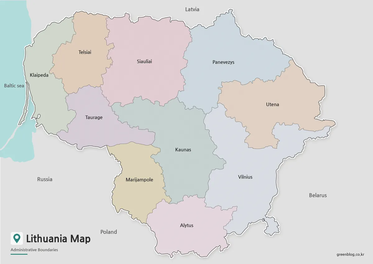
The color map is the most useful version when you want the country layout to be understood quickly. Lithuania’s position between the Baltic Sea and several neighboring countries can be difficult to explain with text only, so the color layout helps separate the country shape, border areas, and nearby regions at a glance.
This version includes Korean and English labels, making it useful for bilingual reference materials or country introduction content. Neighboring countries such as Latvia, Belarus, Poland, and Russia are also included so users can understand Lithuania’s location within the wider Baltic and Eastern European area. The Baltic Sea coastline is shown as well, which helps explain Lithuania’s coastal connection and regional geography.
The color version works well for blog images, visual introductions, presentation slides, and country comparison graphics. It is especially helpful when the map needs to be understood quickly by viewers who may not already know where Lithuania is located.
Black and White Printable Version
For printed materials, the black and white map offers a cleaner layout. Instead of relying on color, this version keeps the background simple while preserving labels and boundary lines. That makes it easier to use in worksheets, reports, classroom packets, and printed reference sheets.
Because Lithuania’s map includes both coastal and inland border relationships, a simplified black and white layout helps reduce visual distraction. Teachers can use it for geography lessons, students can place it inside reports, and bloggers can use it as a clean supporting image in informational posts.
This version is also practical when users want to add small notes, arrows, or highlights directly onto the printed page. The white background leaves enough visual space for marking Vilnius, the Baltic Sea, nearby countries, or regional comparison points.
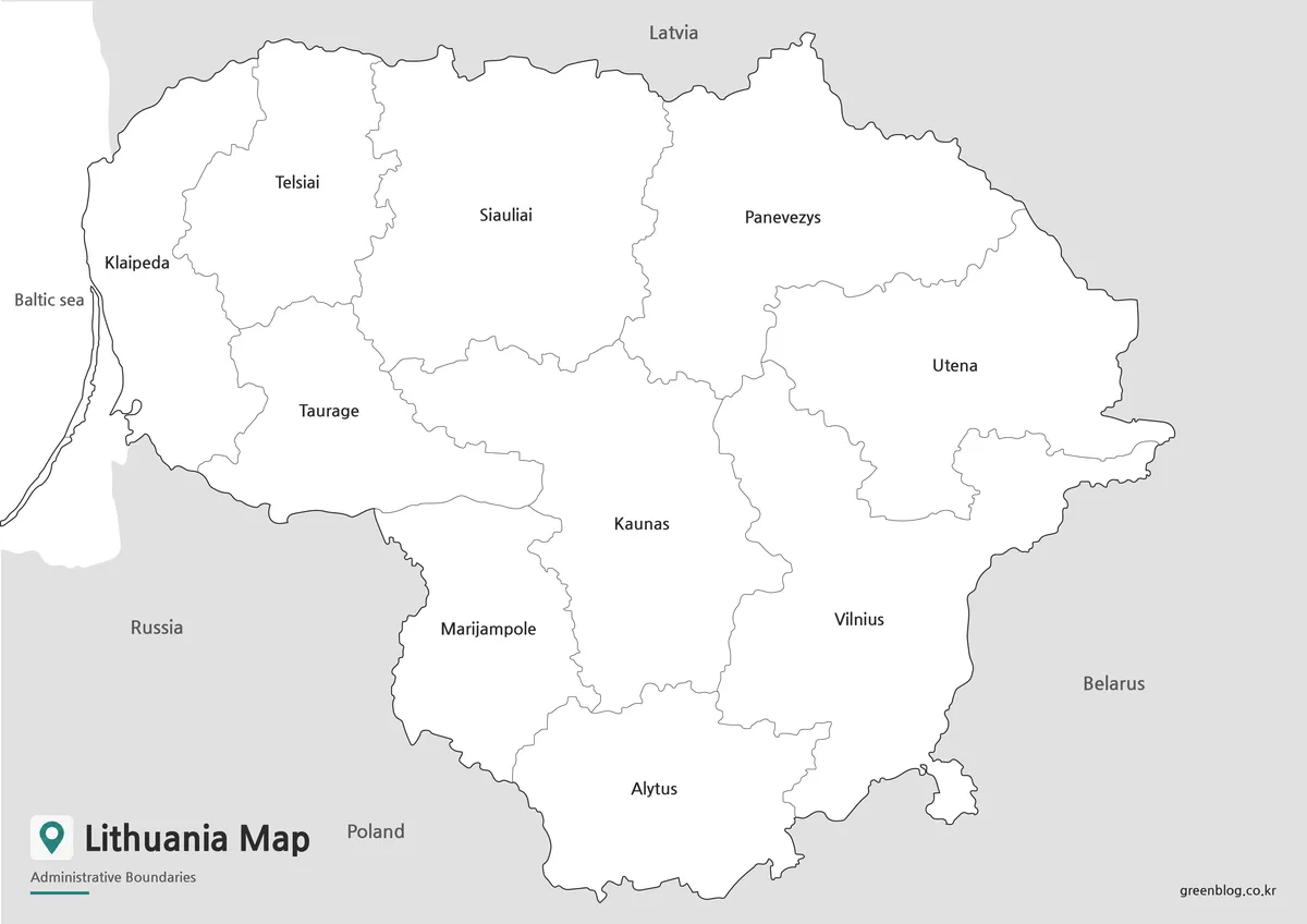
Blank Lithuania Outline Map for Editing
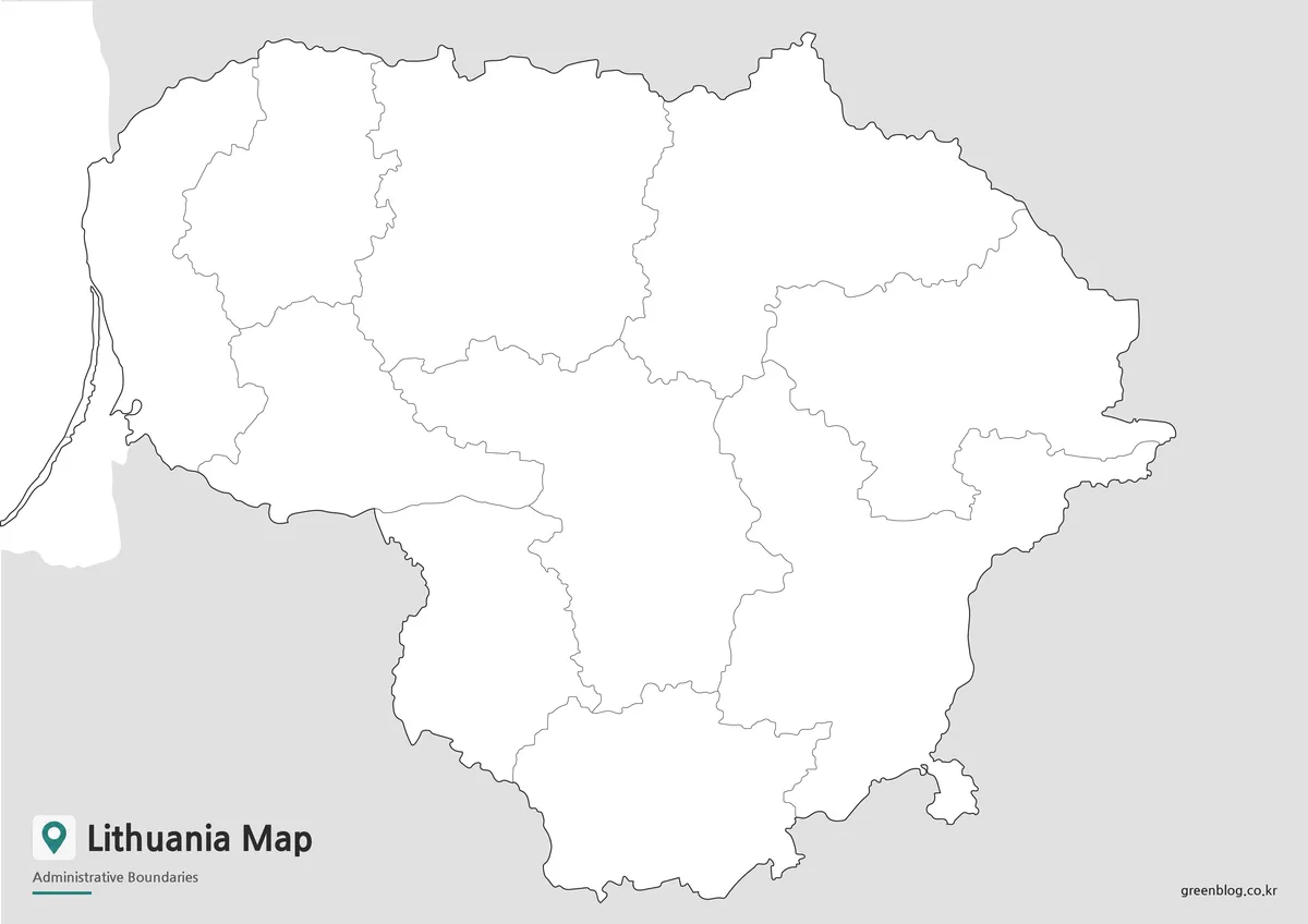
The outline version removes both color and text, leaving only the boundary structure. This makes it the best choice for users who want to build their own custom visual material from a clean base map.
Designers can add colors, icons, city markers, statistical data, travel routes, or presentation highlights. Teachers can use the blank Lithuania outline map for classroom coloring activities, map labeling exercises, or regional comparison worksheets. Bloggers and infographic creators can also use it as a simple background for explaining Baltic geography or country relationships.
Since the map keeps only the essential outline and boundary lines, it is easier to adapt for different visual projects. Users can create their own color scheme, emphasize specific areas, or combine the outline with other educational graphics.
Built for Printing and Visual Projects
The maps were prepared with A3 high-resolution use in mind. This makes them suitable for both digital viewing and larger printed materials. The layout was checked so that the main country shape, coastline, border direction, and labels remain readable when enlarged.
The color map is better for quick visual comparison, the black and white map is better for clean printing, and the outline map is better for custom editing. Together, the three versions provide a flexible Lithuania Map resource for different types of projects.
Practical Uses
This map collection can be used for:
- Classroom geography lessons
- Student reports and worksheets
- Blog posts about Lithuania or the Baltic region
- Presentation slides
- Travel and regional comparison materials
- Infographic design projects
- Printable study resources
- Custom map editing work
Because Lithuania borders several countries and faces the Baltic Sea, the map is especially useful when explaining regional location, neighboring countries, or the broader Baltic states.
Frequently Asked Questions
Can I print this Lithuania Map in A3 size?
Yes. The maps were prepared for A3 high-resolution printing, so they are suitable for classroom materials, reports, and presentation handouts.
Which version is best for printing?
The black and white version is the easiest to print because it keeps the layout clean and reduces unnecessary color use.
Does the map show neighboring countries?
Yes. The labeled version includes nearby countries such as Latvia, Belarus, Poland, and Russia, helping users understand Lithuania’s regional position.
Is the Baltic Sea coastline included?
Yes. The coastline is included so Lithuania’s connection to the Baltic Sea can be seen clearly.
Which Lithuania Map should I use for editing?
The blank outline map is the best option for editing. It works well for adding colors, labels, icons, data, or presentation notes.
Download Information
The downloadable file package includes the color Lithuania Map, black and white map, and outline map together. Choose the version that fits your project, whether you need a printable reference map, a clean document image, or a blank base map for editing.
Lithuania Map Download
This download package includes color, black and white, and outline versions of the Lithuania Map. The files are designed for A3 high-resolution printing, classroom use, presentation materials, blog graphics, and editable visual projects.
- Included Maps: Color map, black and white map, outline map
- Intended Usage: Printing, education, presentations, infographics, editing
- Print Size: A3 high-resolution format
Related Maps
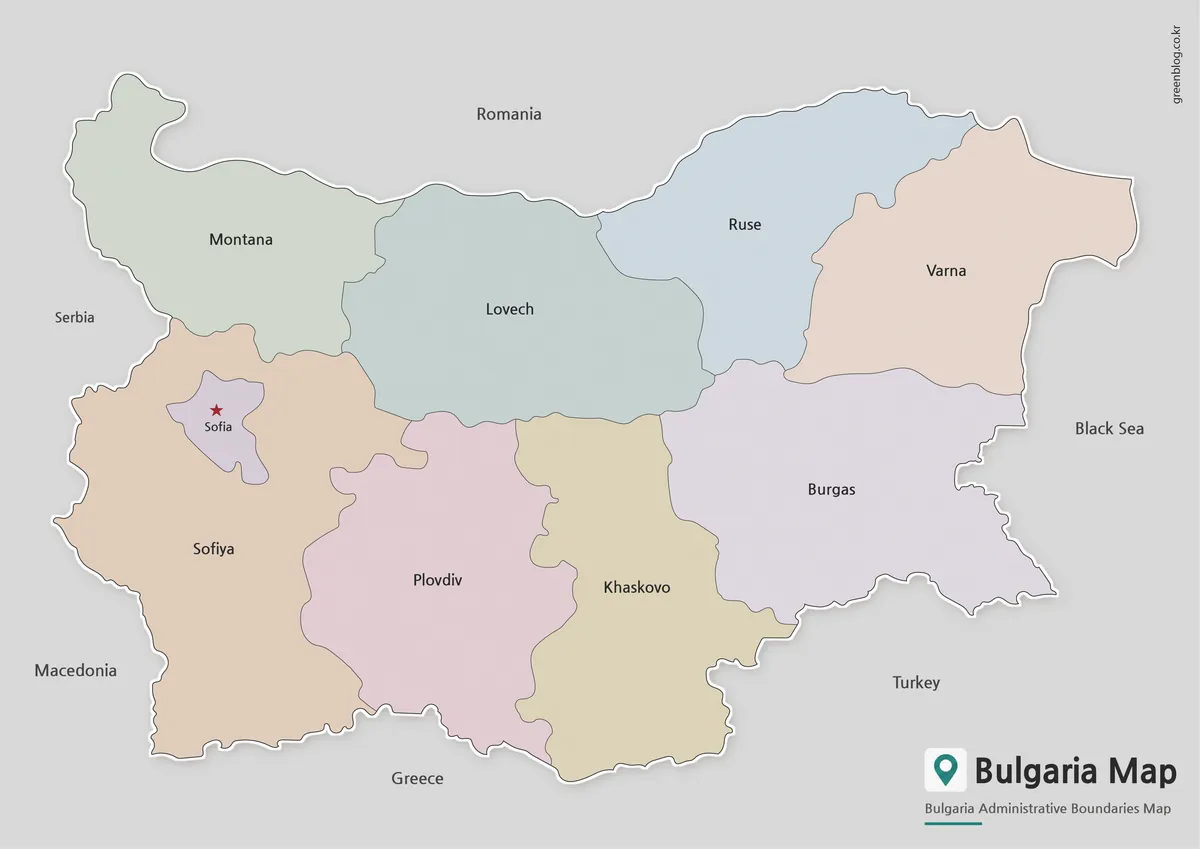
- Bulgaria Map with Regions and Sofia – Color, Detailed, and Outline Versions
- Belarus Map Collection: Printable Administrative, Labeled, and Outline Maps
- High-Resolution Austria Map for Education, Travel, and Graphic Projects
- Printable Armenia Map Download – High Resolution A3 Map Set
Additional Resources
- Geoportal.lt – Lithuania Official Spatial Data Portal : Lithuania’s official geoportal for viewing maps, spatial datasets, and geographic information services.
Green Map creates custom-edited map images using open geographic data sources such as geoBoundaries, Natural Earth, OpenStreetMap, and government open data.
These maps are edited visual materials, not raw data files, and are provided for education, documents, presentations, and graphic reference.