A Korean version of this map page is available. View Korean Page
Finding a clean and readable Greece map can be surprisingly difficult, especially when you need something suitable for printing, editing, or presentation work. Many online maps include too much road data or unnecessary details, making them harder to use for educational or visual projects.
This Greece printable map collection was designed with a simpler layout focused on regional structure, readability, and practical use. The files include color, black and white, and outline versions created for classroom materials, infographic work, blog graphics, and editable design projects.
Rather than functioning as a navigation map, the collection focuses on helping users understand Greece’s regional layout and island structure more clearly. Visitors looking for official travel information about Greece can also refer to the official Visit Greece tourism guide.
Table of Contents
Map Collection Overview
Greece is located in southern Europe and includes both a mainland region and a large number of islands spread across the Aegean and Ionian Seas. Because of this structure, a simplified regional map is often easier to use for visual explanation and comparison materials.
The collection includes:
- Regional color map
- Basic labeled map
- Black and white printable map
- Blank outline map
File Information
- Resolution: 4961 × 3507
- Format: JPG
- Color Mode: CMYK
- Designed for: Printing, editing, classroom reference, presentations, and infographic projects
Regional Color Greece Map
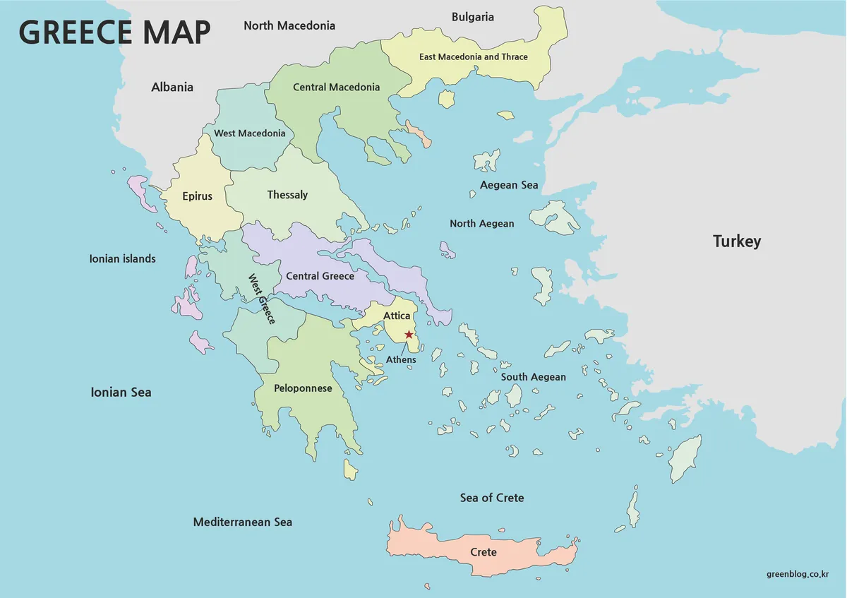
The color version separates Greece’s administrative regions using different tones to make the layout easier to understand at a glance. Neighboring countries and surrounding seas were also included to improve geographic readability.
Athens is marked clearly, helping users quickly identify the capital area when using the map for travel presentations or educational projects.
This version works especially well for:
- presentation slides
- travel blog graphics
- regional comparison materials
- educational reference pages
- infographic layouts
The larger A3-sized layout also keeps labels readable when projected on screens or printed in poster format.
Black and White Printable Version
The black and white version removes most color elements and focuses on boundary visibility instead. This format is often more practical for standard office printing or large classroom printouts.
Minimal visual distractions help maintain readability even in grayscale printing environments.
Useful for:
- educational handouts
- note-taking
- printed reports
- worksheets
- grayscale presentations
Because the structure remains simple, users can also add their own highlights or labels afterward.
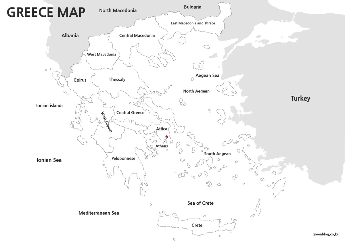
Blank Outline Map for Editing
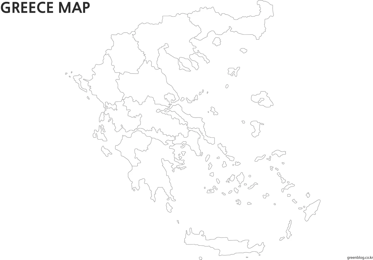
The outline version removes labels and colors completely, leaving only the regional boundaries and outer coastline.
This format is intended for users who need a flexible base layer for graphic editing or custom visual projects.
Common use cases include:
- infographic design
- custom labeling
- multilingual projects
- travel route graphics
- educational exercises
- statistical overlays
The borders were cleaned carefully to make coloring and editing easier inside graphic software.
Designed for Printing and Visual Projects
These Greece maps were created in high resolution to remain readable even when enlarged or printed in A3 format.
The files work well for:
- classroom presentations
- printable study resources
- blog graphics
- infographic layouts
- editable design projects
- regional comparison visuals
Because the maps avoid excessive detail, they also integrate more naturally into slides, reports, and educational materials.
Frequently Asked Questions
Can I print the maps in large size?
Yes. The files were designed for high-resolution A3 printing.
Is the outline map editable?
Yes. The blank version works well for graphic editing, annotations, and custom labeling.
Are roads and transportation details included?
No. The collection focuses on regional readability rather than navigation details.
Are neighboring countries labeled?
Yes. Several surrounding countries and sea regions are included in the main versions.
Greece Map Download
The Greece map collection includes printable and editable versions grouped into one downloadable package.
- Color regional map
- Black and white printable map
- Blank outline map
- File Format: JPG / PNG / ZIP
- Usage: Printing · Presentation · Editing
- Size: High Resolution A3 Format
Choose the version that best fits your project, presentation, or classroom material.
Related Map Suggestions
- Italy Regional Map Set
- France Outline and Printable Maps
- Germany Administrative Map Pack
- Spain Editable Map Collection
Green Map creates custom-edited map images using open geographic data sources such as geoBoundaries, Natural Earth, OpenStreetMap, and government open data.
These maps are edited visual materials, not raw data files, and are provided for education, documents, presentations, and graphic reference.