The Turkmenistan map collection was prepared for users who need a clear printable reference for Central Asia. Turkmenistan is located between the Caspian Sea and several major neighboring countries, including Uzbekistan, Iran, Afghanistan, and Kazakhstan. Because the country sits along the western edge of Central Asia and includes both desert areas and a Caspian coastline, a labeled map is useful for explaining its location more clearly than a simple text description. This English version is rewritten from the original Korean map post provided by the user.
This printable Turkmenistan map set includes three main versions: a color map, a black and white map, and a blank outline map. The original content confirms an A3 layout, JPG file format, CMYK color mode, and an image size of 4961 × 3508. The collection is designed for document printing, classroom reference, blog graphics, presentation slides, and editable map projects. Each version has a different role: the color map gives a quick regional view, the black and white map works better for printing and note-taking, and the outline map provides a clean base for custom design work.
Turkmenistan is a fairly large country in Central Asia, with wide regional areas rather than a dense urban layout. Its west side faces the Caspian Sea, while the rest of the country connects to inland borders. That layout makes the map especially useful for regional comparison, because readers can see how Turkmenistan relates to Uzbekistan, Iran, Afghanistan, and the Caspian Sea at the same time. During the map preparation process, extra attention was given to keeping the regional names readable while also showing the capital, Ashgabat, with a clear star marker.
Table of Contents
Printable Turkmenistan Map Collection
This map collection is built for practical use rather than long country explanation. It works well for students preparing geography assignments, teachers creating classroom handouts, bloggers writing about Central Asia, and designers building infographic layouts. The labeled version helps users identify the country’s main regional structure, while the simplified versions are better for printing or editing.
Turkmenistan is often less familiar to English-speaking readers than countries such as Kazakhstan, Uzbekistan, or Iran. A clear visual map helps place it in context. The Caspian Sea on the west side and the surrounding country names make the map easier to understand when explaining Central Asian geography, cross-border regions, or travel-related location references.
Color Turkmenistan Map with Regional Labels
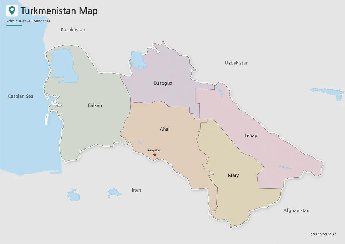
Designed with color-coded regions, the color Turkmenistan map helps separate broad administrative areas without making the layout feel crowded. Since the country has large regional divisions and open desert areas, the color structure makes it easier to compare one area with another at a glance. The capital, Ashgabat, is marked with a star so it can be found quickly in classroom or presentation use.
Neighboring country names are included in a simplified way to keep the focus on Turkmenistan while still showing its position in Central Asia. The Caspian Sea and major water features are separated by color, which helps readers understand the western coastline and nearby geographic features. This version is the most useful for blog graphics, presentation slides, and quick visual explanations.
Black and White Printable Turkmenistan Map
For printed materials, the black and white Turkmenistan map provides a cleaner layout with less visual weight. Removing the regional colors makes the labels and boundaries easier to read on worksheets, handouts, and document pages. This is especially useful when the map needs to be printed in black and white or placed next to written explanations.
The cleaner version also gives users more room to add notes, arrows, or small labels by hand. Because Turkmenistan has a wide land area and neighboring country context, a simplified layout can be easier to use in reports and classroom reference sheets than a fully colored map. It is a practical choice when clarity and printing efficiency are more important than visual color separation.
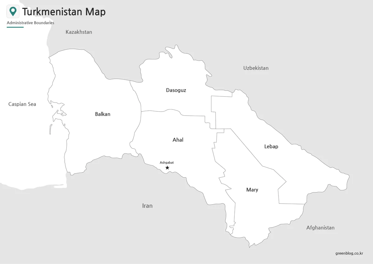
Blank Turkmenistan Outline Map for Editing
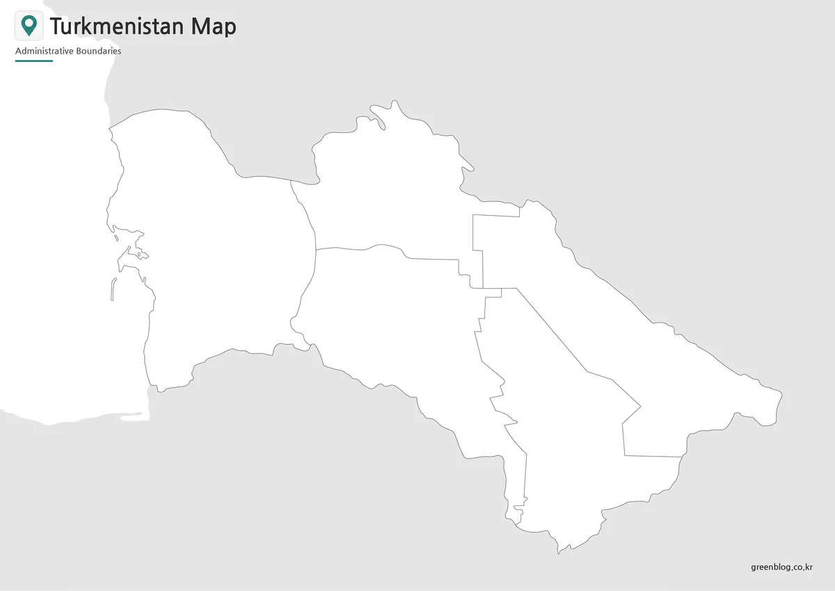
The blank outline map removes color and text, leaving the main boundary structure available as a working base. Designers, teachers, and students can add custom colors, route lines, city markers, regional highlights, or infographic labels without covering existing map details. This makes the outline version useful for custom classroom activities, presentation graphics, and visual comparison projects.
For Central Asia topics, the outline map can be used to mark the Caspian coastline, highlight Ashgabat, compare border areas, or create a simple regional activity sheet. Because the original map preparation focused on connected boundary lines, the outline version is easier to use when filling areas with color or building a custom map graphic.
Turkmenistan Flag for Country Resources
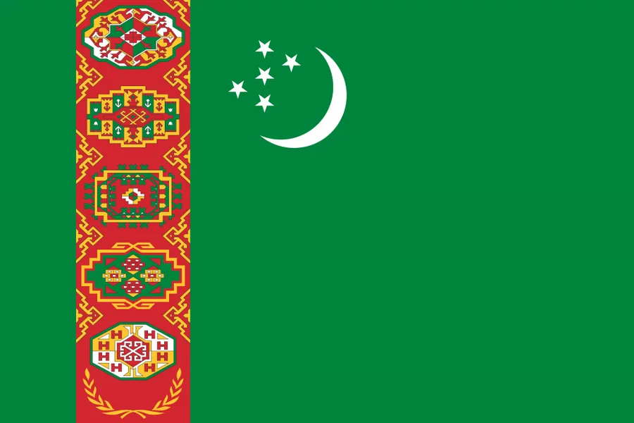
The Turkmenistan flag has a distinctive green background with traditional carpet patterns and national symbols. When used together with a Turkmenistan map, the flag helps create a more complete country reference image. This combination works well for educational posters, country profile pages, travel presentations, and blog resources about Central Asia.
Practical Uses for the Turkmenistan Map
A printable Turkmenistan map can be used in a variety of projects. Teachers may use the black and white version for classroom worksheets or geography handouts. Bloggers can use the color map when explaining Central Asian countries, energy-resource regions, or the Caspian Sea area. Designers may prefer the outline map when building infographics, custom regional comparison graphics, or map-based presentation visuals.
The map is also useful for comparing Turkmenistan with nearby countries such as Uzbekistan, Kazakhstan, Afghanistan, and Iran. For presentation slides, the labeled color version gives viewers a quick regional overview. For editing projects, the blank outline map provides a cleaner base that can be adapted to the exact topic.
Frequently Asked Questions
What is included in this Turkmenistan map collection?
The collection includes a color Turkmenistan map, a black and white map, and a blank outline map. Each version is prepared for a different use, including printing, presentations, classroom materials, and graphic editing.
Can I print the Turkmenistan map in A3 size?
Yes. The original map was prepared in an A3 layout, making it suitable for larger printed reference sheets, worksheets, and presentation materials.
Does the map show neighboring countries?
Yes. The labeled version includes nearby country names such as Iran, Afghanistan, Uzbekistan, and Kazakhstan to help users understand Turkmenistan’s location in Central Asia.
Which version is best for editing?
The outline map is the best option for editing. It works well as a blank base for adding colors, routes, markers, regional data, or infographic annotations.
Why is the Caspian Sea shown separately?
The Caspian Sea is an important geographic feature on the western side of Turkmenistan. Showing it separately helps readers understand the country’s coastline and regional position more clearly.
Map File Information
This download includes printable Turkmenistan map versions for educational use, presentation design, document printing, and editable graphic projects.
- Included Versions: Color map, black and white map, outline map
- Printable Size: A3 layout
- File Type: JPG image files
- Intended Use: Classroom handouts, presentations, blog graphics, infographic editing, and printable reference materials
Related Maps
- Printable Sri Lanka Map Collection – Labeled, Blank, and Outline Versions
- India Maps Download Collection (3 Maps for Regional Reference)
- Laos Map Download – High Resolution A3 Administrative Map Set
- Printable Kyrgyzstan Map Resource for Education, Travel, and Design
Additional Resources
- Humanitarian Data Exchange – Turkmenistan Subnational Administrative Boundaries : This dataset provides Turkmenistan administrative boundary data, including national and subnational levels, which can be useful when checking regional map structure.
Green Map creates custom-edited map images using open geographic data sources such as geoBoundaries, Natural Earth, OpenStreetMap, and government open data.
These maps are edited visual materials, not raw data files, and are provided for education, documents, presentations, and graphic reference.