A Korean version of this map page is available. View Korean Page
This Myanmar Map collection includes color, black and white, and outline versions designed for printing, classroom reference, presentation slides, blog graphics, and editable map projects. Myanmar is located in Southeast Asia and shares borders with China, Thailand, India, Bangladesh, and Laos, so a clear map is useful when explaining both the country’s internal regions and its wider position between South Asia and mainland Southeast Asia.
The country has a long north–south shape, with many neighboring borders and a wide range of regional divisions. Because of that layout, a simple location map is often not enough for classroom materials or country reference pages. A labeled Myanmar Map helps readers see the administrative structure, the surrounding countries, and the capital location more clearly in one image.
This map set was created for practical use rather than detailed navigation. The color version helps separate administrative areas quickly, the black and white version works well for printing and note-taking, and the blank outline version is useful for graphic editing, coloring activities, custom labeling, and infographic projects. Each version is prepared in an A3-sized layout so it can be viewed on screen, enlarged for presentation use, or printed as a study resource.
During the map preparation process, the surrounding countries were included to make Myanmar’s border relationships easier to understand. Dotted boundary lines were used to distinguish neighboring country borders without making the map too crowded. The capital location was marked with a red star icon, and place names were arranged with both Korean and English labels in the original design so the map could work as a bilingual reference image.
Table of Contents
Myanmar Map Overview
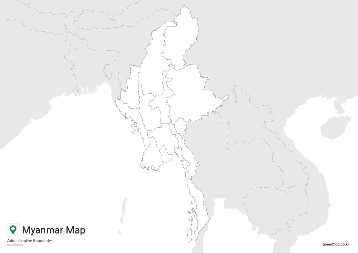
The Myanmar Map is designed as a clean administrative and regional reference. Instead of filling the page with roads, terrain details, or small local features, the layout focuses on boundaries, labels, surrounding countries, and the capital marker.
Myanmar’s position makes this especially useful. It sits between India and Bangladesh to the west, China to the northeast, and Thailand and Laos to the east and southeast. Showing these neighboring countries helps readers understand why Myanmar is often discussed as a connecting country between South Asia and Southeast Asia.
Included Map Versions
This printable map collection includes three main versions:
- Color administrative map
- Black and white basic map
- Blank outline map
Each version serves a different purpose. The color map is best for quick regional recognition, the black and white version is better for printed materials, and the outline map works as a flexible base for editing or custom information.
Color Myanmar Administrative Map
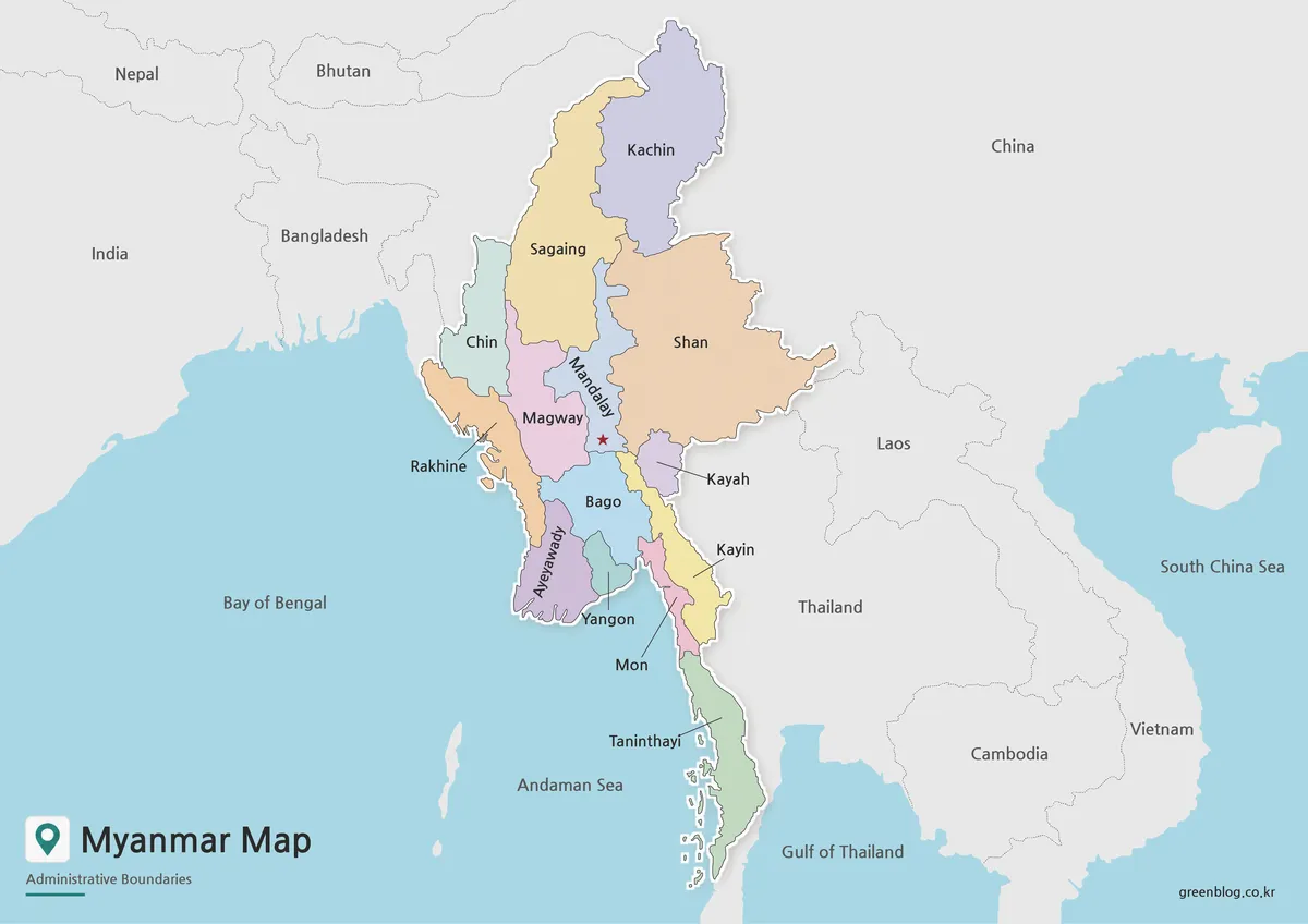
The color Myanmar Map helps readers understand the country’s administrative layout at a glance. Because Myanmar has a long vertical shape and borders several countries, color separation makes it easier to compare regions without losing the larger geographic context.
This version includes simplified neighboring country references, with dotted border styling used to keep Myanmar visually distinct from the surrounding areas. The capital is marked with a red star icon, making it easier for readers to locate Naypyidaw within the broader national layout.
The color map works well for blog posts, classroom geography lessons, Southeast Asia comparison materials, and presentation slides. It is especially useful when explaining Myanmar together with China, Thailand, India, Bangladesh, and Laos because the regional relationship can be understood directly from the map.
Black and White Printable Version
For printed materials, the black and white Myanmar map offers a cleaner layout with the color fills removed. This helps reduce visual weight and makes the labels easier to read in handouts, worksheets, reports, and study materials.
Since Myanmar’s administrative map includes many regional labels and neighboring references, a simpler background is helpful when users need to write notes or add their own marks. The white background gives enough space for annotations, classroom activities, and printed country reports.
This version is also practical for people who want a neutral reference map inside documents. It keeps the boundaries and place names visible without strong colors, making it easier to combine with written explanations, tables, or presentation text.
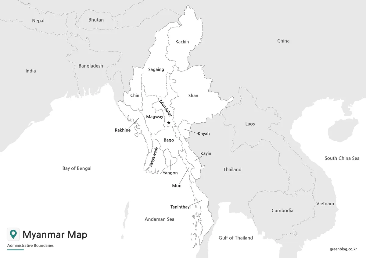
Blank Myanmar Outline Map for Editing
The blank outline version removes both color and text, leaving the boundary structure as a working base map. This format is useful for people who want to create their own Myanmar Map by adding colors, markers, labels, routes, or data.
Teachers can use the outline map for labeling exercises, coloring activities, or geography worksheets. Designers can add regional highlights, travel routes, population notes, or infographic elements. Bloggers and presentation creators can also use it as a base when they need to emphasize only selected areas.
The boundary structure was checked for easier editing, so users can fill or highlight regions without first cleaning up the lines. This makes the outline version more useful than a simple blank image, especially for custom graphic projects in design software.
Myanmar Flag
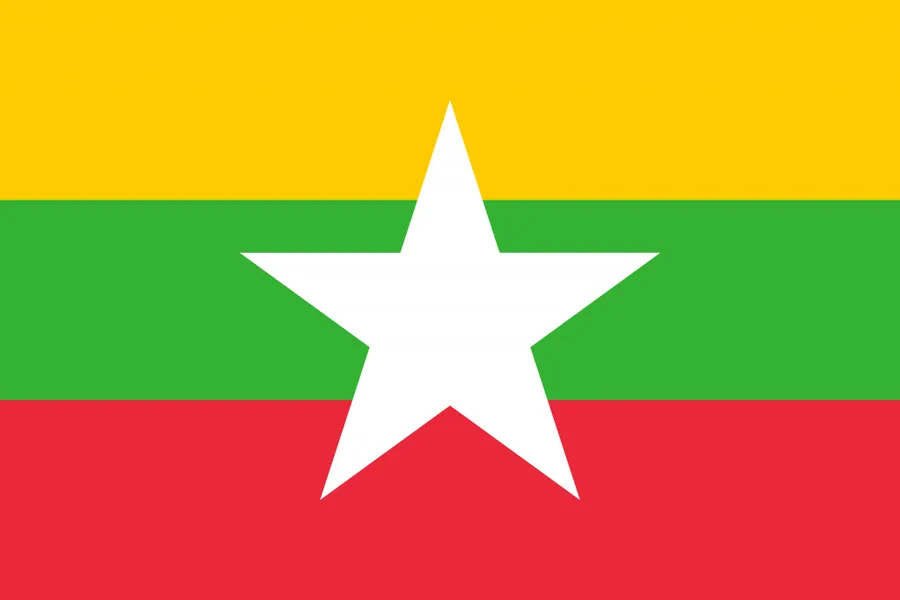
The Myanmar flag includes three horizontal bands of yellow, green, and red with a white star in the center. When used together with the map, the flag helps readers identify the country quickly in educational materials, country profiles, blog graphics, and presentation slides.
A flag image is especially useful when several Southeast Asian countries are compared on the same page. It provides a simple visual reference while the map explains the country’s shape, borders, and regional structure.
Practical Uses for This Myanmar Map
This Myanmar Map collection can be used in classroom lessons, country reports, travel-related articles, regional comparison pages, and infographic projects. For teachers, the labeled and black and white versions work well as printable handouts. For students, the outline version can support note-taking, labeling activities, and geography assignments.
Bloggers and content creators can use the color map when explaining Myanmar’s location within Southeast Asia, while designers may prefer the outline version for custom graphics. The map is also helpful when discussing neighboring countries because it shows Myanmar’s position near China, Thailand, India, Bangladesh, and Laos in a simple visual format.
The collection is not intended to replace a detailed navigation map. Instead, it provides a clean printable and editable reference for users who need to explain Myanmar’s administrative regions, capital position, and surrounding country relationships clearly.
Frequently Asked Questions
Is this Myanmar Map suitable for A3 printing?
Yes. This Myanmar Map was prepared in an A3-sized layout, so it works well for classroom materials, presentation boards, and printed reference sheets.
What information is included on the map?
The map includes administrative boundaries, major regional labels, the capital marker, and surrounding country references depending on the version.
Which version is best for printing?
The black and white version is best for most printed materials because it keeps labels and boundaries clear while reducing color use.
Can I edit the outline map?
Yes. The blank outline version is suitable for adding colors, labels, city markers, travel routes, or infographic data.
Why are neighboring countries shown?
Myanmar borders several countries, so including nearby country names helps readers understand its location in Southeast Asia more easily.
Map File Information
This download includes printable Myanmar map versions for educational use, presentation design, document printing, and editable graphic projects.
- Included Versions: Color map, black and white map, outline map
- Printable Size: A3 layout
- File Type: Image files
- Intended Use: Classroom handouts, presentations, blog graphics, infographic editing, and printable reference materials
Related Maps
- Malaysia Map Resource with Color, Basic, Outline, and Flag Images
- Kazakhstan Map Download | Printable Color, Black and White & Outline Maps
- China Maps Download Collection – 4 Regional Map Types
- India Maps Download Collection (3 Maps for Regional Reference)
Additional Resources
- Humanitarian Data Exchange – Myanmar Administrative Boundaries : Provides administrative boundary datasets for Myanmar that can be useful when checking region-level map references.
Green Map creates custom-edited map images using open geographic data sources such as geoBoundaries, Natural Earth, OpenStreetMap, and government open data.
These maps are edited visual materials, not raw data files, and are provided for education, documents, presentations, and graphic reference.