A Pingtung County map reveals a part of Taiwan whose shape is difficult to grasp on a national map. The county begins beside Kaohsiung in the north, narrows along the west coast, and continues through the Hengchun Peninsula toward the Bashi Channel. Its eastern boundary meets Taitung across a broad mountain zone, while Liuqiu appears offshore in the Taiwan Strait.
This downloadable set contains three 1200 × 1697 WebP images: a pastel color map with names, a black and white map with names, and an unlabeled outline map. All three use the same portrait composition and show the boundaries of the county’s 33 local administrative divisions. The Pingtung County map set is suited to A3-oriented handouts, reports, slides, route diagrams, and activities that need a clear county-level base.
The maps make two patterns immediately visible. Small divisions cluster on the northwestern plain around Pingtung, Chaozhou, and Donggang, while larger mountain divisions occupy much of the east and center. Farther south, the county becomes a long peninsula containing Shizi, Mudan, Checheng, Manzhou, and Hengchun. Liuqiu is separated from the mainland and shown to the southwest.
Use the labeled versions when identification matters and the blank version when the reader should supply information. The maps show administrative boundaries rather than roads, railways, terrain contours, or live navigation data, so they work best as regional reference graphics instead of turn-by-turn travel maps.
Table of Contents
Included Map Versions
The collection provides three treatments of one boundary layout:
- Color map: pastel fills distinguish neighboring divisions, with place names and surrounding geographic labels.
- Black and white map: the same names and boundaries appear without colored administrative fills.
- Outline map: internal boundaries remain, but division names and surrounding geographic labels are removed.
The consistent dimensions make it easy to switch versions without rebuilding a page. A teacher can introduce the labeled color sheet, distribute the outline for an exercise, and use the monochrome version as an answer reference. A designer can also align two versions in successive slides to reveal labels or highlighted areas in stages.
Reading the Pingtung County map
Start at the broad northern end. Ligang, Gaoshu, Sandimen, and Wutai form the upper tier, with the map placing Kaohsiung to the west and Taitung to the east. Below them, many smaller divisions gather around the western plain. Their compact shapes contrast with Majia, Taiwu, Laiyi, and Chunri, which extend through the central and eastern side.
Continue south along the coast to see Fangliao and Fangshan before the map reaches Shizi. The peninsula then divides among Mudan, Checheng, Manzhou, and Hengchun. This north-to-south reading order is useful because the portrait page follows the county’s natural orientation. It also prevents Liuqiu, drawn offshore to the southwest, from being mistaken for part of the mainland.
The labels “Taiwan Strait,” “Philippine Sea,” and “Bashi Channel” provide broad orientation, but they are contextual rather than navigation features. The white boundary lines are the main subject. Closely packed shapes indicate where more care is needed when coloring or adding annotations, especially around the northwestern group of small divisions.
Color Map for Regional Comparison
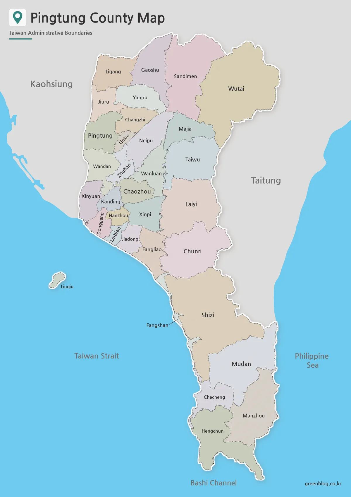
The pastel Pingtung County map gives each adjacent division a different fill, which helps separate narrow or irregular boundaries without using a dense legend. Names are printed directly inside most areas. Where a shape is especially narrow, such as Fangshan, a leader line connects the label to the correct location.
This version is the clearest starting point for a presentation or county overview. The pale palette keeps black labels readable while preserving the visual difference between divisions. It also makes the contrast between the crowded western plain and the larger inland areas easy to explain at a glance.
Black and White Map for Printing
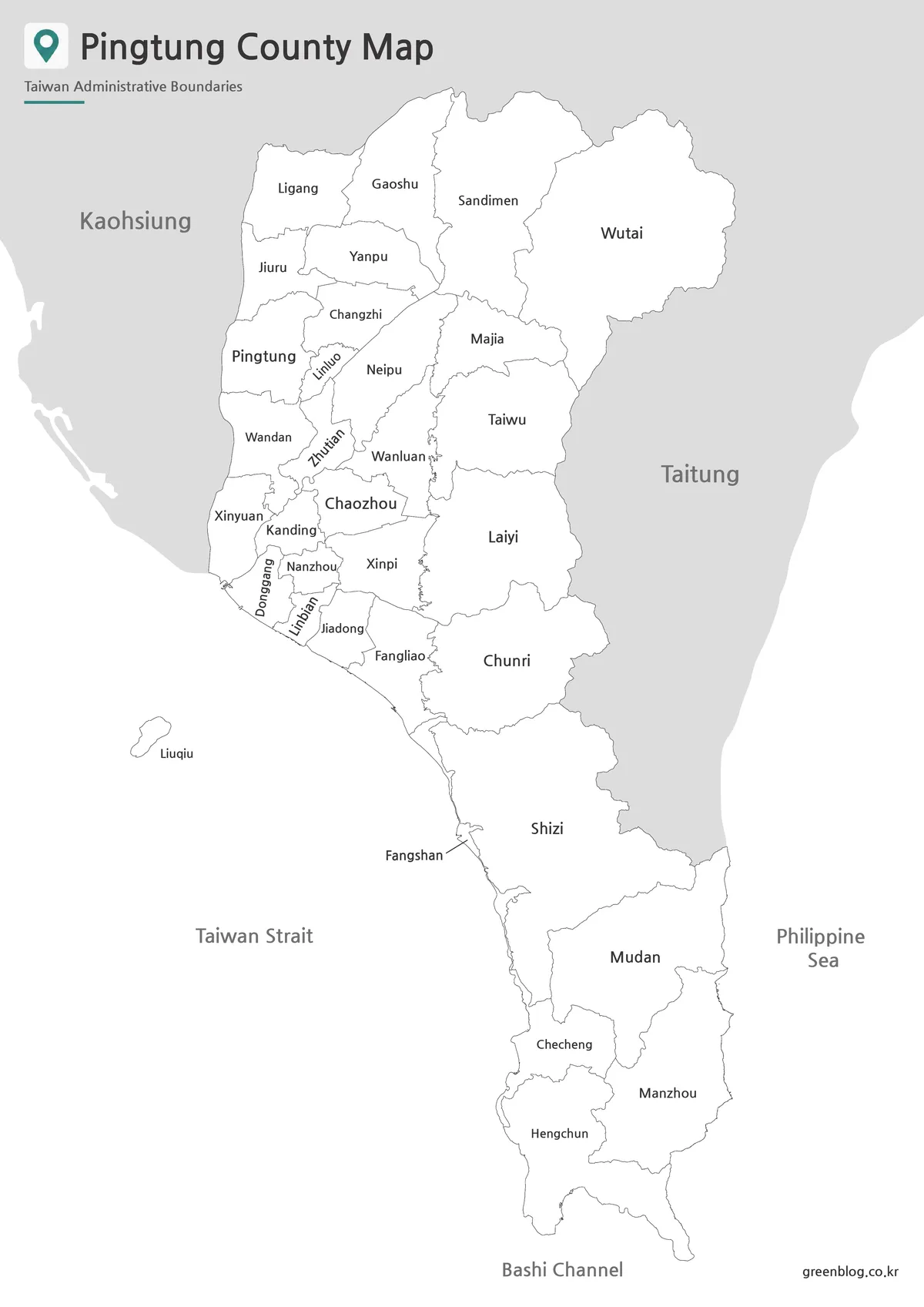
The black and white Pingtung County map retains the division names, county outline, internal borders, neighboring labels, and surrounding water names. Removing the pastel fills reduces ink coverage and makes the graphic sit comfortably beside paragraphs, tables, or other monochrome figures.
For printing, check the smallest northwestern labels in a preview before committing to a large batch. The supplied portrait image has enough height for an A3-oriented composition, but automatic “fit to page” settings can shrink text when wide margins, headers, or footers are added. A short test print will show whether the intended paper and printer preserve the thin boundary lines.
Outline Map for Editing and Custom Marking
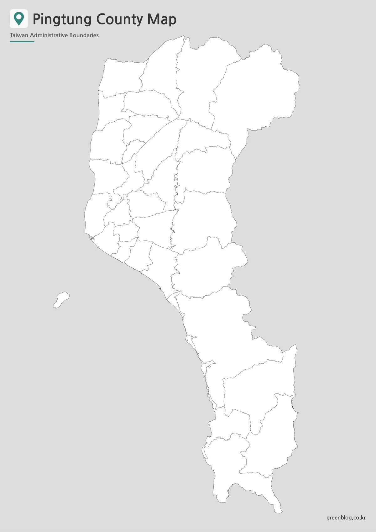
The outline Pingtung County map removes place names and contextual labels while retaining the mainland divisions and the offshore Liuqiu shape. Its plain white areas can accept color fills, numbers, symbols, route lines, or short annotations. Because the file is a raster WebP image, edits should be made in an image or page-layout program rather than treated as editable vector paths.
For a classroom activity, assign colors or numbers to selected divisions and provide a separate key. For a travel graphic, mark a sequence of stops without implying that the boundary lines are roads. For a data illustration, apply a consistent scale and include a legend so readers know what each fill or symbol represents.
Practical Uses for the Map Collection
Choose a Pingtung County map version according to the task rather than using one style everywhere:
- Introduce the county’s 33 divisions with the labeled color map.
- Print a low-ink reference sheet with the black and white version.
- Create a naming, matching, or coloring exercise with the outline.
- Compare the compact northwestern divisions with larger eastern areas.
- Mark county-level study topics, destinations, or presentation data.
Keep the source image’s portrait proportions when resizing the Pingtung County map. Cropping the bottom can remove the southern tip and Bashi Channel label, while cropping the left can remove Liuqiu. If the graphic is placed on a landscape slide, scale the complete image and use the remaining space for a legend or explanatory text instead of trimming the county shape.
Frequently Asked Questions
Where is Pingtung County located?
Pingtung County is located at the southern end of Taiwan. It borders Kaohsiung City to the north and connects with Taitung County through the eastern mountain region.
What versions are included in the Pingtung County map collection?
The collection includes a color map, black and white map, and outline map. Each version is designed for a different use, such as presentation design, printing, or editing.
Can I use the outline map for custom design work?
Yes. The outline map is suitable for adding route lines, color fills, city markers, labels, tourism points, or infographic data.
Is the map suitable for classroom printing?
Yes. The files are prepared for A3 layout use, and the black and white version is especially useful for handouts, worksheets, and printed reference materials.
Map File Information
This download contains each Pingtung County map version shown above, prepared as 1200 × 1697 WebP image files.
- Included Versions: color labeled, black and white labeled, and blank outline
Additional Resources
- Taiwan Tourism Administration: Pingtung — official visitor information for checking destinations and regional travel context.
Related Maps
Green Map creates custom-edited map images using open geographic data sources such as geoBoundaries, Natural Earth, OpenStreetMap, and government open data. These maps are edited visual materials, not raw data files, and are provided for education, documents, presentations, and graphic reference.