A Korean version of this map page is available. View Korean Page
A Hsinchu County map is useful when you need to explain the administrative layout of northwestern Taiwan beyond a simple location marker. Hsinchu County, also written as Hsinchu County or 新竹縣, sits in the northwestern part of Taiwan. It borders Taoyuan City to the north, Miaoli County to the south, and the Taiwan Strait to the west. The eastern side extends into mountainous areas, while the western side is closer to coastal and urban communities. Because of this contrast, a printable map helps readers understand the county more clearly than a small general Taiwan map.
This printable Hsinchu County map collection includes three versions: a color map, a black and white map, and an outline map. The files are prepared as image files for classroom handouts, presentation slides, printable study materials, blog graphics, regional comparison pages, and editable design projects. The color version helps separate administrative areas visually, the black and white version works well for printed documents, and the outline version gives users a clean base for adding labels, colors, route lines, or custom data.
Hsinchu County is sometimes confused with Hsinchu City, but they are separate administrative areas. Hsinchu County includes Zhubei City as its county seat and is divided into one county-administered city, three towns, and nine townships. That structure makes the map especially helpful for users who need to compare Hsinchu County with nearby regions such as Taoyuan City, Hsinchu City, Miaoli County, or other northern Taiwan map areas.
During the map preparation process, the administrative boundaries were organized with print readability in mind. Western and central areas include smaller administrative units, while the eastern side includes wider mountain townships such as Jianshi Township and Wufeng Township. For that reason, the layout was checked so the map remains readable in both full-size printing and reduced blog or presentation use.
Table of Contents
Hsinchu County Map Overview
Hsinchu County is not only a place to mark on a Taiwan map. Its internal layout matters because the county contains compact urban areas, inland towns, rural townships, and large mountain-side regions. A labeled and printable map makes it easier to compare where Zhubei City, Zhudong Town, Guanxi Town, Xinfeng Township, Baoshan Township, Jianshi Township, and other areas sit within the county.
For classroom use, the map can support Taiwan geography lessons, regional comparison activities, or worksheet projects. For bloggers and designers, it can work as a visual reference image when explaining northern Taiwan, local travel planning, administrative divisions, or map-based infographic topics. The outline version is especially useful when users want to add their own labels or highlight only selected areas.
Included Map Versions
This Hsinchu County Map collection includes three practical versions:
- Color map
- Black and white map
- Outline map
Each version has a different purpose. The color map is best for quick visual separation, the black and white map is cleaner for printed documents, and the outline map works as a base for editing or custom annotation.
Color Map for Regional Comparison
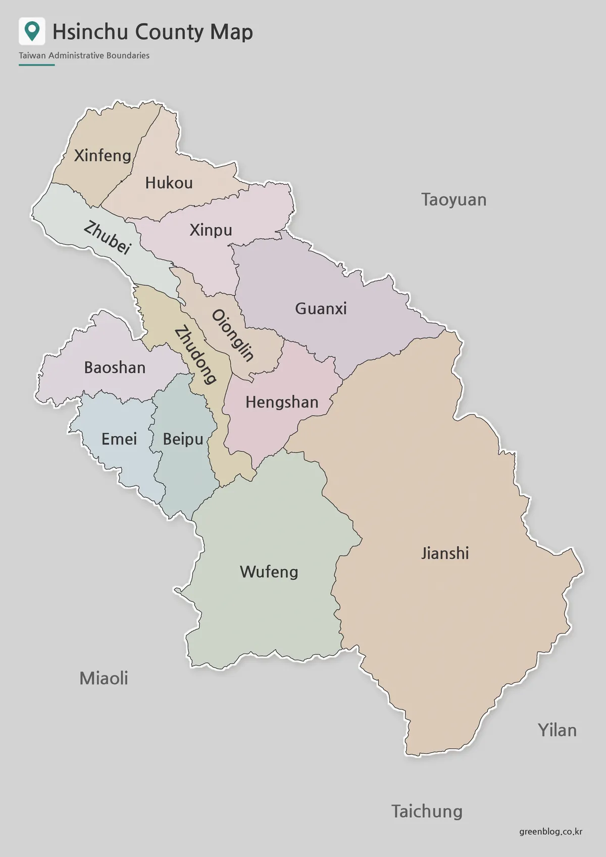
The color Hsinchu County map was created to make the county’s administrative divisions easier to compare at a glance. This is especially helpful because the county has a mix of smaller western and central areas and larger eastern mountain townships. Without color separation, nearby areas around Zhubei City, Zhudong Town, Baoshan Township, and Qionglin Township can feel visually crowded when the map is reduced for a blog image or slide.
This version works well for presentation slides, educational materials, and regional comparison graphics. If you are explaining how Hsinchu County connects with Taoyuan City, Hsinchu City, and Miaoli County, the color-coded layout gives viewers a faster way to read the administrative structure.
Black and White Printable Version
The black and white Hsinchu County Map focuses on boundary lines and place names instead of color. For printed handouts, worksheets, reports, and document inserts, this cleaner style can be easier to read than a color-heavy map. It also works well when the map needs to be copied, printed in grayscale, or placed inside a text-heavy document.
Because Hsinchu County includes both compact and wide administrative areas, the line weight and label placement matter. The goal of this version is to keep the county structure clear without making the smaller western areas feel too crowded. Teachers, students, and presentation creators may find this version useful when the map needs to function as a reference rather than a decorative image.
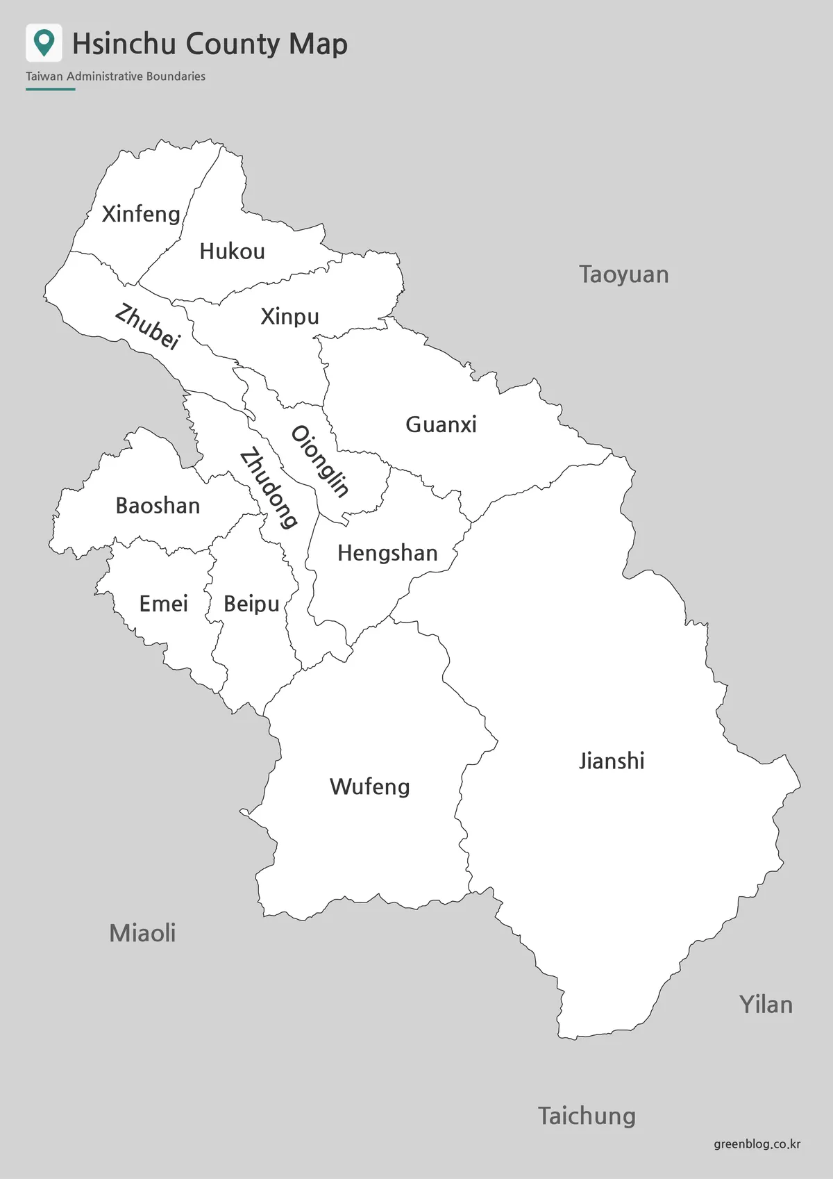
Blank Outline Map for Editing
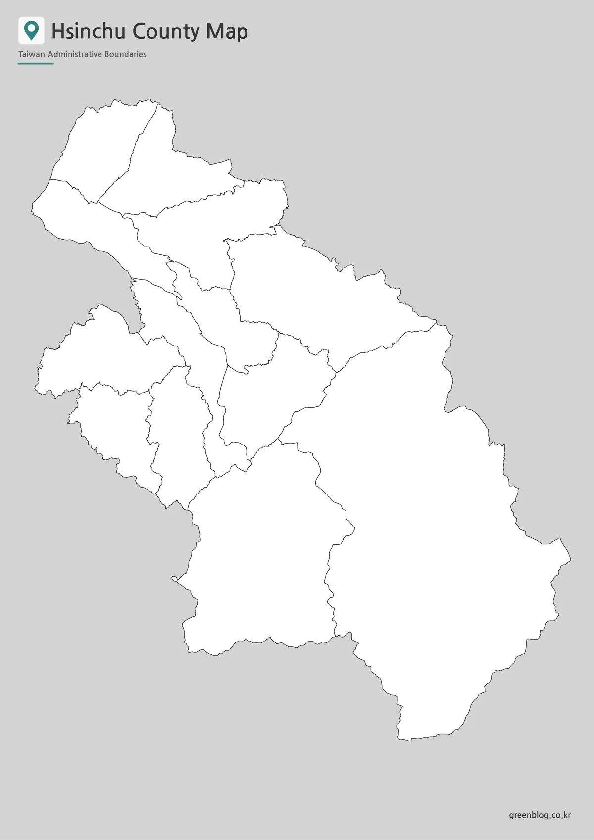
The outline map removes most visual distractions and keeps the boundary structure as the main focus. This version is useful for users who want to create their own customized Hsinchu County graphic. You can add colors, labels, route lines, population data, city markers, project notes, or presentation highlights depending on the purpose of your material.
For classroom activities, the blank map can be used as a coloring worksheet or administrative division exercise. For design projects, it can serve as a simple base map for infographics, travel explanation images, or blog visuals. Because Hsinchu County includes both coastal-side communities and wider mountain townships, the blank boundary layout gives users room to show different regional themes clearly.
Administrative Areas Included
Hsinchu County is divided into 13 administrative areas. These include one county-administered city, three towns, and nine townships.
- Zhubei City
- Zhudong Town
- Xinpu Town
- Guanxi Town
- Xinfeng Township
- Emei Township
- Baoshan Township
- Wufeng Township
- Hengshan Township
- Beipu Township
- Jianshi Township
- Qionglin Township
- Hukou Township
This list is useful when checking whether the map includes all major administrative areas within Hsinchu County. It also helps users avoid confusing Hsinchu County with Hsinchu City, which is a separate administrative area.
Practical Uses for This Map
A Hsinchu County map can be useful in many situations where a simple Taiwan location map is not enough. Students may use it for geography worksheets or regional comparison assignments. Teachers can include it in classroom handouts when explaining Taiwan’s county and city structure. Bloggers may use it as a visual reference for northern Taiwan content, while designers can turn the outline version into a custom infographic base.
The map also works well for presentation slides. When discussing Hsinchu County’s position between Taoyuan and Miaoli, or when comparing Hsinchu County with Hsinchu City, a clear administrative map makes the explanation easier to follow. For printed materials, the black and white version keeps the layout clean without relying on color.
Frequently Asked Questions
Is Hsinchu County the same as Hsinchu City?
No. Hsinchu County and Hsinchu City are separate administrative areas in Taiwan, so a Hsinchu County map should not be treated as a Hsinchu City map. Hsinchu County includes Zhubei City and several towns and townships, while Hsinchu City is managed separately.
What versions are included in this Hsinchu County map collection?
The collection includes a color map, a black and white map, and an outline map. Each version is designed for a different use case, such as presentation design, classroom printing, or custom editing.
Can I use the outline map for coloring or labeling?
Yes. The outline version is suitable for coloring activities, labeling exercises, infographic editing, and custom map projects.
Is the map useful for classroom materials?
Yes. The map can be used for Taiwan geography lessons, worksheets, regional comparison projects, and printable study resources.
Map File Information
This download includes printable Hsinchu County map versions for educational use, presentation design, document printing, and editable graphic projects.
- Included Versions: Color map, black and white map, outline map
- Printable Size: A3 layout
- File Type: Image files
- Intended Use: Classroom handouts, presentations, blog graphics, infographic editing, and printable reference materials
Additional Resources
- National Land Surveying and Mapping Center : A useful official map-related resource for checking Taiwan administrative boundary and mapping data.
Related Maps
- Printable Yilan County Map with Administrative Boundaries
- Kaohsiung City Map – Printable District Map Collection
- High Resolution Tainan City Map for Printing and Editing
- Taichung City Map for Printing, Editing, and Classroom Use
Green Map creates custom-edited map images using open geographic data sources such as geoBoundaries, Natural Earth, OpenStreetMap, and government open data.
These maps are edited visual materials, not raw data files, and are provided for education, documents, presentations, and graphic reference.