
A New Zealand Map needs more than a simple national silhouette to explain how the country is arranged. The North Island and South Island form the main visual axis, but Stewart Island/Rakiura lies beyond the southern coast and the Chatham Islands appear far to the east. Large stretches of water separate these land areas, so their relative positions are easier to understand on a dedicated map than through a list of names.
This collection contains three image-based versions: a color regional map, a black-and-white labeled map, and a blank outline map. The two labeled editions show regional boundaries, selected cities and coastal features, the Tasman Sea, the South Pacific Ocean, and several offshore islands. The outline edition removes the labels and fills while preserving the same geographic arrangement for custom work.
Teachers, students, bloggers, travelers, and presentation designers can use the set for different stages of a project. The color map gives the quickest overview, the monochrome map provides a restrained labeled reference, and the outline image leaves room for coloring, route lines, statistics, or new labels. None of the three should be treated as a road, terrain, or navigation map.
Table of Contents
Reading the New Zealand Map Across Water
New Zealand extends along a northeast-to-southwest axis in the South Pacific. The North Island occupies the upper part of the main map, and the larger South Island continues toward the southwest. Cook Strait separates the two main islands, although the strait is not named on the supplied images. Stewart Island appears below Southland, while the Chatham Islands are placed separately to the east.
Water labels help establish orientation on the New Zealand Map. The Tasman Sea is shown west of the main islands, and the South Pacific Ocean appears to the east. Great Barrier Island is labeled northeast of Auckland, and several coastal names—including Bay of Plenty, Hawke’s Bay, Golden Bay, Pegasus Bay, Canterbury Bight, Karamea Bight, and South Taranaki Bight—provide additional reference points.
The maps use a wide landscape page so the distant Chatham Islands can remain visible without compressing the long shape of the main islands. That decision creates generous open water around the land, but the space is functional rather than decorative. It allows the offshore group to be shown in geographic context and gives large ocean labels room to sit away from regional names.
Regional Boundaries and Place Names
New Zealand has 16 regions in its regional-council geography. On the North Island, the mapped divisions include Northland, Auckland, Waikato, Bay of Plenty, Gisborne, Hawke’s Bay, Taranaki, Manawatū-Whanganui, and Wellington. On and around the South Island, the system includes Tasman, Nelson, Marlborough, West Coast, Canterbury, Otago, and Southland.
The labeled New Zealand Map does not present all 16 regional names in the same way. Fifteen appear as prominent uppercase regional labels, while Nelson is shown primarily as a city name near the top of the South Island. The regional boundary is still part of the map, but readers should not assume that every small label has the same administrative role. The Chatham Islands Territory is outside the 16-region classification.
Several city names assist orientation, including Whangārei, Auckland, Hamilton, Tauranga, Gisborne, New Plymouth, Napier, Palmerston North, Wellington, Nelson, Blenheim, Greymouth, Christchurch, Ashburton, Timaru, Dunedin, and Invercargill. These are selected reference points rather than a complete city inventory. Their markers do not supply roads, travel distances, population rankings, or administrative boundaries of the urban areas.
Some spellings on the images use older or simplified forms. Most notably, Manawatu Wanganui appears where the current standard regional name is Manawatū-Whanganui. In accompanying text, it is better to use current forms such as Whangārei and Manawatū-Whanganui while recognizing that the raster labels themselves may retain the older spelling.
Color Regional and Location Map
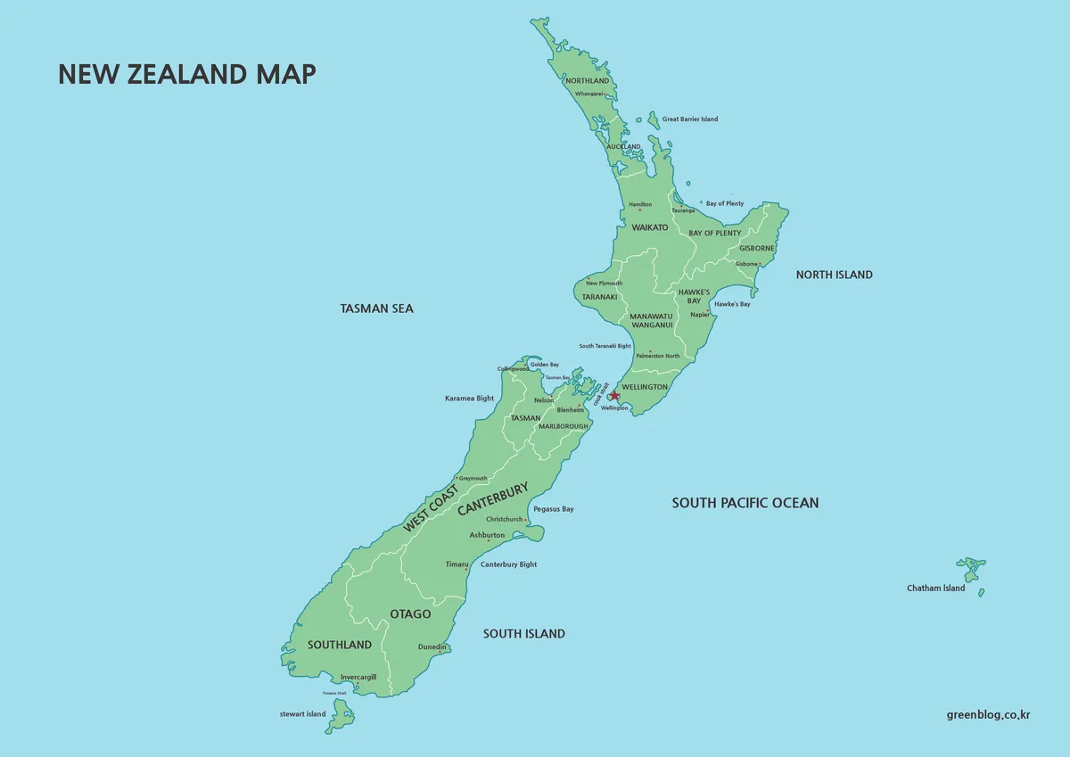
The color New Zealand Map uses green land against a blue water background, with white lines separating regional areas. Because the regional fills use a consistent green family rather than unrelated colors, the country reads as one connected geographic subject. Boundaries remain visible without overpowering the coastlines or city markers.
This edition is especially effective for showing the North Island–South Island relationship, the position of Wellington near Cook Strait, and the separation of the Chatham Islands from the main landmass. A red star identifies Wellington, and smaller markers locate selected cities. The combination suits introductory slides, country profiles, travel overviews, and graphics where readers need both broad structure and named reference points.
Black-and-White Labeled Map
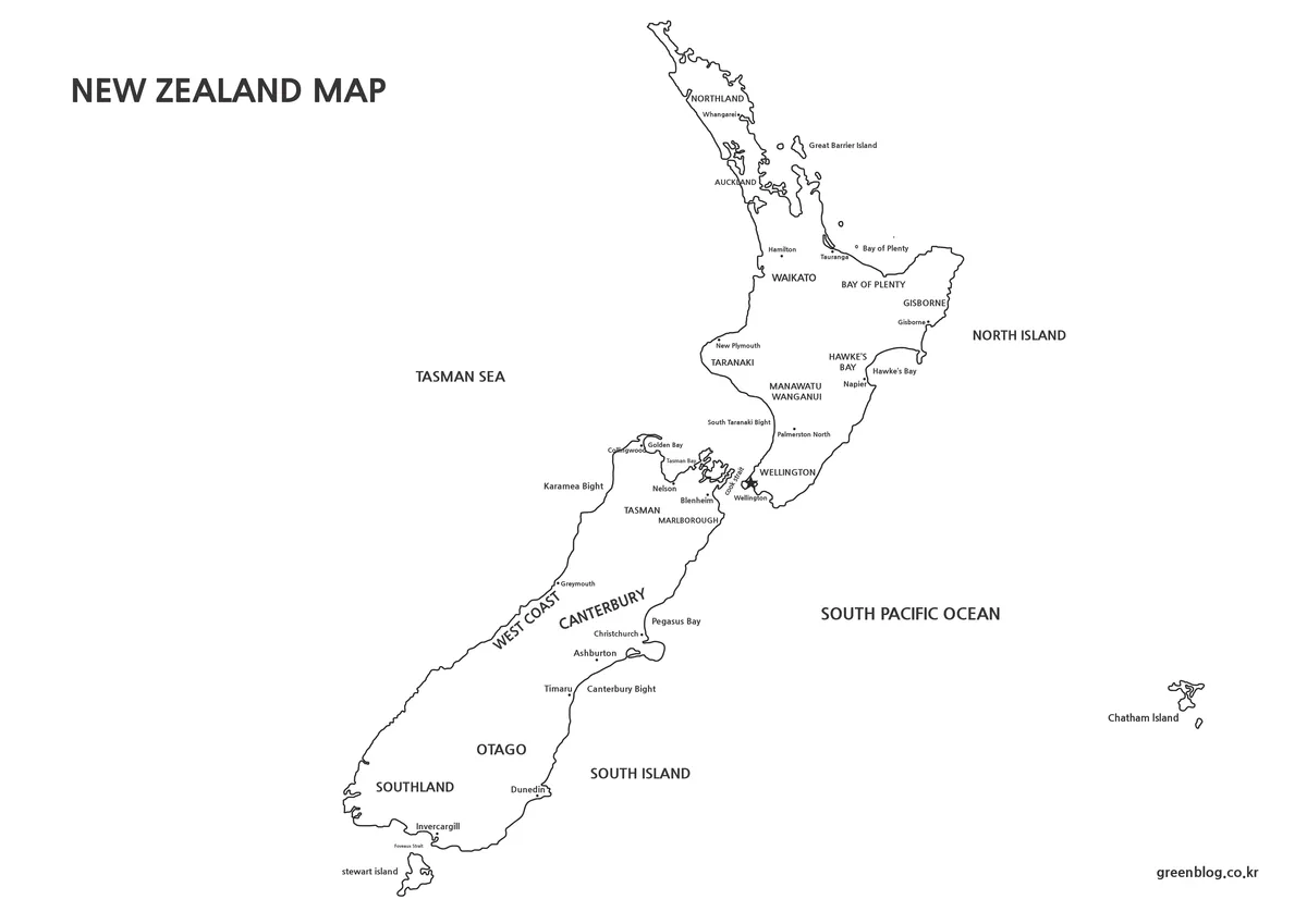
The monochrome New Zealand Map removes the green and blue fills but retains region names, selected cities, islands, bays, and surrounding waters. Black boundary lines carry the regional structure, while open white space makes it easier to place the image beside paragraphs, tables, or photographs. It is a labeled reference rather than simply a color map converted to grayscale.
Label readability depends on output size. Northland, Auckland, Tasman, Marlborough, and the Wellington area contain several names within limited space, while the Chatham Islands label sits far from the main islands. Check these smaller elements in print preview before producing handouts. The monochrome version is appropriate when geographic labels must remain visible but a colored background would compete with the rest of the page.
Blank Regional Outline
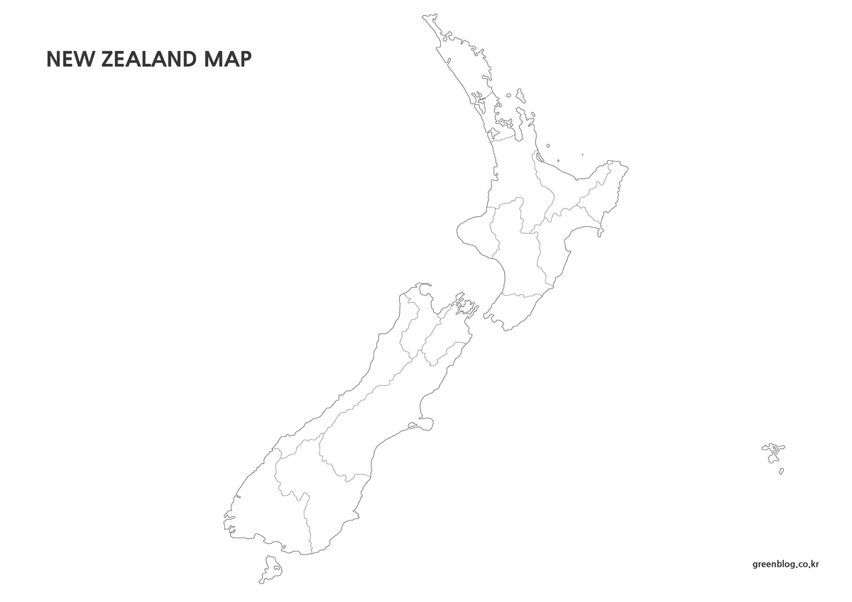
The outline New Zealand Map retains the national coastlines, regional divisions, Stewart Island, the Chatham Islands, and smaller visible islands while removing all place names and background color. Its clean structure makes it suitable for labeling exercises and custom thematic graphics. As a raster image, it should be described as an annotation base rather than an editable vector or source file.
Students can label the two main islands, add Stewart Island/Rakiura and the Chatham Islands, identify the 16 regions, or mark Wellington and other selected cities. Designers can shade regions with verified statistics, draw a multi-island route, or add bilingual place names. A legend should clearly separate newly added information from the boundaries already contained in the map.
Choosing a Version and Preserving Clarity
Choose the file according to what the audience must do. Use color when viewers need a quick geographic overview on a screen. Select black and white when they need a finished labeled reference for a report or worksheet. Choose the outline when the task depends on recall, coloring, route drawing, data shading, or custom annotation.
All three attached previews measure 1200 × 849 pixels. Preserve the landscape proportions when inserting the New Zealand Map into a document or slide. Stretching it vertically would distort the long alignment of the main islands, while aggressive cropping on the right could remove the Chatham Islands and change the geographic meaning of the layout.
The color and monochrome maps contain many small labels, so a large print format does not automatically guarantee readability if the image has been heavily compressed. Review the northern North Island, Cook Strait area, upper South Island, and Chatham Islands at the intended output size. Avoid repeated resaving when preparing a final image or PDF.
Classroom, Travel, and Data Applications
A geography lesson can move from recognition to recall. Begin with the color edition to locate the North Island, South Island, Stewart Island, Chatham Islands, Tasman Sea, and South Pacific Ocean. Continue with the black-and-white version to review regions and selected cities, then use the outline map as an unlabeled exercise.
For a travel presentation, the New Zealand Map can introduce movement between islands or broad regional stages, but it cannot provide driving directions. Route lines, ferry crossings, airports, and travel times must come from current transport sources. Numbered markers with a separate itinerary key will usually remain clearer than adding long attraction names directly to the map.
The outline edition can also support regional comparisons involving a cited dataset. A creator might shade regions by population, land use, climate category, or another verified measure, but the map itself contains none of those values. Include the data year, units, source, and a clear legend so readers do not mistake area size or green shading in the original color map for statistical information.
Frequently Asked Questions
What geographic features are included in the New Zealand Map?
The labeled versions show regional boundaries, selected cities, the North and South Islands, Stewart Island, the Chatham Islands, Great Barrier Island, the Tasman Sea, the South Pacific Ocean, and several bays or bights. Roads, terrain shading, travel distances, and detailed urban boundaries are not included.
Does the collection show all 16 regions?
The regional boundary framework represents New Zealand’s 16-region system, but only 15 regional names are displayed prominently. Nelson appears mainly as a city label. The Chatham Islands Territory is shown geographically but is outside the 16 regional-council areas used by Stats NZ.
Which version is best for printing and written notes?
Choose the black-and-white labeled map when names must remain available in a handout or report. Its open background also provides room for circling places and adding short notes. Always inspect smaller labels near Auckland, Wellington, Nelson, and the Chatham Islands at the intended print size.
Can the blank map be used for regional data?
Yes. Add a limited color scale, legend, source, units, and reference year to the outline edition. Confirm that the data correspond to the same regional geography shown on the map, and treat the Chatham Islands separately when the dataset places the territory outside the 16 regions.
Are all city and region names shown in their current forms?
Not completely. The image uses Manawatu Wanganui, while the current standard regional name is Manawatū-Whanganui. Some other labels omit macrons. Use current official spellings in surrounding text, captions, tables, and newly added annotations even when the original raster label cannot be changed.
Map File Information
This ZIP download contains three image-based New Zealand map styles for regional reference, printing, presentations, labeling, and custom annotation.
- Included Versions: Color labeled map, black-and-white labeled map, and blank regional-outline map
- File Type: Image files grouped in a ZIP archive
- Intended Use: Classroom handouts, country profiles, travel slides, regional labeling, blog graphics, and infographic projects
Related Maps
Additional Resources
- 100% Pure New Zealand — Explore New Zealand: Explore official visitor information about the country’s islands, regions, destinations, and travel connections.
Green Map creates custom-edited map images using open geographic data sources such as geoBoundaries, Natural Earth, OpenStreetMap, and government open data. These maps are edited visual materials, not raw data files, and are provided for education, documents, presentations, and graphic reference.