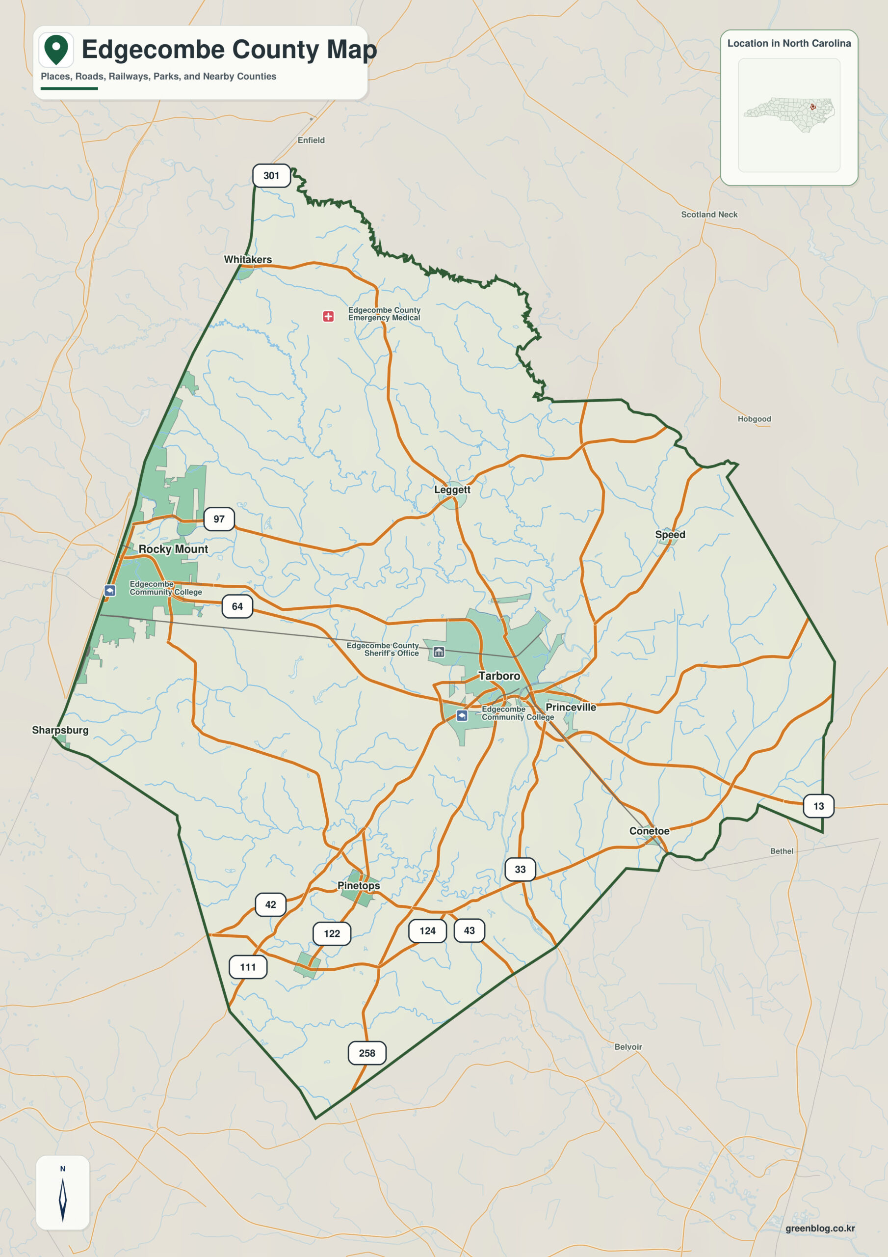
Edgecombe County North Carolina map has two unusual urban relationships: Tarboro and Princeville sit close together across the Tar River floodplain, while Rocky Mount is split by the Edgecombe–Nash county line farther west.
Tarboro, Rocky Mount, and Princeville do not need to perform the same map role. When Tar River and Tar River Reservoir are treated as a second, physical layer, settlement pattern and natural geography remain clearly separated.
Edgecombe County quick facts
- County seat: Tarboro
- North Carolina setting: eastern Coastal Plain
- Place references: Tarboro, Rocky Mount, Princeville
- Physical references: Tar River, Tar River Reservoir, floodplain
- Neighboring counties: Halifax, Martin, Nash, Pitt, Wilson
Read Tarboro and Princeville as a pair
Tarboro serves as the county seat and Princeville occupies the opposite side of the nearby river landscape. Moving west to Rocky Mount introduces a different pattern in which a large urban area itself crosses the political boundary.
A major city divided by the county line
Halifax borders Edgecombe to the north, Martin and Pitt to the east, and Wilson to the southwest. Following the Tar River and reservoir corridor through those directions separates floodplain geography from the western metropolitan boundary.
Floodplain geography and local history
Edgecombe was formed from Bertie County in 1741. Princeville, founded by formerly enslaved people after the Civil War, adds a distinctive historical layer to the floodplain relationship around Tarboro.
This county is clearer when settlement references (Tarboro, Rocky Mount, Princeville) and physical references (Tar River, Tar River Reservoir) remain separate. The distinction improves both geographic interpretation and later use of demographic, transport, or recreation layers.
Using the river to orient the county
- compare Tarboro and Rocky Mount through the Tar River reference
- orient the Halifax side of the county before reading smaller local labels
- use the county image as a base layer before moving to street, parcel, hazard, or navigation mapping
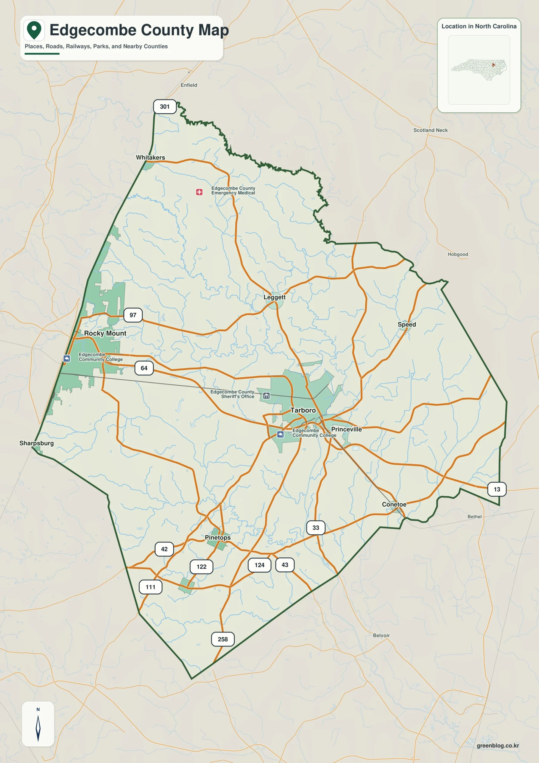
Edgecombe County single map file
The image above is a web preview. The button is reserved for the separate original map asset used in the publishing workflow.
Download the Edgecombe County map fileFrequently Asked Questions
Why is Tar River useful when comparing Tarboro with the outer county?
The value of Tar River is that it explains physical orientation while the named communities explain settlement. Using both layers together produces a more accurate county-scale reading.
What would be lost by folding Rocky Mount into a Tarboro-centered description?
Tarboro and Rocky Mount do not need to have the same administrative status to be equally useful for orientation. One marks the seat; the other helps represent a different part of the county.
Sources
Related County Maps
Green Map creates custom-edited map images using open geographic data sources such as geoBoundaries, Natural Earth, OpenStreetMap, and government open data.
These maps are edited visual materials, not raw data files, and are provided for education, documents, presentations, and graphic reference.