New York County Map resources are useful for much more than locating New York City on a state map. Teachers preparing geography lessons, students working on regional studies, bloggers creating travel content, and designers producing infographics often need a detailed county-level view of New York. Because the state covers a large geographic area and contains 62 counties, understanding regional relationships is much easier with a county map than with a simple state outline.
This printable New York County Map collection includes three versions: a color county map, a black and white labeled map, and a blank outline map for editing. All files were prepared as high-resolution JPG resources suitable for A3 printing. The collection was designed for classroom handouts, travel presentations, regional comparison projects, educational worksheets, and graphic design work that requires a clean county layout.
Located in the northeastern United States, New York borders Pennsylvania, New Jersey, Connecticut, Massachusetts, Vermont, and the Canadian provinces of Ontario and Quebec. Major population centers such as New York City, Buffalo, Rochester, Albany, Syracuse, and Yonkers are spread across different parts of the state, making county boundaries especially useful when explaining regional structure.
Whether the goal is education, presentation design, or custom map editing, a detailed New York County Map provides a clearer understanding of how the state’s regions connect.
During the map preparation process, special attention was given to county boundaries, label placement, and print readability. Large-format printing tests were reviewed to ensure that county names remain visible when enlarged, while boundary lines remain clear in both color and black and white formats.
Table of Contents
New York County Map Overview
The collection includes three separate versions designed for different purposes.
Included files:
- Color county map
- Black and white labeled county map
- Blank outline county map
- High-resolution JPG format
- A3 printable layout
Designed for:
- Classroom reference
- Educational worksheets
- Travel presentations
- Blog graphics
- Regional comparison materials
- Infographic design projects
Because New York contains multiple geographic regions such as the Hudson Valley, Finger Lakes, Western New York, Long Island, and the Adirondack region, county-level maps often provide a more useful visual reference than a basic state map.
Color-Coded County Layout
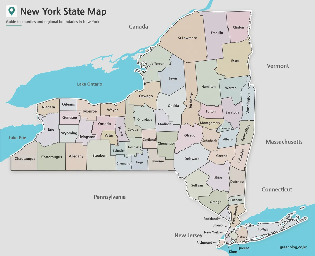
The color version was created to make county boundaries easier to distinguish at a glance. New York’s 62 counties create a complex administrative structure, and neighboring counties can be difficult to separate when using only boundary lines.
Different colors help users identify regional patterns quickly. This format works especially well for classroom presentations, travel articles, and educational content where visual clarity is important. Regional divisions around New York City, the Hudson Valley, the Finger Lakes region, and Western New York become easier to explain when county boundaries are highlighted with contrasting colors.
While preparing the collection, adjacent counties were reviewed to avoid similar color combinations. The final layout was also checked at larger print sizes to ensure visual separation remains clear when projected or printed.
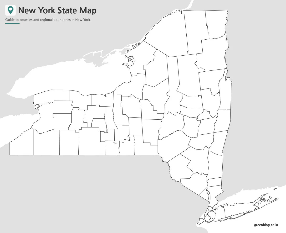
Black and White New York County Map
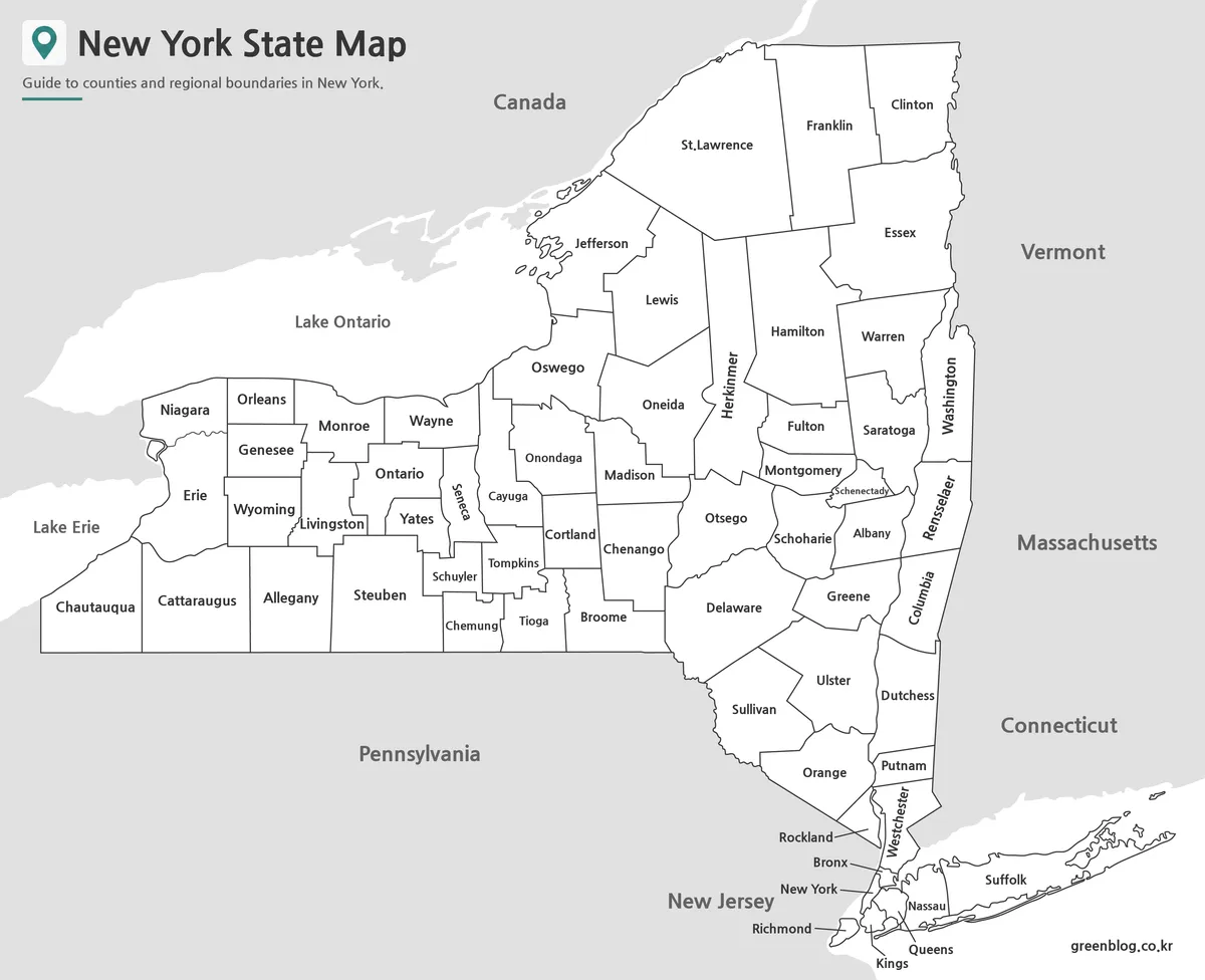
The labeled black and white version focuses on county names and administrative boundaries without relying on color. This creates a cleaner appearance for reports, printed handouts, worksheets, and academic projects.
County labels were adjusted to improve readability in densely populated areas and smaller counties. The layout was reviewed in grayscale printing conditions so that boundary lines remain visible even when color printing is unavailable.
This version also works well when users need to add notes, routes, statistical data, or regional highlights directly onto the map. The simplified design leaves more room for custom annotations without reducing readability.
Outline Map for Editing Projects
The outline version removes labels and colors while keeping county boundaries intact. This creates a flexible base layer for editing, annotation, and custom map design.
Many users prefer a blank county map when creating infographics, educational worksheets, tourism materials, or presentation graphics. The simplified structure allows specific counties or regions to be highlighted without visual distractions.
For New York, this format is particularly useful when emphasizing areas such as Long Island, the Hudson Valley, the Adirondacks, the Niagara region, or the Finger Lakes. Custom color schemes, tourism routes, and data visualizations can be added easily using graphic design software.
Boundary lines were refined to remain visible when enlarged, helping maintain clarity for both print and digital projects.
Practical Uses for a New York County Map
A New York County Map is often used in situations where regional detail matters more than statewide geography.
Common examples include:
- Geography and social studies lessons
- Classroom worksheets
- Regional comparison projects
- Travel planning presentations
- Tourism guides
- Blog graphics
- Demographic analysis
- Infographic creation
- County-based data visualization
Because population centers and economic regions are distributed across the state, county boundaries often provide a more meaningful visual reference than city markers alone.
Frequently Asked Questions
What does the New York County Map include?
The New York County Map collection includes color, labeled, and outline versions showing all county boundaries across the state.
Can I print the maps in A3 size?
Yes. The files were prepared as high-resolution resources and reviewed for large-format printing.
Is the outline version editable?
Yes. The blank version is intended for annotations, custom coloring, infographic projects, and educational activities.
Are all county boundaries included?
Yes. Every version includes county boundary lines, while labels and colors vary depending on the map style.
New York County Map Download
Choose the version that best fits your project. Printable and editable map files are included.
- File Format: JPG
- Image Size: A3 High Resolution
- Map Types: Color, Black & White, Outline
- Intended Usage: Printing, Education, Presentations, Editing
Additional Resources
- New York State GIS Program Office – Official geographic information and county boundary resources for New York State.
Related Maps
- Free Florida Map Download – High Resolution Printable Maps
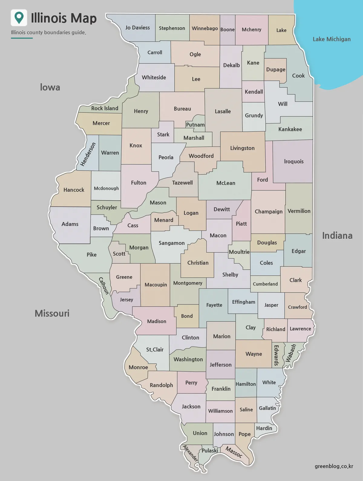
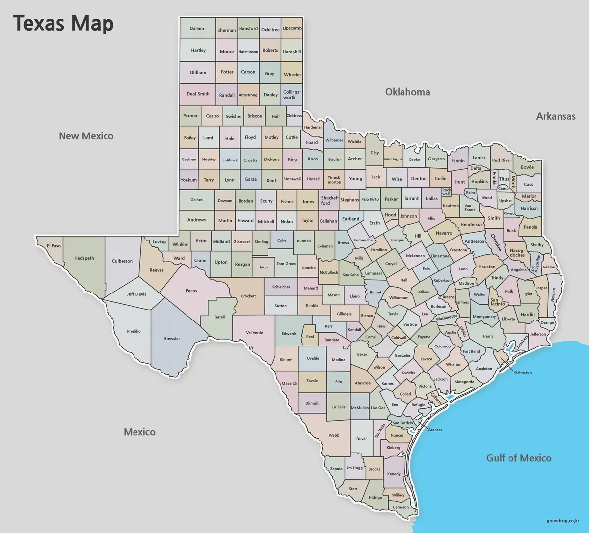
- Free Printable Texas Map Set for Education, Presentations and Editing
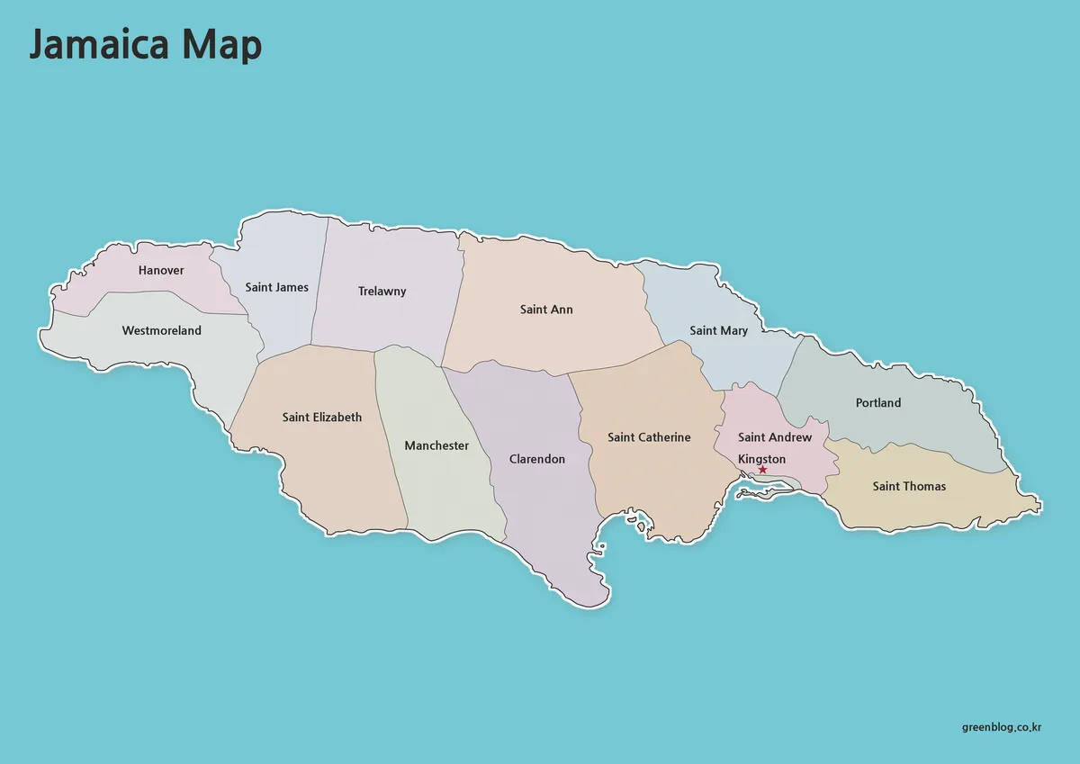
- Jamaica Map Download Pack for Printing, Education and Design Projects
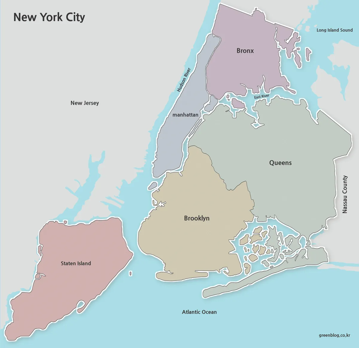
- Printable New York City Map Collection – Color, Black and White & Outline Maps