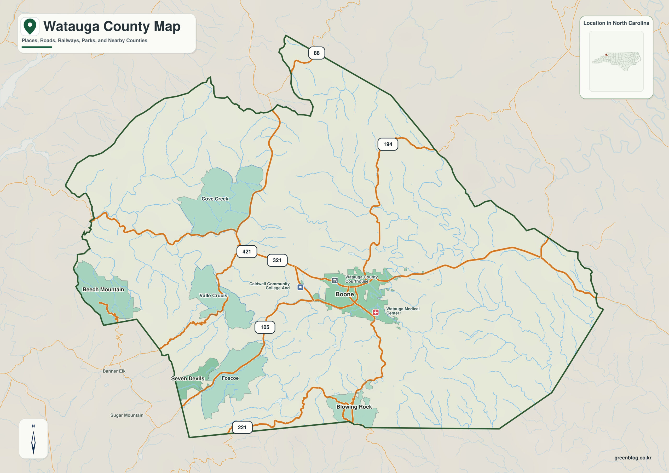
Watauga County North Carolina map is best read as a High Country county centered on Boone, with Blowing Rock to the southeast, Valle Crucis in a separate valley, and New River/Blue Ridge Parkway terrain structuring the mountains. Boone, Blowing Rock, and New River headwaters should be treated as separate orientation anchors rather than one center-and-suburb hierarchy.
The county becomes easier to read in two layers: settlement anchors (Boone, Blowing Rock, Valle Crucis) and physical anchors (New River headwaters, Blue Ridge Parkway). That division adds context without turning every place into the same kind of center.
Watauga County quick facts
- County seat: Boone
- North Carolina setting: High Country / Blue Ridge Mountains
- Place references: Boone, Blowing Rock, Valle Crucis
- Physical references: New River headwaters, Blue Ridge Parkway, high Blue Ridge terrain
- Neighboring counties: Ashe, Avery, Caldwell, Wilkes
Boone university core versus mountain tourism
Boone is the county seat and university center, Blowing Rock is a southeastern tourism town, and Valle Crucis occupies a separate valley setting. They differ in elevation, access, and function.
Blue Ridge Parkway and New River headwaters
Watauga County notes that the Blue Ridge Parkway runs through the county. New River headwaters and high ridges strongly shape roads and settlement, making valleys and passes more meaningful than straight-line distance.
Blowing Rock and Valle Crucis occupy different settings
Watauga is a defining High Country county. Boone’s university urban area, Blowing Rock’s tourism corridor, and rural mountain valleys should remain distinct map contexts.
A practical reading sequence starts at Boone, expands to Blowing Rock and Valle Crucis, and then checks New River headwaters and Blue Ridge Parkway. That order keeps local function, county administration, and physical geography from collapsing into one description.
Comparing elevation and functional zones
Separate Boone’s university urban data, Blowing Rock tourism, and Valle Crucis valley context. Blue Ridge Parkway and New River headwaters can then explain elevation and access without collapsing all mountain communities into one corridor.
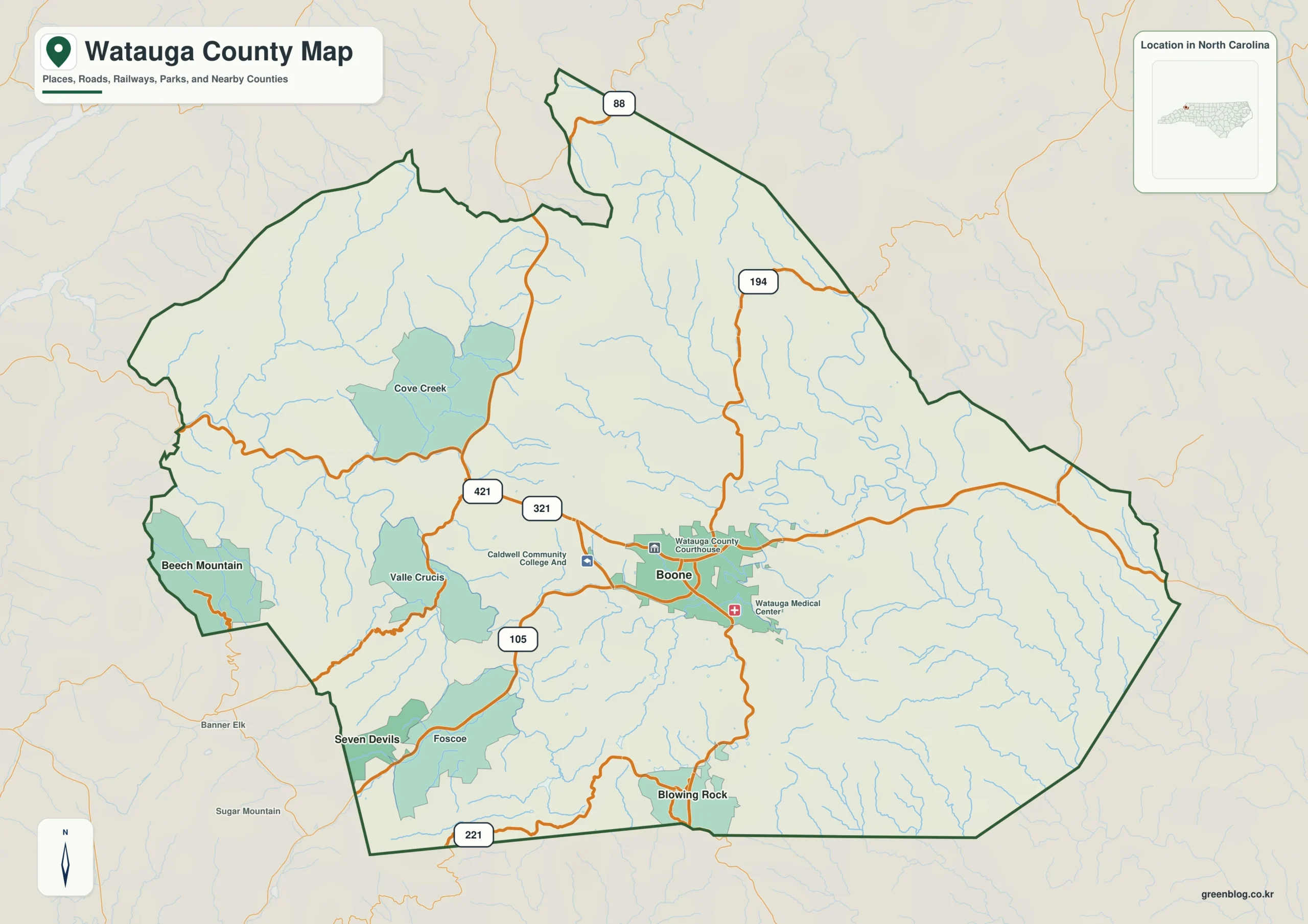
Watauga County single map file
The image above is a web preview; the button is reserved for the separate original map asset.
Download the Watauga County map fileFrequently Asked Questions
Why use New River headwaters as a physical frame for Watauga County?
Starting with New River headwaters gives Boone and the outer communities a common geographic frame. Adding Blue Ridge Parkway then clarifies how the county’s natural setting differs across its mapped area.
How does Blowing Rock broaden the map beyond the administrative center?
The two names represent different map roles rather than competing centers. Boone establishes administration, while Blowing Rock adds another functional or geographic zone.
Sources
Related County Maps
Green Map creates custom-edited map images using open geographic data sources such as geoBoundaries, Natural Earth, OpenStreetMap, and government open data.
These maps are edited visual materials, not raw data files, and are provided for education, documents, presentations, and graphic reference.