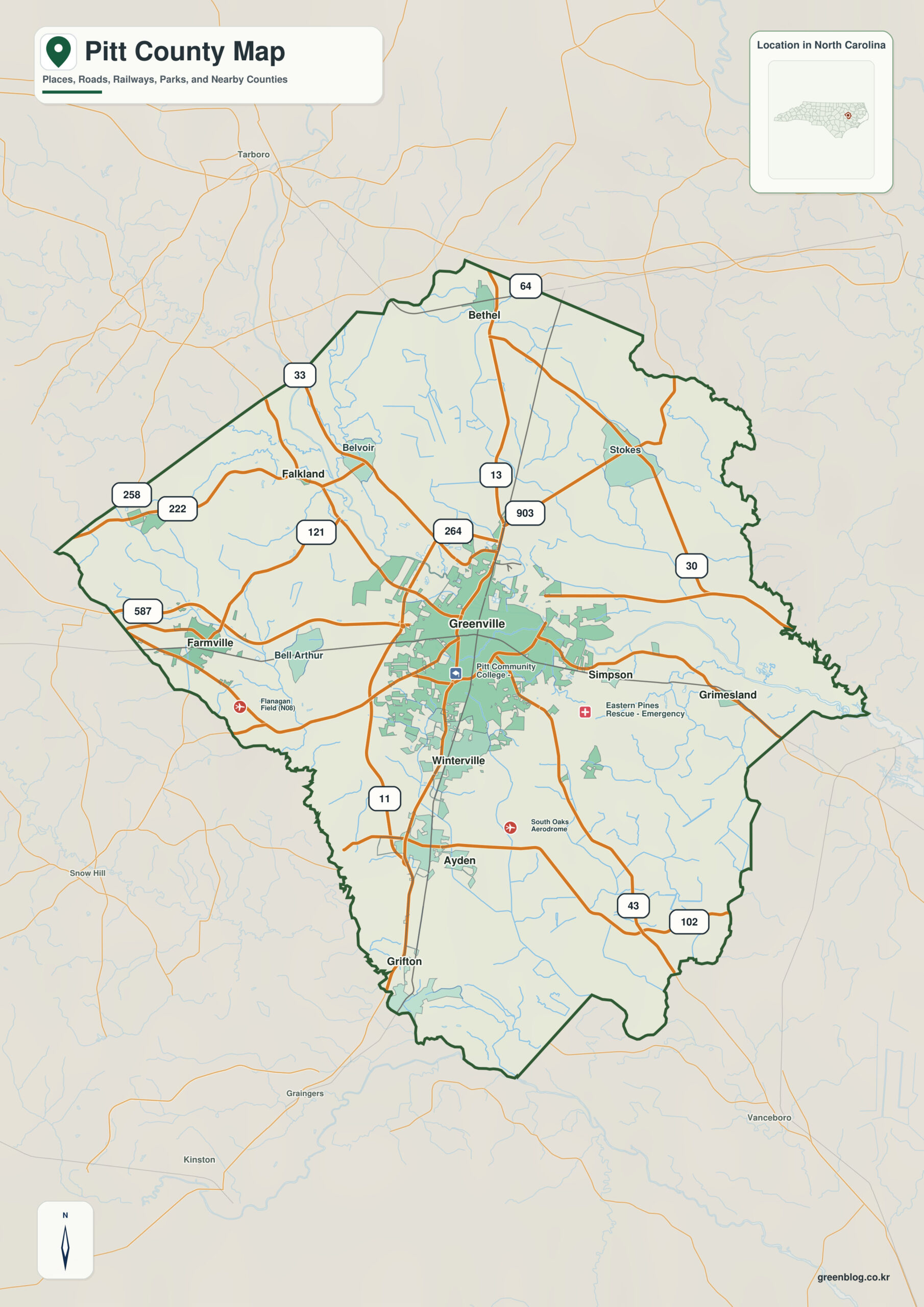
Pitt County North Carolina map cannot be reduced to Greenville’s urban scale. Ayden to the south, Farmville to the west, and the Tar River floodplain provide separate anchors for the large agricultural and lowland landscape surrounding the university-medical core.
Start with Greenville, but keep Ayden and Farmville independent rather than treating them as minor extensions of the county seat. Tar River and Contentnea Creek system provide physical orientation that municipal boundaries alone cannot supply.
Pitt County quick facts
- County seat: Greenville
- North Carolina setting: eastern Coastal Plain
- Place references: Greenville, Ayden, Farmville
- Physical references: Tar River, Contentnea Creek system, Coastal Plain lowlands
- Neighboring counties: Beaufort, Craven, Edgecombe, Greene, Lenoir, Martin, Wilson
Greenville is not the whole county
Greenville is the dominant urban, university, and medical center, while Ayden anchors the south and Farmville the west. Together they separate the metropolitan core from broad rural areas.
Tar River and the southern/western towns
Pitt County notes that the Tar River and many creeks and swamps drain the county, with riverine flooding a common hazard. Waterways should therefore be read before municipal edges.
Lowland drainage beneath urban growth
Pitt has evolved from a heavily agricultural Coastal Plain county into a Greenville-centered university, medical, and service region, while extensive farmland and lowland drainage still dominate the outer county.
Tar River provides the outer physical orientation, while Greenville supplies the administrative center. Ayden and Farmville fill in the settlement pattern between those two kinds of reference.
Separating city geography from floodplain
In Pitt County, Greenville’s urban data and Tar River/creek floodplain data should occupy different layers. Ayden and Farmville provide southern and western anchors so countywide agricultural conditions are not mistaken for features of the Greenville core.
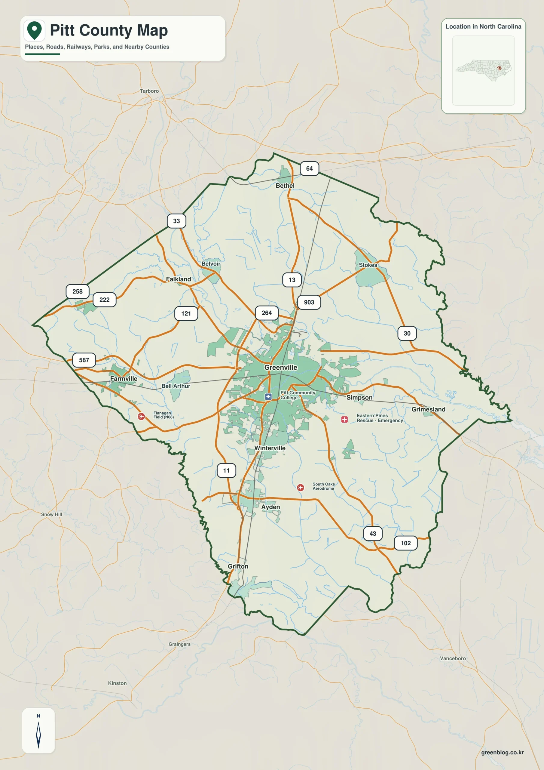
Pitt County single map file
The image above is a web preview; the button is reserved for the separate original map asset.
Download the Pitt County map fileFrequently Asked Questions
What local geographic pattern becomes clearer around Tar River?
Tar River represents part of the county’s physical framework; Greenville, Ayden, and Farmville represent settlement. The two layers should remain distinct so urban or administrative importance does not erase terrain or water context.
What additional local context does Ayden provide?
Ayden extends the map beyond a seat-centered description. It provides another settlement anchor for reading areas that would otherwise be represented only through Greenville.
Sources
Related County Maps
Green Map creates custom-edited map images using open geographic data sources such as geoBoundaries, Natural Earth, OpenStreetMap, and government open data.
These maps are edited visual materials, not raw data files, and are provided for education, documents, presentations, and graphic reference.