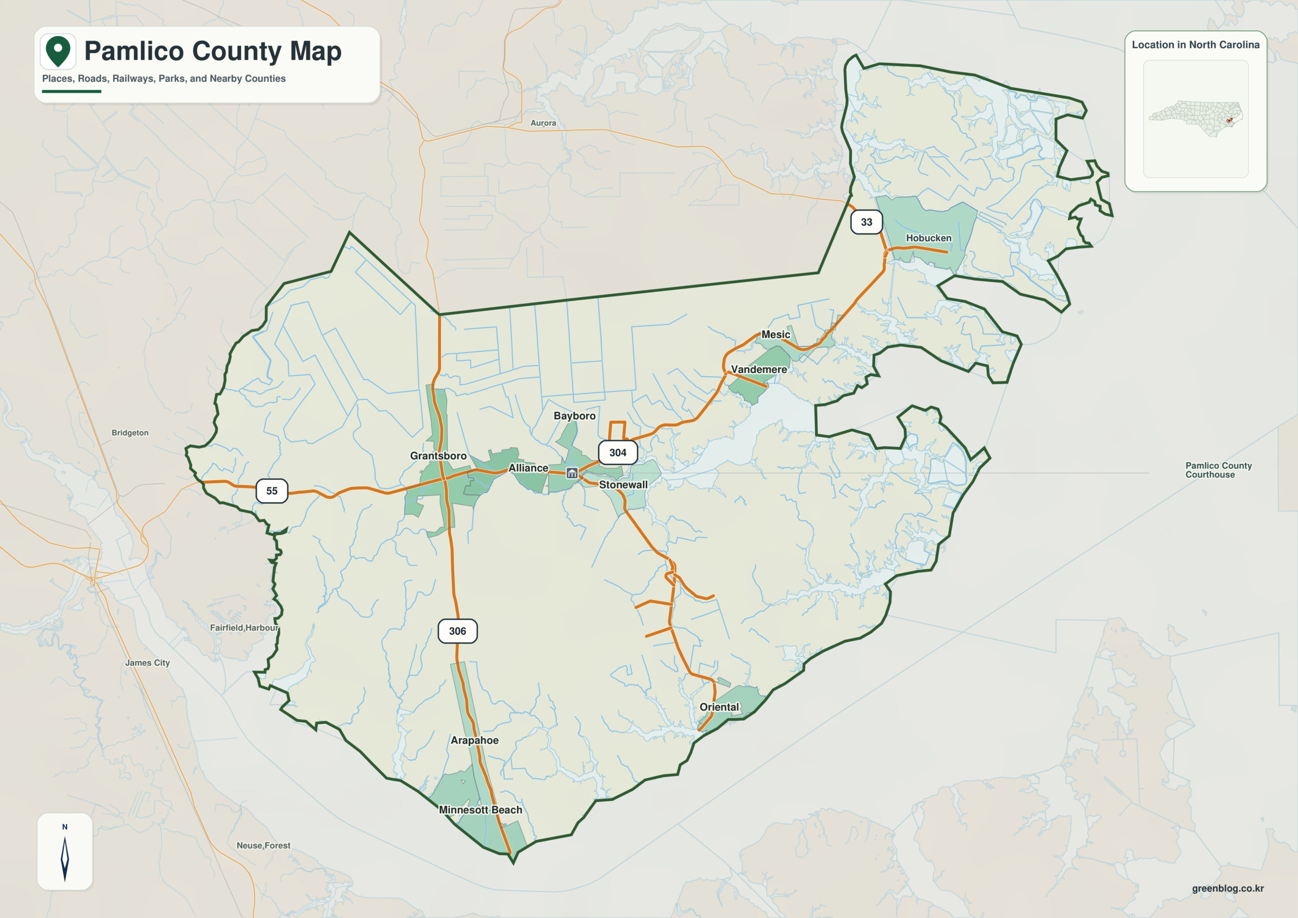
Pamlico County North Carolina map is best read as a low-lying peninsula-and-creek county where inland Bayboro, Oriental on the Neuse side, and Vandemere toward Pamlico Sound occupy different waterfront settings. Bayboro alone does not explain the county; Oriental and Neuse River provide equally important orientation.
Read Bayboro and Oriental through the Neuse River reference, then use Vandemere and Pamlico Sound to extend the map outward. This produces a more informative county-scale interpretation than a simple list of towns.
Pamlico County quick facts
- County seat: Bayboro
- North Carolina setting: Inner Banks / Pamlico Sound coast
- Place references: Bayboro, Oriental, Vandemere
- Physical references: Neuse River, Pamlico Sound, Bay River
- Neighboring counties: Beaufort, Craven
Water comes before town hierarchy
Bayboro lies inland on the Bay River system, Oriental sits on the Neuse waterfront, and Vandemere faces toward Pamlico Sound. Each community belongs to a different water setting despite their small geographic separation.
Neuse, Bay River, and Pamlico Sound
Creeks and bays divide Pamlico’s land into many peninsulas. The Neuse River, Pamlico Sound, and Bay River therefore orient the county more effectively than its short road distances or small town hierarchy.
Peninsulas shape settlement spacing
Pamlico was formed from Craven and Beaufort Counties in 1872 and named for Pamlico Sound. Both the Neuse River and the sound shape county boundaries and settlement.
Neuse River provides the outer physical orientation, while Bayboro supplies the administrative center. Oriental and Vandemere fill in the settlement pattern between those two kinds of reference.
Reading a creek-and-sound county
Pamlico County is particularly useful as a water-body reference map. Boating, fishing, flood, or coastal information should be attached to the correct creek, river, or sound side rather than assumed to radiate from Bayboro.
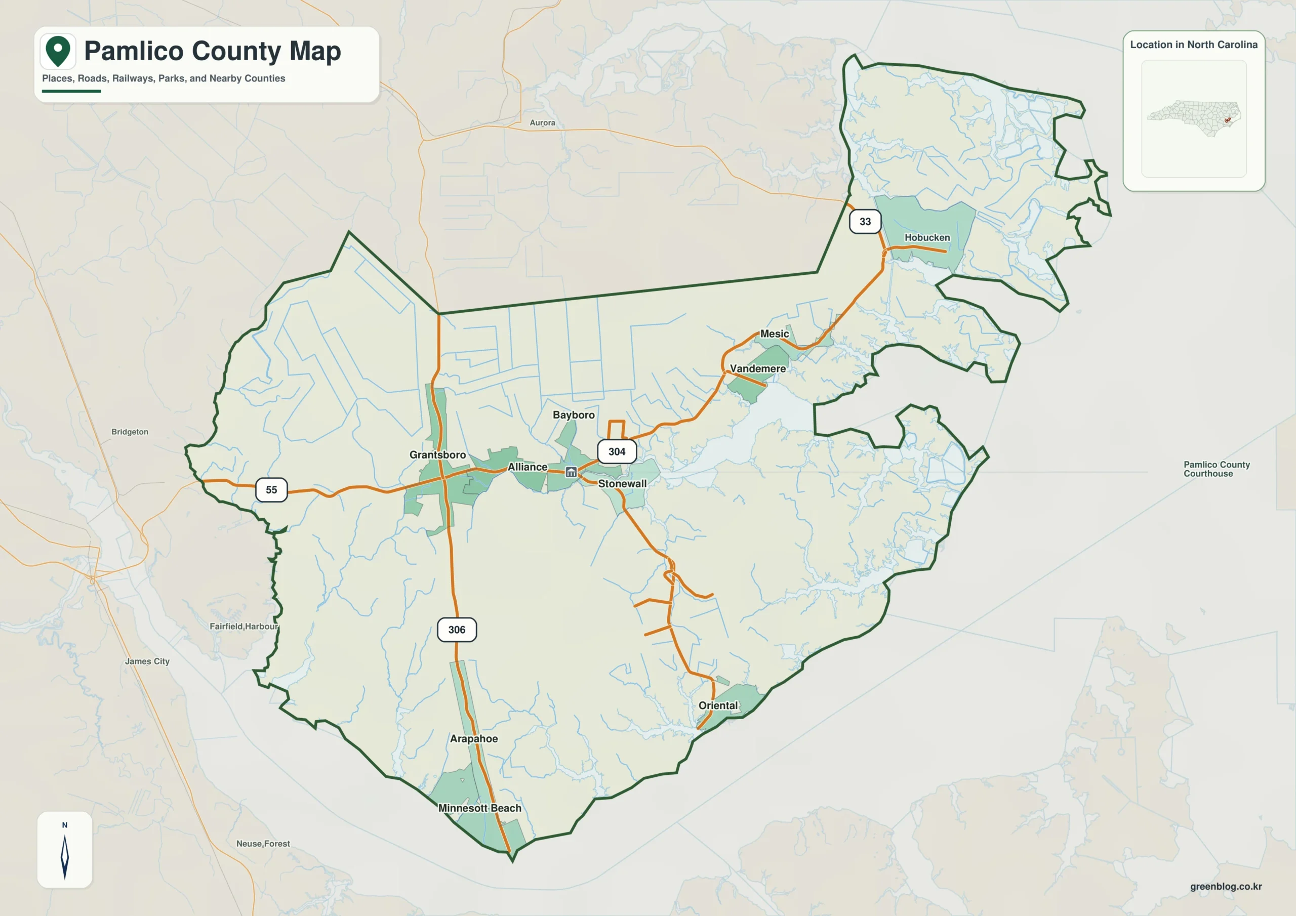
Pamlico County single map file
The image above is a web preview; the button is reserved for the separate original map asset.
Download the Pamlico County map fileFrequently Asked Questions
How does Neuse River sharpen the contrast between the county center and its surroundings?
Neuse River represents part of the county’s physical framework; Bayboro, Oriental, and Vandemere represent settlement. The two layers should remain distinct so urban or administrative importance does not erase terrain or water context.
What part of the county is easier to understand through Oriental?
Oriental extends the map beyond a seat-centered description. It provides another settlement anchor for reading areas that would otherwise be represented only through Bayboro.
Sources
Related County Maps
Green Map creates custom-edited map images using open geographic data sources such as geoBoundaries, Natural Earth, OpenStreetMap, and government open data.
These maps are edited visual materials, not raw data files, and are provided for education, documents, presentations, and graphic reference.