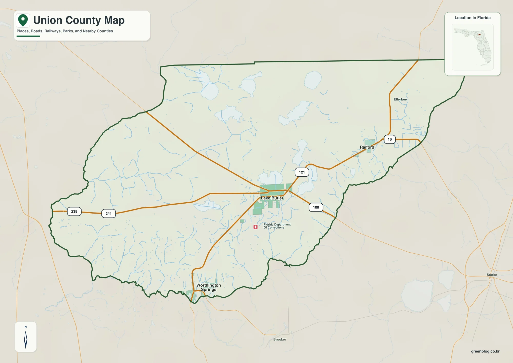
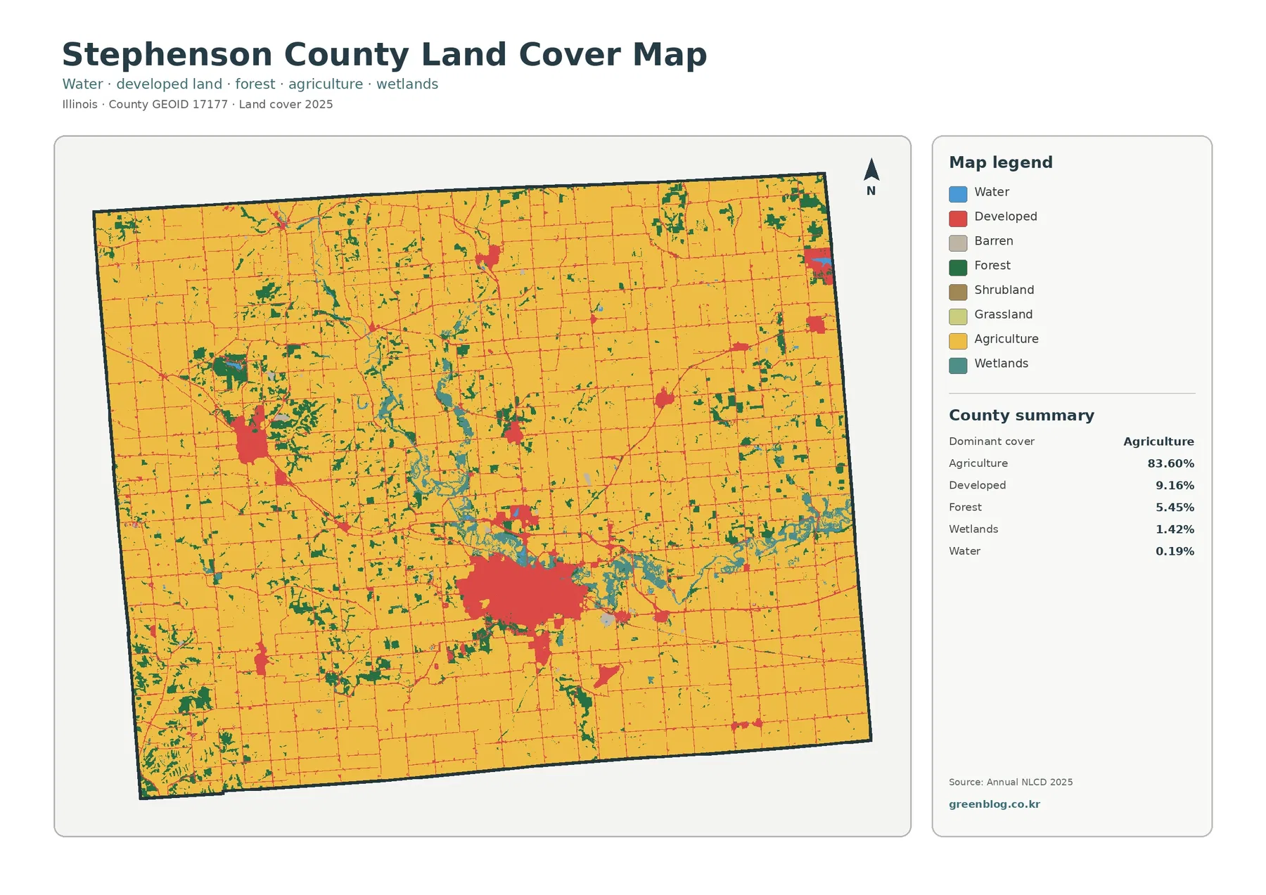
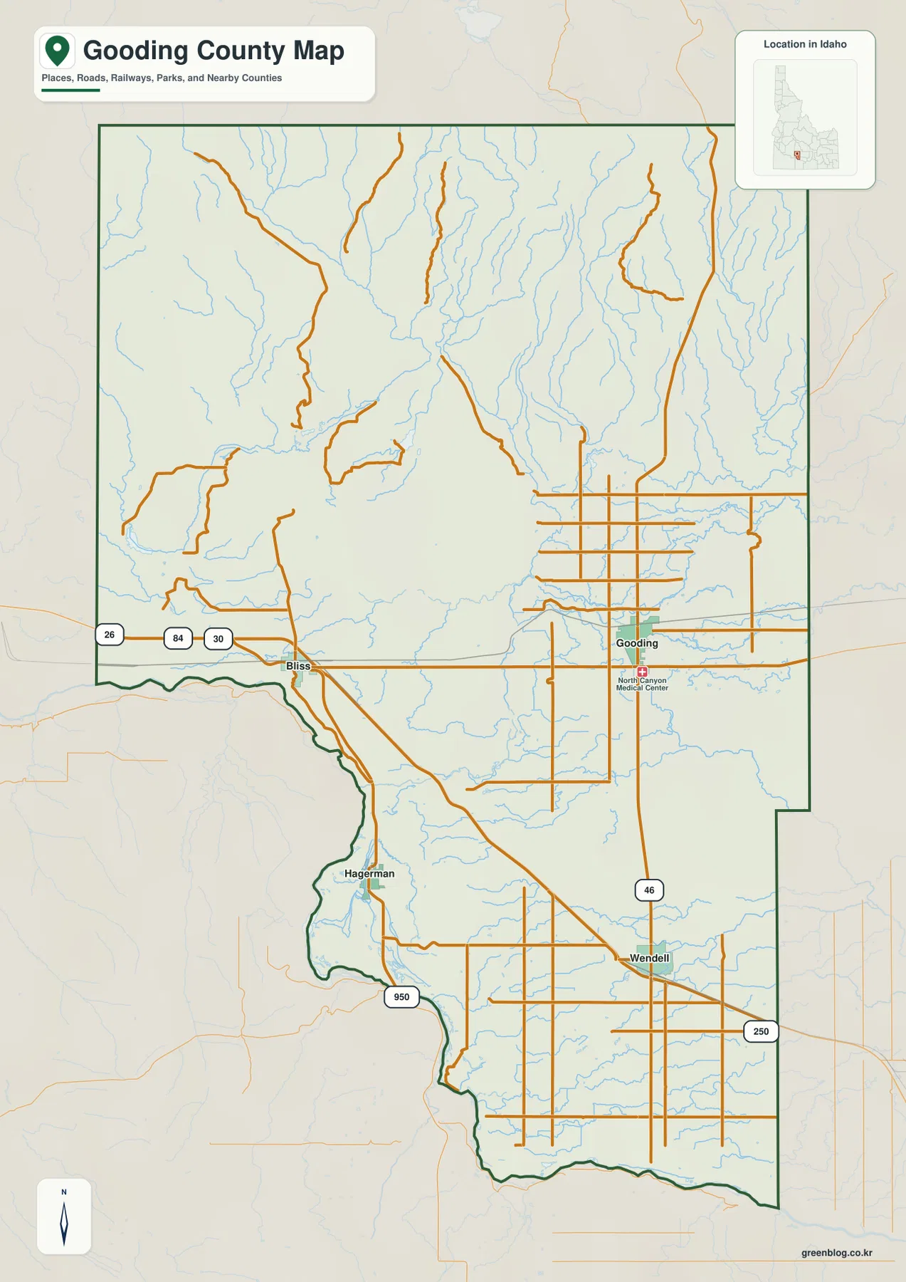
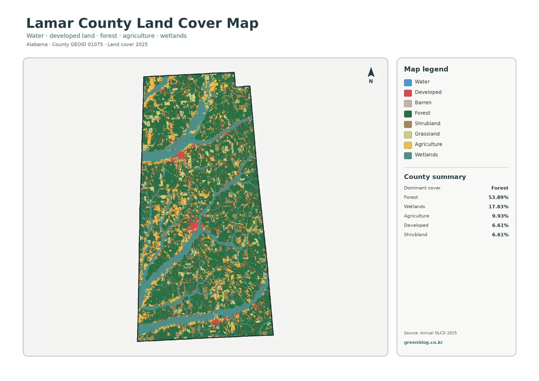
A Franklin County Alabama Map is most useful when it shows more than the county outline. Franklin County lies in the northwestern corner of Alabama, with Russellville near the center of local government and travel, Red Bay and Vina close to the Mississippi side, and Phil Campbell in the hillier southeastern part of the county. The maps on this page separate roads and community labels from city distribution, waterways, and elevation so each subject stays readable. You can also download four high-resolution A3 JPG maps in one ZIP file for printing, classroom work, trip planning, or general reference.
The four graphics answer different practical questions without forcing every detail onto a single sheet. The county map is the best starting point for U.S. 43, Alabama 24, county boundaries, and named communities. The city map strips away some of that detail to show how Russellville, Red Bay, Phil Campbell, Hodges, and Vina are spread across the county. A dedicated water map brings out Bear Creek, Little Bear Creek, reservoirs, ponds, and smaller tributaries, while the elevation map makes the lower western terrain and the higher eastern and southeastern uplands easy to compare.
Table of Contents
Franklin County at Alabama’s Mississippi border
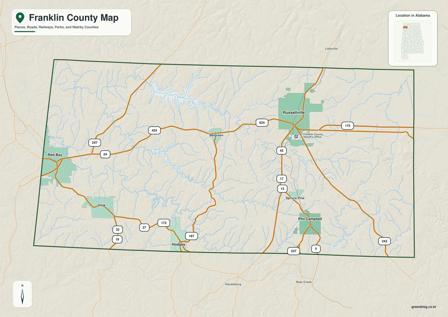
Franklin County occupies northwest Alabama and meets Mississippi along its western edge. Colbert County is to the north, Marion County is to the south, and Lawrence and Winston counties are on the eastern and southeastern side. That setting matters because Franklin County does not function like a suburb of one large city. Its communities face several different directions: Russellville connects north toward the Shoals area, Red Bay and Vina sit near the state line, and the southeastern communities are tied to a more rolling interior landscape.
Russellville is the county seat and the clearest point of orientation on the main map. U.S. 43 runs through the city from north to south, while Alabama 24 crosses the county from west to east. Once those two roads are located, most other labels fall into place. Red Bay sits near the western boundary, Vina is farther south on that side, and Phil Campbell is southeast of Russellville. Belgreen and Spruce Pine also appear as useful local labels even though they are not part of the county’s official list of five incorporated municipalities.
Franklin County government lists Russellville, Red Bay, Phil Campbell, Vina, and Hodges as its incorporated municipalities. The U.S. Census Bureau counted 32,113 residents in the county in 2020 and estimated 32,449 residents on July 1, 2025. The county’s 633.92 square miles of land make those communities relatively spread out, so a map that shows roads alongside place names is more useful than a simple outline when you are trying to understand how one part of the county connects with another.
| State | Alabama |
|---|---|
| County | Franklin County |
| County seat | Russellville |
| 2025 population estimate | 32,449 |
| 2020 Census population | 32,113 |
| 2020 land area | 633.92 sq mi |
| Incorporated municipalities | Russellville, Red Bay, Phil Campbell, Vina, Hodges |
| Main routes | U.S. 43, AL 24, AL 19, AL 13 |
No Interstate crosses Franklin County, which makes the U.S. and state highways especially important for understanding local travel. U.S. 43 is the strongest north-south route through Russellville. Alabama 24 gives the county an east-west connection, and Alabama 19 is important on the Red Bay and Vina side. Alabama 13/5 serves the Phil Campbell area and continues toward the southern part of northwest Alabama. The simplified county map does not show every local road, but it provides enough context to see why Russellville is the main road and service center.
Russellville and the county’s five incorporated places
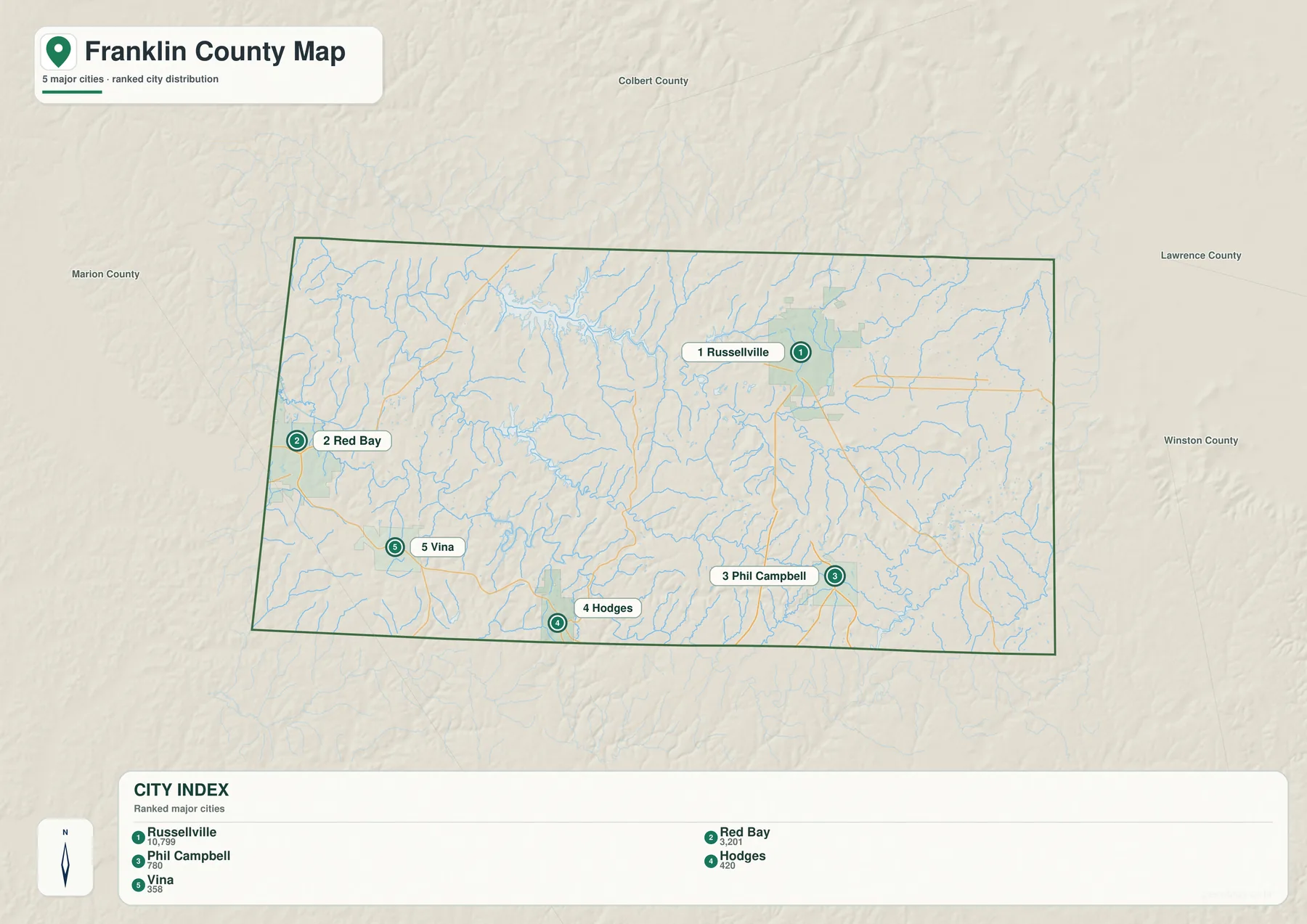
The city map is useful because it removes much of the road detail and lets the settlement pattern stand on its own. Russellville is clearly the dominant place and sits close to the county’s central transportation routes. Red Bay is separated from Russellville on the far western side, close to Mississippi. Vina lies south of Red Bay, while Phil Campbell is southeast of Russellville. Hodges is in the southern interior, west of Phil Campbell, so it should not be described as a northeastern community near Lawrence County.
That correction matters when the page is used for schoolwork or local reference. A reader who only sees a list of five municipality names could easily assume that they are clustered around Russellville. They are not. The map shows a dispersed pattern: one larger county-seat city in the middle, two small places toward the western state line, and smaller towns spread across the southern and southeastern part of the county. The gaps between those places contain extensive rural land, streams, reservoir shorelines, and local roads.
The city index is designed for quick relative comparison rather than turn-by-turn navigation. If the full city graphic includes connector lines or distance values, those measurements should be treated as straight-line distances, not driving mileage. Actual road travel can be longer because routes bend around water, hills, and local road networks. This is particularly important west of Russellville, where the Bear Creek system creates long coves and reservoirs between communities.
For a simple presentation, the city map works well on its own. It can show where the county seat is, which communities are closest to Mississippi, and which places lie in the southern part of Franklin County without requiring the reader to study every highway shield. For a travel-oriented question, however, it is better to place this map beside the county map. The city graphic gives the settlement pattern, while the road map explains how those places are actually connected.
Bear Creek waterways and the reservoir landscape
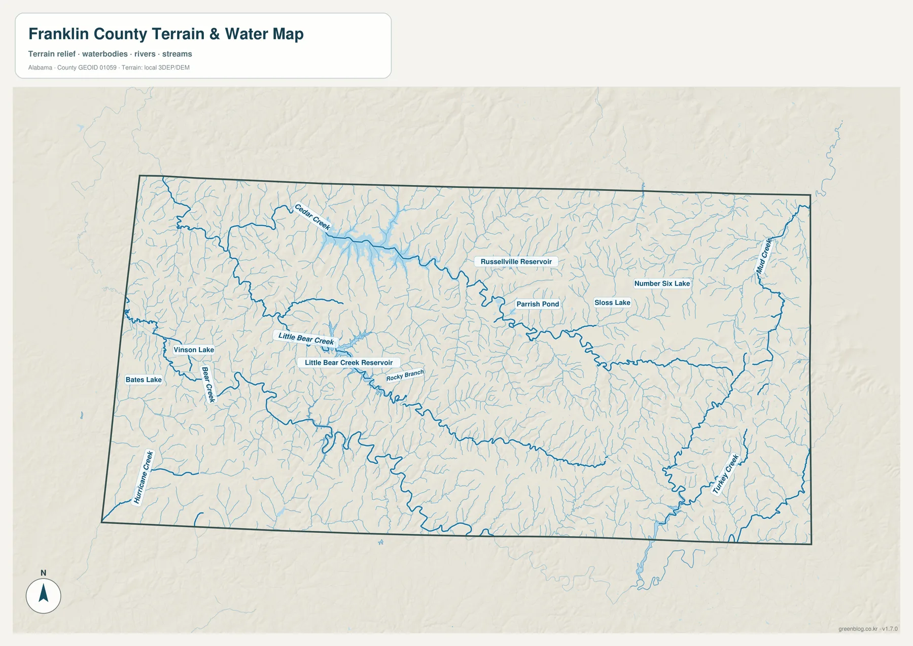
Water is one of the most distinctive features of western Franklin County. The water map labels Bear Creek, Little Bear Creek, Cedar Creek, Turkey Creek, Hurricane Creek, and many smaller tributaries. It also marks Little Bear Creek Reservoir, Russellville Reservoir, Vinson Lake, Bates Lake, Parrish Pond, Sloss Lake, Number Six Lake, and other named water bodies. Seen together, those features make it clear that Franklin County is not organized around one single river. It has a branching system of creeks, impoundments, and small lakes that cuts through the county from several directions.
The Bear Creek system is especially important near Red Bay and the western half of the county. TVA places Bear Creek Dam in Franklin County about ten miles southeast of Red Bay, and Bear Creek Reservoir extends for roughly twelve miles upstream from the dam. Little Bear Creek Reservoir is about fifteen miles west of Russellville and lies entirely within Franklin County. These are not just features on the state boundary; they occupy the interior of the county and help explain why roads between Russellville, Red Bay, Vina, and nearby rural communities often take indirect routes.
TVA groups Bear Creek, Upper Bear Creek, Little Bear Creek, and Cedar Creek as a set of small tributary reservoirs in northwest Alabama. Their purposes include flood-damage reduction, water supply, and recreation. Bear Creek Dam itself has no hydroelectric generators, so this is not a map of a large power-producing complex. For most readers, the useful information is the shape and location of the water bodies, the surrounding creek network, and the way those waters divide the rural road landscape.
The water map is also helpful for pairing natural features with the elevation map. Streams occupy the lower grooves between ridges, and reservoirs spread into those lower valleys. The map can support general recreation planning, regional geography, or classroom study, but it is not a flood-hazard map, parcel map, legal boundary survey, or navigation chart. Water levels and access conditions can also change, so boating, fishing, or land-use decisions should rely on the appropriate official source rather than this general reference graphic.
Elevation rises into the eastern and southeastern uplands
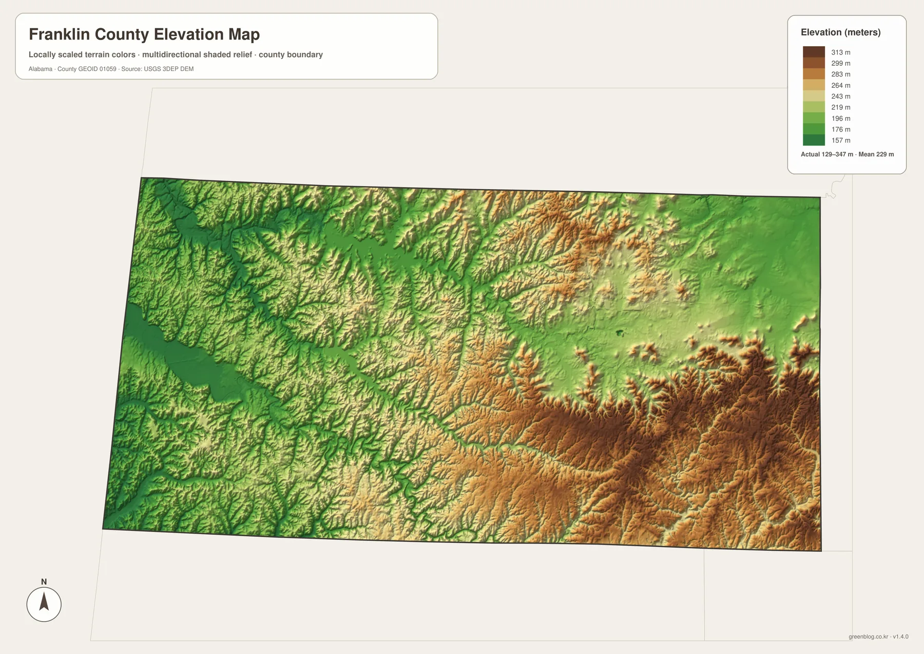
The elevation map adds context that the road and city maps cannot provide. The graphic reports an actual elevation range of about 129 to 347 meters, with a mean near 229 meters. The western side contains more of the lower green tones, while higher tan and brown terrain becomes more common toward the east and southeast. The contrast is strongest across the rolling ridges near the Phil Campbell side and the southeastern edge of the county.
Russellville sits between those two broad terrain zones. Moving west toward Red Bay and the Bear Creek reservoir area generally brings more lower terrain and broader creek valleys. Moving east and southeast reveals more closely spaced ridges and valleys. When the elevation and water maps are compared side by side, the relationship becomes easier to see: many streams follow lower corridors through the hills, and reservoirs occupy elongated valley shapes rather than round, isolated basins.
This map should be read as a county-scale terrain reference, not as survey-grade elevation measurement. The shading and locally scaled colors are intended to make relative high and low areas visible across a large area. They are useful for understanding why some roads bend, why drainage routes follow certain valleys, or why the eastern part of the county looks more rugged. They are not precise enough to determine the elevation of a house lot, design a construction project, calculate a property slope, or replace field surveying.
For general geographic study, the terrain contrast helps explain why Franklin County’s settlement pattern is uneven. Russellville developed around the central road network, while western communities relate closely to the state line and reservoir country. The southeastern side, including Phil Campbell and nearby rural areas, sits in a more broken upland landscape. That does not mean the entire east is mountainous or the entire west is flat, but the broad difference is clear enough on the supplied elevation graphic to be useful.
Which Franklin County map should you use?
Choose the county map when you need the best all-purpose reference. It combines the boundary, major roads, streams, and familiar community names, making it suitable for a report, a travel overview, or a quick location check. Choose the city map when the goal is to compare Russellville, Red Bay, Vina, Hodges, and Phil Campbell without a dense road background. The water map is the better choice for Bear Creek, Little Bear Creek, reservoirs, and tributaries, while the elevation map is the clearest way to explain the west-to-east terrain difference.
For printed material, the downloadable JPG files provide more detail than the compressed WebP previews used in the article. The ZIP contains four original high-resolution A3 maps, so you can keep the complete set and then use only the sheet that fits a particular task. A teacher might pair the city map with the elevation map, for example, while someone comparing roads and recreation areas may prefer the county map beside the water map.
It is also useful to remember what each map does not show. The county map is not a legal parcel map. The water sheet does not identify current flood risk or safe boating routes. The elevation surface is generalized and should not be used for engineering measurements. Keeping those limits in mind makes the map set more useful, because each graphic can be used for the kind of broad geographic reference it was designed to provide.
The WebP images in the article are convenient for quick viewing, but the JPG archive is the better option when you need to zoom into smaller labels or print at A3 size. Waterway names and fine terrain shading are especially easier to inspect in the original files. Because all four JPGs are packaged together, there is no need to download each map separately.
Frequently Asked Questions
Why is Russellville the best starting point on the Franklin County map?
Russellville is the county seat, the largest of Franklin County’s incorporated places, and the point where the main local road pattern is easiest to understand. U.S. 43 runs north and south through the city, while Alabama 24 provides an important east-west route. Once Russellville is located, Red Bay and Vina can be placed to the west and southwest, with Phil Campbell and Hodges across the southern part of the county.
Where are the main Bear Creek reservoirs in relation to Russellville and Red Bay?
The Bear Creek reservoir country is concentrated west and southwest of Russellville. TVA places Bear Creek Dam about ten miles southeast of Red Bay, while Little Bear Creek Reservoir is about fifteen miles west of Russellville and lies entirely within Franklin County. The water map also shows Cedar Creek and many smaller tributaries, so it is the best sheet for understanding how water features break up the western road network.
Can the elevation map be used for property or engineering measurements?
No. The elevation map is a county-scale reference that shows broad terrain differences, including the lower western side and higher eastern and southeastern uplands. Its reported range of roughly 129 to 347 meters is useful for regional comparison, but a specific property, building site, or construction project requires authoritative detailed elevation data or a professional survey.
Map File Information
Franklin County A3 map files
- Included Files: 4 high-resolution JPG map files shown in this article
- File Type: JPG files in a ZIP archive
- Intended Use: Printing, education, presentations, and map-based projects
Related Maps
Sources and further reference
The article uses the supplied map previews together with official county, Census, transportation, reservoir, and elevation sources. The links below are useful for checking current statistics or obtaining more specialized information than a general printable map can provide.
- U.S. Census Bureau QuickFacts – Franklin County, Alabama
- Franklin County official website – county seat and incorporated municipalities
- Alabama Department of Transportation – Highway Functional Classification Maps
- TVA – Bear Creek Reservoir Land Management Plan
- TVA – Little Bear Creek Reservoir Land Management Plan
- USGS 3D Elevation Program
- Alabama Population Density Map: Urban Clusters, County Totals and a Decade of Change
- Franklin County Alabama Land Cover Map: Forest-Farm Contrast and 4 JPG Downloads
Green Map creates custom-edited map images using open geographic data sources such as geoBoundaries, Natural Earth, OpenStreetMap, and government open data. These maps are edited visual materials, not raw data files, and are provided for education, documents, presentations, and graphic reference.