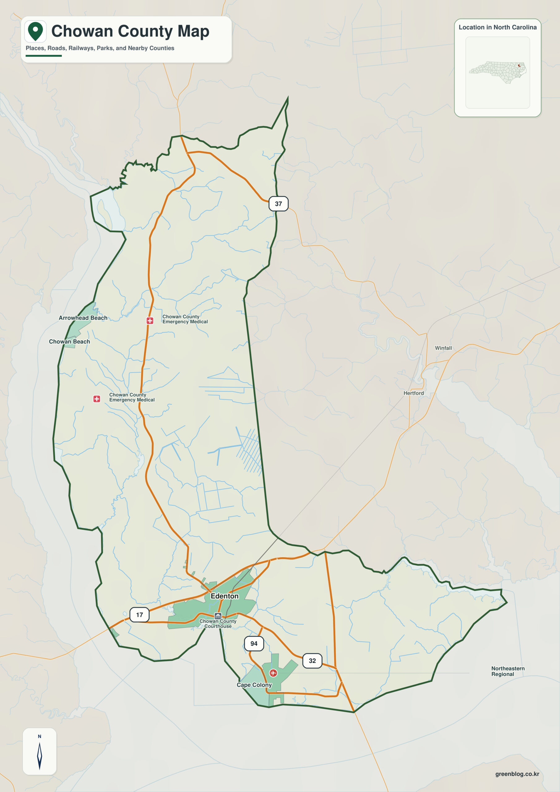
Chowan County North Carolina map is more informative when Albemarle Sound is treated as the first orientation point rather than as a decorative label. The southern side opens onto Albemarle Sound and the western side connects with the Chowan River, so water provides a stronger orientation than roads alone. That relationship explains a compact Inner Banks county where Edenton faces Albemarle Sound near the Chowan River.
Use Edenton as the administrative reference, then keep Tyner and Rocky Hock as separate settlement anchors. Reading those places against Albemarle Sound and Chowan River makes it easier to distinguish functional geography from the county boundary itself.
Chowan County quick facts
- County seat: Edenton
- North Carolina setting: northeastern Inner Banks
- Place references: Edenton, Tyner, Rocky Hock
- Physical references: Albemarle Sound, Chowan River, Edenton Bay
- Neighboring counties for orientation: Bertie, Gates, Perquimans
Read the strongest physical feature first
Edenton works best as a waterfront anchor rather than simply a county-seat label. Albemarle Sound lies to the south, the Chowan River defines the western water context, and inland Tyner gives the northern half a separate reference.
Settlement anchors with different roles
Edenton Bay creates a small protected-water setting inside the much larger Albemarle system. Reading Rocky Hock and Tyner outward from that bay makes the county’s compact rural interior easier to distinguish from its shoreline.
How history and geography overlap
Chowan’s administrative roots reach back to 1668, and Edenton’s long history as a port remains visible in the modern spatial pattern. The county is therefore better interpreted from shore to interior than from largest town to smallest town.
Edenton works as the administrative reference, while Tyner provides a second settlement perspective. Keeping Albemarle Sound and Chowan River as physical references prevents municipal information and landscape information from being treated as the same thing.
Useful limits of a county reference map
- compare Edenton and Tyner using Albemarle Sound as the physical reference
- orient the Bertie side of the boundary before reading smaller settlement labels
- use the county image as a reference layer before switching to street, parcel, hazard, or navigation mapping
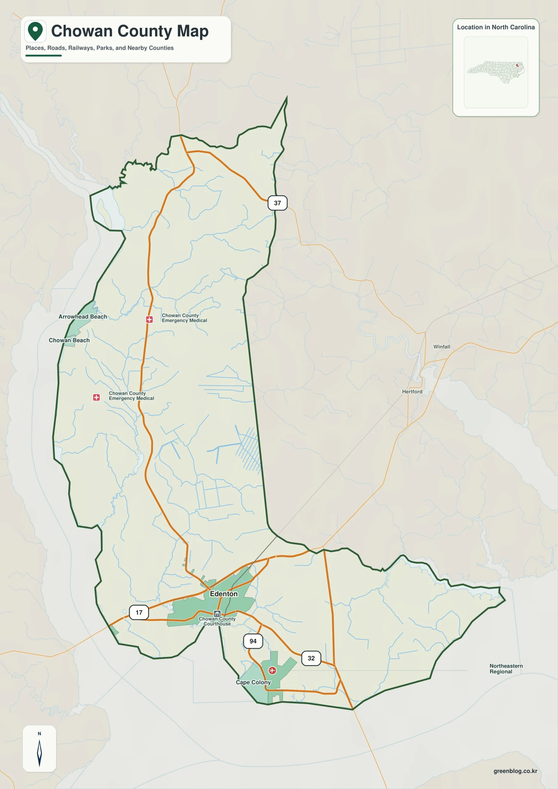
Chowan County single map file
The image above is a web preview. The button is reserved for the separate original map asset used by the publishing workflow.
Download the Chowan County map fileFrequently Asked Questions
What orientation problem does Albemarle Sound solve on this county map?
Albemarle Sound is used as a physical anchor rather than a decorative label. Read alongside Edenton, Tyner, and Rocky Hock, it helps separate settlement geography from the county’s natural structure.
Why does Tyner need a separate role in the county description?
Edenton carries the county-seat role, while Tyner is useful as a separate settlement or functional-area reference. Keeping both visible makes the county less dependent on a single administrative center.
Sources
Related County Maps
Green Map creates custom-edited map images using open geographic data sources such as geoBoundaries, Natural Earth, OpenStreetMap, and government open data.
These maps are edited visual materials, not raw data files, and are provided for education, documents, presentations, and graphic reference.