A traveler crossing the Texas Panhandle on Interstate 40 encounters Amarillo as a major regional center, but the city’s county geography is less obvious than its skyline. The Potter County Texas map separates the northern part of Amarillo from the portions that extend into Randall County and then follows the county north toward the Canadian River, Lake Meredith, and the open High Plains.
Potter County had an estimated 114,649 residents in 2024 and 908.39 square miles of land. Most residents live within the Amarillo urban area, while the northern half contains ranchland, river breaks, industrial sites, and protected cultural landscapes. That sharp contrast gives the county two distinct geographic identities within one boundary.
- Continent: North America
- Country: United States
- State: Texas
- County: Potter County
- Location in State: Central Texas Panhandle
- Adjacent Counties: Moore County, Hutchinson County, Carson County, Randall County, Oldham County
- Major Places: Amarillo, Bushland, Bishop Hills
- Geographic Features: Canadian River, Lake Meredith, Alibates Flint Quarries
Table of Contents
Railroads created the Panhandle crossroads
Potter County was organized in 1887, and the county-seat contest was closely tied to the meeting of the Fort Worth and Denver and Santa Fe railroads. The settlement first called Oneida became Amarillo and rapidly gained an advantage as cattle, grain, passengers, and commercial services moved through the junction.
The railroad legacy remains visible in Amarillo’s regional role. The city became a headquarters and service point for ranching, petroleum, transportation, education, and health care across a wide part of the Panhandle. Its importance is much larger than the county boundary alone would suggest.
A city divided between two counties
Amarillo is the Potter County seat, but municipal expansion carried the city south across the Randall County line. Downtown, the historic civic core, and much of northern Amarillo remain in Potter County, while substantial southern neighborhoods and commercial districts lie in Randall County.
This split matters for courthouse services, elections, taxing jurisdictions, school districts, and address-based research. A city map without county lines may hide the distinction, which is why a county-focused map is useful even for a well-known urban area.
The Canadian River breaks the level plains
North of Amarillo, the landscape changes as the Canadian River cuts across the High Plains. Bluffs, draws, and broken terrain replace some of the broad level surfaces associated with the city and surrounding farms. U.S. 87 and U.S. 287 cross this corridor on the route toward Moore County and the northern Panhandle.
Farther northeast, Lake Meredith occupies the Canadian River valley, and Alibates Flint Quarries preserves a nationally significant source of colorful flint used by Indigenous peoples for thousands of years. These features give northern Potter County a cultural and recreational identity that differs from the transportation and commercial character of Amarillo.
Bushland, Bishop Hills, and the urban edge
Bushland developed west of Amarillo along a railroad line and now sits beside Interstate 40 within the broader metropolitan orbit. It combines agricultural surroundings with commuting access to the city. Bishop Hills, northwest of Amarillo, is a small incorporated village that represents another form of low-density settlement near the urban edge.
The two places help define the county beyond Amarillo’s limits. Bushland follows the westbound highway corridor, while Bishop Hills occupies a separate residential setting closer to the northwestern side of the city.
Highways continue the junction economy
Interstate 40 carries national east-west traffic across southern Potter County, and the U.S. 87/U.S. 287 corridor provides the principal northbound connection. The crossing of these routes near Amarillo reinforces the city’s long-standing role as a freight, service, and travel center.
The Potter County Texas map becomes especially useful when those routes are compared with the Canadian River and county boundaries. The highway pattern explains why development is concentrated near Amarillo and Bushland, while the northern landscape remains much more open.
Population concentrated in one urban core
The county’s population declined from 118,373 in 2020 to 114,649 in 2024, a change of roughly 3.1 percent. Countywide averages, however, mask the difference between dense city neighborhoods and sparsely populated ranch or river country.
For regional analysis, Potter County is therefore best viewed as an urban-centered county with a large rural northern extension. Amarillo supplies most public and commercial functions, but the county’s land area reaches well beyond the built-up city.
Color Map
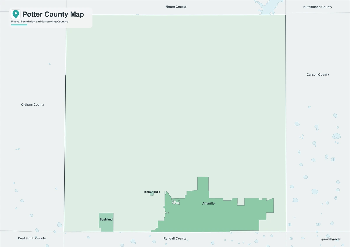
The color edition emphasizes Potter County’s relationship with Randall County to the south and Oldham County to the west. Amarillo occupies the southern urban focus, Bushland marks the I-40 corridor, and Bishop Hills adds a smaller northwestern reference. The Canadian River side of the county creates a second visual zone beyond the metropolitan area.
Black-and-White Map
The monochrome version keeps the county lines and selected place labels clear for reports and printing. Users can compare Amarillo’s northern position with the Randall County line or trace a route from I-40 toward the U.S. 87 crossing of the Canadian River. The open background leaves room for transportation or jurisdiction notes.
Outline Map
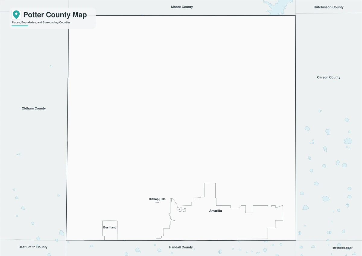
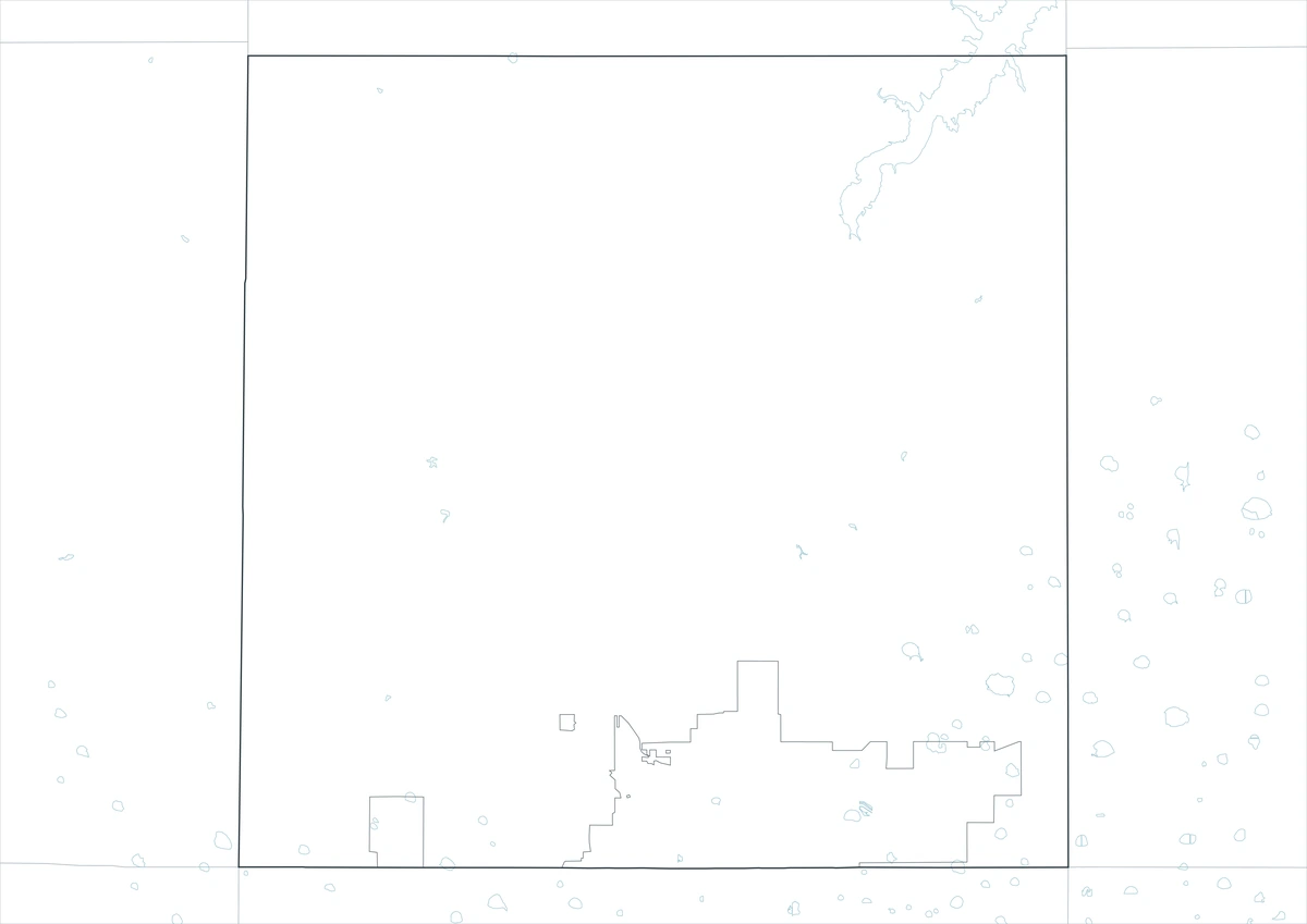
The outline file removes names and fills so users can build a custom Panhandle reference. It can be labeled with Amarillo, Lake Meredith, Alibates, nearby counties, or the principal highway corridors. The format also works for illustrating the contrast between the urban south and the open northern half.
Download the printable county maps
The map set includes color, black-and-white, and outline JPG editions in an A3 layout. The labeled versions support quick geographic reference, while the blank outline is suited to route marking, classroom work, and custom graphics.
County Map File Information
The download includes three Potter County map styles. Major place names appear on the color and monochrome editions, while the outline edition retains boundary linework without labels or area fills.
- Included Versions: Color, Black and White, Outline
- File Type: JPG
- Printable Size: A3
- Map Coverage: County perimeter, included internal boundaries, neighboring county context
- Suggested Uses: Printing, lessons, reports, presentations, and custom route marking
Frequently Asked Questions
Why does Amarillo appear in both Potter and Randall counties?
The city expanded beyond its original Potter County core and crossed the county line into Randall County. Municipal limits and county limits do not have to match.
What makes northern Potter County different from Amarillo?
The northern area includes the Canadian River breaks, ranchland, Lake Meredith, and the Alibates cultural landscape rather than a continuous urban environment.
Which major routes cross Potter County?
Interstate 40 is the principal east-west route, while U.S. 87 and U.S. 287 provide the main northbound corridor from Amarillo.
Official and historical references
- Potter County: About the County — Official background on the 1887 county-seat selection and Amarillo’s railroad setting.
- U.S. Census Bureau QuickFacts — Federal population and land-area statistics for Potter County.
- Handbook of Texas: Potter County — Historical context for Amarillo, county development, industry, and local communities.
- Alibates Flint Quarries National Monument — National Park Service information about the flint resources and cultural history of northern Potter County.
Related Maps
- Shackelford County Texas map|Albany, Fort Griffin, Hereford Ranches, and Clear Fork Country
- Roberts County Texas map|Miami, Canadian River Breaks, and Ranch Country
- Titus County Texas map|Mount Pleasant, Pine Country, and Two Lakes
- Sterling County Texas map|Sterling City, North Concho Ranchland, and Oil Country
- Young County Texas map|Graham, Olney, Newcastle, and Possum Kingdom Lake
Green Map creates custom-edited map images using open geographic data sources such as geoBoundaries, Natural Earth, OpenStreetMap, and government open data.
These maps are edited visual materials, not raw data files, and are provided for education, documents, presentations, and graphic reference.