Jamaica is one of the most recognizable island nations in the Caribbean, located south of Cuba and west of Haiti. Its long east-to-west shape makes the country easy to identify on a regional map, but understanding how the island is organized becomes much easier with a clear visual reference. Whether you are preparing geography materials, creating travel content, building classroom resources, or designing presentation slides, a printable Jamaica map often provides information more effectively than text alone.
This printable Jamaica map collection includes three versions: a color regional map, a black and white labeled map, and a blank outline map. Each file was prepared at A3 size and optimized for high-resolution printing. The collection was designed for users who need a practical visual resource rather than a detailed geographic atlas. Teachers, students, bloggers, infographic creators, and graphic designers can all benefit from having multiple map styles available in a single collection.
Jamaica covers approximately 10,991 square kilometers and has a population of nearly three million people. Kingston, the capital and largest city, is located on the southeastern coast of the island. Because Jamaica is frequently discussed alongside neighboring Caribbean countries such as Cuba, Haiti, and the Dominican Republic, maps are commonly used to explain regional location, travel routes, and island geography.
During the map preparation process, extra attention was given to boundary visibility and label placement. The layouts were reviewed at larger print sizes to ensure that parish names remain readable when enlarged. The maps were also checked in reduced-size previews to verify that major geographic features remain easy to identify on presentation slides and educational worksheets.
Table of Contents
Included Jamaica Map Versions
The collection contains three map styles designed for different purposes:
- Color regional map
- Black and white labeled map
- Blank outline map
Each version serves a different type of project, allowing users to choose the most suitable layout for their needs.
Jamaica Color Map
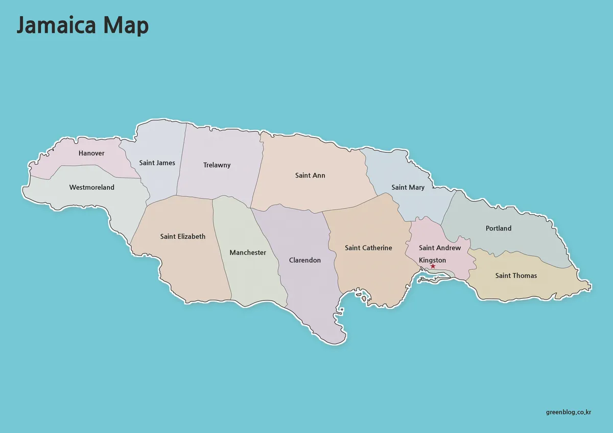
The color version is intended for situations where regional divisions need to be understood quickly. Different areas are displayed using contrasting colors, making administrative boundaries easier to recognize at a glance.
This style works particularly well for geography lessons, travel presentations, blog graphics, and Caribbean regional comparisons. Kingston is highlighted separately so users can identify the capital city without searching through labels. During the design process, color saturation was adjusted to improve readability while avoiding overly bright tones that can become distracting in printed materials.
For users creating educational posters or presentation slides, the color map is usually the easiest version to understand immediately.
Printable Jamaica Map (Black and White)
The black and white map focuses on labels and boundary lines rather than color distinctions. This creates a cleaner appearance when inserted into reports, worksheets, research documents, or classroom handouts.
Because many educational environments still rely on monochrome printing, special attention was given to line thickness and text readability. Parish names remain visible even when the map is printed at reduced sizes.
The simplified design also makes it easier to add notes, highlights, and custom annotations directly onto the map.
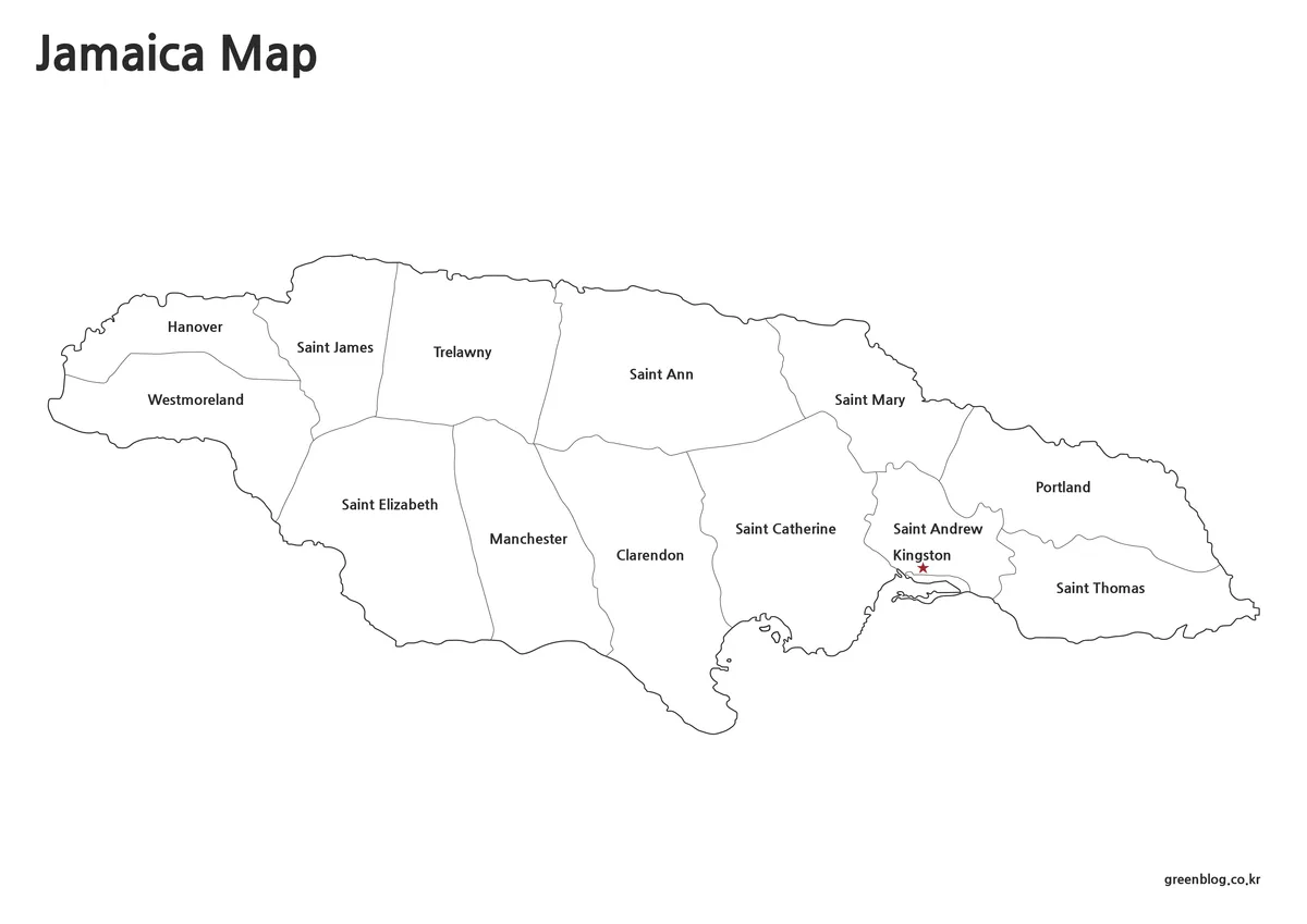
Blank Outline Map for Editing
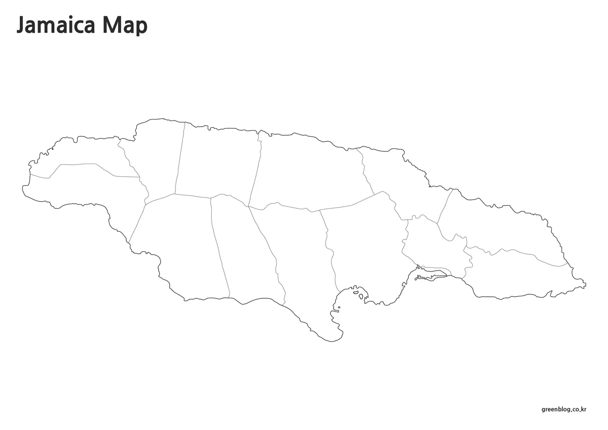
The outline version removes colors and labels, leaving only the boundary framework of Jamaica. This format is often preferred by designers, educators, and content creators who need a flexible base map.
The simplified structure works well for:
- Infographic projects
- Educational worksheets
- Travel route illustrations
- Custom regional analysis
- Presentation graphics
- Classroom activities
While preparing this version, overlapping boundary areas were refined to improve editing efficiency. The result is a clean template that can easily be customized in graphic design software such as Adobe Illustrator or Photoshop.
Jamaica Flag and Map Combination
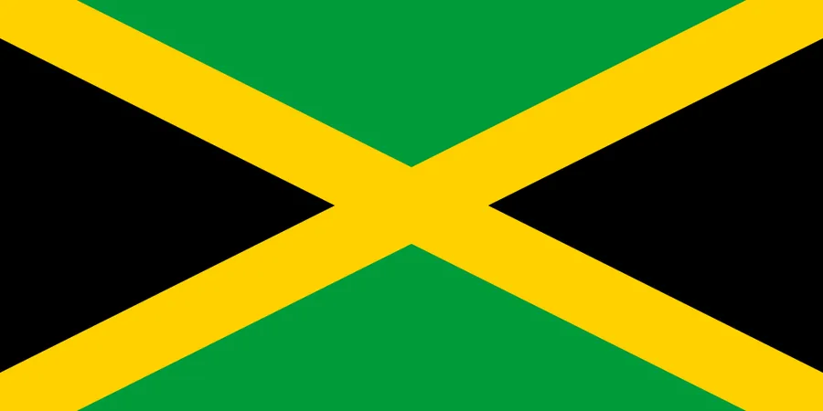
Many educational and presentation projects combine maps with national flags to provide additional visual context. Jamaica’s flag is instantly recognizable because of its distinctive black, green, and gold design.
Using the flag alongside the map helps viewers connect the country’s geographic location with its national identity. This combination is particularly useful in school projects, country comparison presentations, travel materials, and infographic layouts.
Useful Applications
A printable Jamaica map can be helpful in many situations:
- Caribbean geography lessons
- Regional comparison projects
- Travel presentations
- Educational handouts
- Blog and website graphics
- Infographic design
- Classroom worksheets
- Visual reference materials
Because Jamaica is frequently discussed alongside nearby Caribbean islands, maps are often used to explain regional relationships more clearly than written descriptions alone.
Frequently Asked Questions
Can I print the maps on A4 paper?
Yes. Although the files were prepared for A3 printing, they remain readable when scaled down to A4 size.
Which version is best for editing?
The outline map is the most flexible option because it contains only boundary lines.
Are the maps suitable for classroom use?
Yes. The collection was designed with educational printing and presentation visibility in mind.
Which version works best for presentations?
The color map is generally the easiest to understand during presentations because regional divisions are visually distinct.
Jamaica Map Download
Choose the map version that best fits your project. Printable and editable map files are included for educational, presentation, and design purposes.
- File Format: JPG
- Image Size: A3 High Resolution
- Color Mode: CMYK
- Usage: Printing, Education, Presentation, Editing
Related Maps
- Panama Map Collection – Color, Labeled, and Outline Maps for Printing
- Printable New York City Map Collection – Color, Black and White & Outline Maps
- Washington State Map Download – Color, Blank, and Printable Map Pack
- 5 United States Maps for Download (Color, Black & White, Outline)
Additional Resources
- National Land Agency Jamaica – Official Jamaican government agency providing surveying, mapping, cadastral, and geographic information resources for land and spatial data services.
Green Map creates custom-edited map images using open geographic data sources such as geoBoundaries, Natural Earth, OpenStreetMap, and government open data.
These maps are edited visual materials, not raw data files, and are provided for education, documents, presentations, and graphic reference.