Ranch roads, eroded river breaks, and a very small number of towns spread across nearly one thousand square miles in Motley County. The Motley County Texas map places Matador at the central highway junction, Roaring Springs to the south, and Flomot near the northwestern edge of the Rolling Plains. The county’s 2024 estimated population was 1,015.
Only 0.249 square mile of the county is classified as water, yet springs and Pease River tributaries influenced early settlement and travel. The western side rises toward the Caprock, while the central and eastern portions open into rolling ranchland cut by shallow valleys. Three map editions provide labeled orientation, grayscale printing, and an open base for custom work.
- Continent: North America
- Country: United States
- State: Texas
- County: Motley County
- Location in State: Northwest Texas, Rolling Plains east of the Caprock
- Adjacent Counties: Briscoe County, Hall County, Cottle County, Dickens County, Floyd County, Crosby County
- Major Places: Matador, Roaring Springs, Flomot, Whiteflat, Northfield
- Geographic Features: South Pease River, Middle Pease River, Roaring Springs, Caprock escarpment
Table of Contents
Matador grew from ranch headquarters to county seat
The Matador Ranch began in the late 1870s near Ballard Springs and became one of the best-known large ranching operations in Northwest Texas. The settlement that developed nearby adopted the ranch name and became the county seat when Motley County was organized in 1891.
Matador remains the location of the courthouse, post office, school services, and the county’s principal highway junction. U.S. 62/70 crosses State Highway 70 in town, making it the most practical service point for residents scattered across ranches and small communities.
A spring and a railroad shaped Roaring Springs
Roaring Springs lies about eight miles south of Matador on State Highway 70. The community took its name from a group of springs near the South Pease, or Tongue River, drainage. Reliable water supported ranch use and later recreation in a landscape where permanent surface water is scarce.
Rail access arrived in 1913 through the Quanah, Acme and Pacific system, helping the town handle livestock and agricultural shipments. The railroad era faded, but the springs, Old Settlers Reunion, and rural service role preserve a distinct identity separate from the county seat.
The Caprock descends into Pease River country
Western Motley County approaches the eastern edge of the Llano Estacado and Caprock escarpment. Eastward, the terrain becomes rolling and dissected by Dutchman Creek, the South Pease River, the Middle Pease River, and smaller branches.
These waterways do not create large mapped lakes, but they shape ranch boundaries, road crossings, and habitat. The change in elevation also explains why Flomot and Whiteflat face different nearby counties and travel routes from settlements farther east.
Two highways carry most through traffic
U.S. 62/70 passes east and west through Matador, connecting Floyd County with Cottle County. State Highway 70 runs north and south through Whiteflat, Matador, and Roaring Springs before continuing toward Dickens County.
Because local roads often serve individual ranches or remote fields, these state and federal routes organize most public travel. A Motley County Texas map is useful for showing that a short straight-line distance may still require returning to one of the main paved corridors.
A population of about one person per square mile
The estimated population declined from 1,064 in 2020 to 1,015 in 2024, a decrease of about 4.6 percent. With 989.57 square miles of land, average density is close to one resident per square mile.
Most people live in Matador, Roaring Springs, or scattered rural homes. Flomot, Whiteflat, and Northfield remain useful geographic names even where permanent population and commercial services are extremely limited.
Color Map
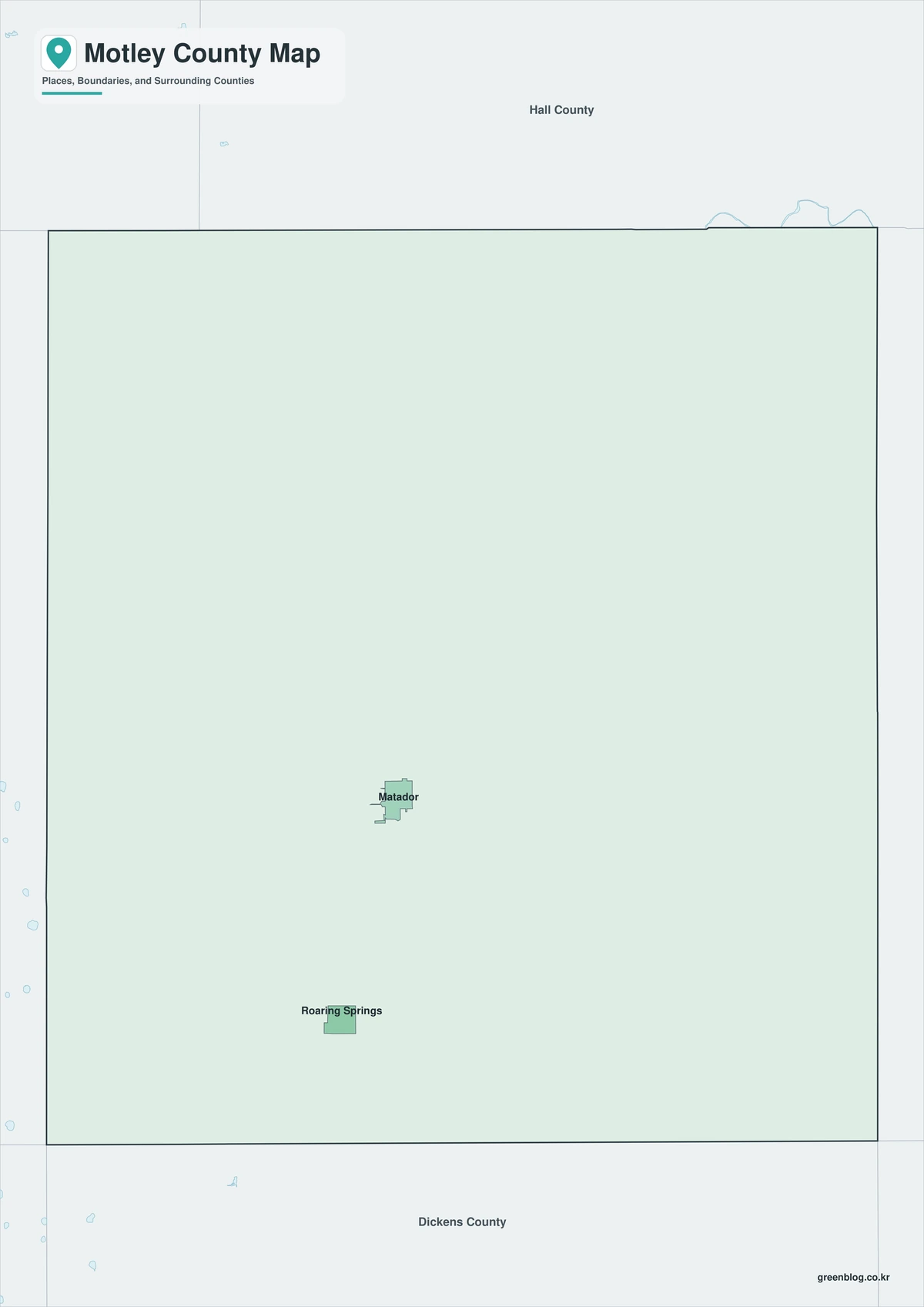
The color edition separates Motley County from Briscoe, Hall, Cottle, Dickens, Floyd, and Crosby counties. Matador forms the central reference, Roaring Springs marks the southern State Highway 70 corridor, and Flomot identifies the northwest. The western Caprock side can be compared with the Pease River drainage toward the east. Large uninterrupted areas reflect ranchland rather than missing information.
Black-and-White Map
The monochrome map retains selected names and boundary lines without colored fills. Users can trace U.S. 62/70 through Matador, add State Highway 70 toward Roaring Springs, or mark the direction of Flomot and the Caprock. Its open background is appropriate for printed ranch-route notes and county history material.
Outline Map
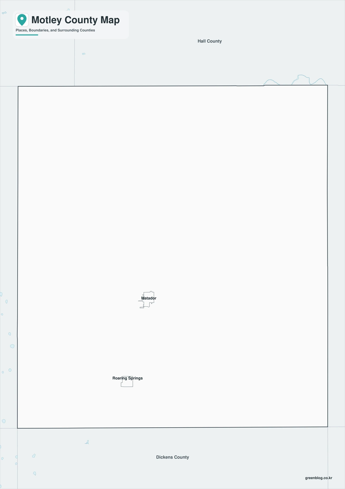
The outline edition removes printed place names and area colors, leaving the county perimeter and included internal linework. It can be labeled with Matador, Roaring Springs, South Pease River, and the Matador Ranch country. Adjacent counties and the two principal highway corridors may also be added for a custom Rolling Plains reference.

Download the three map editions
The A3 JPG set includes a color reference, a printer-friendly black-and-white version, and an unlabeled outline base. These editions support county orientation, local-history projects, route annotations, and classroom use.
Motley County Map Editions
The package provides three treatments of the same county extent. The color map emphasizes regional separation, the monochrome map supports clean printing, and the outline edition leaves room for user-added towns, streams, and routes.
- Map Choices: Color, Black and White, Outline
- File Format: JPG
- Print Layout: A3 proportion
- Geographic Content: County perimeter, included internal boundaries, selected communities, and neighboring context
- Useful For: Reports, ranch-route notes, lessons, presentations, and custom labels
Frequently Asked Questions
What is the county seat of Motley County?
Matador is the county seat and the location of the courthouse and main highway junction.
What gave Roaring Springs its name?
The town was named for nearby springs associated with the South Pease River drainage. The water source supported ranching, settlement, and recreation.
Why are so few communities shown across the county?
Motley County has roughly one resident per square mile. Most of the land is ranch country, open grassland, or creek and river-break terrain rather than incorporated settlement.
Official and historical references
- Motley County, Texas — Official county-government and courthouse information in Matador.
- Handbook of Texas: Motley County — County formation, economy, communities, and historical background.
- Handbook of Texas: Matador Ranch — History of the ranch that shaped settlement and the county economy.
- Handbook of Texas: Roaring Springs — Location and development of the southern county community.
- U.S. Census Bureau QuickFacts — Federal population and geographic statistics used for the county profile.
Related Maps
- Oldham County Texas map|Vega, Route 66 towns, and Canadian River ranch country
- Pecos County Texas map|Fort Stockton, oil towns, and long West Texas distances
- Upton County Texas map|Rankin, McCamey, and West Texas Oil Country
- San Jacinto County Texas map|Lake Livingston, Pine Forests, and the Houston Gateway
- Polk County Texas map|Lake Livingston communities and the Piney Woods
Green Map creates custom-edited map images using open geographic data sources such as geoBoundaries, Natural Earth, OpenStreetMap, and government open data.
These maps are edited visual materials, not raw data files, and are provided for education, documents, presentations, and graphic reference.