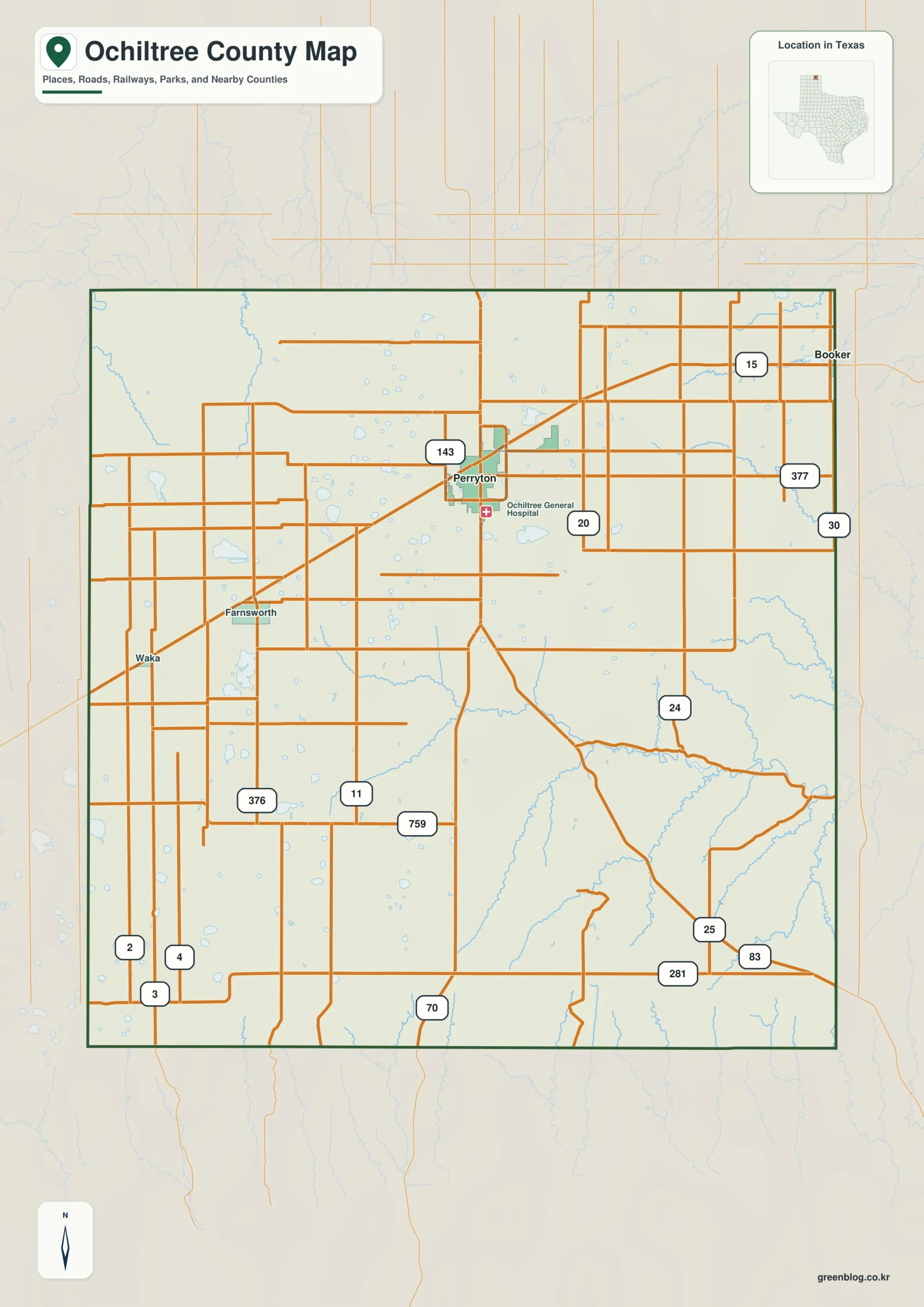
Ochiltree County Texas map — Ochiltree County is a High Plains farm county centered on Perryton, with Booker near the eastern border and Waka to the south.
Download the Ochiltree County map
- Map file: County reference map
- File format: ZIP
Table of Contents
Quick Facts
- State: Texas
- County: Ochiltree County
- County seat: Perryton
- Mapped places: Perryton, Booker, Waka
- Natural features: Wolf Creek, Ogallala Aquifer farms, northern Panhandle plains
- Main routes: U.S. 83, State Highway 15
What the Map Shows
Perryton lies north-central, Booker east near Oklahoma, and Waka south. Large fields and straight roads fill most of the space between them.
County Layout and Location
U.S. 83 crosses Perryton north-south, while State Highway 15 provides the east-west line. Wolf Creek is the clearest natural feature within the farm grid.
Local Context
Wheat, corn, sorghum, cattle, and agricultural processing support the county. Perryton supplies regional schools, healthcare, retail, and farm services.
Ways to Use This Map
- Compare Perryton with Booker
- Locate the highway junction
- Use Wolf Creek to break the farm grid
Frequently Asked Questions
Which community lies closest to the eastern border?
Booker provides the clearest Oklahoma-side reference.
Why does Wolf Creek matter on the map?
Its winding drainage contrasts with the straight agricultural road pattern.
Green Map creates custom-edited map images using open geographic data sources such as geoBoundaries, Natural Earth, OpenStreetMap, and government open data.
These maps are edited visual materials, not raw data files, and are provided for education, documents, presentations, and graphic reference.